

A | B | C | D | E | F | G | H | CH | I | J | K | L | M | N | O | P | Q | R | S | T | U | V | W | X | Y | Z | 0 | 1 | 2 | 3 | 4 | 5 | 6 | 7 | 8 | 9
South Kalimantan
Kalimantan Selatan | |
|---|---|
| Province of South Kalimantan | |
 Coat of arms | |
| Motto(s): Wadja Sampai Kaputing (Banjar) Strong as steel until the end | |
 Location of South Kalimantan in Indonesia | |
OpenStreetMap  | |
| Coordinates: 2°30′S 115°30′E / 2.500°S 115.500°E | |
| Established | 14 August 1950 |
| Capital | Banjarbaru[1] 03°26′33″S 114°49′57″E / 3.44250°S 114.83250°E |
| Largest city | Banjarmasin 3°20′S 114°35′E / 3.333°S 114.583°E |
| Government | |
| • Body | South Kalimantan Provincial Government |
| • Governor | Sahbirin Noor |
| • Vice Governor | Muhidin |
| Area | |
| • Total | 38,320.66 km2 (14,795.69 sq mi) |
| • Rank | 19th in Indonesia |
| Highest elevation (Gunung Besar) | 1,901 m (6,237 ft) |
| Population (mid 2023 estimate)[2] | |
| • Total | 4,221,929 |
| • Density | 110/km2 (290/sq mi) |
| Demographics | |
| • Ethnic groups | 76% Banjarese 13% Javanese 11% other (Buginese, Dayak, Madurese, Sundanese, Chinese etc)[3] |
| • Languages | Indonesian (official) Banjarese |
| Time zone | UTC+8 (Indonesia Central Time) |
| ISO 3166 code | ID-KS |
| GDP (nominal) | 2022 |
| - Total[4] | Rp 251.3 trillion (18th) US$ 16.9 billion Int$ 52.8 billion (PPP) |
| - Per capita[5] | Rp 60.1 million (16th) US$ 4,046 Int$ 12,626 (PPP) |
| - Growth[6] | |
| HDI | |
| Website | kalselprov |
South Kalimantan (Indonesian: Kalimantan Selatan) is a province of Indonesia. It is the smallest province in Kalimantan, the Indonesian territory of the island of Borneo. The provincial capital was Banjarmasin until 15 February 2022 when it was legally moved to Banjarbaru.[1][7] The population of South Kalimantan was recorded at just over 3.625 million people at the 2010 Census,[8] and at 4.07 million at the 2020 Census.[9] The official estimate as at mid 2023 was 4,221,929 (comprising 2,133,224 males and 2,088,705 females).[2] One of the five Indonesian provinces in Kalimantan, it is bordered by the Makassar Strait in the east, Central Kalimantan in the west and north, the Java Sea in the south, and East Kalimantan in the northeast. The province also includes the island of Pulau Laut ("Sea Island"), located off the eastern coast of Kalimantan, as well as other smaller offshore islands. The province is divided into 11 regencies and 2 cities. South Kalimantan is the traditional homeland of the Banjar people, although some parts of East Kalimantan and Central Kalimantan are also included in this criterion. Nevertheless, South Kalimantan, especially the former capital city Banjarmasin has always been the cultural capital of Banjarese culture. Many Banjarese have migrated to other parts of Indonesia, as well as neighbouring countries such as Singapore and Malaysia. In addition, other ethnic groups also inhabit the province, such as several groups of the Dayaks, who mostly live in the interior part of the province, as well as the Javanese, who mostly migrated from Java due to the Transmigration program which dated from the Dutch colonial era. It is one of the provinces in Indonesia that has a larger population than Mongolia.
The territory of what is now South Kalimantan, bounced between local Kingdoms, because of its strategic location for trade, before becoming tributes to the Sultanate of Mataram in the 17th century, with increasing Dutch encroachment, the territory was colonized as part of the Dutch East Indies and the Japanese Empire until Indonesian Independence in 1945.
History
Etymology
South Kalimantan is known as the Land of Lambung Mangkurat (Indonesian: Bumi Lambung Mangkurat).[10][11][12] Lambung Mangkurat, which is the Banjarese pronunciation for Lambu (Lembu) Mangkurat,[13][14][15][16] was the second king of the Kingdom of Dipa (the forerunner of the Banjar Sultanate).[citation needed] Lambung Mangkurat replaces his father Ampu Jatmaka or Mpu / Empu Jatmika ang Maharaja in Candi, a wealthy immigrant merchant from the land of Keling, Kediri[17] who was the founder of the kingdom of Dipa around the beginning of the 14th century or around 1380 or 1387.[18][19][20]
Pre-Sultanate era
.jpg)
According to the mythology of the Maanyan people (the oldest ethnic group in South Kalimantan), the first kingdom in southern Kalimantan was the Nan Sarunai Kingdom which was estimated to have territory ranging from Tabalong to Paser. The Maanyan mythology tells of the golden age of the Nan Sarunai Kingdom, uniting the Maanyan people and made connections with the island of Madagascar off the coast of Africa.[citation needed] One of the archaeological remains from this era is the Great Temple located in the town of Amuntai. In 1996, C-14 testing of charcoal samples from the Agung Temple dated the structure between 242 and 226 BC.[21] Judging from the number of years referred, the Kingdom of Nan Saruna was 600 years older than the Kutai Martapura Kingdom in East Kalimantan. According to Hikayat Sang Bima, the people who brought descended into the kings of Banjar were the gods that also descended into the kings of Bima, Bali, Dompu and Gowa who is the five sons of Maharaja Pandu Dewata.[22][23]
The Malagasy language in Madagascar is similar to the Banjar language. Francois-Xavier Ricaut has shown that the Malagasy people's genetic makeup is 68 percent of Africans and 32 percent of Asians. Based on their evidence, Banjar is the Asian group that is most likely to have traveled to Madagascar. Genetic dating supports the hypothesis that Austronesian migration occurred about 1,000 years ago, while the last significant Bantu migration to Madagascar began 300 years later, after climatic change in Africa. Language shifts are thought to have occurred in Southeast Kalimantan after the Banjar migration to Madagascar. It is estimated that the Banjar people, who currently speak Malay, may speak a language closer to the language reconstructed for Proto-Malagasy. This linguistic change follow the main cultural and genetic mix with Malays, driven by the trade post of the Malay Empires in Southeast Kalimantan. The collapse of the Malay Empires during the 15th and 16th centuries coincide with the end of the mixture of Malay genes into the Banjar population.[24] Genetically, ancient Banjar tribes has a mixture of ancient Malay Dayak and Maanyan ancestry. The Banjar tribes, which had dominant Malay genetics, migrated out of Borneo around 830 AD or 1,200 years ago to what is now known as Madagascar.[25][26][27]
The Nan Sarunai kingdom was invaded by the Majapahit multiple times, with the third and last invasion under the reign of Hayam Wuruk in 1355.[28] At the time Nan Sarunai was led by Raden Anyan or Datu Tatuyan Wulau Miharaja Papangkat Amas. This invasion was led by Ampu Jatmika with his entourage which according to Hikayat Banjar included his advisor Aria Megatsari, general Tumenggung Tatah Jiwa, minister Wiramartas, punokawan Patih Baras, Patih Basi, Patih Luhu, dan Patih Dulu, and bodyguards Sang Panimba Segara, Sang Pembelah Batung, Sang Jampang Sasak, and Sang Pengeruntung 'Garuntung' Manau. Multiple battles happened with the first battle in April 1358;[29] killed Majapahit soldiers were burned in Tambak Wasi. Nansarunai admiral Jamuhala was also killed in this battle. While prince Jarang and prince Idong hid in Man near the Tabalong-kiwa river. Nansarunai soldiers regrouped in Pulau Kadap before the second battle occurred in December 1362. Casualties from this second battle were buried in Tambak in Bayu Hinrang. In this battle Raden Anyan was killed, speared by Mpu Nala, and buried in Banua Lawas.[30] In its place, Ampu Jatmika founded a Hindu kingdom, Negara Dipa under Majapahit tributary, predecessor of Negara Daha and Banjar Sultanate. Its remnants include Candi Agung complex of Amuntai constructed by Ampu Jatmika on an older Ma'anyan site. While surviving Javanese, Dayak, Madurese, and Bugis soldiers, sailors, metalsmiths of the war settled in Amuntai, Alabio, and Nagara.[28] These invasions were recorded in Dayak Ma'anyan poetry as Nansarunai Usak Jawa.[31][32]
Maharaja Sukarama, the King of Negara Daha, had the intention that his successor would be his grandson Raden Samudera, son of his daughter Puteri Galuh Intan Sari. The father of Raden Samudera was Raden Manteri Jaya, son of Raden Begawan, brother of Maharaja Sukarama. The will caused Raden Samudera to be threatened with safety because the sons of Maharaja Sukarama were ambitious as kings, namely Prince Bagalung, Prince Mangkubumi and Prince Tumenggung. Assisted by Arya Taranggana, Raden Samudra fled by boat to the lower Barito river. After Sukarama's death, Prince Mangkubumi became King of the Negara Daha, then succeeded by Prince Tumenggung who was also a son of Sukarama. Raden Samudra.
Pangeran Tumenggung attacked the Bandarmasih. Prince Samudra was assisted by the Kingdom of Demak with the strength of 40,000 soldiers with a fleet of 1,000 boats each carrying 400 soldiers capable of withstanding the attack.[33] Prince Tumenggung was willing to give up the power of the Negara Daha to Raden Samudra. Negara Daha was later merged into the Sultanate of Banjar which held a place in Bandarmasih, while Prince Tumenggung was given an area in Batang Alai.
In 1521, Raden Samudra became the first king of the Sultanate of Banjar with the title Sultan Suriansyah. He also became the first king to convert to Islam, guided by the Islamic cleric Khatib Dayan.[34][35][36]
Sultanate era

The Banjar Sultanate began experiencing its golden age in the first decade of the 17th century with pepper as a commodity of trade, with the southwest, southeast and east of the island of Borneo paying tribute to the Sultanate. Previously, the Banjar Sultanate paid tribute to the Demak Sultanate, but after the fall of the Demak Sultanate and the rise of the Pajang Sultanate, the Banjar Sultanate no longer sent tribute to Java.[37]
The supremacy of Java against Banjarmasin, was carried out again by Tuban in 1615 to conquer Banjarmasin with the help of Madura (Arosbaya) and Surabaya, but failed due to fierce resistance.[38]
Sultan Agung of Mataram, developed his power over the island of Java by defeating the port city of the northern coast of Java such as Jepara and Gresik (1610), Tuban (1619), Madura (1924) and Surabaya (1625). In 1622, the Mataram Sultanate, again planned an occupation of the kingdoms south, southwest and southeast of the island of Borneo, and Sultan Agung consolidated his authority over the Kingdom of Sukadana in 1622.[39]
In 1636, because he felt he had enough strength in the military and economy to deal with an invasion from other kingdoms, The Sultan of Banjar claimed Sambas, Lawai, Sukadana, Kotawaringin, Pembuang, Sampit, Mendawai, Kahayan Hilir and Kahayan Hulu, Kutai, Pasir, Pulau Laut, Satui, Asam Asam, Kintap and Swarangan as vassals of the Sultanate of Banjarmasin.[16][40][41][42]
Since 1631, Banjarmasin was preparing to face an attack from the Mataram Sultanate, but due to lack of logistics, the planned attack from the Mataram Sultanate never materialised. After 1637 there was a massive migration from Java by the victims of Sultan Agung's political aggression. The arrival of immigrants from Java had a huge influence with the ports on the island of Borneo becoming the center of diffusion of Javanese culture.
Besides facing an invasion plan from Mataram, the Sultanate of Banjarmasin also had to face the increasing Dutch presence in the region. In 1637 Banjarmasin and Mataram held peace conference after years of tense relations.[38] The Makassar War (1660–1669) caused many traders to move from Somba Opu, then under the rule of the Gowa Sultanate to Banjarmasin.[43] The currency circulating in the Sultanate of Banjar was called doit.[44]
Before it was divided into several small kingdoms, the Banjar Sultanate included the modern-day provinces of South Kalimantan and Central Kalimantan, to the west it bordered the Kingdom of Tanjungpura at Ketapang and to the east by the Paser Sultanate at Tanjung Aru. In the area, the local rules had the title Prince, only the Sultan of Banjar has the right to use the title Sultan. Other sultanates sent tribute to the Sultanate of Banjar, including the Paser Sultanate which was conquered in 1636 with the help of the Dutch.
Initially, the capital of the Banjar Sultanate was in Banjarmasin, but it was moved to Martapura.[45] at its height, the area under the influence of the Banjar Sultanate encompassed the central point of the king's palace in Martapura and ended at the outer point at present-day Sambas Regency in West Kalimantan in the northwest to the Karasikan region (present-day Sulu Archipelago) in the northeast. The Sambas and Karasikan Kingdoms sent tribute to the Sultan of Banjar. In the Hikayat Banjar also mentioned countries in Batang Lawai, Sukadana, Bunyut (Kutai Hulu) and Sewa Agung (Sawakung).
Colonial era

In the 18th century, Prince Tamjidullah I succeeded in gaining power to his dynasty and designated Prince Nata Dilaga as the first Sultan as Panembahan Kaharudin Khalilullah. Prince Nata Dilaga who became the first king of the Tamjidullah dynasty, declared himself as Susuhunan Nata Alam in 1772. The son of Sultan Muhammad Aliuddin Aminullah, Prince Amir, the grandson of Sultan Hamidullah fled to the Paser Kingdom, and requested assistance from his uncle, Arung Tarawe (and Queen Goddess). Prince Amir then returned and invaded the Banjar Sultanate with a large Buginese army in 1757, and tried to reclaim his throne from Susuhunan Nata Alam. Fearing the loss of the throne and the fall of the kingdom under the Bugis, Susuhunan Nata Alam requested assistance from the Dutch East India Company (VOC).
The VOC accepted the request and sent Captain Hoffman with his forces and succeeded in defeating the Buginese forces. Prince Amir was forced to flee back to the Paser Kingdom. Some time later [when?] Prince Amir tried to ask for assistance from the Banjar nobles in the Barito area who were not happy with the Dutch presence. In this second battle, Prince Amir was captured and was exiled to Ceylon in 1787. After that an agreement was made between the Sultanate of Banjar and the VOC, where the kings of the Banjar ruled the kingdom as borrowers of VOC land. In 1826 a re-agreement was held between the Dutch East Indies Government and Sultan Adam, based on the previous agreement. According to the new agreement, the Dutch were allowed to interfere with the appointment of the Crown Prince and the Mangkubumi, which resulted in the destruction of this royal custom, which was one of the causes of the Banjarmasin War.

The Banjarmasin War took place between 1859 and 1905 (1859–1863 according to Dutch sources).[46][47][48][49][50] Sultan Hidayatullah II of Banjar and Prince Antasari used a strategy of guerrilla warfare by moving the government to the interior and building fortifications in the Borneon jungles. The resistance established unity between the Banjar and the Dayak people, tied to kinship through marriage ties. The association gave birth to the status of pegustian and temenggung which became a unifying tool for the Banjar-Dayak coalition facing the Dutch.[51]
Pangeran Antasari also collaborated with the Kutai Kertanegara Sultanate through his relatives in Tenggarong. Pangeran Antasari wrote to other princes from Kutai such as Prince Nata Kusuma, Pangeran Anom, and Kerta. They all assisted the smuggling of firearms from Kutai to Hamlet (Banjar). However, when the Banjar War was continued by the descendants of Pangeran Antasari, The Sultan of Kutai Aji Muhammad Sulaiman did not respond positively to requests for help from Prince Perbatasari. In fact, Prince Perbatasari was handed over to the Dutch in 1885. The Dutch launched the "Expedition to the Southern and Eastern region of Borneo" (Dutch: Expeditie naar de Zuider- en Oosterafdeling van Borneo), resulting in the destruction of the Banjar Sultanate. Resistance towards the Dutch continued until 1905, when Dutch forces under the leadership of Lieutenant Christofel veteran of the Aceh War, with a large number of Korps Marechaussee te voet troops, attacked Manawing fortress in January 1905. The Korps Marechaussee te voet was a non-military corps established by the Dutch East Indies Government in 1890 to handle police duties help the military. Massively outnumbered, Sultan Muhammad Seman did not survive the battle. The Sultan was shot and killed on January 24, 1905.[52][53][54]

The Dutch annexed and placed the former territory of the Banjar Sultanate under the jurisdiction of the Residency of South and Eastern Borneo (Dutch: Residentie Zuider en Oosterafdeeling van Borneo). In 1938, the Residency of Western Borneo (Dutch: Residentie Westerafdeeling van Borneo) and the Residency of South and Eastern Borneo were merged into the Government of Borneo (Dutch: Gouvernement of Borneo) with Bandjermasin as its capital (Dutch: stadsgemeente).
Japanese invasion and occupation
During the Dutch East Indies campaign of World War II, the Japanese invaded Borneo. Immediately after capturing Balikpapan on January 26, 1942, the 56th Mixed Infantry Group was ordered to complete the occupation of Dutch Borneo by invading Bandjermasin, its capital. During the Battle of Balikpapan and also after the occupation of the city, efforts were made to gather information from Japanese residents, natives and prisoners of war. Reconnaissance flights in the area were carried out by naval air units. It was necessary to capture Bandjermasin, as soon as possible, to secure its airfield for combat aircraft scheduled to participate in the Java Operation.
A Sea Drive Unit under command of Captain Yoshibumi Okamoto left Balikpapan on the evening of January 27, 1942, three days ahead of the main Land Drive Unit. The craft moved only at night and were carefully concealed in the river banks during daylight and camouflaged with mangrove branches, while the troops were resting in the forest, so that they were completely hidden from aerial reconnaissance planes. Radio silence was maintained all the time. One naval officer was attached to the unit as a pilot. The surprise night attack was successfully carried out on the town of Kotabaroe on Laoet Island, as planned. Very little resistance was encountered and a large quantity of military supplies and provisions was captured.
The local administrative governor was unhappy with his territorial commander and asked the main Royal Netherlands East Indies Army (KNIL) HQ on Java for a replacement. The replacement commander was on his way by airplane, but returned as they saw Bandjarmasin was on fire and they thought, although wrongly, that it was already occupied by Japanese troops and perhaps it would be unwise to attempt a landing. The Okamoto's unit landed at a point approximately 80 km southeast of Bandjarmasin on February 8, 1942, and advanced overland without opposition, to the airfield. As the Land Drive Unit had already dispersed the enemy, there was no fighting after the Sea Drive Unit reached the Martapoera airfield on February 10, 1942.
At 0900 on February 10, the Martapoera airfield was captured by the Advance Force together with the Engineer Company. By the evening of February 10, with the arrival of the main force and the Sea Land Unit, Bandjermasin was finally occupied. There was no fighting.
Lieutenant Colonel H. T. Halkema came by sea to the Barito River, with his staff, accompanied by elements of units under his command. By now many KNIL native soldiers had already deserted. Lieutenant Colonel Halkema received orders to proceed to Kotawarangin airfield. When he arrived there, with only 75 men left under his depleted command, he received an order to have part of his shrunken force, to staunchly defend the airfield, while those that were too weak and exhausted should to be sent to Java. Lieutenant Colonel Halkema was later court-marshalled by the military court (Hoog Militair Gerechtshof). In the meantime a brave group of civilians, and military escapees, 180 persons, managed to evade the Japanese aboard a small coaster to Madoera Island, among which also included 20 women.
The official Japanese casualties during the Bandjermasin operation numbered only 9 soldiers who were killed or died from various diseases, while at least 80% of the men infected with malaria. The casualties and the number of POWs on the Dutch side are unknown. The distance travelled by land routes was approximately 400 km and the distance through jungle approximately 100 km.[55]
During the Japanese occupation, Borneo and eastern Indonesia were controlled by the 2nd South Fleet of the Imperial Japanese Navy. During the occupation, the Japanese committed brutal war crimes against the local population, resulting in thousands of casualties. All of people's lives were closely monitored by the Kempetai. Towards the end of Japanese rule, many romusha in the form of skeletal clad in full leather, young girls from Java and South Kalimantan themselves were made jugun ianfu (comfort women).
In 1943, a scheme by Indonesian nationalists and Dutch in South Kalimantan against the Japanese was uncovered before the Pontianak incident occurred.[56] According to some sources this happened in September 1943 at Amuntai in South Kalimantan and involved establishing up an Islamic State and expelling the Japanese but the plan was foiled.[57][58]
Revolution and modern era

On September 17, 1945, Japan surrendered to the Australian Army who entered Banjarmasin.[59][60] On July 1, 1946, the Australian handed control back to the Dutch colonial government. Governor-General Hubertus van Mook draw up a plan for a federal government through the Malino Conference (July 16–22, 1946) and the Denpasar Conference (December 7–24, 1946) which decided on the formation of four federal states, Java, Sumatra, Borneo (Netherlands Borneo) and the Great East (State of East Indonesia), the formation of the Borneo state was opposed by the people of Banjarmasin, led by several figure such as Hasan Basry.[61][62][63][64]
The Dutch remained in South Kalimantan until 1949, when the Dutch–Indonesian Round Table Conference resulted in the Dutch recognizing Indonesia's sovereignty. The Dutch then withdraw from the region, ending the three-century long Dutch presence in the region. The region was initially incorporated into the Indonesian province of Kalimantan, but in 1956 the province was dissolved and separated into two province, West Kalimantan and South Kalimantan. In 1957 South Kalimantan was divided to provide the Dayak population with greater autonomy from the Muslim population in the province. The change was approved by the Indonesian Government on May 23, 1957, under Presidential Law No. 10 Year 1957, which declared Central Kalimantan the seventeenth province of Indonesia.
Geography
South Kalimantan is a province located on the island of Borneo, located between longitude 21 21 49 "LS, 114 19" 33 "BT – 116 33 '28 BT, and 21' 49" LS 110 "14" LS on the map.[discuss] South Kalimantan has a total area of 38,320.66 km2 and is divided into eleven regencies (kabupaten) and two independent cities (kota).
Geographically, South Kalimantan is in the southeastern part of the island of Borneo, has a low-lying area in the west and east coast, and a plateau formed by the Meratus Mountains in the middle. South Kalimantan consists of two main geographic features, namely the lowlands and the highlands. Lowland areas are mostly in the form of peatlands to swamps, which are rich in biodiversity sources of freshwater animals. Some highland areas are still natural tropical forests and protected by the government.[citation needed]
South Kalimantan has extensive forests namely Permanent Forests (139,315 ha), Production Forests (1,325,024 ha), Protected Forests (139,315 ha), Convention Forests (348,919 ha). Forestry consists of two types, namely wood and non-wood. The area of forest in South Kalimantan is 1,659,003 ha including; protected forests, natural forests, permanent production forests, limited production forests, conversion forests and mangrove forests. Some are tropical forests and protected by the government.[citation needed]
South Kalimantan is known as "the land of a thousand rivers", it is due to the large number of rivers in South Kalimantan. From these rivers, one of the well-known rivers is the Barito River, whose name is based on the Barito region (formerly Onder Afdeeling Barito) which is upstream including Central Kalimantan, but is often used to name all of the watershed to its mouth at the Java Sea in South Kalimantan is called Muara Banjar/Kuala Banjar. Barito River is commonly used for buying and selling floating markets. In addition, there is also the Martapura River, a tributary of the Barito, which is located in the city of Banjarmasin and in the upper part is the city of Martapura, the capital of Banjar Regency.[citation needed]
Climate
This region has a tropical savanna climate, similar to most other Indonesian provinces. The season in West Sumatra is similar to other regions in Indonesia, only known for two seasons, namely the dry season and the rainy season. From June to September wind flows from Australia and do not contain much water vapor, resulting in a dry season. Conversely in December to March many wind currents contain water vapor from Asia and the Pacific Oceanduring the rainy season. Such conditions occur every half-year after passing the transition period in between April – May and October – November.
| Climate data for Banjarmasin | |||||||||||||
|---|---|---|---|---|---|---|---|---|---|---|---|---|---|
| Month | Jan | Feb | Mar | Apr | May | Jun | Jul | Aug | Sep | Oct | Nov | Dec | Year |
| Mean daily maximum °C (°F) | 29 (85) |
29 (85) |
30 (86) |
31 (87) |
31 (88) |
31 (87) |
31 (87) |
31 (88) |
31 (88) |
31 (88) |
31 (87) |
29 (85) |
31 (87) |
| Mean daily minimum °C (°F) | 25 (77) |
25 (77) |
24 (76) |
26 (78) |
26 (78) |
25 (77) |
24 (75) |
24 (75) |
24 (75) |
25 (77) |
25 (77) |
24 (76) |
24 (76) |
| Average precipitation mm (inches) | 350 (13.8) |
300 (11.8) |
310 (12.2) |
210 (8.3) |
200 (7.9) |
120 (4.7) |
120 (4.7) |
110 (4.3) |
130 (5.1) |
120 (4.7) |
230 (9.1) |
290 (11.4) |
2,570 (101.2) |
| Source: http://www.weatherbase.com/weather/weather.php3?s=58669&refer=&units=metric | |||||||||||||
As in most other province of Indonesia, South Kalimantan has a tropical rainforest climate (Köppen climate classification Af) bordering on a tropical monsoon climate and tropical savanna climate (Köppen climate classification Aw) along the savanna grassland plains. The climate is very much dictated by the surrounding sea and the prevailing wind system. It has high average temperature and high average rainfall.[citation needed]
Government
The Province of South Kalimantan is led by a governor who is elected directly with his representative for a 5-year term. In addition to being a regional government, the Governor also acts as a representative or extension of the central government in the province, whose authority is regulated in Law No. 32 of 2004 and Government Regulation number 19 of 2010.
While the relationship between the provincial government and the regency and city governments is not a sub-ordinate, each of these regional governments governs and manages government affairs according to the principle of autonomy and co-administration.
Administrative Divisions

.jpg)
From the formation of the Province of South Kalimantan there were four regencies (kabupaten) - Banjar, Barito, Kotabaru and Hulu Sungai - together with the independent city of Banjarmasin. However, one of these - Barito Regency - had previously been partly situated in what had become Central Kalimantan Province in 1958, and so was formed into a separate Barito Kuala Regency on 26 June 1959; on the same date, the existing Hulu Sungai Regency was split into separate regencies of South Hulu Sungai, Central Hulu Sungai and North Hulu Sungai. On 14 July 1965 three further regencies were created - Tanah Laut from part of Banjar Regency, Tapin from part of South Hulu Sungai Regency, and Tabalong from part of North Hulu Sungai Regency.
A second independent city - Banjarbaru - was created on 20 April 1999, and on 25 February 2003 two additional regencies were created - Tanah Bumbu from part of Kotabaru Regency, and Balangan from part of Hulu Sungai Utara Regency. There are now therefore eleven regencies (kabupaten) and two cities (kota) in South Kalimantan as listed below with their areas and their populations at the 2010[65] and 2020[66] Censuses together with the official estimates as at mid 2023[2] and their administrative capitals.
| Kode Wilayah |
Name of City or Regency |
Area in km2 |
Pop'n 2010 Census |
Pop'n 2020 Census |
Pop'n mid 2023 estimate |
Capital | HDI[67] 2023 Estimates |
|---|---|---|---|---|---|---|---|
| 63.01 | Tanah Laut Regency | 3,841.37 | 296,333 | 348,966 | 364,117 | Pelaihari | 0.729 (High) |
| 63.02 | Kotabaru Regency | 9,480.17 | 290,142 | 325,622 | 329,641 | Kotabaru | 0.720 (High) |
| 63.03 | Banjar Regency | 4,668.50 | 506,839 | 565,635 | 575,115 | Martapura | 0.740 (High) |
| 63.04 | Barito Kuala Regency | 2,996.46 | 276,147 | 313,021 | 324,502 | Marabahan | 0.706 (High) |
| 63.05 | Tapin Regency | 2,174.95 | 167,877 | 189,475 | 197,893 | Rantau | 0.735 (High) |
| 63.06 | South Hulu Sungai Regency (Hulu Sungai Selatan) |
1,804.94 | 212,485 | 228,006 | 237,319 | Kandangan | 0.732 (High) |
| 63.07 | Central Hulu Sungai Regency (Hulu Sungai Tengah) |
1,770.77 | 243,460 | 258,721 | 268,360 | Barabai | 0.727 (High) |
| 63.08 | North Hulu Sungai Regency (Hulu Sungai Utara) |
907.72 | 209,246 | 226,727 | 233,412 | Amuntai | 0.711 (High) |
| 63.09 | Tabalong Regency | 3,553.36 | 218,620 | 253,305 | 262,631 | Tanjung | 0.754 (High) |
| 63.10 | Tanah Bumbu Regency | 4,890.30 | 267,929 | 322,646 | 343,741 | Batulicin | 0.738 (High) |
| 63.11 | Balangan Regency | 1,828.51 | 112,430 | 130,355 | 136,520 | Paringin | 0.729 (High) |
| 63.71 | Banjarmasin City | 98.46 | 625,481 | 657,663 | 675,915 | Banjarmasin | 0.799 (High) |
| 63.72 | Banjarbaru City | 305.15 | 199,627 | 253,442 | 272,763 | Banjarbaru | 0.812 (Very High) |
| Totals | 38,320.66 | 3,626,616 | 4,073,584 | 4,221,929 | Banjarbaru | 0.746 (High) |
Demographics
| Year | Pop. | ±% |
|---|---|---|
| 1961 | 1,473,155 | — |
| 1971 | 1,699,105 | +15.3% |
| 1980 | 2,064,649 | +21.5% |
| 1990 | 2,597,572 | +25.8% |
| 1995 | 2,893,477 | +11.4% |
| 2000 | 2,985,240 | +3.2% |
| 2005 | 3,281,993 | +9.9% |
| 2010 | 3,626,616 | +10.5% |
| 2015 | 3,984,315 | +9.9% |
| 2020 | 4,073,584 | +2.2% |
| 2023 | 4,221,929 | +3.6% |
| Source: Badan Pusat Statistik 2024 and earlier volumes. | ||
Ethnicity
The majority of the population of South Kalimantan is the Banjar (74.34%) consisting of three groups, namely Banjar Kuala, Banjar Pahuluan and Banjar Batang Banyu. Based on the 2010 population census the Banjar people numbered 4.1 million. About 3 million Banjar people live in South Kalimantan, another million Banjar people live in the other Kalimantan provinces and 500,000 other Banjars live outside Kalimantan. The Banjar people originated from the Banjar area, which is a mix of communities in several river basins, namely those of the Bahan, Barito, Martapura and Tabanio rivers. From this central cultural area, the Banjar tribe has since moved extensively for centrifugal migration or jumping of frogs to various regions in the archipelago to Madagascar.
The second largest ethnic group is the Javanese (14.51%) who occupy the transmigration area. Other ethnic groups also exist in South Kalimantan. The Tionghoa Parit (Banjarese: Cina Parit) is a sub-group of the Chinese Indonesians. They inhabit the Parit river area in Pelaihari District of Tanah Laut Regency, South Kalimantan. In the daily term, the Chinese are called Cina Parit by the Banjar people and it is quite difficult for the Banjar tongue to pronounce Tionghoa Parit, and in fact the Chinese people in Banjarmasin live in the Chinatown area which consists of the Pacinan Laut Village (near the river) and Pacinan Darat Village (from the river). The Chinese community call themselves as Tionghoa Parit instead of Cina Parit.
The Dayak are also original inhabitants of the province. They occupy the Meratus Mountains region, from which the Barito River flows to Central Kalimantan.
Language
The language used in everyday life by Banjarese as a mother tongue and as a lingua franca for the people of South Kalimantan generally is the Banjar language, which has two major dialects, namely the Banjar Kuala dialect and the Banjar Hulu dialect.[68] Dayak tribes who inhabit the southern region of the Meratus Mountains speak the Dayak Meratus language.
The Dayak Dusmala (Dusun-Maanyan-Lawangan) who use the Eastern Barito languages inhabit the northern region of the Meratus Mountains; these include the Dayak Maanyan Warukin language, the Dayak Samihin language, the Dayak Dusun Deyah language, the Dayak Lawangan language, and the Dayak Abal language. The Dayak Biaju who use the Western Barito languages inhabit the basin of the Barito River; these include numerous languages, among others the Dayak Bakumpai language and the Dayak Barangas language. The Dayak Ngaju language, a language originating from Central Kalimantan is used as a liturgical language in the Borneo Evangelical Church headquartered in Banjarmasin.
Indonesian is widely used as a second language and also for inter-ethnic communication.
Religion
Islam is the majority religion adhered to around 96% of people in South Kalimantan. There was also Christian, Hindu and Buddhist communities as well as the Kaharingan belief embraced by the Dayak people who lived around the Meratus Mountains region.
- Religion South Kalimantan
-
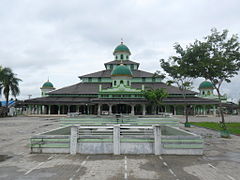 Banjarmasin Great Mosque
 -
 Protestant Church of Western Indonesia in Banjarmasin
 -
 Klenteng Soetji Nurani
 -
 Evangelist Kalimantan Church of Eppata in Banjarmasin
.jpg)


Culture
Traditional Music

One of the arts in the form of traditional music typical of the Banjar people is Panting. This music is called Panting because it is dominated by musical instruments called panting, a type of stringed instrument that uses strings (important) so it is called important music. Initially, the music came from the Tapin area, South Kalimantan. Panting is a musical instrument that is picked which is shaped like an Arab cork but is smaller in size. In the past, panting music was only played individually or solo. The name of the important music comes from the name of the musical instrument itself, because in important music that is famous for its musical instruments and which plays a very important role. Until now, panting is still famous as traditional music originating from South Kalimantan.[70]
Besides that, there is a traditional Banjar music art, namely Kentung. This music comes from the Banjar Regency area, namely in the village of Sungai Alat, Astambul and the village of Bincau, Martapura. At present, this kentung music has begun to scarce. The past of this musical instrument was contested. In this match not only the sound, but also the things that are magical, such as if in the match this instrument can be broken or cannot be heard from the opponent's competition.[71]
Zdroj:https://en.wikipedia.org?pojem=South_KalimantanText je dostupný za podmienok Creative Commons Attribution/Share-Alike License 3.0 Unported; prípadne za ďalších podmienok. Podrobnejšie informácie nájdete na stránke Podmienky použitia.
Antropológia
Aplikované vedy
Bibliometria
Dejiny vedy
Encyklopédie
Filozofia vedy
Forenzné vedy
Humanitné vedy
Knižničná veda
Kryogenika
Kryptológia
Kulturológia
Literárna veda
Medzidisciplinárne oblasti
Metódy kvantitatívnej analýzy
Metavedy
Metodika
Text je dostupný za podmienok Creative
Commons Attribution/Share-Alike License 3.0 Unported; prípadne za ďalších
podmienok.
Podrobnejšie informácie nájdete na stránke Podmienky
použitia.
www.astronomia.sk | www.biologia.sk | www.botanika.sk | www.dejiny.sk | www.economy.sk | www.elektrotechnika.sk | www.estetika.sk | www.farmakologia.sk | www.filozofia.sk | Fyzika | www.futurologia.sk | www.genetika.sk | www.chemia.sk | www.lingvistika.sk | www.politologia.sk | www.psychologia.sk | www.sexuologia.sk | www.sociologia.sk | www.veda.sk I www.zoologia.sk