

A | B | C | D | E | F | G | H | CH | I | J | K | L | M | N | O | P | Q | R | S | T | U | V | W | X | Y | Z | 0 | 1 | 2 | 3 | 4 | 5 | 6 | 7 | 8 | 9
Timiș County
Județul Timiș | |
|---|---|
 Coat of arms | |
| Etymology: Timiș River | |
 Location of Timiș County in Romania | |
OpenStreetMap  | |
| Coordinates: 45°41′34.08″N 21°24′19.8″E / 45.6928000°N 21.405500°E | |
| Country | Romania |
| Historical region | Banat |
| Development region | West |
| Established | 1968 |
| County seat | Timișoara |
| Government | |
| • Body | Timiș County Council |
| • President | Alin Nica (PNL)[1] |
| • Prefect | Mihai Ritivoiu (PSD)[2] |
| Area | |
| • Total | 8,696.7 km2 (3,357.8 sq mi) |
| • Rank | 1st |
| Population (2021-12-01)[3] | |
| • Total | 650,533 |
| • Rank | 6th |
| • Density | 75/km2 (190/sq mi) |
| Demonym(s) | timișean (male), timișeană (female)[4] |
| Time zone | UTC+2 (EET) |
| • Summer (DST) | UTC+3 (EEST) |
| SIRUTA code | 350 |
| Registration plate | TM |
| Website | cjtimis |
Timiș (Romanian pronunciation: [ˈtimiʃ]) is a county (județ) of western Romania on the border with Hungary and Serbia, in the historical region of Banat, with the county seat at Timișoara. It is the westernmost and the largest county in Romania in terms of land area. The county is also part of the Danube–Criș–Mureș–Tisa Euroregion.
Name
The name of the county comes from the Timiș River, known in Roman antiquity as Tibisis or Tibiscus. According to Lajos Kiss' etymological dictionary, the name of the river probably comes from the Dacian language: thibh-isjo ("marshy").[5] In Hungarian, Timiș County is known as Temes megye, in German as Kreis Temesch, in Serbian as Тамишки округ/Tamiški okrug, in Ukrainian as Тімішський повіт, and in Banat Bulgarian as okrug Timiš.
Geography

Timiș is the largest county in Romania, occupying 8,696.7 km2, i.e. 3.65% of the country's area.[6]: 3 It is crossed by the 46th parallel north, the 21st meridian east and the 22nd meridian east. On its territory is the westernmost point of Romania, i.e. Beba Veche, at 20°15'44", in the Triplex Confinium point.[7]
Timiș County is part of the West Development Region along with the counties of Arad, Caraș-Severin and Hunedoara, being located in the center of the historical province of Banat. Due to its geographical position, almost a third of the county's borders are at the same time state borders. Thus, in the northwestern part, it borders Csongrád-Csanád County (Hungary), 18 km of this border being on the Mureș River. To the southwest, between Beba Veche and Lățunaș, Timiș County borders the Autonomous Province of Vojvodina (Serbia). The land connection with the counties of the neighboring countries is ensured by the border crossing points from Cenad, Moravița and Jimbolia. The neighboring Romanian counties with Timiș County are Arad to the north, Hunedoara to the east and Caraș-Severin to the southeast.[8]: 20
Relief

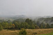
The relief is characterized by the predominance of plains, which cover the western part (low plain) and the central part (high plain) of the county. Timiș County features all landforms, with altitudes between 75 m in Banat Plain and 1,374 m in Poiana Ruscă Mountains. Proportionally, the plain covers about 6,700 km2, representing 77.2% of the county's area; the hills cover about 1,650 km2, i.e. 19.01%; and the mountains cover a relatively small area of 300 km2, i.e. 3.45%.[6]: 3
The plain penetrates in a gulf-like manner the hilly areas, on the valleys of Timiș (towards Lugoj) and Bega (towards Făget).[9] In the east of the county lie the pre-mountain hills of Buziaș and the southern sector of the Lipova Plateau, whose peaks rise to altitudes between 200 and 400 m. The hills of Lăpugiu, Făget, Lugoj, Lipova, Silagiu and Sacoș are rich in pastures, orchards of fruit trees, vineyards, but also in cereal crops. The relief in the eastern part of the county is dominated by the Poiana Ruscă Mountains, with deep valleys and steep slopes, with heights that rarely exceed 1300 m (Padeș peak – 1374 m, Rusca peak – 1355 m).[10]: 8–9
-
 Agricultural landscape in Aranca Plain
 -
 Lipova Plateau
 -
 Poiana Ruscă Mountains

.JPG)

Natural resources
Located in the southeastern part of the Pannonian Plain, the subsoil of Timiș County there are deposits of lignite (Sinersig), basalt (Lucareț–Șanovița), manganese (Pietroasa), clay (Biled, Cărpiniș, Jimbolia, Lugoj and Sânnicolau Mare), crude oil and gas (in the western part of the county), sand (Șag) and glass sand (Groși–Făget, Tomești and Gladna Montană).[6]: 4 Mineral waters are also exploited in Buziaș, Călacea, Ivanda, Bogda and Timișoara. The soil of Timiș County offers extremely favorable conditions for the cultivation of agricultural plants, especially for the cultivation of cereals, but also for technical and fodder plants, as well as for fruit growing and viticulture. The forests are relatively few. In the eastern part there are forests of fir, spruce and beech. In the other parts of the county there are small forests of oak, Austrian oak, Hungarian oak, and in the meadows – poplars and willows.[11]
Hydrography

The hydrographic network of Timiș County, spread over 3,104 km, is composed of two hydrographic basins: Bega–Timiș–Caraș and Mureș. The most important rivers in size and hydropower potential in the county, which cross the territory through the center, dividing it into two halves, south and north, are Timiș and Bega. Timiș is the largest inland river in Banat, which has its sources on the eastern slopes of the Semenic Mountains, in Caraș-Severin County. The river is formed at the confluence of three branches: Semenic, Grădiște and Brebu. It crosses the whole of Timiș County, then passes into Serbia where it flows into the Danube, to Pančevo. Bega River springs from the Poiana Ruscă Mountains and flows into the Tisza after a route of 244 km, being its southernmost tributary. Downstream, towards the western edge, up to the border, the course of the Bega River is completely canalized. The Bega Canal is navigable both in Romania and in Serbia, having a length of 44 km only in Romania.

The natural lakes, with small areas and depths, are represented by the lake complex of Satchinez (40 ha; 1.5 m deep), the two lakes of Becicherecu Mic (one of 33 ha and another of 13 ha), the Petra pond of Jebel, etc. Between 1969 and 1975, pond-like lakes for flood control, irrigation and fishing were arranged on the courses of both Timiș and Bega. The largest of these, Lake Surduc, was arranged on Gladna stream, a tributary of the Bega, and has an area of 460 ha and a volume of 51 million m3.[12] In the county there are also two lakes with hot (20 °C) and mineral water at Românești, with an area of 50 m2 and the muddy volcano from Ohaba-Forgaci, in the Magheruș valley, of 50 m2.
The high density of the hydrographic network, the low slopes of the riverbeds in the plain sector, the reduced depth of the groundwater, the presence of ultisols, all favor the floods and marshes. To reduce the amplitude of these phenomena, since the first half of the 18teenth century, large engineering works (damming, canalization, draining etc.) were made in the region, most of which are still functional today. Among the major flash floods and floods in the Banat Plain, the most important were those of May 1912, June 1966 and April 2005.[13]
Flora
The natural vegetation, strongly influenced by human activities, is characterized by the small-scale presence of forest-steppe plants and by a higher frequency of hydro- and hygrophilous vegetation in low plains and meadows with excess moisture. The extensive agricultural crops in the plain alternate with small areas of secondary meadows dominated by fescue associations (Festuca valesiaca, Festuca rupicola and Festuca pseudovina) mixed with wormwood (Artemisia austriaca) and others. The deciduous forests, made up of pedunculate oak (Quercus robur), Austrian oak (Quercus cerris) and Hungarian oak (Quercus frainetto), occupy insularly or on compact areas the Lipova Plateau, the Lugoj and Pogăniș Hills and partly the Gătaia Plain. In the eastern extremity of Timiș County there are sessile oak forests (Quercus petraea) mixed with Austrian oak (Quercus cerris), beech forests (Fagus sylvatica) mixed with hornbeam (Carpinus betulus), and the upper slopes of the Poiana Ruscă Mountains are covered with spruce forests mixed with fir and beech.
In Timiș County there are 45 nature reserves that total 134,766.49 ha or about 13% of the county's area.[14]
Fauna
The fauna, adapted to the relief and vegetation conditions, includes steppe species (hares, ground squirrels, polecats, field mice, moles, rollers, quails, partridges, larks, starlings, lizards, various insects), forest species (deer, squirrels, bears, wolves, foxes, wild boars, wildcats, dormice, jays, salamanders, etc.) and water species (herons, mallards, geese, storks, frogs and a wide variety of fish, such as pike, barbel, Prussian carp, wels, perch, carp, etc.).
Climate
The climate has a moderate temperate continental character, with hot summers and mild winters due to both the influences of the oceanic (from the west) and Mediterranean (from the south and southwest) air masses and the fact that over 85% of the territory belongs to the plain climate (the remaining 15% belongs to the climate of hilly and mountainous regions).[15]: 49 The western area of the Banat Plain is classified according to Köppen's guide as Cfa, and the mountainous area in the east of the county as Dfb.[15]: 50 Due to the high uniformity of the relief, the average annual temperatures are poorly differentiated on the territory of Timiș County. The annual averages are close to 11 °C in the region with plain climate and decrease by 1–2 °C on the hills in the east of the county.[10]: 9 The averages of the warmest month (July) exceed 21 °C in the plain and fall below 18 °C in the east. The averages of the coldest month (January) are higher than –2 °C in the plain and rise to values higher than –1 °C in the east of the county. The absolute maximum temperature (42 °C) was recorded in Banloc (24 July 2007), and the absolute minimum temperature (–35.3 °C) in Timișoara (29 January 1963).[15]: 55
The average multiannual precipitation amounts to increasing quantities from west to east, i.e. 569 mm in Jimbolia, 620.6 mm in Timișoara, 734 mm in Făget and over 1,200 mm on the ridges of the Poiana Ruscă Mountains. The maximum rainfall occurs in June, as a result of the intensification of cyclonic activity in the North Atlantic or in the Mediterranean basin. On the other hand, the lowest average monthly amounts fall in February–March. The snow layer is unstable and has insignificant thicknesses.
Predominant winds blow from the north (16.9%), east (15%), northwest (9.1%) and south (8.4%), with average annual speeds between 1.2 and 3.8 m/s. Local winds include austru (dry wind from the south), coșavă (high-speed cold wind), rușavăț (in the Banat Plain) and mountain breezes (in the east).[15]: 65
| Territory | Plain | Hills | Mountains | ||
|---|---|---|---|---|---|
| Topoclimate | Low plain | High plain | Banat Hills | Poiana Ruscă | |
| Average annual temperature (°C) | 10…11 | 10…11 | 8…11 | 2…6 | |
| Average temperature (°C) in | January | >–2 | <–2 | <–3 | –4…–6 |
| July | >21 | 20…21 | 18…19 | 14…17 | |
| Average annual amplitude (°C) | >23 | 22…23 | 21…22 | 20…21 | |
| No. of days with frost | <90 | <90 | 100…110 | >180 | |
| No. of days without frost | 190 | 180…190 | 160…180 | 120…160 | |
| No. of tropical days | >40 | 30…40 | 20…30 | <5 | |
| Average annual rainfall (mm) | <600 | 600…700 | 800…1,000 | >1,200 | |
| No. of days with snow cover | <40 | 40…50 | 50…75 | 75…100 | |
| Relative humidity in July (%) | <64 | <64 | <64…>72 | 72…80 | |
| No. of clear days | >60 | >60 | >50 | 40…50 | |
| Sources: [16][17] | |||||
History
This section is empty. You can help by adding to it. (June 2022) |
Demographics
Ethnic composition of Timiș County (2021)
Religious composition of Timiș County (2021)
According to the 2021 census, Timiș County had a population of 650,533 (or 3.4% of the country's population), being the sixth most populous county in Romania. The population density was 74.8/km2 (193.7/sq mi).[18]
Timiș County has an urbanization rate of 61.8%,[19]: 8 above the national rate but decreasing amid an expanding suburbanization.[20]
| ||||||||||||
| Census[21][22] | Ethnic group | |||||||||||
|---|---|---|---|---|---|---|---|---|---|---|---|---|
| Year | Population | Romanians | Hungarians | Germans | Jews | Roma | Ukrainians | Serbs | Slovaks | Bulgarians | ||
| 1880 | 454,145 | 200,834 (44.2%) | 33,947 (7.5%) | 171,539 (37.8%) | — | — | 64 (<0.1%) | 31,316 (6.9%) | 3,549 (0.8%) | — | ||
| 1890* | 502,582 | 211,748 (42.1%) | 45,998 (9.2%) | 195,588 (38.9%) | — | — | 49 (<0.1%) | 31,467 (6.3%) | 2,869 (0.6%) | — | ||
| 1900* | 541,849 | 221,305 (40.8%) | 70,338 (13%) | 201,795 (37.2%) | — | — | 69 (<0.1%) | 30,939 (5.7%) | 2,911 (0.5%) | — | ||
| 1910* | 560,258 | 223,816 (39.9%) | 96,364 (17.2%) | 188,440 (33.6%) | — | — | 296 (0.1%) | 32,430 (5.8%) | 3,269 (0.6%) | — | ||
| 1920 | 512,891 | 217,056 (42.3%) | 74,324 (14.5%) | 168,605 (32.9%) | 11,779 (2.3%) | — | — | — | — | — | ||
| 1930 | 559,591 | 236,305 (42.2%) | 84,756 (15.1%) | 178,238 (31.9%) | 9,768 (1.7%) | 8,090 (1.4%) | 1,399 (0.3%) | 27,075 (4.8%) | 3,919 (0.7%) | 7,527 (1.3%) | ||
| 1941 | 578,881 | 263,474 (45.5%) | 74,745 (12.9%) | 176,732 (30.5%) | — | — | — | — | — | — | ||
| 1956 | 568,881 | 325,834 (57.3%) | 77,530 (13.6%) | 114,194 (20.1%) | 7,378 (1.3%) | 6,089 (1.1%) | 1,405 (0.2%) | 23,781 (4.2%) | 2,667 (0.5%) | 7,440 (1.3%) | ||
| 1966 | 607,596 | 378,183 (62.2%) | 76,183 (12.5%) | 109,315 (18%) | 2,909 (0.5%) | 4,637 (0.8%) | 1,780 (0.3%) | 22,709 (3.7%) | 2,300 (0.4%) | 7,509 (1.2%) | ||
| 1977 | 696,884 | 472,912 (67.9%) | 77,525 (11.1%) | 98,296 (14.1%) | 1,799 (0.3%) | 9,828 (1.4%) | 3,773 (0.5%) | 20,891 (3%) | 2,128 (0.3%) | 7,151 (1%) | ||
| 1992 | 700,033 | 561,200 (80.2%) | 62,866 (9%) | 26,722 (3.8%) | 625 (0.1%) | 14,836 (2.1%) | 6,468 (0.9%) | 17,144 (2.4%) | 2,229 (0.3%) | 6,466 (0.9%) | ||
| 2002 | 677,926 | 565,639 (83.4%) | 50,556 (7.5%) | 14,174 (2.1%) | 441 (0.1%) | 16,084 (2.4%) | 7,321 (1.1%) | 13,273 (2%) | 1,908 (0.3%) | 5,562 (0.8%) | ||
| 2011 | 683,540 | 550,836 (80.6%) | 35,295 (5.2%) | 8,504 (1.2%) | 220 (<0.1%) | 14,525 (2.1%) | 5,950 (0.9%) | 10,344 (1.5%) | 1,424 (0.2%) | 4,478 (0.7%) | ||
| *Censuses in italics are based on mother tongue and not ethnicity. | ||||||||||||
According to the 2011 census, Hungarians are the largest ethnic minority in Timiș County, numbering 35,295 people or 5.2% of the county's population. Significant concentrations of the Hungarian population follow the areas where the policy of colonization of the Kingdom of Hungary manifested itself in the 19th century and the beginning of the 20th century. At the 2011 census, there were 16 localities – all rural – that had at least 20% Hungarian population. However, their total population represents only 12.6% of the Hungarian population in the county. This is explained by the migration of Hungarians from rural to urban areas after 1990. By weight, the largest Hungarian communities are found in Otelec (Ótelek; 75.1%), Cherestur (Pusztakeresztúr; 69.7%), Bodo (Nagybodófalva; 64%), Tormac (Végvár; 60.6%) and Otvești (Ötvösd; 52.6%).[23]
Roma are the second largest minority, with 14,525 people (or 2.1% of the county's population) at the 2011 census, although unofficial estimates put the figure at 45,000.[24] Măguri, a component locality of Lugoj municipality, is the only village in the county where the Roma have an absolute majority (69.4% in 2011).[25]
The largest communities of Serbs, Germans and Bulgarians in Romania also live in Timiș County. The number of Serbs living in Timiș exceeds 10,000. Most of them are located in Timișoara and in the localities near the border with Serbia: Cralovăț (Краљевац/Kraljevac; 64.5%), Petrovaselo (Петрово Село/Petrovo Selo; 48.4%), Sânmartinu Sârbesc (Српски Семартон/Srpski Semarton; 35.6%), Cenei (Ченеј/Čenej; 24.2%), Diniaș (Дињаш/Dinjaš; 21.8%), etc.[26] Up to the 20th century, the Germans (specifically Banat Swabians) were a very large community. They were colonized here at the end of the 17th century and during the 18th century, in three successive waves, during the reigns of Charles VI, Maria Theresa and Joseph II. They came from different areas of Germany, especially Rhineland, the Palatinate and Swabia, but also Luxembourg, Lorraine, Alsace, Westphalia, Hesse, East Franconia and Bavaria. Deported to the Soviet Union for forced labor after 1945 and subjected to nationalization and collectivization during the communist period, most Germans in Timiș County left for Germany and Austria, with one last wave after 1990.[27] At present, they account for merely 1/24 of the number at the 1900 census, when the highest number of Germans was recorded. Banat Bulgarians, a Bulgarian Catholic minority, began settling in Banat in the late 17th century from the north and northwest of today's Bulgaria. The largest communities of Banat Bulgarians in Timiș County live in Breștea (Brešća; 80.3%), Dudeștii Vechi (Stár Bišnov; 66.5%) and Denta (Dénta; 5.2%).[28]
Religion
In Timiș County there are over 300 places of worship.[29] Timisoara is the seat of the Archbishopric of Timișoara, the see of the Metropolis of Banat. The archbishopric has jurisdiction over the territory of Timiș County, which is divided into 273 parishes organized in six deaneries (Timișoara I, Timișoara II, Lugoj, Făget, Deta and Sânnicolau Mare).[30] Timișoara is also the seat of the Roman Catholic Archbishopric of Timișoara and the Serbian Orthodox Diocese of Timișoara and one of the nine deaneries of the Reformed Eparchy of Piatra Craiului. Lugoj is the seat of the Greek Catholic Archbishopric of Lugoj and one of the two deaneries of the Ukrainian Orthodox Vicarage.[31]
Politics and administration
Timiș County is administered by a county council (consiliu județean) consisting of 36 councilors. Following the 2020 local elections, the council is chaired by Alin Nica from PNL,[1] and the political composition of the council is as follows:[32]