A | B | C | D | E | F | G | H | CH | I | J | K | L | M | N | O | P | Q | R | S | T | U | V | W | X | Y | Z | 0 | 1 | 2 | 3 | 4 | 5 | 6 | 7 | 8 | 9
Slovak Republic Slovenská republika (Slovak) | |
|---|---|
| Anthem: Nad Tatrou sa blýska (Slovak) (English: "Lightning over the Tatras") | |
| National seal | |
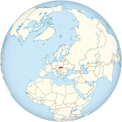
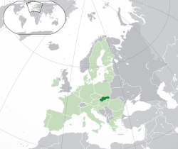
Location of Slovakia (dark green) – in Europe (green & dark grey) | |
| Capital and largest city | Bratislava 48°09′N 17°07′E / 48.150°N 17.117°E |
| Official languages | Slovak |
| Ethnic groups (2021)[1] |
|
| Religion (2021)[2] |
|
| Demonym(s) | Slovak |
| Government | Unitary parliamentary republic |
| Zuzana Čaputová | |
| Robert Fico | |
| Peter Žiga (acting) | |
| Legislature | National Council |
| Establishment history | |
| 28 October 1918 | |
| 30 September 1938 | |
• Autonomous Land of Slovakia (within Second Czechoslovak Republic) | 23 November 1938 |
| 14 March 1939 | |
| 24 October 1945 | |
| 25 February 1948 | |
| 11 July 1960 | |
• Slovak Socialist Republic (within Czechoslovak Socialist Republic, change of unitary Czechoslovak state into a federation) | 1 January 1969 |
• Slovak Republic (change of name within established Czech and Slovak Federative Republic) | 1 March 1990 |
| 1 January 1993 | |
| Area | |
• Total | 49,035 km2 (18,933 sq mi) (127th) |
• Water (%) | 0.72 (2015)[3] |
| Population | |
• 2022 census | |
• Density | 111/km2 (287.5/sq mi) (88th) |
| GDP (PPP) | 2024 estimate |
• Total | |
• Per capita | |
| GDP (nominal) | 2024 estimate |
• Total | |
• Per capita | |
| Gini (2022) | low (1st) |
| HDI (2022) | very high (45th) |
| Currency | Euro (€) (EUR) |
| Time zone | UTC+1 (CET) |
• Summer (DST) | UTC+2 (CEST) |
| Date format | d. m. yyyy |
| Driving side | right |
| Calling code | +421 |
| ISO 3166 code | SK |
| Internet TLD | .sk and .eu |
Slovakia (/sloʊˈvækiə, -ˈvɑːk-/ ;[8][9] Slovak: Slovensko [ˈslɔʋenskɔ] ), officially the Slovak Republic (Slovak: Slovenská republika [ˈslɔʋenskaː ˈrepublika] ), is a landlocked country in Central Europe. It is bordered by Poland to the north, Ukraine to the east, Hungary to the south, Austria to the west, and the Czech Republic to the northwest. Slovakia's mostly mountainous territory spans about 49,000 square kilometres (19,000 sq mi), hosting a population exceeding 5.4 million. The capital and largest city is Bratislava, while the second largest city is Košice.
The Slavs arrived in the territory of the present-day Slovakia in the 5th and 6th centuries. From the late 6th century, parts of modern Slovakia were incorporated in the Avar Khaghanate. In the 7th century, the Slavs played a significant role in the creation of Samo's Empire. In the 9th century, the Avar Khaghanate dissolved, and the Slavs established the Principality of Nitra, which was later conquered by the Principality of Moravia, leading to the formation of Great Moravia. In the 10th century, after the dissolution of Great Moravia, the territory was integrated into the Principality of Hungary, which then became the Kingdom of Hungary in 1000.[10] In 1241 and 1242, after the Mongol invasion of Europe, much of the territory was destroyed, but was recovered largely thanks to Béla IV.
After World War I and the dissolution of the Austro-Hungarian Empire, the state of Czechoslovakia was established, incorporating Slovakia. In the lead up to World War II, local fascist parties gradually came to power in the Slovak lands, and the first Slovak Republic was established as a client state under the control of Nazi Germany.[11] The local Jewish population was heavily persecuted, with almost 70,000 Jews being murdered or deported. Internal opposition to the fascist government's policies culminated in the Slovak National Uprising, itself triggered by the Nazi German occupation of the country. Although the uprising was eventually suppressed, partisan resistance continued, and Czechoslovak independence was re-established after the country's liberation at the end of the war.
Following the Soviet-backed coup of 1948, Czechoslovakia became a communist state within the Eastern Bloc and a satellite state of the Soviet Union. Attempts to liberalise communism culminated in the Prague Spring, which was suppressed by the Warsaw Pact invasion of Czechoslovakia in August 1968. In 1989, the Velvet Revolution peacefully ended Communist rule in Czechoslovakia. Slovakia became an independent state on 1 January 1993 after the peaceful dissolution of Czechoslovakia, sometimes known as the Velvet Divorce.
Slovakia is a developed country with an advanced high-income economy. The country maintains a combination of a market economy with a comprehensive social security system, providing citizens with universal health care, free education, and one of the longest paid parental leaves in the OECD.[12] Slovakia is a member of the European Union, the Eurozone, the Schengen Area, the United Nations, NATO, CERN, the OECD, the WTO, the Council of Europe, the Visegrád Group, and the OSCE. Slovakia is also home to eight UNESCO World Heritage Sites. The world's largest per-capita car producer, Slovakia manufactured a total of 1.1 million cars in 2019, representing 43% of its total industrial output.[13]
Etymology
Slovakia's name means the "Land of the Slavs" (Slovensko in Slovak stemming from the older form Sloven/Slovienin). As such, it is a cognate of the words Slovenia and Slavonia. In medieval Latin, German, and even some Slavic sources, the same name has often been used for Slovaks, Slovenes, Slavonians, and Slavs in general. According to one of the theories, a new form of national name formed for the ancestors of the Slovaks between the 13th and 14th century, possibly due to foreign influence; the Czech word Slovák (in medieval sources from 1291 onward).[14] This form slowly replaced the name for the male members of the community, but the female name (Slovenka), reference to the lands inhabited (Slovensko) and the name of the language (slovenčina) all remained the same, with their base in the older form (compare to Slovenian counterparts). Most foreign translations tend to stem from this newer form (Slovakia in English, Slowakei in German, Slovaquie in French, etc.).
In medieval Latin sources, terms Slavus, Slavonia, or Slavorum (and more variants, from as early as 1029)[14] have been used. In German sources, names for the Slovak lands were Windenland or Windische Lande (early 15th century),[15] with the forms Slovakia and Schlowakei starting to appear in the 16th century.[16] The present Slovak form Slovensko is first attested in the year 1675.[17]
History
The oldest surviving human artefacts from Slovakia are found near Nové Mesto nad Váhom and are dated at 270,000 BCE, in the Early Paleolithic era. These ancient tools, made by the Clactonian technique, bear witness to the ancient habitation of Slovakia.[18]
Other stone tools from the Middle Paleolithic era (200,000–80,000 BCE) come from the Prévôt (Prepoštská) cave in Bojnice and from other nearby sites.[19] The most important discovery from that era is a Neanderthal cranium (c. 200,000 BCE), discovered near Gánovce, a village in northern Slovakia.
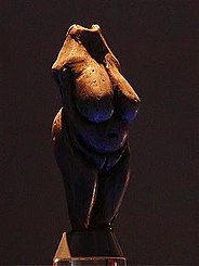
Archaeologists have found prehistoric human skeletons in the region, as well as numerous objects and vestiges of the Gravettian culture, principally in the river valleys of Nitra, Hron, Ipeľ, Váh and as far as the city of Žilina, and near the foot of the Vihorlat, Inovec, and Tribeč mountains, as well as in the Myjava Mountains. The most well-known finds include the oldest female statue made of mammoth bone (22,800 BCE), the famous Venus of Moravany. The statue was found in the 1940s in Moravany nad Váhom near Piešťany. Numerous necklaces made of shells from Cypraca thermophile gastropods of the Tertiary period have come from the sites of Zákovská, Podkovice, Hubina, and Radošina. These findings provide the most ancient evidence of commercial exchanges carried out between the Mediterranean and Central Europe.
Bronze Age
During the Bronze Age, the geographical territory of modern-day Slovakia went through three stages of development, stretching from 2000 to 800 BCE. Major cultural, economic, and political development can be attributed to the significant growth in production of copper, especially in central Slovakia (for example in Špania Dolina) and northwest Slovakia. Copper became a stable source of prosperity for the local population.
After the disappearance of the Čakany and Velatice cultures, the Lusatian people expanded building of strong and complex fortifications, with the large permanent buildings and administrative centres. Excavations of Lusatian hill forts document the substantial development of trade and agriculture at that period. The richness and diversity of tombs increased considerably. The inhabitants of the area manufactured arms, shields, jewellery, dishes, and statues.
Iron Age
Hallstatt Period
The arrival of tribes from Thrace disrupted the people of the Kalenderberg culture, who lived in the hamlets located on the plain (Sereď) and in the hill forts like Molpír, near Smolenice, in the Little Carpathians. During Hallstatt times, monumental burial mounds were erected in western Slovakia, with princely equipment consisting of richly decorated vessels, ornaments and decorations. The burial rites consisted entirely of cremation. Common people were buried in flat urnfield cemeteries.
A special role was given to weaving and the production of textiles. The local power of the "Princes" of the Hallstatt period disappeared in Slovakia during the century before the middle of first millennium BCE, after strife between the Scytho-Thracian people and locals, resulting in abandonment of the old hill-forts. Relatively depopulated areas soon caught the interest of emerging Celtic tribes, who advanced from the south towards the north, following the Slovak rivers, peacefully integrating into the remnants of the local population.
La Tène Period
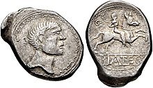
From around 500 BCE, the territory of modern-day Slovakia was settled by Celts, who built powerful oppida on the sites of modern-day Bratislava and Devín. Biatecs, silver coins with inscriptions in the Latin alphabet, represent the first known use of writing in Slovakia. At the northern regions, remnants of the local population of Lusatian origin, together with Celtic and later Dacian influence, gave rise to the unique Púchov culture, with advanced crafts and iron-working, many hill-forts and fortified settlements of central type with the coinage of the "Velkobysterecky" type (no inscriptions, with a horse on one side and a head on the other). This culture is often connected with the Celtic tribe mentioned in Roman sources as Cotini.
Roman Period

From 2 CE, the expanding Roman Empire established and maintained a series of outposts around and just south of the Danube, the largest of which were known as Carnuntum (whose remains are on the main road halfway between Vienna and Bratislava) and Brigetio (present-day Szőny at the Slovak-Hungarian border). Such Roman border settlements were built on the present area of Rusovce, currently a suburb of Bratislava. The military fort was surrounded by a civilian vicus and several farms of the villa rustica type. The name of this settlement was Gerulata. The military fort had an auxiliary cavalry unit, approximately 300 horses strong, modelled after the Cananefates. The remains of Roman buildings have also survived in Stupava, Devín Castle, Bratislava Castle Hill, and the Bratislava-Dúbravka suburb.
Near the northernmost line of the Roman hinterlands, the Limes Romanus, there existed the winter camp of Laugaricio (modern-day Trenčín) where the Auxiliary of Legion II fought and prevailed in a decisive battle over the Germanic Quadi tribe in 179 CE during the Marcomannic Wars. The Kingdom of Vannius, a kingdom founded by the Germanic Suebi tribes of Quadi and Marcomanni, as well as several small Germanic and Celtic tribes, including the Osi and Cotini, existed in western and central Slovakia from 8–6 BCE to 179 CE.
Great invasions from the fourth to seventh centuries
In the second and third centuries CE, the Huns began to leave the Centrál Asian steppes. They crossed the Danube in 377 CE and occupied Pannonia, which they used for 75 years as their base for launching looting-raids into Western Europe. However, Attila's death in 453 brought about the disappearance of the Hunnic empire. In 568, a Turko-Mongol tribal confederacy, the Avars, conducted its invasion into the Middle Danube region. The Avars occupied the lowlands of the Pannonian Plain and established an empire dominating the Carpathian Basin.
In 623, the Slavic population living in the western parts of Pannonia seceded from their empire after a revolution led by Samo, a Frankish merchant.[20] After 626, the Avar power started a gradual decline[21] but its reign lasted to 804.
Slavic states
The Slavic tribes settled in the territory of present-day Slovakia in the fifth century. Western Slovakia was the centre of Samo's empire in the seventh century. A Slavic state known as the Principality of Nitra arose in the eighth century and its ruler Pribina had the first known Christian church of the territory of present-day Slovakia consecrated by 828. Together with neighbouring Moravia, the principality formed the core of the Great Moravian Empire from 833. The high point of this Slavonic empire came with the arrival of Saints Cyril and Methodius in 863, during the reign of Duke Rastislav, and the territorial expansion under King Svätopluk I.
Great Moravia (830–before 907)
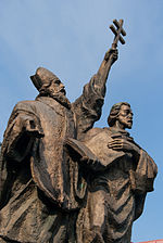
Great Moravia arose around 830 when Mojmír I unified the Slavic tribes settled north of the Danube and extended the Moravian supremacy over them.[22] When Mojmír I endeavoured to secede from the supremacy of the king of East Francia in 846, King Louis the German deposed him and assisted Mojmír's nephew Rastislav (846–870) in acquiring the throne.[23] The new monarch pursued an independent policy: after stopping a Frankish attack in 855, he also sought to weaken the influence of Frankish priests preaching in his realm. Duke Rastislav asked the Byzantine Emperor Michael III to send teachers who would interpret Christianity in the Slavic vernacular.
On Rastislav's request, two brothers, Byzantine officials and missionaries Saints Cyril and Methodius came in 863. Cyril developed the first Slavic alphabet and translated the Gospel into the Old Church Slavonic language. Rastislav was also preoccupied with the security and administration of his state. Numerous fortified castles built throughout the country are dated to his reign and some of them (e.g., Dowina, sometimes identified with Devín Castle)[24][25] are also mentioned in connection with Rastislav by Frankish chronicles.[26][27]
During Rastislav's reign, the Principality of Nitra was given to his nephew Svätopluk as an appanage.[25] The rebellious prince allied himself with the Franks and overthrew his uncle in 870. Similarly to his predecessor, Svätopluk I (871–894) assumed the title of the king (rex). During his reign, the Great Moravian Empire reached its greatest territorial extent, when not only present-day Moravia and Slovakia but also present-day northern and central Hungary, Lower Austria, Bohemia, Silesia, Lusatia, southern Poland and northern Serbia belonged to the empire, but the exact borders of his domains are still disputed by modern authors.[28] Svatopluk also withstood attacks of the Magyar tribes and the Bulgarian Empire, although sometimes it was he who hired the Magyars when waging war against East Francia.[29]
In 880, Pope John VIII set up an independent ecclesiastical province in Great Moravia with Archbishop Methodius as its head. He also named the German cleric Wiching the Bishop of Nitra.

After the death of Prince Svatopluk in 894, his sons Mojmír II (894–906?) and Svatopluk II succeeded him as the Prince of Great Moravia and the Prince of Nitra respectively.[25] However, they started to quarrel for domination of the whole empire. Weakened by an internal conflict as well as by constant warfare with Eastern Francia, Great Moravia lost most of its peripheral territories.
In the meantime, the semi-nomadic Magyar tribes, possibly having suffered defeat from the similarly nomadic Pechenegs, left their territories east of the Carpathian Mountains,[30] invaded the Carpathian Basin and started to occupy the territory gradually around 896.[31] Their armies' advance may have been promoted by continuous wars among the countries of the region whose rulers still hired them occasionally to intervene in their struggles.[32]
It is not known what happened with both Mojmír II and Svatopluk II because they are not mentioned in written sources after 906. In three battles (4–5 July and 9 August 907) near Bratislava, the Magyars routed Bavarian armies. Some historians put this year as the date of the break-up of the Great Moravian Empire, due to the Hungarian conquest; other historians take the date a little bit earlier (to 902).
Great Moravia left behind a lasting legacy in Central and Eastern Europe. The Glagolitic script and its successor Cyrillic were disseminated to other Slavic countries, charting a new path in their sociocultural development.
The Kingdom of Hungary, the Habsburg Monarchy and the Ottoman Empire (1000–1918)

Following the disintegration of the Great Moravian Empire at the turn of the tenth century, the Hungarians annexed the territory comprising modern Slovakia. After their defeat on the river Lech, the Hungarians abandoned their nomadic ways and settled in the centre of the Carpathian valley, slowly adopting Christianity and began to build a new state—the Hungarian kingdom.[33]
In the years 1001–1002 and 1018–1029, Slovakia was part of the Kingdom of Poland, having been conquered by Boleslaus I the Brave.[34] After the territory of Slovakia was returned to Hungary, a semi-autonomous polity continued to exist (or was created in 1048 by king Andrew I) called Duchy of Nitra. Comprising roughly the territory of Principality of Nitra and Bihar principality, they formed what was called a tercia pars regni, third of a kingdom.[35]
This polity existed up until 1108/1110, after which it was not restored. After this, until the year 1918, when the Austro-Hungarian empire collapsed, the territory of Slovakia was an integral part of the Hungarian state.[36][37][38] The ethnic composition of Slovakia became more diverse with the arrival of the Carpathian Germans in the 13th century and the Jews in the 14th century.
A significant decline in the population resulted from the invasion of the Mongols in 1241 and the subsequent famine. However, in medieval times the area of Slovakia was characterised by German and Jewish immigration, burgeoning towns, construction of numerous stone castles, and the cultivation of the arts.[39] The arrival of German element sometimes proved a problem for the autochthonous Slovaks (and even Hungarians in the broader Hungary), since they often quickly gained most power in medieval towns, only to later refuse to share it. Breaking of old customs by Germans often resulted in national quarrels. One of which had to be sorted out by the king Louis I. with the proclamation Privilegium pro Slavis (Privilege for Slovaks) in the year 1381. According to this privilege, Slovaks and Germans were to occupy each half of the seats in the city council of Žilina and the mayor should be elected each year, alternating between those nationalities. This would not be the last such case.[40]
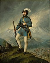
In 1465, King Matthias Corvinus founded the Hungarian Kingdom's third university, in Pressburg (Bratislava), but it was closed in 1490 after his death.[41] Hussites also settled in the region after the Hussite Wars.[42]
Owing to the Ottoman Empire's expansion into Hungarian territory, Bratislava was designated the new capital of Hungary in 1536, ahead of the fall of the old Hungarian capital of Buda in 1541. It became part of the Austrian Habsburg monarchy, marking the beginning of a new era. The territory comprising modern Slovakia, then known as Upper Hungary, became the place of settlement for nearly two-thirds of the Magyar nobility fleeing the Turks and became far more linguistically and culturally Hungarian than it was before.[42] Partly thanks to old Hussite families and Slovaks studying under Martin Luther, the region then experienced a growth in Protestantism.[42] For a short period in the 17th century, most Slovaks were Lutherans.[42] They defied the Catholic Habsburgs and sought protection from neighbouring Transylvania, a rival continuation of the Magyar state that practised religious tolerance and normally had Ottoman backing. Upper Hungary, modern Slovakia, became the site of frequent wars between Catholics in the west territory and Protestants in the east, as well as against Turks; the frontier was on a constant state of military alert and heavily fortified by castles and citadels often manned by Catholic German and Slovak troops on the Habsburg side. By 1648, Slovakia was not spared the Counter-Reformation, which brought the majority of its population from Lutheranism back to Roman Catholicism. In 1655, the printing press at the Trnava university produced the Jesuit Benedikt Szöllősi's Cantus Catholici, a Catholic hymnal in Slovak that reaffirmed links to the earlier works of Cyril and Methodius.
The Ottoman wars, the rivalry between Austria and Transylvania, and the frequent insurrections against the Habsburg monarchy inflicted a great deal of devastation, especially in the rural areas.[43] In the Austro-Turkish War (1663–1664) a Turkish army led by the Grand Vizier decimated Slovakia.[42] In 1682, the Principality of Upper Hungary, a short-lived Ottoman vassal state, was established in the territory of modern Slovakia. Prior to this, regions on its southern rim were already encompassed in the Egri, Budin and Uyvar eyalets.[44][45] Thököly's kuruc rebels from the Principality of Upper Hungary fought alongside the Turks against the Austrians and Poles at the Battle of Vienna of 1683 led by John III Sobieski. As the Turks withdrew from Hungary in the late 17th century, the importance of the territory composing modern Slovakia decreased, although Pressburg retained its status as the capital of Hungary until 1848 when it was transferred back to Buda.[46]
During the revolution of 1848–49, the Slovaks supported the Austrian Emperor, hoping for independence from the Hungarian part of the Dual Monarchy, but they failed to achieve their aim. Thereafter relations between the nationalities deteriorated (see Magyarisation), culminating in the secession of Slovakia from Hungary after World War I.[47]
Czechoslovak independence (1918–1939)

On 18 October 1918, Tomáš Garrigue Masaryk, Milan Rastislav Štefánik and Edvard Beneš declared in Washington, D.C. the independence for the territories of Bohemia, Moravia, Silesia, Upper Hungary and Carpathian Ruthenia from the Austro-Hungarian Empire and proclaimed a common state, Czechoslovakia. In 1919, during the chaos following the break-up of Austria-Hungary, Czechoslovakia was formed with numerous Germans, Slovaks, Hungarians and Ruthenians within the newly set borders. The borders were set by the Treaty of Saint Germain and Treaty of Trianon. In the peace following the World War, Czechoslovakia emerged as a sovereign European state. It provided what were at the time rather extensive rights to its minorities.
During the Interwar period, democratic Czechoslovakia was allied with France, and also with Romania and Yugoslavia (Little Entente); however, the Locarno Treaties of 1925 left East European security open. Both Czechs and Slovaks enjoyed a period of relative prosperity. There was progress in not only the development of the country's economy but also culture and educational opportunities. Yet the Great Depression caused a sharp economic downturn, followed by political disruption and insecurity in Europe.[48]
In the 1930s Czechoslovakia came under continuous pressure from the revanchist governments of Germany, Hungary and Poland who used the aggrieved minorities in the country as a useful vehicle. Revision of the borders was called for, as Czechs constituted only 43% of the population. Eventually, this pressure led to the Munich Agreement of September 1938, which allowed the majority ethnic Germans in the Sudetenland, borderlands of Czechoslovakia, to join with Germany. The remaining minorities stepped up their pressures for autonomy and the State became federalised, with Diets in Slovakia and Ruthenia. The remainder of Czechoslovakia was renamed Czecho-Slovakia and promised a greater degree of Slovak political autonomy. This, however, failed to materialise.[49] Parts of southern and eastern Slovakia were also reclaimed by Hungary at the First Vienna Award of November 1938.
World War II (1939–1945)
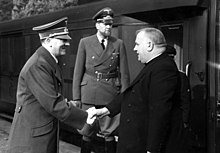
After the Munich Agreement and its Vienna Award, Nazi Germany threatened to annex part of Slovakia and allow the remaining regions to be partitioned by Hungary or Poland unless independence was declared.[citation needed] Thus, Slovakia seceded from Czecho-Slovakia in March 1939 and allied itself, as demanded by Germany, with Hitler's coalition.[50] Secession had created the first Slovak state in history.[51] The government of the First Slovak Republic, led by Jozef Tiso and Vojtech Tuka, was strongly influenced by Germany and gradually became a puppet regime in many respects. On 24 November 1940, Slovakia joined the Axis when its leaders signed the Tripartite Pact.
Meanwhile, the Czechoslovak government-in-exile sought to reverse the Munich Agreement and the subsequent German occupation of Czechoslovakia and to return the Republic to its 1937 boundaries. The government operated from London and it was ultimately considered, by those countries that recognised it, the legitimate government for Czechoslovakia throughout the Second World War.
As part of the Holocaust in Slovakia, 75,000 Jews out of 80,000 who remained on Slovak territory after Hungary had seized southern regions were deported and taken to German death camps.[52][53] Thousands of Jews, Gypsies and other politically undesirable people remained in Slovak forced labour camps in Sereď, Vyhne, and Nováky.[54] Tiso, through the granting of presidential exceptions, allowed between 1,000 and 4,000 people crucial to the war economy to avoid deportations.[55] Under Tiso's government and Hungarian occupation, the vast majority of Slovakia's pre-war Jewish population (between 75,000 and 105,000 individuals including those who perished from the occupied territory) were murdered.[56][57] The Slovak state paid Germany 500 RM per every deported Jew for "retraining and accommodation" (a similar but smaller payment of 30 RM was paid by Croatia).[58]
After it became clear that the Soviet Red Army was going to push the Nazis out of eastern and central Europe, an anti-Nazi resistance movement launched a fierce armed insurrection, known as the Slovak National Uprising, near the end of summer 1944. A bloody German occupation and a guerilla war followed. Germans and their local collaborators completely destroyed 93 villages and massacred thousands of civilians, often hundreds at a time.[59] The territory of Slovakia was liberated by Soviet and Romanian forces by the end of April 1945.
Communist party rule in Czechoslovakia (1948–1989)

After World War II, Czechoslovakia was reconstituted and Jozef Tiso was executed in 1947 for collaboration with the Nazis. More than 80,000 Hungarians[60] and 32,000 Germans[61] were forced to leave Slovakia, in a series of population transfers initiated by the Allies at the Potsdam Conference.[62] Out of about 130,000 Carpathian Germans in Slovakia in 1938, by 1947 only some 20,000 remained.[63][failed verification] The NKVD arrested and deported over 20,000 people to Siberia[64]
As a result of the Yalta Conference, Czechoslovakia came under the influence and later under direct occupation of the Soviet Union and its Warsaw Pact, after a coup in 1948. Eight thousand two hundred and forty people went to forced labour camps in 1948–1953.[65]

In 1968, following the Prague Spring, the country was invaded by the Warsaw Pact forces (People's Republic of Bulgaria, People's Republic of Hungary, People's Republic of Poland, and Soviet Union, with the exception of Socialist Republic of Romania and People's Socialist Republic of Albania), ending a period of liberalisation under the leadership of Alexander Dubček. 137 Czechoslovak civilians were killed[66] and 500 seriously wounded during the occupation.[67]
In 1969, Czechoslovakia became a federation of the Czech Socialist Republic and the Slovak Socialist Republic in the Czechoslovak Socialist Republic. It became a puppet state of the Soviet Union, but it was never part of the Soviet Union and remained independent to a certain degree.
Borders with the West were protected by the Iron Curtain. About 600 people, men, women, and children, were killed on the Czechoslovak border with Austria and West Germany between 1948 and 1989.[68]
Dissolution of Czechoslovakia (1989–1992)
The end of Communist rule in Czechoslovakia in 1989, during the peaceful Velvet Revolution, was followed once again by the country's dissolution, this time into two successor states. The word "socialist" was dropped in the names of the two republics, with the Slovak Socialist Republic renamed as Slovak Republic. On 17 July 1992, Slovakia, led by Prime Minister Vladimír Mečiar, declared itself a sovereign state, meaning that its laws took precedence over those of the federal government. Throughout the autumn of 1992, Mečiar and Czech Prime Minister Václav Klaus negotiated the details for disbanding the federation. In November, the federal parliament voted to dissolve the country officially on 31 December 1992.
Slovak Republic (1993–present)
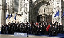
The Slovak Republic and the Czech Republic went their separate ways after 1 January 1993, an event sometimes called the Velvet Divorce.[69][70] Slovakia has, nevertheless, remained a close partner with the Czech Republic. Both countries co-operate with Hungary and Poland in the Visegrád Group. Slovakia became a member of NATO on 29 March 2004 and of the European Union on 1 May 2004. 21 December 2007 saw Slovakia join the Schengen area allowing visa free travel. On 1 January 2009, Slovakia adopted the Euro as its national currency at 30.1260 korunas to the euro.[71] In 2019, Zuzana Čaputová became Slovakia's first female president.[72]
Geography
Slovakia lies between latitudes 47° and 50° N, and longitudes 16° and 23° E. The Slovak landscape is noted primarily for its mountainous nature, with the Carpathian Mountains extending across most of the northern half of the country. Among these mountain ranges are the high peaks of the Fatra-Tatra Area (including Tatra Mountains, Greater Fatra and Lesser Fatra), Slovak Ore Mountains, Slovak Central Mountains or Beskids. The largest lowland is the fertile Danubian Lowland in the southwest, followed by the Eastern Slovak Lowland in the southeast.[73] Forests cover 41% of Slovak land surface.[74]
Tatra mountains

The Tatra Mountains, with 29 peaks higher than 2,500 metres (8,202 feet) AMSL, are the highest mountain range in the Carpathian Mountains. The Tatras occupy an area of 750 square kilometres (290 sq mi), of which the greater part 600 square kilometres (232 sq mi) lies in Slovakia. They are divided into several parts.
To the north, close to the Polish border, are the High Tatras which are a popular hiking and skiing destination and home to many scenic lakes and valleys as well as the highest point in Slovakia, the Gerlachovský štít at 2,655 metres (8,711 ft) and the country's highly symbolic mountain Kriváň. To the west are the Western Tatras with their highest peak of Bystrá at 2,248 metres (7,375 ft) and to the east are the Belianske Tatras, smallest by area.
Separated from the Tatras proper by the valley of the Váh river are the Low Tatras, with their highest peak of Ďumbier at 2,043 metres (6,703 ft).
The Tatra mountain range is represented as one of the three hills on the coat of arms of Slovakia.
National parksedit

There are 9 national parks in Slovakia, covering 6.5% of the Slovak land surface.[75]
| Name | Established | Area (km2) |
|---|---|---|
| Tatra National Park | 1949 | 738 |
| Low Tatras National Park | 1978 | 728 |
| Veľká Fatra National Park | 2002 | 404 |
| Slovak Karst National Park | 2002 | 346 |
| Poloniny National Park | 1997 | 298 |
| Malá Fatra National Park | 1988 | 226 |
| Muránska planina National Park | 1998 | 203 |
| Slovak Paradise National Park | 1988 | 197 |
| Pieniny National Park | 1967 | 38 |
Cavesedit

Slovakia has hundreds of caves and caverns under its mountains, of which 30 are open to the public.[76] Most of the caves have stalagmites rising from the ground and stalactites hanging from above. There are currently five Slovak caves under UNESCO's World Heritage Site status. They are Dobšiná Ice Cave, Domica, Gombasek Cave, Jasovská Cave and Ochtinská Aragonite Cave. Other caves open to the public include Belianska Cave, Demänovská Cave of Liberty, Demänovská Ice Cave or Bystrianska Cave.
Riversedit

Most of the rivers arise in the Slovak mountains. Some only pass through Slovakia, while others make a natural border with surrounding countries (more than 620 kilometres 390 mi). For example, the Dunajec (17 kilometres 11 mi) to the north, the Danube (172 kilometres 107 mi) to the south or the Morava (119 kilometres 74 mi) to the West. The total length of the rivers on Slovak territory is 49,774 kilometres (30,928 mi).
The longest river in Slovakia is the Váh (403 kilometres 250 mi), the shortest is the Čierna voda. Other important and large rivers are the Myjava, the Nitra (197 kilometres 122 mi), the Orava, the Hron (298 kilometres 185 mi), the Hornád (193 kilometres 120 mi), the Slaná (110 kilometres 68 mi), the Ipeľ (232 kilometres 144 mi, forming the border with Hungary), the Bodrog, the Laborec, the Latorica and the Ondava.
The biggest volume of discharge in Slovak rivers is during spring, when the snow melts from the mountains. The only exception is the Danube, whose discharge is the greatest during summer when the snow melts in the Alps. The Danube is the largest river that flows through Slovakia.[77]
Climateedit
The Slovak climate lies between the temperate and continental climate zones with relatively warm summers and cold, cloudy and humid winters. Temperature extremes are between −41 and 40.3 °C (−41.8 and 104.5 °F) although temperatures below −30 °C (−22 °F) are rare. The weather differs from the mountainous north to the plains in the south.
The warmest region is Bratislava and Southern Slovakia where the temperatures may reach 30 °C (86 °F) in summer, occasionally to 39 °C (102 °F) in Hurbanovo. During night, the temperatures drop to 20 °C (68 °F). The daily temperatures in winter average in the range of −5 °C (23 °F) to 10 °C (50 °F). During night it may be freezing, but usually not below −10 °C (14 °F).
In Slovakia, there are four seasons, each season (spring, summer, autumn and winter) lasts three months. The dry continental air brings in the summer heat and winter frosts. In contrast, oceanic air brings rainfalls and reduces summer temperatures. In the lowlands and valleys, there is often fog, especially in winter.
Spring starts with 21 March and is characterised by colder weather with an average daily temperature of 9 °C (48 °F) in the first weeks and about 14 °C (57 °F) in May and 17 °C (63 °F) in June. In Slovakia, the weather and climate in the spring are very unstable.
Summer starts on 22 June and is usually characterised by hot weather with daily temperatures exceeding 30 °C (86 °F). July is the warmest month with temperatures up to about 37 to 40 °C (99 to 104 °F), especially in regions of southern Slovakia - in the urban area of Komárno, Hurbanovo or Štúrovo. Showers or thunderstorms may occur because of the summer monsoon called Medardova kvapka (Medard drop - 40 days of rain). Summer in Northern Slovakia is usually mild with temperatures around 25 °C (77 °F) (less in the mountains).
Autumn in Slovakia starts on 23 September and is mostly characterised by wet weather and wind, although the first weeks can be very warm and sunny. The average temperature in September is around 14 °C (57 °F), in November to 3 °C (37 °F). Late September and early October is a dry and sunny time of year (so-called Indian summer).
Winter starts on 21 December with temperatures around −5 to −10 °C (23 to 14 °F). In December and January, it is usually snowing, these are the coldest months of the year. At lower altitudes, snow does not stay the whole winter, it changes into the thaw and frost. Winters are colder in the mountains, where the snow usually lasts until March or April and the night temperatures fall to −20 °C (−4 °F) and colder.[78]
Biodiversityedit

Slovakia signed the Rio Convention on Biological Diversity on 19 May 1993, and became a party to the convention on 25 August 1994.[79] It has subsequently produced a National Biodiversity Strategy and Action Plan, which was received by the convention on 2 November 1998.[80]
The biodiversity of Slovakia comprises animals (such as annelids, arthropods, molluscs, nematodes and vertebrates), fungi (Ascomycota, Basidiomycota, Chytridiomycota, Glomeromycota and Zygomycota), micro-organisms (including Mycetozoa), and plants. The geographical position of Slovakia determines the richness of the diversity of fauna and flora. More than 11,000 plant species have been described throughout its territory, nearly 29,000 animal species and over 1,000 species of protozoa. Endemic biodiversity is also common.[81]

Slovakia is located in the biome of temperate broadleaf and mixed forests and terrestrial ecoregions of Pannonian mixed forests and Carpathian montane conifer forests.[82] As the altitude changes, the vegetation associations and animal communities are forming height levels (oak, beech, spruce, scrub pine, alpine meadows and subsoil). Forests cover 44% of the territory of Slovakia.[83] The country had a 2019 Forest Landscape Integrity Index mean score of 4.34/10, ranking it 129th globally out of 172 countries.[84] In terms of forest stands, 60% are broadleaf trees and 40% are coniferous trees. The occurrence of animal species is strongly connected to the appropriate types of plant associations and biotopes.[81]
Over 4,000 species of fungi have been recorded from Slovakia.[85][86] Of these, nearly 1,500 are lichen-forming species.[87] Some of these fungi are undoubtedly endemic, but not enough is known to say how many. Of the lichen-forming species, about 40% have been classified as threatened in some way. About 7% are apparently extinct, 9% endangered, 17% vulnerable, and 7% rare. The conservation status of non-lichen-forming fungi in Slovakia is not well documented, but there is a red list for its larger fungi.[88]
Government and politicsedit
Text je dostupný za podmienok Creative Commons Attribution/Share-Alike License 3.0 Unported; prípadne za ďalších podmienok. Podrobnejšie informácie nájdete na stránke Podmienky použitia.
Antropológia
Aplikované vedy
Bibliometria
Dejiny vedy
Encyklopédie
Filozofia vedy
Forenzné vedy
Humanitné vedy
Knižničná veda
Kryogenika
Kryptológia
Kulturológia
Literárna veda
Medzidisciplinárne oblasti
Metódy kvantitatívnej analýzy
Metavedy
Metodika
Text je dostupný za podmienok Creative
Commons Attribution/Share-Alike License 3.0 Unported; prípadne za ďalších
podmienok.
Podrobnejšie informácie nájdete na stránke Podmienky
použitia.
www.astronomia.sk | www.biologia.sk | www.botanika.sk | www.dejiny.sk | www.economy.sk | www.elektrotechnika.sk | www.estetika.sk | www.farmakologia.sk | www.filozofia.sk | Fyzika | www.futurologia.sk | www.genetika.sk | www.chemia.sk | www.lingvistika.sk | www.politologia.sk | www.psychologia.sk | www.sexuologia.sk | www.sociologia.sk | www.veda.sk I www.zoologia.sk


