

A | B | C | D | E | F | G | H | CH | I | J | K | L | M | N | O | P | Q | R | S | T | U | V | W | X | Y | Z | 0 | 1 | 2 | 3 | 4 | 5 | 6 | 7 | 8 | 9
Ningxia | |
|---|---|
| Ningxia Hui Autonomous Region | |
| Chinese transcription(s) | |
| • Chinese characters | 宁夏回族自治区 |
| • Xiao'erjing | نِئٍثِيَا خُوِزُو زِجِکِیُوِ |
| • Pinyin | Níngxià Huízú Zìzhìqū |
| NX/宁 (Níng) transcription(s) | |
 View of the Yellow River passing through Shapotou | |
.svg) Location of Ningxia within China | |
| Country | China |
| Capital (and largest city) | Yinchuan |
| Divisions | 5 prefectures, 21 counties, 219 townships |
| Government | |
| • Type | Autonomous region |
| • Body | Ningxia Hui Autonomous Regional People's Congress |
| • CCP Secretary | Liang Yanshun |
| • Congress Chairman | Liang Yanshun |
| • Government Chairman | Zhang Yupu |
| • CPPCC Chairman | Chen Yong |
| Area | |
| • Total | 66,399.73 km2 (25,637.08 sq mi) |
| • Rank | 27th |
| Highest elevation | 3,556 m (11,667 ft) |
| Population (2020)[2] | |
| • Total | 7,202,654 |
| • Rank | 30th |
| • Density | 110/km2 (280/sq mi) |
| • Rank | 25th |
| Demographics | |
| • Ethnic composition | Han: 62% Hui: 38% |
| • Languages and dialects | Lanyin Mandarin, Zhongyuan Mandarin |
| GDP[3] | |
| • Total | CN¥ 452.0 billion US$ 71.2 billion |
| • Per capita | CN¥ 62,549 US$ 9,695 |
| ISO 3166 code | CN-NX |
| HDI (2019) | 0.728[4] (high) (25th) |
| Website | www |
| Ningxia | |||||||||||||||||||||||||||||||||||||||||||||||||
|---|---|---|---|---|---|---|---|---|---|---|---|---|---|---|---|---|---|---|---|---|---|---|---|---|---|---|---|---|---|---|---|---|---|---|---|---|---|---|---|---|---|---|---|---|---|---|---|---|---|
.svg) "Níngxià" in Simplified (top) and Traditional (bottom) Chinese characters | |||||||||||||||||||||||||||||||||||||||||||||||||
| Simplified Chinese | 宁夏 | ||||||||||||||||||||||||||||||||||||||||||||||||
| Traditional Chinese | 寧夏 | ||||||||||||||||||||||||||||||||||||||||||||||||
| Xiao'erjing | نِئٍثِيَا | ||||||||||||||||||||||||||||||||||||||||||||||||
| Hanyu Pinyin | Níngxià | ||||||||||||||||||||||||||||||||||||||||||||||||
| Postal | Ningsia | ||||||||||||||||||||||||||||||||||||||||||||||||
| Literal meaning | "Pacified Xià" | ||||||||||||||||||||||||||||||||||||||||||||||||
| |||||||||||||||||||||||||||||||||||||||||||||||||
| Ningxia Hui Autonomous Region | |||||||||||||||||||||||||||||||||||||||||||||||||
| Simplified Chinese | 宁夏回族自治区 | ||||||||||||||||||||||||||||||||||||||||||||||||
| Traditional Chinese | 寧夏回族自治區 | ||||||||||||||||||||||||||||||||||||||||||||||||
| Xiao'erjing | نِئٍثِيَا خُوِزُو زِجِٿِيُوِ | ||||||||||||||||||||||||||||||||||||||||||||||||
| Hanyu Pinyin | Níngxià Huízú Zìzhìqū | ||||||||||||||||||||||||||||||||||||||||||||||||
| Postal | Ningsia Hui Autonomous Region | ||||||||||||||||||||||||||||||||||||||||||||||||
| |||||||||||||||||||||||||||||||||||||||||||||||||
Ningxia,[a] officially the Ningxia Hui Autonomous Region, is an autonomous region in Northwestern China.
Formerly a province, Ningxia was incorporated into Gansu in 1954 but was later separated from Gansu in 1958 and reconstituted as an autonomous region for the Hui people, one of the 56 officially recognised nationalities of China. Twenty percent of China's Hui population lives in Ningxia.[7]
Ningxia is bounded by Shaanxi to the east, Gansu to the south and west and Inner Mongolia Autonomous Region to the north and has an area of around 66,400 square kilometres (25,600 sq mi).[1] This sparsely settled, mostly desert region lies partially on the Loess Plateau and in the vast plain of the Yellow River and features the Great Wall of China along its northeastern boundary. Over about 2000 years, an extensive system of canals (with a total length of approximately 1397 kilometers)[8] has been built from Qin dynasty. Extensive land reclamation and irrigation projects have made increased cultivation possible. The arid region of Xihaigu, which covers large parts of the province, suffers from severe water shortage, which the canals were intended to alleviate.[9]
Ningxia was the core area of the Western Xia in the 11th–13th centuries, established by the Tangut people; its name, "Peaceful Xia", derived from the Mongol conquest of the state.[10] The Tanguts made significant achievements in literature, art, music, and architecture, particularly invented Tangut script. Long one of the country's poorest areas, a small winemaking industry has become economically important since the 1980s. Before the arrival of viticulture, Ningxia's 6.8 million people, 36 per cent of whom are Muslims from the Hui ethnic group, relied largely on animal grazing, subsistence agriculture and the cultivation of wolfberries used in traditional Chinese medicine. Since then, winemaking has become the premier specialty of Ningxia, and the province devotes almost 40,000 hectares to vineyards and producing 120 million bottles of wine in 2017 – a quarter of the entire nation's production.[11]
History

As a frontier zone between nomadic pastoralists and sedentary farmers, Ningxia was a frequent seat of war and incursions by non-Chinese tribes. Ningxia and its surrounding areas were incorporated into the Qin as the Beidi Commandery as early as the 3rd century BC. To pacify the region, the imperial government established military colonies to reclaim land. In addition, horse pasturages were founded under the Imperial Stud to safeguard the supply of army horses, as early as the Western Han dynasty (206 BC – AD 9).[12] Throughout the Han dynasty and the Tang dynasty there were several large cities established in the region. The Liang Province rebellion at the end of the Han Dynasty affected Ningxia.
By the 11th century the Tangut people had established the Western Xia dynasty on the outskirts of the then-Song dynasty. Jews also lived in Ningxia, as evidenced by the fact that in 1489, after a major flood destroyed Torah scrolls in Kaifeng, a replacement set was sent to the Kaifeng Jews by the Ningbo and Ningxia Jewish communities.[13]
It then came under Mongol domination after Genghis Khan conquered Yinchuan in the early 13th century. Muslims from Central Asia also began moving into Ningxia from the west. By the late 17th century, Ningxia had become a weaving centre, producing many early Chinese carpets.[14] The Muslim Dungan Revolt of the 19th century affected Ningxia.
In 1914, Ningxia was merged with the province of Gansu. However, in 1928 it was detached from Gansu and became a separate province. Between 1914 and 1928, the Ma clique ruled the provinces of Qinghai, Ningxia and Gansu; General Ma Hongkui was the military governor of Ningxia and had absolute authority in the province. The Muslim conflict in Gansu, which lasted from 1927 to 1930, spilt over into Ningxia. In 1934, warlord and National Revolutionary Army general Sun Dianying attempted to conquer the province, but was defeated by an alliance led by the Ma clique.[15]
From 1950 to 1958, a Kuomintang Islamic insurgency resulted in fighting throughout Northwest China, including Ningxia. In 1954, the Chinese government merged Ningxia with Gansu, but in 1958 Ningxia formally became an autonomous region of China. In 1969, Ningxia received a part of the Inner Mongolian Autonomous Region, but this area was returned in 1979.
A number of Chinese artifacts dating from the Tang dynasty and Song dynasty, some of which had been owned by Emperor Zhenzong, were excavated and then came into the hands of Ma Hongkui, who refused to publicize the findings. Among the artifacts were a white marble tablet from the Tang dynasty, gold nails, and bands made out of metal. It was not until after Ma died that his wife went to Taiwan in 1971 from America to bring the artifacts to Chiang Kai-shek, who turned them over to the Taipei National Palace Museum.[16]
Geography

Present-day Ningxia is one of the nation's smallest provincial-level units and borders the provinces of Shaanxi and Gansu and the Inner Mongolia Autonomous Region. At 3556 meters above sea level, Aobaogeda (敖包疙瘩) in the Helan Mountains is the highest point in Ningxia.[17]
Ningxia is a relatively dry, desert-like region and features a diverse geography of forested mountains and hills, table lands, deserts, flood plains and basins cut through by the Yellow River. The Ningxia ecosystem is one of the least studied regions in the world. Significant irrigation supports the growing of wolfberries, a commonly consumed fruit throughout the region. Ningxia's deserts include the Tengger desert in Shapotou.
The northern section, through which the Yellow River flows, supports the best agricultural land. A railroad, linking Lanzhou with Baotou, crosses the region. A highway has been built across the Yellow River at Yinchuan.
On 16 December 1920, the Haiyuan earthquake, 8.6 magnitude, at 36°36′N 105°19′E / 36.6°N 105.32°E, initiated a series of landslides that killed an estimated 200,000 people. Over 600 large loess landslides created more than 40 new lakes.[18][19]
| Part of a series on Islam in China |
|---|
 |
|
|
In 2006, satellite images indicated that a 700 by 200-meter fenced area within Ningxia—5 km (3.1 mi) southwest of Yinchuan, near the remote village of Huangyangtan—is a near-exact 1:500 scale terrain model reproduction of a 450 by 350-kilometer area of Aksai Chin bordering India, complete with mountains, valleys, lakes and hills. Its purpose is as yet unknown.[20][21]
Grasslands
It was reported that approximately 34 percent (33.85 million mu; 22,600 km2) of the region's total surface consisted of grassland.[22] This figure is down from approximately 40 percent in the 1990s. The grasslands are spread over the dry desert-steppe area in the northeast (which forms a part of the Inner Mongolian steppe region), and the hilly pastures located on the semi-arid Loess Plateau in the south.[23] It is ascertained that the grasslands of Ningxia have been degraded to various degrees.[24] However, there is scientific debate as to what extent this degradation is taking place as measured in time and space.[25] Historical research has also found limited evidence of expanding grassland degradation and desertification in Ningxia.[12][26] A major component of land management in Ningxia is a ban on open grazing, which has been in place since 2003.[27] The ecological and socio-economic effects of this Grazing Ban in relation to the grasslands and pastoralists' livelihood are contested.[23] The ban stipulates that animal husbandry be limited to enclosed pens and no open grazing be permitted in certain time periods set by the Autonomous Region's People's Government.
Climate
| Taole | ||||||||||||||||||||||||||||||||||||||||||||||||||||||||||||
|---|---|---|---|---|---|---|---|---|---|---|---|---|---|---|---|---|---|---|---|---|---|---|---|---|---|---|---|---|---|---|---|---|---|---|---|---|---|---|---|---|---|---|---|---|---|---|---|---|---|---|---|---|---|---|---|---|---|---|---|---|
| Climate chart (explanation) | ||||||||||||||||||||||||||||||||||||||||||||||||||||||||||||
| ||||||||||||||||||||||||||||||||||||||||||||||||||||||||||||
| ||||||||||||||||||||||||||||||||||||||||||||||||||||||||||||
The region is 1,200 kilometres (750 mi) from the sea and has an arid continental climate on the north to humid continental climate to the south, with average summer temperatures rising to 17 to 24 °C (63 to 75 °F) in July and average winter temperatures dropping to between −7 and −15 °C (19 and 5 °F) in January. Seasonal extreme temperatures can reach 39 °C (102 °F) in summer and −30 °C (−22 °F) in winter. The diurnal temperature variation can reach above 17 °C (31 °F), especially in spring. Annual rainfall averages from 190 to 700 millimetres (7.5 to 27.6 in), with more rain falling in the south of the region.
Mineral resources
Ningxia is rich in mineral resources with proven deposits of 34 kinds of minerals, much of which located in grassland areas.[23] In 2011 it was estimated that the potential value per capita of these resources accounted for 163.5 percent of the nation's average. Ningxia boasts verified coal reserves of over 30 billion tons, with an estimated reserve of more than 202 billion tons, ranking sixth nationwide. Coal deposits are spread over one-third of the total surface of Ningxia, and mined in four major fields in the Helan and Xiangshan mountains, Ningdong and Yuanzhou (or Guyuan). The region's reserves of oil and natural gas can be found in Yanchi and Lingwu County, and are ideal for large-scale development of oil, natural gas and chemical industries. Ningxia leads China in gypsum deposits, with a proven reserve of more than 4.5 billion tons, of which the rarely found, top-grade gypsum accounts for half of the total deposits. The Hejiakouzi deposit in Tongxin County features a reserve of 20 million tons of gypsum with a total thickness of 100 meters. There is a considerable deposit of quartz sandstone, of which 17 million tons have been ascertained. In addition, there are phosphorus, flint, copper, iron, barite, other minerals and Helan stone – a special clay stone.[10][29]
Governance
The politics of Ningxia is structured in a dual party-government system like all other governing institutions in mainland China.[citation needed]
The Chairman of the Autonomous Region is the highest-ranking official in the People's Government of Ningxia. However, in the Autonomous Region's dual party-government governing system, the chairman has less power than the Chinese Communist Party (CCP) Ningxia Committee Secretary, colloquially termed the "Ningxia CCP Party Chief".[citation needed]
Ningxia has a friendship agreement with Sogn og Fjordane county of Norway.[30]
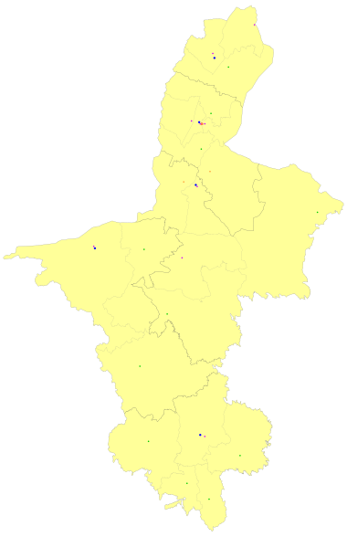
Administrative divisions
Ningxia is divided into five prefecture-level divisions: all prefecture-level cities:
| Administrative divisions of Ningxia | ||||||||
|---|---|---|---|---|---|---|---|---|
| Division code[31] | Division | Area in km2[32] | Population 2020[33] | Seat | Divisions[34] | |||
| Districts | Counties | CL cities | ||||||
| 640000 | Ningxia Hui Autonomous Region | 66,400.00 | 7,202,654 | Yinchuan city | 9 | 11 | 2 | |
| 640100 | Yinchuan city | 8,874.61 | 2,859,074 | Jinfeng District | 3 | 2 | 1 | |
| 640200 | Shizuishan city | 5,208.13 | 751,389 | Dawukou District | 2 | 1 | ||
| 640300 | Wuzhong city | 21,420.14 | 1,382,713 | Litong District | 2 | 2 | 1 | |
| 640400 | Guyuan city | 13,449.03 | 1,142,142 | Yuanzhou District | 1 | 4 | ||
| 640500 | Zhongwei city | 17,448.09 | 1,067,336 | Shapotou District | 1 | 2 | ||
| Administrative divisions in Chinese and varieties of romanizations | ||||
|---|---|---|---|---|
| English | Chinese | Pinyin | Xiao'erjing | |
| Ningxia Hui Autonomous Region | 宁夏回族自治区 | Níngxià Huízú Zìzhìqū | نِئٍثِيَا خُوِزُو زِجِٿِيُوِ | |
| Yinchuan city | 银川市 | Yínchuān Shì | ءٍچُوًا شِ | |
| Shizuishan city | 石嘴山市 | Shízuǐshān Shì | شِظُوِشًا شِ | |
| Wuzhong city | 吴忠市 | Wúzhōng Shì | وُجْو شِ | |
| Guyuan city | 固原市 | Gùyuán Shì | قُيُوًا شِ | |
| Zhongwei city | 中卫市 | Zhōngwèi Shì | جْووِ شِ | |
The five prefecture-level cities of Ningxia are subdivided into 22 county-level divisions (9 districts, 2 county-level cities, and 11 counties).