A | B | C | D | E | F | G | H | CH | I | J | K | L | M | N | O | P | Q | R | S | T | U | V | W | X | Y | Z | 0 | 1 | 2 | 3 | 4 | 5 | 6 | 7 | 8 | 9
Netherlands Nederland (Dutch) | |
|---|---|
| Motto: | |
| Anthem: Wilhelmus (Dutch) ("William of Nassau") | |
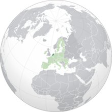
Location of Netherlands (dark green) – in Europe (light green & dark grey) | |
| Sovereign state | Kingdom of the Netherlands |
| Before independence | Spanish Netherlands |
| Act of Abjuration | 26 July 1581 |
| Peace of Münster | 30 January 1648 |
| Kingdom established | 16 March 1815 |
| Liberation Day | 5 May 1945 |
| Kingdom Charter | 15 December 1954 |
| Caribbean reorganisation | 10 October 2010 |
| Capital and largest city | Amsterdam[a] 52°22′N 4°53′E / 52.367°N 4.883°E |
| Government seat | The Hague[a] |
| Official languages | Dutch |
Recognised languages | |
| Ethnic groups (2022) |
|
| Religion (2021)[4] |
|
| Demonym(s) | Dutch |
| Government | Unitary parliamentary constitutional monarchy |
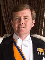
• Monarch | Willem-Alexander |
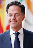
| Mark Rutte | |
| Legislature | States General |
| Senate | |
| House of Representatives | |
| European Parliament | |
| 26 seats | |
| Area | |
• Total | 41,865[5][e] km2 (16,164 sq mi) (134th) |
• Water (%) | 18.41[6] |
| Highest elevation | 322.4 m (1,057.7 ft) |
| Population | |
• 25 April 2024 estimate | |
• 2011 census | 16,655,799[8] |
• Density | 520/km2 (1,346.8/sq mi) (33rd) |
| GDP (PPP) | 2024 estimate |
• Total | |
• Per capita | |
| GDP (nominal) | 2024 estimate |
• Total | |
• Per capita | |
| Gini (2021) | low |
| HDI (2022) | very high · 10th |
| Currency | |
| Time zone | [g] |
• Summer (DST) | |
| Driving side | right |
| Calling code | +31, +599[h] |
| Internet TLD | .nl, .bq[i] |
The Netherlands,[j] informally Holland, is a country located in northwestern Europe with overseas territories in the Caribbean. It is the largest of the four constituent countries of the Kingdom of the Netherlands.[13] The Netherlands consists of twelve provinces; it borders Germany to the east and Belgium to the south, with a North Sea coastline to the north and west. It shares maritime borders with the United Kingdom, Germany, and Belgium.[14] The official language is Dutch, with West Frisian as a secondary official language in the province of Friesland.[1] Dutch, English, and Papiamento are official in the Caribbean territories.[1]
Netherlands literally means "lower countries" in reference to its low elevation and flat topography, with 26% situated below sea level.[15] Most of the areas below sea level, known as polders, are the result of land reclamation that began in the 14th century.[16] In the Republican period, which began in 1588, the Netherlands entered a unique era of political, economic, and cultural greatness, ranked among the most powerful and influential in Europe and the world; this period is known as the Dutch Golden Age.[17] During this time, its trading companies, the Dutch East India Company and the Dutch West India Company, established colonies and trading posts all over the world.[18][19]
With a population of 17.9 million people, all living within a total area of 41,850 km2 (16,160 sq mi)—of which the land area is 33,500 km2 (12,900 sq mi)—the Netherlands is the 33rd most densely populated country, with a density of 535 people per square kilometre (1,390 people/sq mi). Nevertheless, it is the world's second-largest exporter of food and agricultural products by value, owing to its fertile soil, mild climate, intensive agriculture, and inventiveness.[20][21][22] The four largest cities in the Netherlands are Amsterdam, Rotterdam, The Hague and Utrecht.[23] Amsterdam is the country's most populous city and the nominal capital, though the primary national political institutions are located in the Hague.[24]
The Netherlands has been a parliamentary constitutional monarchy with a unitary structure since 1848. The country has a tradition of pillarisation (separation of citizens into groups by religion and political beliefs) and a long record of social tolerance, having legalised prostitution and euthanasia, along with maintaining a liberal drug policy. The Netherlands allowed women's suffrage in 1919 and was the first country to legalise same-sex marriage in 2001.[25] Its mixed-market advanced economy has the eleventh-highest per capita income globally. The Hague holds the seat of the States General, Cabinet and Supreme Court.[26] The Port of Rotterdam is the busiest in Europe.[27] Schiphol is the busiest airport in the Netherlands, and the fourth busiest in Europe. Being a developed country, the Netherlands is a founding member of the European Union, Eurozone, G10, NATO, OECD, and WTO, as well as a part of the Schengen Area and the trilateral Benelux Union. It hosts intergovernmental organisations and international courts, many of which are in The Hague.[28]
Etymology
Netherlands and the Low Countries
The countries that comprise the region called the Low Countries (Netherlands, Belgium, and Luxembourg) all have comparatively the same toponymy. Place names with Neder, Nieder, Nedre, Nether, Lage(r) or Low(er) (in Germanic languages) and Bas or Inferior (in Romance languages) are in use in low-lying places all over Europe. The Romans made a distinction between the Roman provinces of downstream Germania Inferior (nowadays part of Belgium and the Netherlands) and upstream Germania Superior. Thus, in the case of the Low Countries and the Netherlands, the geographical location of this lower region is more or less downstream and near the sea, compared to that of the upper region of Germania Superior. The designation 'Low' returned in the 10th-century Duchy of Lower Lorraine, which covered much of the Low Countries.[29][30]
The Dukes of Burgundy used the term les pays de par deçà ("the lands over here") for the Low Countries.[31] Under Habsburg rule, this became pays d'embas ("lands down-here").[32] This was translated as Neder-landen in contemporary Dutch official documents.[33] From a regional point of view, Niderlant was also the area between the Meuse and the lower Rhine in the late Middle Ages. From the mid-sixteenth century, the "Low Countries" and the "Netherlands" lost their original deictic meaning.
In most Romance languages, the term "Low Countries" is officially used as the name for the Netherlands.
Holland
The term Holland has frequently been used informally to refer to the whole of the modern country of the Netherlands in various languages,[34] including Dutch[35][36] and English. In some languages, Holland is used as the formal name for the Netherlands. However, Holland is a region within the Netherlands that consists of the two provinces of North and South Holland. Formerly these were a single province, and earlier the County of Holland, which included parts of present-day Utrecht. The emphasis on Holland during the formation of the Dutch Republic, the Eighty Years' War, and the Anglo-Dutch Wars in the 16th, 17th, and 18th centuries, made Holland a pars pro toto for the entire country.[37][38]
Many Dutch people object to the country being referred to as Holland instead of the Netherlands, on much the same grounds as many Welsh or Scottish people object to the United Kingdom being referred to as England.[39] In particular, those from regions other than Holland find it undesirable or misrepresentative to use the term Holland for the whole country,[34] as the Holland region only comprises two of the twelve provinces, and 38% of Dutch citizens. In January 2020, the Dutch government officially dropped its support of the word Holland for the whole country.[40][41][42]
Often Holland or Hollanders is used by the Flemish to refer to the Dutch in the Netherlands,[43] and by the Southern Dutch (Dutch living "below the great rivers", a natural cultural, social and religious boundary formed by the rivers Rhine and Meuse) to refer to the Northern Dutch (Dutch living North of these rivers).[44] In the Southern province of Limburg, the term is used for the Dutch from the other 11 provinces.[45] The use of the term in this context by the Southern Dutch is in a derogatory fashion.[44][45]
Dutch
Dutch is used as the adjective for the Netherlands, as well as the demonym. The origins of the word go back to Proto-Germanic *þiudiskaz, Latinised into Theodiscus, meaning "popular" or "of the people", akin to Old Dutch Dietsch or Old English þeodisc, meaning "(of) the common (Germanic) people".[46] At first, the English language used Dutch to refer to any or all speakers of West Germanic languages. Gradually its meaning shifted to the West Germanic people they had the most contact with.[47]
History
Prehistory (before 800 BC)
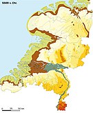
The oldest human (Neanderthal) traces in the Netherlands, believed to be about 250,000 years old, were found near Maastricht.[48] At the end of the Ice Age, the nomadic late Upper Palaeolithic Hamburg culture (13,000–10,000 BC) hunted reindeer in the area, using spears. The later Ahrensburg culture (11,200–9,500 BC) used bow and arrow. From Mesolithic Maglemosian-like tribes (c. 8000 BC), the world's oldest canoe was found in Drenthe.[49]
Indigenous late Mesolithic hunter-gatherers from the Swifterbant culture (c. 5600 BC), related to the southern Scandinavian Ertebølle culture, were strongly linked to rivers and open water.[50] Between 4800 and 4500 BC, the Swifterbant people started to adopt from the neighbouring Linear Pottery culture the practice of animal husbandry, and between 4300 and 4000 BC agriculture.[51] The Funnelbeaker culture (4300–2800 BC) erected the dolmens, large stone grave monuments found in Drenthe. There was a quick transition from the Funnelbeaker farming culture to the pan-European Corded Ware pastoralist culture (c. 2950 BC). In the southwest, the Seine-Oise-Marne culture—related to the Vlaardingen culture (c. 2600 BC)—survived well into the Neolithic period, until it too was succeeded by the Corded Ware culture.
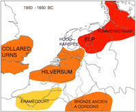
The subsequent Bell Beaker culture (2700–2100 BC)[52] introduced metalwork in copper, gold and later bronze and opened new international trade routes, reflected in copper artifacts. Finds of rare bronze objects suggest that Drenthe was a trading centre in the Bronze Age (2000–800 BC). The Bell Beaker culture developed locally into the Barbed-Wire Beaker culture (2100–1800 BC) and later the Elp culture (1800–800 BC),[53] a Middle Bronze Age culture marked by earthenware pottery. The southern region became dominated by the related Hilversum culture (1800–800 BC).
Celts, Germanic tribes and Romans (800 BC–410 AD)
From 800 BC onwards, the Iron Age Celtic Hallstatt culture became influential, replacing the Hilversum culture. Iron ore brought a measure of prosperity and was available throughout the country. Smiths travelled from settlement to settlement with bronze and iron, fabricating tools on demand. The King's grave of Oss (700 BC) was found in a burial mound, the largest of its kind in Western Europe.
The deteriorating climate in Scandinavia from 850 BC and 650 BC might have triggered the migration of Germanic tribes from the North. By the time this migration was complete, around 250 BC, a few general cultural and linguistic groups had emerged.[54][55] The North Sea Germanic Ingaevones inhabited the northern part of the Low Countries. They would later develop into the Frisii and the early Saxons.[55] The Weser–Rhine Germanic (or Istvaeones) extended along the middle Rhine and Weser and inhabited the Low Countries south of the great rivers. These tribes would eventually develop into the Salian Franks.[55] The Celtic La Tène culture (c. 450 BC to the Roman conquest) expanded over a wide range, including the southern area of the Low Countries. Some scholars have speculated that even a third ethnic identity and language, neither Germanic nor Celtic, survived in the Netherlands until the Roman period, the Nordwestblock culture.[56][57]
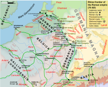
The first author to describe the coast of Holland and Flanders was the geographer Pytheas, who noted in c. 325 BC that in these regions, "more people died in the struggle against water than in the struggle against men."[58] During the Gallic Wars, the area south and west of the Rhine was conquered by Roman forces under Julius Caesar from 57 BC to 53 BC.[57] Caesar describes two main Celtic tribes living in what is now the southern Netherlands: the Menapii and the Eburones. Under Augustus, the Roman Empire would conquer the entirety of the modern day Netherlands, incorporating it into the province of Germania Antiqua in 7 BC, but would be repelled back across the Rhine after the Battle of Teutoburg Forest in 9 AD, with the Rhine becoming fixed as Rome's permanent northern frontier around 12 AD. Notable towns would arise along the Limes Germanicus: Nijmegen and Voorburg. In the first part of Gallia Belgica, the area south of the Limes became part of the Roman province of Germania Inferior. The area to the north of the Rhine, inhabited by the Frisii, remained outside Roman rule, while the Germanic border tribes of the Batavi and Cananefates served in the Roman cavalry.[59] The Batavi rose against the Romans in the Batavian rebellion of 69 AD but were eventually defeated. The Batavi later merged with other tribes into the confederation of the Salian Franks, whose identity emerged in the first half of the third century.[60] Salian Franks appear in Roman texts as both allies and enemies. They were forced by the confederation of the Saxons from the east to move over the Rhine into Roman territory in the fourth century. From their new base in West Flanders and the Southwest Netherlands, they were raiding the English Channel. Roman forces pacified the region but did not expel the Franks, who continued to be feared at least until the time of Julian the Apostate (358) when Salian Franks were allowed to settle as foederati in Texandria.[60]
Early Middle Ages (411–1000)
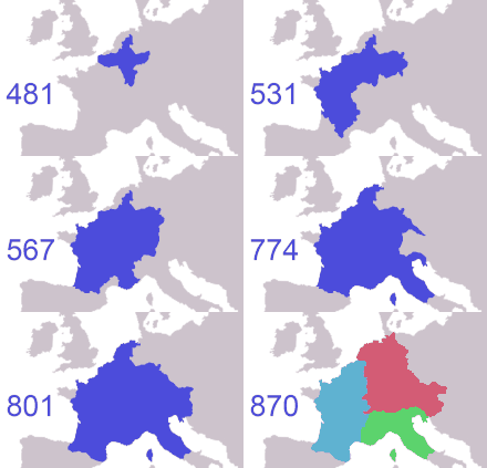
After the Roman government in the area collapsed in roughly the year 406,[61] the Franks expanded their territories into numerous kingdoms. By the 490s, Clovis I had conquered and united all these territories in the southern Netherlands in one Frankish kingdom, and from there continued his conquests into Gaul. During this expansion, Franks migrating to the south (modern territory of France and Walloon part of Belgium) eventually adopted the Vulgar Latin of the local population.[55] A widening cultural divide grew with the Franks remaining in their original homeland in the north (i.e. the southern Netherlands and Flanders), who kept on speaking Old Frankish, which by the ninth century had evolved into Old Low Franconian or Old Dutch.[55] A Dutch-French language boundary hence came into existence.[55][62]
To the north of the Franks, climatic conditions improved, and during the Migration Period Saxons, the closely related Angles, Jutes and Frisii settled the coast.[63] Many moved on to England and came to be known as Anglo-Saxons, but those who stayed would be referred to as Frisians and their language as Frisian.[63] Frisian was spoken along the entire southern North Sea coast. By the seventh century, a Frisian Kingdom (650–734) under King Aldegisel and King Redbad emerged with Traiectum (Utrecht) as its centre of power,[63][64] while Dorestad was a flourishing trading place.[65][66] Between 600 and around 719 the cities were often fought over between the Frisians and the Franks. In 734, at the Battle of the Boarn, the Frisians were defeated after a series of wars. With the approval of the Franks, the Anglo-Saxon missionary Willibrord converted the Frisian people to Christianity and established the Archdiocese of Utrecht. However, his successor Boniface was murdered by the Frisians in 754.

The Frankish Carolingian empire controlled much of Western Europe. In 843, it was divided into three parts—East, Middle, and West Francia. Most of present-day Netherlands became part of Middle Francia, which was a weak kingdom and subject to numerous partitions and annexation attempts by its stronger neighbours. It comprised territories from Frisia in the north to the Kingdom of Italy in the south. Around 850, Lothair I of Middle Francia acknowledged the Viking Rorik of Dorestad as ruler of most of Frisia. When the kingdom of Middle Francia was partitioned in 855, the lands north of the Alps passed to Lothair II and subsequently were named Lotharingia. After he died in 869, Lotharingia was partitioned, into Upper and Lower Lotharingia, the latter comprising the Low Countries that became part of East Francia in 870. Around 879, another Viking expedition led by Godfrid, Duke of Frisia, raided the Frisian lands. Resistance to the Vikings, if any, came from local nobles, who gained in stature as a result, and that laid the basis for the disintegration of Lower Lotharingia into semi-independent states. One of these local nobles was Gerolf of Holland, who assumed lordship in Frisia, and Viking rule came to an end.[67]
High Middle Ages (1000–1384)
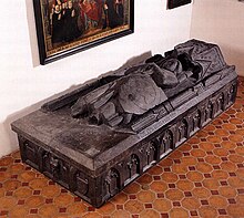
The Holy Roman Empire ruled much of the Low Countries in the 10th and 11th century but was not able to maintain political unity. Powerful local nobles turned their cities, counties and duchies into private kingdoms that felt little sense of obligation to the emperor.[68] Holland, Hainaut, Flanders, Gelre, Brabant, and Utrecht were in a state of almost continual war or paradoxically formed personal unions. As Frankish settlement progressed from Flanders and Brabant, the area quickly became Old Low Franconian (or Old Dutch).
Around 1000 AD, due to several agricultural developments, the economy started to develop at a fast pace, and the higher productivity allowed workers to farm more land or become tradesmen. Towns grew around monasteries and castles, and a mercantile middle class began to develop in these urban areas, especially in Flanders, and later Brabant. Wealthy cities started to buy certain privileges for themselves from the sovereign.
Around 1100 AD, farmers from Flanders and Utrecht began draining and cultivating uninhabited swampy land in the western Netherlands, making the emergence of the County of Holland as the centre of power possible. The title of Count of Holland was fought over in the Hook and Cod Wars between 1350 and 1490. The Cod faction consisted of the more progressive cities, while the Hook faction consisted of the conservative noblemen. These noblemen invited Duke Philip the Good of Burgundy to conquer Holland.[citation needed]
Burgundian, Habsburg and Spanish Habsburg Netherlands (1384–1581)
Most of the Imperial and French fiefs in what is now the Netherlands and Belgium were united in a personal union by Philip the Good in 1433. The House of Valois-Burgundy and their Habsburg heirs would rule the Low Countries from 1384 to 1581. The new rulers defended Dutch trading interests. The fleets of the County of Holland defeated the fleets of the Hanseatic League several times. Amsterdam grew and in the 15th century became the primary trading port in Europe for grain from the Baltic region. Amsterdam distributed grain to the major cities of Belgium, Northern France and England. This trade was vital because Holland could no longer produce enough grain to feed itself. Land drainage had caused the peat of the former wetlands to reduce to a level that was too low for drainage to be maintained.[69]
Under Habsburg Charles V, all fiefs in the current Netherlands region were united into the Seventeen Provinces, which included most of present-day Belgium, Luxembourg, and parts of France and Germany. In 1568, under Phillip II, the Eighty Years' War between the Provinces and their Spanish ruler began. The level of ferocity exhibited by both sides can be gleaned from a Dutch chronicler's report:[70]
On more than one occasion men were seen hanging their own brothers, who had been taken prisoners in the enemy's ranks... A Spaniard had ceased to be human in their eyes. On one occasion, a surgeon at Veer cut the heart from a Spanish prisoner, nailed it on a vessel's prow, and invited the townsmen to come and fasten their teeth in it, which many did with savage satisfaction.
The Duke of Alba attempted to suppress the Protestant movement in the Netherlands. Netherlanders were "burned, strangled, beheaded, or buried alive" by his "Blood Council" and Spanish soldiers. Bodies were displayed along roads to terrorise the population into submission. Alba boasted of having executed 18,600;[71][72] this figure does not include those who perished by war and famine.[73]
The first great siege was Alba's effort to capture Haarlem and thereby cut Holland in half. It dragged on from December 1572 to the next summer, when Haarlemers finally surrendered on 13 July upon the promise that the city would be spared from being sacked. It was a stipulation Don Fadrique was unable to honour, when his soldiers mutinied, angered over pay owed and the miserable conditions of the campaign.[74] On 4 November 1576, Spanish tercios seized Antwerp and subjected it to the worst pillage in the Netherlands' history. The citizens resisted but were overcome; seven thousand were killed and a thousand buildings were torched.[75]
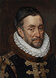
Following the sack of Antwerp, delegates from Catholic Brabant, Protestant Holland and Zeeland agreed to join Utrecht and William the Silent in driving out Spanish troops and forming a new government for the Netherlands. Don Juan of Austria, the new Spanish governor, was forced to concede initially, but within months returned to active hostilities. The Dutch looked for help from the Protestant Elizabeth I of England, but she initially stood by her commitments to the Spanish in the Treaty of Bristol of 1574. When the next large-scale battle occurred at Gembloux in 1578, the Spanish forces won easily.[76] In light of the defeat at Gembloux, the southern states of the Seventeen Provinces distanced themselves from the rebels in the north with the 1579 Union of Arras. Opposing them, the northern half of the Seventeen Provinces forged the Union of Utrecht in which they committed to support each other against the Spanish.[77] The Union of Utrecht is seen as the foundation of the modern Netherlands.[78]
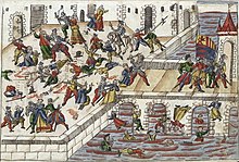
Spanish troops sacked Maastricht in 1579, killing over 10,000 civilians.[79] In 1581, the northern provinces adopted the Act of Abjuration, the declaration of independence in which the provinces officially deposed Philip II.[80] Against the rebels Philip could draw on the resources of the Spanish Empire. Elizabeth I sympathised with the Dutch struggle and sent an army of 7,600 soldiers to aid them.[81] English forces faced the Spanish in the Netherlands under the Duke of Parma in a series of largely indecisive actions that tied down significant numbers of Spanish troops and bought time for the Dutch to reorganise their defences.[82] The war continued until 1648, when Spain under King Philip IV recognised the independence of the seven north-western provinces in the Peace of Münster.[61] Parts of the southern provinces became de facto colonies of the new republican-mercantile empire.[83]
Dutch Republic (1581–1795)

Following the declaration of independence, the provinces of Holland, Zeeland, Groningen, Friesland, Utrecht, Overijssel, and Gelderland entered into a confederation. All these duchies, lordships and counties enjoyed a significant degree of autonomy and was governed by its own administrative body known as the States-Provincial. The confederal government, known as the States General, was headquartered in The Hague and comprised representatives from each of the seven provinces. The sparsely populated region of Drenthe was part of the republic, albeit not considered a province in its own right. Moreover, during the Eighty Years' War, the Republic came to occupy a number of Generality Lands located in Flanders, Brabant and Limburg. These areas were primarily inhabited by Roman Catholics and lacked a distinct governmental structure of their own. They were utilized as a buffer zone between the Republic and the Spanish-controlled Southern Netherlands.[84]


In the Dutch Golden Age, spanning much of the 17th century, the Dutch Empire grew to become one of the major seafaring and economic powers. Science, military and art (especially painting) were among the most acclaimed in the world. By 1650, the Dutch owned 16,000 merchant ships.[85] The Dutch East India Company and the Dutch West India Company established colonies and trading posts all over the world. The Dutch settlement in North America began with the founding of New Amsterdam in 1614. In South Africa, the Dutch settled the Cape Colony in 1652. Dutch colonies in South America were established along the many rivers in the fertile Guyana plains, among them Colony of Surinam (now Suriname). In Asia, the Dutch established a presence in India, the Dutch East Indies (now Indonesia), Formosa (now Taiwan), and the only western trading post in Japan, Dejima.[86] During the period of Proto-industrialisation, the empire received 50% of textiles and 80% of silks import from the India's Mughal Empire.[87][88][89][90]
Many economic historians regard the Netherlands as the first thoroughly capitalist country. In early modern Europe, it had the wealthiest trading city (Amsterdam) and the first full-time stock exchange. The inventiveness of the traders led to insurance and retirement funds as well as phenomena such as the boom-bust cycle, the world's first asset-inflation bubble, the tulip mania of 1636–1637, and the world's first bear raider, Isaac le Maire.[91] In 1672 – known in Dutch history as the Rampjaar (Disaster Year) – the Dutch Republic was attacked by France, England and three German Bishoprics simultaneously, in what would become known as the Franco-Dutch War. At sea, it could successfully prevent the English and French navies from blockading the western shores. On land, however, it was almost taken over by the advancing French and German armies from the east. It managed to turn the tide by inundating parts of Holland.[92]
From 1672 to 1712, the Republic, led by William III of Orange and Anthonie Heinsius would regularly clash with France in what some historians have come to call the Forty Years' War. In the Nine Years' War and the War of the Spanish Succession, the Republic was at the centre of anti-French coalitions. The Dutch ultimately successfully defended the Spanish Netherlands, established a barrier there, and their troops proved central to the alliance which halted French territorial expansion in Europe until a new cycle began in 1792 with the French Revolutionary Wars.[93] However, the wars left them effectively bankrupt, and inflicted permanent damage on the Dutch merchant navy; while they remained the dominant economic power in the Far East, Britain took over as the pre-eminent global commercial and maritime power.[94] Between 1590 and 1713, the United Provinces consistently possessed one of Europe's largest and most capable armies. However, following the conclusion of the War of the Spanish Succession, other major powers such as Prussia, Austria, Britain, and Russia significantly expanded their military forces. The Republic struggled to match these developments, and gradually assumed the status of a mid-tier power. However, historians have sometimes overstated the extent of this decline, especially when considering the period up to the 1750s.[95]
Batavian Republic and Kingdom (1795–1890)
In the 18th century the Dutch Republic had seen a state of a general decline, with economic competition from England and long-standing rivalries between the two main factions in Dutch society, the republican Staatsgezinden and the supporters of the stadtholder the Prinsgezinden as main political factions.[92] With the armed support of revolutionary France, Dutch republicans proclaimed the Batavian Republic, modelled after the French Republic and rendering the Netherlands a unitary state on 19 January 1795. The stadtholder William V of Orange had fled to England. From 1806 to 1810, the Kingdom of Holland was set up by Napoleon Bonaparte as a puppet kingdom governed by his brother Louis Bonaparte. However, King Louis Bonaparte tried to serve Dutch interests instead of his brother's, and he was forced to abdicate on 1 July 1810. The Emperor sent in an army and the Netherlands became part of the French Empire until November 1813, when Napoleon was defeated in the Battle of Leipzig.[96]

William Frederick, son of the last stadtholder, returned to the Netherlands in 1813 and proclaimed himself Sovereign Prince. Two years later, the Congress of Vienna added the southern Netherlands to the north to create a strong country on the northern border of France. William Frederick raised this United Netherlands to the status of a kingdom and proclaimed himself as King William I in 1815.[97] William became hereditary Grand Duke of Luxembourg in exchange for his German possessions. However, the Southern Netherlands had been culturally separate from the north since 1581, and rebelled. The south gained independence in 1830 as Belgium (recognised by the Northern Netherlands in 1839 as the Kingdom of the Netherlands was created by decree), while the personal union between Luxembourg and the Netherlands was severed in 1890, when William III died with no surviving male heirs. Ascendancy laws prevented his daughter Queen Wilhelmina from becoming the next Grand Duchess.[98]
The Belgian Revolution and the Java War in the Dutch East Indies brought the Netherlands to the brink of bankruptcy. However, the Cultivation System was introduced in 1830; in the Dutch East Indies, 20% of village land had to be devoted to government crops for export. The policy brought the Dutch enormous wealth and made the colony self-sufficient.[99] The Netherlands abolished slavery in its colonies in 1863.[100] Enslaved people in Suriname would be fully free only in 1873.[101]
World wars and beyond (1890–present)
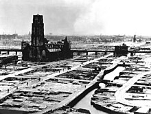
The Netherlands remained neutral during World War I, in part because the import of goods through the Netherlands proved essential to German survival until the blockade by the British Royal Navy in 1916.[102] That changed in World War II, when Germany invaded the Netherlands on 10 May 1940. The Rotterdam Blitz forced most of the Dutch army to surrender. During the occupation, over 100,000 Dutch Jews[103] were transported to Nazi extermination camps; only a few survived. Dutch workers were conscripted for forced labour in Germany, civilians who resisted were killed in reprisal for attacks on German soldiers, and the countryside was plundered for food. Although there were thousands of Dutch who risked their lives by hiding Jews from the Germans, over 20,000 Dutch fascists joined the Waffen SS.[104] Political collaborators were members of the fascist NSB, the only legal political party in the occupied Netherlands. On 8 December 1941, the Dutch government-in-exile in London declared war on Japan,[105] but could not prevent the Japanese occupation of the Dutch East Indies.[106] In 1944–45, the First Canadian Army liberated much of the Netherlands.[107] Soon after VE Day, the Dutch fought a colonial war against the new Republic of Indonesia.[108][109]
Decolonisation
In 1954, the Charter for the Kingdom of the Netherlands reformed the political structure as a result of international pressure to carry out decolonisation. The Dutch colonies of Surinam and Curaçao and Dependencies and the European country all became countries within the Kingdom, on a basis of equality. Indonesia had declared its independence in August 1945. Suriname followed in 1975. The Netherlands was one of the founding members of Benelux and NATO.[110][111] In the 1950s, the Netherlands became one of the six founding countries of the European Communities, following the 1952 establishment of the European Coal and Steel Community, and subsequent 1958 creations of the European Economic Community and European Atomic Energy Community.[112] In 1993, the former two were incorporated into the European Union.[112]
Government-encouraged emigration efforts to reduce population density prompted some 500,000 Dutch to leave the country after the war.[113] The 1960s and 1970s were a time of great social and cultural change, such as rapid de-pillarisation. Students and other youth rejected traditional mores and pushed for change in matters such as women's rights, sexuality, disarmament and environmental issues. In 2002 the euro was introduced as fiat money, and in 2010 the Netherlands Antilles was dissolved. Referendums were held on each island. As a result, Bonaire, Sint Eustatius and Saba (the BES islands) were incorporated as special municipalities upon the dissolution of the Netherlands Antilles. The special municipalities are collectively known as the Caribbean Netherlands.[114]
Geography
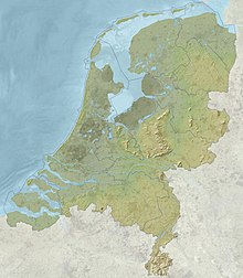
The European Netherlands has a total area of 41,543 km2 (16,040 sq mi), including water bodies, and a land area of 33,481 km2 (12,927 sq mi). The Caribbean Netherlands has a total area of 328 km2 (127 sq mi)[115] It lies between latitudes 50° and 54° N, and longitudes 3° and 8° E.
The Netherlands is geographically very low relative to sea level and is considered a flat country, with about 26% of its area[15] and 21% of its population[116] below sea level. The European part of the country is for the most part flat, with the exception of foothills in the far southeast, up to a height of no more than 321 metres, and some low hill ranges in the central parts. Most of the areas below sea level are caused by peat extraction or achieved through land reclamation. Since the late 16th century, large polder areas are preserved through elaborate drainage systems that include dikes, canals and pumping stations.
Much of the country was originally formed by the estuaries of three large European rivers: the Rhine (Rijn), the Meuse (Maas) and the Scheldt (Schelde), as well as their tributaries. The south-western part of the Netherlands is a river delta of these rivers, the Rhine–Meuse–Scheldt delta.[117]
The European Netherlands is divided into north and south parts by the Rhine, the Waal, its main tributary branch, and the Meuse. These rivers functioned as a natural barrier between fiefdoms and hence historically created a cultural divide, as is evident in some phonetic traits that are recognisable on either side of what the Dutch call their "Great Rivers" (de Grote Rivieren). Another significant branch of the Rhine, the IJssel river, discharges into Lake IJssel, the former Zuiderzee ('southern sea'). Just like the previous, this river forms a linguistic divide: people to the northeast of this river speak Dutch Low Saxon dialects (except for the province of Friesland, which has its own language).[118]
Geology
The Netherlands is mostly composed of deltaic, coastal and aeolian derived sediments during the Pleistocene glacial and interglacial periods.[118]
Almost the entire west Netherlands is composed of the Rhine-Meuse river estuary. In the east of the Netherlands, remains are found of the last ice age, which ended approximately ten thousand years ago. As the continental ice sheet moved in from the north, it pushed moraine forward. The ice sheet halted as it covered the eastern half of the Netherlands. After the ice age ended, the moraine remained in the form of a long hill-line. The cities of Arnhem and Nijmegen are built on these hills.[119]
Floods
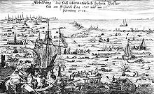
Over the centuries, the Dutch coastline has changed considerably as a result of natural disasters and human intervention.
On 14 December 1287, St. Lucia's flood affected the Netherlands and Germany, killing more than 50,000 people in one of the most destructive floods in recorded history.[120] The St. Elizabeth flood of 1421 and the mismanagement in its aftermath destroyed a newly reclaimed polder, replacing it with the 72 km2 (28 sq mi) Biesbosch tidal floodplains. The huge North Sea flood of February 1953 caused the collapse of several dikes in the southwest Netherlands; more than 1,800 people drowned. The Dutch government subsequently instituted a large-scale programme, the "Delta Works", to protect the country against future flooding, which was completed over a period of more than 40 years.[121]

The impact of disasters was, to an extent, increased through human activity. Relatively high-lying swampland was drained to be used as farmland. The drainage caused the fertile peat to contract and ground levels to drop; groundwater levels were lowered to compensate, causing the underlying peat to contract further. Additionally, until the 19th century peat was mined, dried, and used for fuel, further exacerbating the problem. Even in flooded areas, peat extraction continued through turf dredging.[122]
To guard against floods, a series of defences against the water were contrived. In the first millennium AD, villages and farmhouses were built on hills called terps. Later, these terps were connected by dikes. In the 12th century, local government agencies called "waterschappen" ("water boards") or "hoogheemraadschappen" ("high home councils") started to appear, whose job it was to maintain the water level and to protect a region from floods; these agencies continue to exist. As the ground level dropped, the dikes by necessity grew and merged into an integrated system. By the 13th century windmills had come into use to pump water. The windmills were later used to drain lakes, creating the famous polders.[123] In 1932 the Afsluitdijk ("Closure Dike") was completed, blocking the former Zuiderzee (Southern Sea) from the North Sea and thus creating the IJsselmeer (IJssel Lake). It became part of the larger Zuiderzee Works in which four polders totalling 2,500 square kilometres (965 sq mi) were reclaimed from the sea.[124][125]
The Netherlands is one of the countries that may suffer most from climate change. Not only is the rising sea a problem, but erratic weather patterns may cause the rivers to overflow.[126][127][128]
Delta Works

After the 1953 disaster, the Delta Works was constructed, which is a comprehensive set of civil works throughout the Dutch coast. The project started in 1958 and was largely completed in 1997 with the completion of the Maeslantkering. Since then, new projects have been periodically started to renovate and renew the Delta Works. The main goal of the Delta project was to reduce the risk of flooding in South Holland and Zeeland. This was achieved by raising 3,000 km (1,900 mi) of outer sea-dikes and 10,000 km (6,200 mi) of the inner, canal, and river dikes, and by closing off the sea estuaries of Zeeland. New risk assessments occasionally show problems requiring additional Delta project dike reinforcements. The Delta project is considered by the American Society of Civil Engineers as one of the seven wonders of the modern world.[129]
It is anticipated that global warming will result in a rise in sea level. The Netherlands is actively preparing for a sea-level rise. A politically neutral Delta Commission has formulated an action plan to cope with a sea-level rise of 1.10 m (4 ft) and a simultaneous land height decline of 10 cm (4 in). The plan encompasses the reinforcement of existing coastal defences like dikes and dunes with 1.30 m (4.3 ft) of additional flood protection. Climate change will not only threaten the Netherlands from the coast, but could also alter rainfall patterns and river run-off. To protect the country from river flooding, another programme is already being executed. The Room for the River plan grants more flow space to rivers, protects the major populated areas and allows for periodic flooding of indefensible lands. The few residents who lived in these so-called "overflow areas" have been moved to higher ground, with some of that ground having been raised above anticipated flood levels.[130]
Climate change
The Netherlands is already affected by climate change. The average temperature in the Netherlands rose by more than 2 °C from 1901 to 2020.[131] Climate change has resulted in increased frequency of droughts and heatwaves. Because significant portions of the Netherlands have been reclaimed from the sea or otherwise are very near sea level, the Netherlands is very vulnerable to sea level rise.
The Netherlands has the fourth largest greenhouse gas emissions per capita of the European Union,[132] in part due to the large number of cows.[133] The Dutch government has set goals to lower emissions in the next few decades. The Dutch response to climate change is driven by a number of unique factors, including larger green recovery plans by the European Union in the face of the COVID-19 and a climate change litigation case, State of the Netherlands v. Urgenda Foundation, which created mandatory climate change mitigation through emissions reductions 25% below 1990 levels.[134][135] In 2021 CO2 emissions were down 14% compared to 1990 levels.[136] The goal of the Dutch government is to reduce emissions in 2030 by 49%.[137]
Nature

The Netherlands has 21 national parks[138] and hundreds of other nature reserves. Most of these are owned by Staatsbosbeheer, the national department for forestry and nature conservation and Natuurmonumenten, a private organisation that buys, protects and manages nature reserves.[139] The Wadden Sea in the north, with its tidal flats and wetlands, is rich in biological diversity, and is a UNESCO World Heritage Nature Site.[140] The Eastern Scheldt, formerly the northeast estuary of the river Scheldt was designated a national park in 2002, making it the largest national park in the Netherlands at an area of 370 km2 (140 sq mi).
Phytogeographically, the European Netherlands is shared between the Atlantic European and Central European provinces of the Circumboreal Region within the Boreal Kingdom. According to the World Wide Fund for Nature, the European territory of the Netherlands belongs to the ecoregion of Atlantic mixed forests.[141] In 1871, the last old original natural woods were cut down.[142] These woods were planted on anthropogenic heaths and sand-drifts (overgrazed heaths) (Veluwe). The Netherlands had a 2019 Forest Landscape Integrity Index mean score of 0.6/10, ranking it 169th globally out of 172 countries.[143]
Nitrogen pollution is a problem.[133] The number of flying insects in the Netherlands has dropped by 75% since the 1990s.[144]
Caribbean islands
In the Lesser Antilles islands of the Caribbean, the territories of Curaçao, Aruba and Sint Maarten have a constituent country status within the wider Kingdom of the Netherlands. Another three territories which make up the Caribbean Netherlands are designated as special municipalities. The Caribbean Netherlands have maritime borders with Anguilla, Curaçao, France (Saint Barthélemy), Saint Kitts and Nevis, Sint Maarten, the U.S. Virgin Islands and Venezuela.[145] The islands of the Caribbean Netherlands enjoy a tropical climate with warm weather all year round.[146]

Within this island group:
- Bonaire is part of the ABC islands within the Leeward Antilles island chain off the Venezuelan coast. The Leeward Antilles have a mixed volcanic and coral origin.
- Saba and Sint Eustatius are part of the SSS islands. They are located east of Puerto Rico and the Virgin Islands. Although in the English language they are considered part of the Leeward Islands, French, Spanish, Dutch and the English spoken locally consider them part of the Windward Islands. The Windward Islands are all of volcanic origin and hilly, leaving little ground suitable for agriculture. The highest point is Mount Scenery, 887 m (2,910 ft), on Saba. This is the highest point in the country and in the entire Kingdom of the Netherlands.
Government and politics

The Netherlands has been a constitutional monarchy since 1815 and a parliamentary democracy since 1848. The Netherlands is described as a consociational state. Dutch politics and governance are characterised by an effort to achieve broad consensus on important issues. The Netherlands was ranked as the 17th best electoral democracy in the world by V-Dem Democracy indices in 2023[147] and 9th most democratic country in the world by the Democracy Index (The Economist) in 2022.[148]
The monarch is the head of state, at present King Willem-Alexander of the Netherlands. Constitutionally, the position is equipped with limited powers. By law, the King has the right to be periodically briefed and consulted on government affairs.
The executive power is formed by the Council of Ministers, the deliberative organ of the Dutch cabinet. The cabinet usually consists of 13 to 16 ministers and a varying number of state secretaries. One to three ministers are ministers without portfolio. The head of government is the Prime Minister of the Netherlands, who often is the leader of the largest party of the coalition. The Prime Minister is a primus inter pares, with no explicit powers beyond those of the other ministers. Mark Rutte has been Prime Minister since October 2010.
The cabinet is responsible to the bicameral parliament, the States General, which also has legislative powers. The 150 members of the House of Representatives, the lower house, are elected in direct elections on the basis of party-list proportional representation. These are held every four years, or sooner in case the cabinet falls. The provincial assemblies, the States Provincial, are directly elected every four years as well. The members of the provincial assemblies elect the 75 members of the Senate, the upper house, which has the power to reject laws, but not amend them.[149]
Political culture

Both trade unions and employers organisations are consulted in policymaking in the financial, economic and social areas. They meet regularly with the government in the Social-Economic Council.
The Netherlands has a tradition of social tolerance.[150] In the late 19th century this Dutch tradition of religious tolerance transformed into a system of pillarisation, in which religious groups coexisted separately and only interacted at the level of government.[151] Protection for LGBT and abortion rights are enshrined within the Netherlands' foreign aid policy.[152]
No single party has held a majority in parliament since the 19th century, and as a result, coalition cabinets had to be formed. Since suffrage became universal in 1917, the Dutch political system has been dominated by three families of political parties: Christian Democrats (currently the CDA), Social Democrats (currently the PvdA), and Liberals (currently the VVD). In March 2021, centre-right VVD of Prime Minister Mark Rutte was the winner of the elections, securing 34 out of 150 seats. The second biggest party was the centre-left D66 with 24 seats. Geert Wilders' far-right party lost support. Prime Minister Mark Rutte, in power since 2010, formed his fourth coalition government, the Fourth Rutte cabinet.[153]
Administrative divisions

The Netherlands is divided into twelve provinces, each under a King's Commissioner. All provinces are divided into municipalities (gemeenten), of which there are 342 (2023).[154]
The country is subdivided into 21 water districts, governed by a water board (waterschap or hoogheemraadschap), each having authority in matters concerning water management.[155][156] The creation of water boards pre-dates that of the nation itself, the first appearing in 1196. The Dutch water boards are among the oldest democratic entities in the world still in existence. Direct elections of the water boards take place every four years.
Within the Dutch town of Baarle-Nassau, are 22 Belgian exclaves[157] and within those are 8 Dutch enclaves.
| Province | Capital | Largest city | Total area (km2)[158] |
Land area (km2)[159] |
Population (2023)[159] |
Density (/km2) |
|---|---|---|---|---|---|---|
| 2,680 | 2,633 | 502,051 | 191 | |||
| 2,412 | 1,410 | 444,701 | 315 | |||
| 5,753 | 3,340 | 659,551 | 197 | |||
| 5,136 | 4,960 | 2,133,708 | 430 | |||
| 2,955 | 2,316 | 596,075 | 257 | |||
| 2,210 | 2,145 | 1,128,367 | 526 | |||
| 5,082 | 4,902 | 2,626,210 | 536 | |||
| 4,092 | 2,663 | 2,952,622 | 1,109 | |||
| 3,421 | 3,317 | 1,184,333 | 357 | |||
| 3,308 | 2,698 | 3,804,906 | 1,410 | |||
| 1,560 | 1,484 | 1,387,643 | 935 | |||
| 2,933 | 1,780 | 391,124 | 220 | |||
| Mainland | 41,543 | Zdroj:https://en.wikipedia.org?pojem=Netherlands|||||


