

A | B | C | D | E | F | G | H | CH | I | J | K | L | M | N | O | P | Q | R | S | T | U | V | W | X | Y | Z | 0 | 1 | 2 | 3 | 4 | 5 | 6 | 7 | 8 | 9
Los Angeles | |
|---|---|
| Nicknames: | |
 Location within Los Angeles County | |
 Los Angeles Location within California  Los Angeles Location within the United States  Los Angeles Location within North America | |
| Coordinates: 34°03′N 118°15′W / 34.050°N 118.250°W | |
| Country | United States |
| State | California |
| County | Los Angeles |
| Region | Southern California |
| CSA | Los Angeles-Long Beach |
| MSA | Los Angeles-Long Beach-Anaheim |
| Pueblo | September 4, 1781[2] |
| City status | May 23, 1835[3] |
| Incorporated | April 4, 1850[4] |
| Named for | Our Lady, Queen of the Angels |
| Government | |
| • Type | Strong mayor–council[5] |
| • Body | Los Angeles City Council |
| • Mayor | Karen Bass (D) |
| • City Attorney | Hydee Feldstein Soto (D) |
| • City Controller | Kenneth Mejia (D) |
| Area | |
| • Total | 501.55 sq mi (1,299.01 km2) |
| • Land | 469.49 sq mi (1,215.97 km2) |
| • Water | 32.06 sq mi (83.04 km2) |
| Elevation | 305 ft (93 m) |
| Highest elevation | 5,075 ft (1,576 m) |
| Lowest elevation | 0 ft (0 m) |
| Population | |
| • Total | 3,898,747 |
| • Estimate (2022)[7] | 3,819,538 |
| • Rank | 3rd in North America 2nd in the United States 1st in California |
| • Density | 8,304.22/sq mi (3,206.29/km2) |
| • Urban | 12,237,376 (US: 2nd) |
| • Urban density | 7,476.3/sq mi (2,886.6/km2) |
| • Metro | 13,200,998 (US: 2nd) |
| Demonyms | Angeleno, Angelino, Angeleño[10][11] |
| GDP | |
| • MSA | $1.227 trillion (2022) |
| • CSA | $1.528 trillion (2022) |
| Time zone | UTC–08:00 (PST) |
| • Summer (DST) | UTC–07:00 (PDT) |
| ZIP Codes | List
|
| Area codes | 213, 323, 310, 424, 818, 747, 626 |
| FIPS code | 06-44000 |
| GNIS feature IDs | 1662328, 2410877 |
| Website | lacity |

.jpg)

.jpg)
.jpg)

.jpg)


Los Angeles,[a] often referred to by its initials L.A., is the most populous city in the U.S. state of California. With roughly 3.9 million residents within the city limits as of 2020[update],[7] Los Angeles is the second-most populous city in the United States, behind only New York City; it is also the commercial, financial and cultural center of Southern California. Los Angeles has an ethnically and culturally diverse population, and is the principal city of a metropolitan area of 13.2 million people. Greater Los Angeles, which includes the Los Angeles and Riverside–San Bernardino metropolitan areas, is a sprawling metropolis of over 18 million residents.
The majority of the city proper lies in a basin in Southern California adjacent to the Pacific Ocean in the west and extending partly through the Santa Monica Mountains and north into the San Fernando Valley, with the city bordering the San Gabriel Valley to its east. It covers about 469 square miles (1,210 km2),[6] and is the county seat of Los Angeles County, which is the most populous county in the United States with an estimated 9.86 million residents as of 2022[update].[16] It is the fourth-most visited city in the U.S. with over 2.7 million visitors as of 2022.[17]
The area that became Los Angeles was originally inhabited by the indigenous Tongva people and later claimed by Juan Rodríguez Cabrillo for Spain in 1542. The city was founded on September 4, 1781, under Spanish governor Felipe de Neve, on the village of Yaanga.[18] It became a part of Mexico in 1821 following the Mexican War of Independence. In 1848, at the end of the Mexican–American War, Los Angeles and the rest of California were purchased as part of the Treaty of Guadalupe Hidalgo and became part of the United States. Los Angeles was incorporated as a municipality on April 4, 1850, five months before California achieved statehood. The discovery of oil in the 1890s brought rapid growth to the city.[19] The city was further expanded with the completion of the Los Angeles Aqueduct in 1913, which delivers water from Eastern California.
Los Angeles has a diverse economy with a broad range of industries. Los Angeles is best known as the home of the Hollywood film industry, the world's largest by revenue; the city was an important site in the history of film. It also has one of the busiest container ports in the Americas.[20][21][22] In 2018, the Los Angeles metropolitan area had a gross metropolitan product of over $1.0 trillion,[23] making it the city with the third-largest GDP in the world, after New York and Tokyo. Los Angeles hosted the Summer Olympics in 1932 and 1984, and will also host in 2028. Despite a business exodus from Downtown Los Angeles since the COVID-19 pandemic, the city's urban core is evolving as a cultural center with the world's largest showcase of architecture designed by Frank Gehry.[24] More recently, statewide droughts in California have strained both the city's and Los Angeles County's water security.[25][26]
Toponymy
On September 4, 1781, a group of 44 settlers known as "Los Pobladores" founded the pueblo (town) they called El Pueblo de Nuestra Señora la Reina de los Ángeles, 'The Town of Our Lady the Queen of the Angels'.[27] The original name of the settlement is disputed; the Guinness Book of World Records rendered it as "El Pueblo de Nuestra Señora la Reina de los Ángeles de Porciúncula";[28] other sources have shortened or alternate versions of the longer name.[29]
The local English pronunciation of the name of the city has varied over time. A 1953 article in the journal of the American Name Society asserts that the pronunciation /lɔːs ˈændʒələs/ lawss AN-jəl-əs was established following the 1850 incorporation of the city and that since the 1880s the pronunciation /loʊs ˈæŋɡələs/ lohss ANG-gəl-əs emerged from a trend in California to give places Spanish, or Spanish-sounding, names and pronunciations.[30] In 1908, librarian Charles Fletcher Lummis, who argued for the name's pronunciation with a hard g (/ɡ/),[31][32] reported that there were at least 12 pronunciation variants.[33] In the early 1900s, the Los Angeles Times advocated for pronouncing it Loce AHNG-hayl-ais (/loʊs ˈɑːŋheɪleɪs/), approximating Spanish [los ˈaŋxeles], by printing the respelling under its masthead for several years.[34] This did not find favor.[35]
Since the 1930s, /lɔːs ˈændʒələs/ has been most common.[36] In 1934, the United States Board on Geographic Names decreed that this pronunciation be used by the federal government.[34] This was also endorsed in 1952 by a "jury" appointed by Mayor Fletcher Bowron to devise an official pronunciation.[30][34]
Common pronunciations in the United Kingdom include /lɒs ˈændʒɪliːz, -lɪz, -lɪs/ loss AN-jil-eez, -iz, -iss.[37] Phonetician Jack Windsor Lewis described the most common one, /lɒs ˈændʒɪliːz/ ⓘ, as a spelling pronunciation based on analogy to Greek words ending in -es, "reflecting a time when the classics were familiar if Spanish was not".[38]
History
Indigenous history

The settlement of Indigenous Californians in the modern Los Angeles Basin and the San Fernando Valley was dominated by the Tongva (now also known as the Gabrieleño since the era of Spanish colonization). The historic center of Tongva power in the region was the settlement of Yaanga (Tongva: Iyáangẚ), meaning "place of the poison oak", which would one day be the site where the Spanish founded the Pueblo de Los Ángeles. Iyáangẚ has also been translated as "the valley of smoke".[39][40][41][42][18]
Spanish rule
Maritime explorer Juan Rodríguez Cabrillo claimed the area of southern California for the Spanish Empire in 1542 while on an official military exploring expedition moving northward along the Pacific coast from earlier colonizing bases of New Spain in Central and South America.[43] Gaspar de Portolà and Franciscan missionary Juan Crespí reached the present site of Los Angeles on August 2, 1769.[44]
_(cropped).jpg)
In 1771, Franciscan friar Junípero Serra directed the building of the Mission San Gabriel Arcángel, the first mission in the area.[45] On September 4, 1781, a group of 44 settlers known as "Los Pobladores" founded the pueblo (town) they called El Pueblo de Nuestra Señora la Reina de los Ángeles, 'The Town of Our Lady the Queen of the Angels'.[27] The present-day city has the largest Roman Catholic archdiocese in the United States. Two-thirds of the Mexican or (New Spain) settlers were mestizo or mulatto, a mixture of African, indigenous and European ancestry.[46] The settlement remained a small ranch town for decades, but by 1820, the population had increased to about 650 residents.[47] Today, the pueblo is commemorated in the historic district of Los Angeles Pueblo Plaza and Olvera Street, the oldest part of Los Angeles.[48]
Mexican rule
_(detail).jpg)
New Spain achieved its independence from the Spanish Empire in 1821, and the pueblo now existed within the new Mexican Republic. During Mexican rule, Governor Pío Pico made Los Angeles the regional capital of Alta California.[49] By this time, the new republic introduced more secularization acts within the Los Angeles region.[50] In 1846, during the wider Mexican-American war, marines from the United States occupied the pueblo. This resulted in the siege of Los Angeles where 150 Mexican militias fought the occupiers which eventually surrendered.[51]
Mexican rule ended during following the American Conquest of California, part of the larger Mexican-American War. Americans took control from the Californios after a series of battles, culminating with the signing of the Treaty of Cahuenga on January 13, 1847.[52] The Mexican Cession was formalized in the Treaty of Guadalupe Hidalgo in 1848, which ceded Los Angeles and the rest of Alta California to the United States.
Post-Conquest era

Railroads arrived with the completion of the transcontinental Southern Pacific line from New Orleans to Los Angeles in 1876 and the Santa Fe Railroad in 1885.[53] Petroleum was discovered in the city and surrounding area in 1892, and by 1923, the discoveries had helped California become the country's largest oil producer, accounting for about one-quarter of the world's petroleum output.[54]
By 1900, the population had grown to more than 102,000,[55] putting pressure on the city's water supply.[56] The completion of the Los Angeles Aqueduct in 1913, under the supervision of William Mulholland, ensured the continued growth of the city.[57] Because of clauses in the city's charter that prevented the City of Los Angeles from selling or providing water from the aqueduct to any area outside its borders, many adjacent cities and communities felt compelled to join Los Angeles.[58][59][60]
.jpg)
Los Angeles created the first municipal zoning ordinance in the United States. On September 14, 1908, the Los Angeles City Council promulgated residential and industrial land use zones. The new ordinance established three residential zones of a single type, where industrial uses were prohibited. The proscriptions included barns, lumber yards, and any industrial land use employing machine-powered equipment. These laws were enforced against industrial properties after the fact. These prohibitions were in addition to existing activities that were already regulated as nuisances. These included explosives warehousing, gas works, oil drilling, slaughterhouses, and tanneries. Los Angeles City Council also designated seven industrial zones within the city. However, between 1908 and 1915, the Los Angeles City Council created various exceptions to the broad proscriptions that applied to these three residential zones, and as a consequence, some industrial uses emerged within them. There are two differences between the 1908 Residence District Ordinance and later zoning laws in the United States. First, the 1908 laws did not establish a comprehensive zoning map as the 1916 New York City Zoning Ordinance did. Second, the residential zones did not distinguish types of housing; they treated apartments, hotels, and detached-single-family housing equally.[61]
In 1910, Hollywood merged into Los Angeles, with 10 movie companies already operating in the city at the time. By 1921, more than 80 percent of the world's film industry was concentrated in L.A.[62] The money generated by the industry kept the city insulated from much of the economic loss suffered by the rest of the country during the Great Depression.[63] By 1930, the population surpassed one million.[64] In 1932, the city hosted the Summer Olympics.
Post-WWII

During World War II Los Angeles was a major center of wartime manufacturing, such as shipbuilding and aircraft. Calship built hundreds of Liberty Ships and Victory Ships on Terminal Island, and the Los Angeles area was the headquarters of six of the country's major aircraft manufacturers (Douglas Aircraft Company, Hughes Aircraft, Lockheed, North American Aviation, Northrop Corporation, and Vultee). During the war, more aircraft were produced in one year than in all the pre-war years since the Wright brothers flew the first airplane in 1903, combined. Manufacturing in Los Angeles skyrocketed, and as William S. Knudsen, of the National Defense Advisory Commission put it, "We won because we smothered the enemy in an avalanche of production, the like of which he had never seen, nor dreamed possible."[65]
After the end of World War II Los Angeles grew more rapidly than ever, sprawling into the San Fernando Valley.[66] The expansion of the state owned Interstate Highway System during the 1950s and 1960s helped propel suburban growth and signaled the demise of the city's privately owned electrified rail system, once the world's largest.
As a consequence of World War II, suburban growth, and population density, many amusement parks were built and operated in this area.[67] An example is Beverly Park, which was located at the corner of Beverly Boulevard and La Cienega before being closed and substituted by the Beverly Center.[68]
In the second half of the 20th century, Los Angeles substantially reduced the amount of housing that could be built by drastically downzoning the city. In 1960, the city had a total zoned capacity for approximately 10 million people. By 1990, that capacity had fallen to 4.5 million as a result of policy decisions to ban housing through zoning.[69]
Racial tensions led to the Watts riots in 1965, resulting in 34 deaths and over 1,000 injuries.[70]

In 1969, California became the birthplace of the Internet, as the first ARPANET transmission was sent from the University of California, Los Angeles (UCLA) to the Stanford Research Institute in Menlo Park.[71]
In 1973, Tom Bradley was elected as the city's first African American mayor, serving for five terms until retiring in 1993. Other events in the city during the 1970s included the Symbionese Liberation Army's South Central standoff in 1974 and the Hillside Stranglers murder cases in 1977–1978.[72]
In early 1984, the city surpassed Chicago in population, thus becoming the second largest city in the United States.
In 1984, the city hosted the Summer Olympic Games for the second time. Despite being boycotted by 14 Communist countries, the 1984 Olympics became more financially successful than any previous,[73] and the second Olympics to turn a profit; the other, according to an analysis of contemporary newspaper reports, was the 1932 Summer Olympics, also held in Los Angeles.[74]
.jpg)
Racial tensions erupted on April 29, 1992, with the acquittal by a Simi Valley jury of four Los Angeles Police Department (LAPD) officers captured on videotape beating Rodney King, culminating in large-scale riots.[75][76]
In 1994, the magnitude 6.7 Northridge earthquake shook the city, causing $12.5 billion in damage and 72 deaths.[77] The century ended with the Rampart scandal, one of the most extensive documented cases of police misconduct in American history.[78]
21st century
In 2002, Mayor James Hahn led the campaign against secession, resulting in voters defeating efforts by the San Fernando Valley and Hollywood to secede from the city.[79]
In 2022, Karen Bass became the city's first female mayor, making Los Angeles the largest U.S. city to have ever had a woman as mayor.[80]
Los Angeles will host the 2028 Summer Olympics and Paralympic Games, making Los Angeles the third city to host the Olympics three times.[81][82]
Geography
Topography

The city of Los Angeles covers a total area of 502.7 square miles (1,302 km2), comprising 468.7 square miles (1,214 km2) of land and 34.0 square miles (88 km2) of water.[83] The city extends for 44 miles (71 km) from north to south and for 29 miles (47 km) from east to west. The perimeter of the city is 342 miles (550 km).
Los Angeles is both flat and hilly. The highest point in the city proper is Mount Lukens at 5,074 ft (1,547 m),[84][85] located in the foothills of the San Gabriel Mountains at the north extent of the Crescenta Valley. The eastern end of the Santa Monica Mountains stretches from Downtown to the Pacific Ocean and separates the Los Angeles Basin from the San Fernando Valley. Other hilly parts of Los Angeles include the Mt. Washington area north of Downtown, eastern parts such as Boyle Heights, the Crenshaw district around the Baldwin Hills, and the San Pedro district.
Surrounding the city are much higher mountains. Immediately to the north lie the San Gabriel Mountains, which is a popular recreation area for Angelenos. Its high point is Mount San Antonio, locally known as Mount Baldy, which reaches 10,064 feet (3,068 m). Further afield, the highest point in southern California is San Gorgonio Mountain, 81 miles (130 km) east of downtown Los Angeles,[86] with a height of 11,503 feet (3,506 m).
The Los Angeles River, which is largely seasonal, is the primary drainage channel. It was straightened and lined in 51 miles (82 km) of concrete by the Army Corps of Engineers to act as a flood control channel.[87] The river begins in the Canoga Park district of the city, flows east from the San Fernando Valley along the north edge of the Santa Monica Mountains, and turns south through the city center, flowing to its mouth in the Port of Long Beach at the Pacific Ocean. The smaller Ballona Creek flows into the Santa Monica Bay at Playa del Rey.
Vegetation

Los Angeles is rich in native plant species partly because of its diversity of habitats, including beaches, wetlands, and mountains. The most prevalent plant communities are coastal sage scrub, chaparral shrubland, and riparian woodland.[88] Native plants include: the California poppy, matilija poppy, toyon, Ceanothus, Chamise, Coast Live Oak, sycamore, willow and Giant Wildrye. Many of these native species, such as the Los Angeles sunflower, have become so rare as to be considered endangered. Mexican Fan Palms, Canary Island Palms, Queen Palms, Date Palms, and California Fan Palms are common in the Los Angeles area, although only the last is native to California, though still not native to the City of Los Angeles.
Los Angeles has a number of official flora:
- the official tree of Los Angeles is the Coral Tree (Erythrina caffra)[89]
- the official flower is the Bird of Paradise (Strelitzia reginae)[90]
- the official plant is toyon (Heteromeles arbutifolia)[91]
Geology

Los Angeles is subject to earthquakes because of its location on the Pacific Ring of Fire. The geologic instability has produced numerous faults, which cause approximately 10,000 earthquakes annually in Southern California, though most of them are too small to be felt.[92] The strike-slip San Andreas Fault system, which sits at the boundary between the Pacific Plate and the North American Plate, passes through the Los Angeles metropolitan area. The segment of the fault passing through Southern California experiences a major earthquake roughly every 110 to 140 years, and seismologists have warned about the next "big one", as the last major earthquake was the 1857 Fort Tejon earthquake.[93] The Los Angeles basin and metropolitan area are also at risk from blind thrust earthquakes.[94] Major earthquakes that have hit the Los Angeles area include the 1933 Long Beach, 1971 San Fernando, 1987 Whittier Narrows, and the 1994 Northridge events. All but a few are of low intensity and are not felt. The USGS has released the UCERF California earthquake forecast, which models earthquake occurrence in California. Parts of the city are also vulnerable to tsunamis; harbor areas were damaged by waves from Aleutian Islands earthquake in 1946, Valdivia earthquake in 1960, Alaska earthquake in 1964, Chile earthquake in 2010 and Japan earthquake in 2011.[95]
Cityscape
.jpg)
The city is divided into many different districts and neighborhoods,[96][97] some of which were incorporated cities that have merged with Los Angeles.[98] These neighborhoods were developed piecemeal, and are well-defined enough that the city has signage which marks nearly all of them.[99]
Overview

The city's street patterns generally follow a grid plan, with uniform block lengths and occasional roads that cut across blocks. However, this is complicated by rugged terrain, which has necessitated having different grids for each of the valleys that Los Angeles covers. Major streets are designed to move large volumes of traffic through many parts of the city, many of which are extremely long; Sepulveda Boulevard is 43 miles (69 km) long, while Foothill Boulevard is over 60 miles (97 km) long, reaching as far east as San Bernardino. Drivers in Los Angeles suffer from one of the worst rush hour periods in the world, according to an annual traffic index by navigation system maker, TomTom. LA drivers spend an additional 92 hours in traffic each year. During the peak rush hour, there is 80% congestion, according to the index.[100]
Los Angeles is often characterized by the presence of low-rise buildings, in contrast to New York City. Outside of a few centers such as Downtown, Warner Center, Century City, Koreatown, Miracle Mile, Hollywood, and Westwood, skyscrapers and high-rise buildings are not common in Los Angeles. The few skyscrapers built outside of those areas often stand out above the rest of the surrounding landscape. Most construction is done in separate units, rather than wall-to-wall. However, Downtown Los Angeles itself has many buildings over 30 stories, with fourteen over 50 stories, and two over 70 stories, the tallest of which is the Wilshire Grand Center. Also Los Angeles is increasingly becoming a city of apartments rather than single-family dwellings, especially in the dense inner city and Westside neighborhoods.[citation needed]
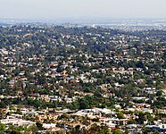
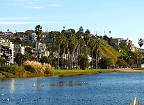
- Selection of neighborhoods in Los Angeles
-

-

-

-

-

-
-

-

-

-

-
-

_(cropped2).jpg)


.jpg)
.JPG)
.jpg)

.jpg)
_(cropped).jpg)
_July_2022_(3).jpg)
.jpg)
.jpg)