A | B | C | D | E | F | G | H | CH | I | J | K | L | M | N | O | P | Q | R | S | T | U | V | W | X | Y | Z | 0 | 1 | 2 | 3 | 4 | 5 | 6 | 7 | 8 | 9
Kern County | |
|---|---|
|
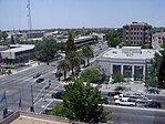
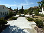
Images, from top down, left to right: Downtown Bakersfield, Cesar E. Chavez National Monument, Fort Tejon barracks, an F-35 landing at Edwards Air Force Base, the Midway-Sunset Oil Field | |
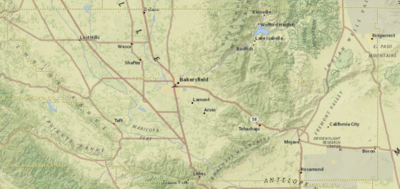
 Interactive map of Kern County | |
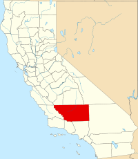
 Location in the state of California | |
| Coordinates: 35°20′N 118°43′W / 35.34°N 118.72°W | |
| Country | United States |
| State | California |
| Incorporated | April 2, 1866 |
| Named for | Kern River and Edward Kern |
| County seat | Bakersfield |
| Largest city | Bakersfield (population) California City (area) |
| Incorporated cities | 11 |
| Government | |
| • Type | Council–Administration |
| • Body | Board of Supervisors [1][2][3][4][5] |
| • Chair | Jeff Flores (N.P.) |
| • Vice Chair | Zack Scrivner (N.P.) |
| • Board of Supervisors[6] | |
| • Chief Administrative Officer[7] | Ryan J. Alsop |
| Area | |
| • Total | 8,163 sq mi (21,140 km2) |
| • Land | 8,132 sq mi (21,060 km2) |
| • Water | 31 sq mi (80 km2) |
| Highest elevation | 8,755 ft (2,669 m) |
| Lowest elevation | 206 ft (63 m) |
| Population | |
| • Total | 909,235 |
| • Density | 110/sq mi (43/km2) |
| Gross Domestic Product | |
| • Total | US$43.822 billion (2022) |
| Time zone | UTC−8 (Pacific Time Zone) |
| • Summer (DST) | UTC−7 (Pacific Daylight Time) |
| Area code | 661, 760 |
| FIPS code | 06-029 |
| GNIS feature ID | 2054176 |
| Congressional districts | 20th, 22nd, 23rd |
| Website | www |
Kern County is a county located in the U.S. state of California. As of the 2020 census, the population was 909,235.[9] Its county seat is Bakersfield.[11]
Kern County comprises the Bakersfield, California, Metropolitan statistical area. The county spans the southern end of the Central Valley. Covering 8,161.42 square miles (21,138.0 km2), it ranges west to the southern slope of the Coast Ranges, and east beyond the southern slope of the eastern Sierra Nevada into the Mojave Desert, at the city of Ridgecrest. Its northernmost city is Delano, and its southern reach extends to just beyond Frazier Park, and the northern extremity of the parallel Antelope Valley.
The county's economy is heavily linked to agriculture and to petroleum extraction. There is also a strong aviation, space, and military presence, such as Edwards Air Force Base, the China Lake Naval Air Weapons Station, and the Mojave Air and Space Port.
With a population that is 54.9% Hispanic as of 2020, Kern is California's third-most populous majority-Hispanic county and the sixth-largest nationwide.[12]
History
Indigenous Era
Native Americans lived in this region for hundreds of years: Chumash, tribes grouped together under the settler name Yokuts, and others.[13]
Spanish era
Spain claimed the area in 1769. Entering from Grapevine Canyon to the south in 1772, Commander Don Pedro Fages became the first European to set foot in the area.
The Battle of San Emigdio took place in Kern County in March 1824. The Chumash Native Americans of Mission Santa Barbara rebelled against the Mexican government and its taking over mission property and ejecting the natives. The battle occurred in the canyon where San Emigdio Creek flows down San Emigdio Mountain and the Blue Ridge, south of Bakersfield near today's Highway 166. Mexican forces from Monterey were commanded by Carlos Carrillo and the conflict was a low-casualty encounter, with only four Native Americans being killed and no Mexicans. The surviving Native Americans were pacified and brought back to Santa Barbara in June 1824 after a pursuit and negotiation in which many were allowed to keep their arms for the return march over the mountains.[14]
American era

In the beginning, what was to become Kern County was dominated by mining in the mountains and in the desert. In 1855 the California legislature attempted to form a county in the area by giving the southeastern territory of Tulare County on the west of the Sierra Nevada Mountains to Buena Vista County. However, it was never officially organized prior to 1859, when the enabling legislation expired. The south of Tulare County was later organized as Kern County in 1866, with additions from Los Angeles and San Bernardino Counties. Its first county seat was the mining town of Havilah, in the mountains east of Bakersfield and north of Tehachapi.[15]
Settlers considered the flat land of the valley inhospitable and impassable at the time due to swamps, lakes, tule reeds and diseases such as malaria. This changed when residents started draining land for farming and constructing canals, most dug by hired Chinese laborers. Within 10 years the valley surpassed the mining areas as the economic power of the county, and as a result the county seat was moved from Havilah to Bakersfield in 1874.[citation needed]
In 1899, the discovery well of the Kern River Oil Field was dug by hand[16] and soon the towns of Oil City, Oil Center and Oildale came into existence.[16]
Etymology
The county derives its name from the Kern River, which was named for Edward Kern, cartographer for General John C. Frémont's 1845 expedition, which crossed Walker Pass. The Kern River was originally named Rio Bravo de San Felipe by Father Francisco Garcés when he explored the area in 1776.
Earthquakes
This section needs additional citations for verification. (August 2017) |
Throughout recorded history, severe earthquakes have struck Kern County, including the 1857 Fort Tejon earthquake.
On July 21, 1952, an earthquake occurred with the epicenter about 23 miles (37 km) south of Bakersfield. It measured 7.3 on the moment magnitude scale and killed 12 people. In addition to the deaths, it was responsible for hundreds of injuries and more than $60 million in property damage. The main shock was felt over much of California and as far away as Phoenix, Arizona and Reno, Nevada. The earthquake occurred on the White Wolf Fault and was the strongest to occur in California since the 1906 San Francisco earthquake. Tehachapi suffered the greatest damage and loss of life from the earthquake, though its effects were widely felt throughout central and southern California. The event had a significant aftershock sequence that persisted into July and August with the strongest coming on August 22, an M5.8 event with a maximum perceived intensity of VIII (Severe) and resulted in two additional deaths and an additional $10 million in property damage. Repercussions of the sequence of earthquakes were still being felt in the heavily damaged downtown area of Bakersfield well into the 1990s as city leaders attempted to improve safety of the surviving non-reinforced masonry buildings.
Following the event, a field survey was conducted along the fault zone with the goal of estimating the peak ground acceleration of the shock based on visually evaluating rock formations and other indicators. Ground disturbances that were created by the earthquakes were also surveyed, both in the valley and in the foothills, with both vertical and horizontal displacements present in the epicenter area. The motion records that were acquired from the event were significant, and a reconnaissance report was recognized for its coverage of the event, and its setting a standard for similar engineering or scientific papers.
Abuse trials
Between 1983 and 1986, several ritual sex ring child abuse cases occurred in Kern County, resulting in numerous long prison sentences, all of which were overturned—some of them decades later, because the prosecutors had coerced false testimonies from the purported child victims.[17] The details of these false accusations are covered extensively in the 2008 documentary Witch Hunt, narrated by Sean Penn.[18]
Geography

According to the United States Census Bureau, the county has a total area of 8,163 square miles (21,140 km2), of which 8,132 square miles (21,060 km2) is land and 31 square miles (80 km2) (0.4%) is water.[19] It is the third-largest county by area in California. The tallest peak in the county is Sawmill Mountain with an elevation of 8822 ft. Its area is nearly the size of the state of New Hampshire; it extends:
- East beyond the southern slope of the Sierra Nevada range into the Mojave Desert, and includes parts of the Indian Wells Valley and Antelope Valley.
- West from the Sierra across the floor of the San Joaquin Valley to the eastern edge of the Temblor Range, part of the Coast Ranges.
- South over the ridge of the Tehachapi Mountains.
Air quality

Kern County suffers from severe air pollution. Particulates cause poor visibility, especially in the winter. Western Kern County lies in the San Joaquin Valley and the topography traps pollutants. Although the topography is not as unfavorable in eastern Kern County, eastern Kern County is a non-attainment area for particulates.[20] Air pollution caused by particulates is "in the unhealthy range an average of 40 days a year, according to the American Lung Association's (ALA) 2018 State of the Air Report.[21]
Vegetation
Chaparral comprises a considerable portion of the natural area within Kern County; the species diversity within these chaparral habitats, however, is considerably less than in many other regions of California.[22] Whitethorn is a prominent example of chaparral species on the rocky slopes of the Sierra Nevada as well as the Inner Coastal Ranges.[23] California Buckeye is a notable tree found in both chaparral and forests and whose southern range terminates in Kern County.[24]
National protected areas
Demographics
| Census | Pop. | Note | %± |
|---|---|---|---|
| 1870 | 2,925 | — | |
| 1880 | 5,601 | 91.5% | |
| 1890 | 9,808 | 75.1% | |
| 1900 | 16,480 | 68.0% | |
| 1910 | 37,715 | 128.9% | |
| 1920 | 54,843 | 45.4% | |
| 1930 | 82,570 | 50.6% | |
| 1940 | 135,124 | 63.6% | |
| 1950 | 228,309 | 69.0% | |
| 1960 | 291,984 | 27.9% | |
| 1970 | 329,162 | 12.7% | |
| 1980 | 403,089 | 22.5% | |
| 1990 | 543,477 | 34.8% | |
| 2000 | 661,645 | 21.7% | |
| 2010 | 839,631 | 26.9% | |
| 2020 | 909,235 | 8.3% | |
| 2023 (est.) | 913,820 | [25] | 0.5% |
| U.S. Decennial Census[26] 1790–1960[27] 1900–1990[28] 1990–2000[29] 2010[30] 2020[9] | |||
According to the 2020 United States Census, Kern County's population was 909,235.[9] It was the eleventh-largest county by population in California.[31] The center of population of California is located in Kern County, in the town of Buttonwillow.[32]
2020 census
| Race / Ethnicity | Pop 2010[30] | Pop 2020[33] | % 2010 | % 2020 |
|---|---|---|---|---|
| White alone (NH) | 323,794 | 279,600 | 38.56% | 30.75% |
| Black or African American alone (NH) | 45,377 | 46,776 | 5.40% | 5.14% |
| Native American or Alaska Native alone (NH) | 5,893 | 5,197 | 0.70% | 0.57% |
| Asian alone (NH) | 33,100 | 44,257 | 3.94% | 4.87% |
| Pacific Islander alone (NH) | 995 | 1,127 | 0.12% | 0.12% |
| Some Other Race alone (NH) | 1,472 | 4,557 | 0.18% | 0.50% |
| Mixed Race/Multi-Racial (NH) | 15,967 | 28,563 | 1.90% | 3.14% |
| Hispanic or Latino (any race) | 413,033 | 499,158 | 49.19% | 54.90% |
| Total | 839,631 | 909,235 | 100.00% | 100.00% |
Note: the US Census treats Hispanic/Latino as an ethnic category. This table excludes Latinos from the racial categories and assigns them to a separate category. Hispanics/Latinos can be of any race.
According to the 2020 United States Census:[34]
- Hispanic (54.9%)
- White Non-Hispanic (30.8%)
- Black (5.5%)
- Asian (5.1%)
- Two or more races (16.1%)
- Indigenous (2.0%)
- Some other race (30.2%)
(Total can be greater than 100% because Hispanics may be counted in any race.)


