Upozornenie: Prezeranie týchto stránok je určené len pre návštevníkov nad 18 rokov! Zásady ochrany osobných údajov. Používaním tohto webu súhlasíte s uchovávaním cookies, ktoré slúžia na poskytovanie služieb, nastavenie reklám a analýzu návštevnosti. OK, súhlasím
"Bolivarian Republic of Venezuela" redirects here. For the period when it was known as the "Republic of Venezuela" from 1953 to 1999, see Republic of Venezuela.
^ The "Bolivarian Republic of Venezuela" has been the full official title since the adoption of the Constitution of 1999, when the state was renamed in honor of Simón Bolívar.
^ Area totals include only Venezuelan-administered territory.
^ On 1 October 2021, a new bolivar was introduced, the Bolívar digital (ISO 4217 code VED) worth 1,000,000 VES.
Venezuela,[a] officially the Bolivarian Republic of Venezuela,[b] is a country on the northern coast of South America, consisting of a continental landmass and many islands and islets in the Caribbean Sea. Venezuela comprises an area of 916,445 km2 (353,841 sq mi), and its population was estimated at 29 million in 2022.[13] The capital and largest urban agglomeration is the city of Caracas.
The territory of Venezuela was colonized by Spain in 1522 amid resistance from Indigenous peoples. In 1811, it became one of the first Spanish-American territories to declare independence from the Spanish and to form part of the first federal Republic of Colombia (Gran Colombia). It separated as a full sovereign country in 1830. During the 19th century, Venezuela suffered political turmoil and autocracy, remaining dominated by regional military dictators until the mid-20th century. Since 1958, the country has had a series of democratic governments, as an exception where most of the region was ruled by military dictatorships, and the period was characterized by economic prosperity.
Venezuela is a developing country having the world's largest known oil reserves and has been one of the world's leading exporters of oil. Previously, the country was an underdeveloped exporter of agricultural commodities such as coffee and cocoa, but oil quickly came to dominate exports and government revenues. The excesses and poor policies of the incumbent government led to the collapse of Venezuela's entire economy.[24][25] The country struggles with record hyperinflation,[26][27]shortages of basic goods,[28] unemployment,[29] poverty,[30] disease, high child mortality, malnutrition, environmental issues, severe crime and corruption. These factors have precipitated the Venezuelan refugee crisis where more than seven million people have fled the country.[31] By 2017, Venezuela was declared to be in default regarding debt payments by credit rating agencies.[32][33] The crisis in Venezuela has contributed to a rapidly deteriorating human rights situation.
Etymology
According to the most popular and accepted version, in 1499, an expedition led by Alonso de Ojeda visited the Venezuelan coast. The stilt houses in the area of Lake Maracaibo reminded the Italian navigator, Amerigo Vespucci, of the city of Venice, Italy, so he named the region Veneziola, or "Little Venice".[34] The Spanish version of Veneziola is Venezuela.[35]
Martín Fernández de Enciso, a member of the Vespucci and Ojeda crew, gave a different account. In his work Summa de geografía, he states that the crew found Indigenous peoples who called themselves the Veneciuela. Thus, the name "Venezuela" may have evolved from the native word.[36]
Evidence exists of human habitation in the area now known as Venezuela from about 15,000 years ago. Tools have been found on the high riverine terraces of the Rio Pedregal in western Venezuela.[37]Late Pleistocene hunting artifacts, including spear tips, have been found at a similar series of sites in northwestern Venezuela; according to radiocarbon dating, these date from 13,000 to 7,000 BC.[38]
It is unknown how many people lived in Venezuela before the Spanish conquest; it has been estimated at one million.[39] In addition to Indigenous peoples known today, the population included groups such as the Kalina (Caribs), Auaké, Caquetio, Mariche, and Timoto–Cuicas. The Timoto–Cuica culture was the most complex society in Pre-Columbian Venezuela, with pre-planned permanent villages, surrounded by irrigated, terraced fields.[40] Their houses were made of stone and wood with thatched roofs. They were peaceful and depended on growing crops. Regional crops included potatoes and ullucos.[41] They left behind art, particularly anthropomorphic ceramics, but no major monuments. They spun vegetable fibers to weave into textiles and mats for housing. They are credited with having invented the arepa, a staple in Venezuelan cuisine.[42]
After the conquest, the population dropped markedly, mainly through the spread of infectious diseases from Europe.[39] Two main north–south axes of pre-Columbian population were present, who cultivated maize in the west and manioc in the east.[39] Large parts of the llanos were cultivated through a combination of slash and burn and permanent settled agriculture.[39]
The German Welser Armada exploring Venezuela, German Welsers ruled Venezuela from 1528 to 1546, before it was retaken by the Spanish Empire. Painting of 1560 by Hieronymus Köler.
In 1498, during his third voyage to the Americas, Christopher Columbus sailed near the Orinoco Delta and landed in the Gulf of Paria.[43] Amazed by the great offshore current of freshwater which deflected his course eastward, Columbus expressed in a letter to Isabella and Ferdinand that he must have reached Heaven on Earth (terrestrial paradise):
Great signs are these of the Terrestrial Paradise... for I have never read or heard of such a large quantity of fresh water being inside and in such close proximity to salt water; the very mild temperateness also corroborates this; and if the water of which I speak does not proceed from Paradise then it is an even greater marvel, because I do not believe such a large and deep river has ever been known to exist in this world.[44]
In 1528, Charles V granted the Welsers the right to explore, rule and colonize the territory, as well as to seek the mythical golden town of El Dorado.[47][48][49] The first expedition was led by Ambrosius Ehinger, who established Maracaibo in 1529. After the deaths of first Ehinger (1533), then Nikolaus Federmann, and Georg von Speyer (1540), Philipp von Hutten persisted in exploring the interior. In absence of von Hutten from the capital of the province, the crown of Spain claimed the right to appoint a governor. On Hutten's return to the capital, Santa Ana de Coro, in 1546, the Spanish governor Juan de Carvajal had Hutten and Bartholomeus VI. Welser executed. Subsequently, Charles V revoked Welser's concession. The Welsers transported German miners to the colony, in addition to 4,000 African slaves to plant sugar cane plantations. Many German colonists died from tropical diseases, to which they had no immunity, or through wars with the Indigenous inhabitants.
Late 15th century to early 17th century
Native caciques (leaders) such as Guaicaipuro (c. 1530–1568) and Tamanaco (died 1573) attempted to resist Spanish incursions, but the newcomers ultimately subdued them.[50]
In the 16th century, during the Spanish colonization, indigenous peoples such as the Mariches, themselves descendants of the Kalina, were converted to Roman Catholicism. Some resisting tribes or leaders are commemorated in place names, including Caracas, Chacao and Los Teques. The early colonial settlements focused on the northern coast,[39] but in the mid-18th century, the Spanish pushed farther inland along the Orinoco River. Here, the Ye'kuana organized resistance in 1775-76.[51]
Spain's eastern Venezuelan settlements were incorporated into New Andalusia Province. Administered by the Royal Audiencia of Santo Domingo from the early 16th century, most of Venezuela became part of the Viceroyalty of New Granada in the early 18th century, and was then reorganized as an autonomous Captaincy General starting in 1777. Caracas, founded in the central coastal region in 1567, was well-placed to become a key location, being near the coastal port of La Guaira and in a valley, in a mountain range, providing defensive strength against pirates and a more fertile and healthy climate.[52]
The end of the French invasion of homeland Spain in 1814 allowed a large expeditionary force to come under general Pablo Morillo, with the goal to regain the lost territory in Venezuela and New Granada. As the war reached a stalemate on 1817, Bolívar reestablished the Third Republic of Venezuela on the territory still controlled by the patriots, mainly in the Guayana and Llanos regions. This republic was short-lived as only two years later, during the Congress of Angostura of 1819, the union of Venezuela with New Granada was decreed to form the Republic of Colombia. The war continued until full victory and sovereignty was attained after the Battle of Carabobo on 24 June 1821.[56] On 24 July 1823, José Prudencio Padilla and Rafael Urdaneta helped seal Venezuelan independence with their victory in the Battle of Lake Maracaibo.[57] New Granada's congress gave Bolívar control of the Granadian army; leading it, he liberated several countries and founded the Republic of Colombia (Gran Colombia).[56]
Revolution of 19 April 1810, the beginning of Venezuela's independence, by Martín Tovar y Tovar
Sucre went on to liberate Ecuador and become the second president of Bolivia. Venezuela remained part of Gran Colombia until 1830, when a rebellion led by José Antonio Páez allowed the proclamation of a newly independent Venezuela, on 22 September;[58] Páez became the first president of the new State of Venezuela.[59] Between one-quarter and one-third of Venezuela's population was lost during these two decades of war (including about half the Venezuelans of European descent),[60] which by 1830, was estimated at 800,000.[61] In the Flag of Venezuela, the yellow stands for land wealth, the blue for the sea that separates Venezuela from Spain, and the red for the blood shed by the heroes of independence.[62]
Slavery in Venezuela was abolished in 1854.[61] Much of Venezuela's 19th-century history was characterized by political turmoil and dictatorial rule, including the Independence leader José Antonio Páez, who gained the presidency three times and served 11 years between 1830 and 1863. This culminated in the Federal War (1859–63). In the latter half of the century, Antonio Guzmán Blanco, another caudillo, served 13 years, between 1870 and 1887, with three other presidents interspersed.
In 1895, a longstanding dispute with Great Britain about the Essequibo territory, which Britain claimed as part of British Guiana and Venezuela saw as Venezuelan territory, erupted into the Venezuela Crisis of 1895. The dispute became a diplomatic crisis when Venezuela's lobbyist, William L. Scruggs, sought to argue that British behavior over the issue violated the United States' Monroe Doctrine of 1823, and used his influence in Washington, D.C., to pursue the matter. Then, U.S. president Grover Cleveland adopted a broad interpretation of the doctrine that declared an American interest in any matter within the hemisphere.[63] Britain ultimately accepted arbitration, but in negotiations over its terms was able to persuade the U.S. on many details. A tribunal convened in Paris in 1898 to decide the issue and in 1899 awarded the bulk of the disputed territory to British Guiana.[64]
In 1899, Cipriano Castro, assisted by his friend Juan Vicente Gómez, seized power in Caracas. Castro defaulted on Venezuela's considerable foreign debts and declined to pay compensation to foreigners caught up in Venezuela's civil wars. This led to the Venezuela Crisis of 1902–1903, in which Britain, Germany and Italy imposed a naval blockade before international arbitration at the new Permanent Court of Arbitration was agreed. In 1908, another dispute broke out with the Netherlands, which was resolved when Castro left for medical treatment in Germany and was promptly overthrown by Juan Vicente Gómez (1908–35).
20th century
Flag of Venezuela between 1954 and 2006
The discovery of massive oil deposits in Lake Maracaibo during World War I[65] proved pivotal for Venezuela and transformed its economy from a heavy dependence on agricultural exports. It prompted a boom that lasted into the 1980s; by 1935, Venezuela's per capita gross domestic product was Latin America's highest.[66] Gómez benefited handsomely from this, as corruption thrived, but at the same time, the new source of income helped him centralize the state and develop its authority.
He remained the most powerful man in Venezuela until his death in 1935. The gomecista dictatorship (1935–1945) system largely continued under Eleazar López Contreras, but from 1941, under Isaías Medina Angarita, was relaxed. Angarita granted a range of reforms, including the legalization of all political parties. After World War II, immigration from Southern Europe and poorer Latin American countries markedly diversified Venezuelan society.[67]
Rómulo Betancourt (president 1945–1948 / 1959–1964), one of the major democracy leaders of Venezuela.
The most powerful man in the military junta (1948–58) was Pérez Jiménez and he was suspected of being behind the death of Chalbaud, who died in a bungled kidnapping in 1950. When the junta unexpectedly lost the 1952 presidential election, it ignored the results and Jiménez was installed as president[citation needed] Jiménez was forced out on 23 January 1958.[57] In an effort to consolidate a young democracy, the three major political parties (Acción Democrática (AD), COPEI and Unión Republicana Democrática (URD), with the notable exception of the Communist Party of Venezuela), signed the Puntofijo Pact power-sharing agreement. AD and COPEI dominated the political landscape for four decades.
Table where the Puntofijo Pact was signed on 31 October 1958
During the presidencies of Rómulo Betancourt (1959–64, his second term) and Raúl Leoni (1964–69), substantial guerilla movements occurred. Most laid down their arms under Rafael Caldera's first presidency (1969–74). Caldera had won the 1968 election for COPEI, the first time a party other than Democratic Action took the presidency through a democratic election. The new democratic order had its antagonists. Betancourt suffered an attack planned by the Dominican dictator Rafael Trujillo in 1960, and the leftists excluded from the Pact initiated an insurgency by organizing themselves into the Armed Forces of National Liberation, sponsored by the Communist Party and Fidel Castro. In 1962 they tried to destabilize the military corps, with failed revolts. Betancourt promoted a foreign policy, the Betancourt Doctrine, in which he only recognized elected governments by popular vote.[need quotation to verify]
The 1973 Venezuelan presidential election of Carlos Andrés Pérez coincided with an oil crisis, in which Venezuela's income exploded as oil prices soared; oil industries were nationalized in 1976. This led to massive increases in public spending, but also increases in external debts, until the collapse of oil prices during the 1980s crippled the economy. As the government started to devalue the currency in 1983 to face its financial obligations, standards of living fell dramatically. Failed economic policies and increasing corruption in government led to rising poverty and crime, worsening social indicators, and increased political instability.[70]
In the 1980s, the Presidential Commission for State Reform (COPRE) emerged as a mechanism of political innovation. Venezuela decentralized its political system and diversified its economy, reducing the size of the state. COPRE operated as an innovation mechanism, also by incorporating issues into the political agenda, that were excluded from public deliberation by the main actors of the democratic system. The most discussed topics were incorporated into the public agenda: decentralization, political participation, municipalization, judicial order reforms and the role of the state in a new economic strategy. The social reality made the changes difficult to apply.[71]
Economic crises in the 1980s and 1990s led to a political crisis. Hundreds of people were killed by security forces and the military in the Caracazo riots of 1989, during the second presidential term of Carlos Andrés Pérez (1989–1993) and after the implementation of economic austerity measures.[72]Hugo Chávez, who in 1982 had promised to depose the bipartisanship governments, used the growing anger at economic austerity measures to justify a coup attempt in February 1992;[73][74] a second coup d'état attempt occurred in November.[74] President Carlos Andrés Pérez (re-elected in 1988) was impeached under embezzlement charges in 1993, leading to the interim presidency of Ramón José Velásquez (1993–1994). Coup leader Chávez was pardoned in March 1994 by president Rafael Caldera (1994–1999, his second term), with a clean slate and his political rights reinstated, allowing Chávez to win and maintain the presidency continuously from 1999 until his death in 2013. Chávez won the elections of 1998, 2000, 2006 and 2012 and the presidential referendum of 2004.
A collapse in confidence in the existing parties led to Hugo Chávez being elected president in 1998 and the subsequent launch of a "Bolivarian Revolution", beginning with a 1999 constituent assembly to write a new Constitution. The Revolution refers to a left-wing populismsocial movement and political process led by Chávez, who founded the Fifth Republic Movement in 1997 and the United Socialist Party of Venezuela in 2007. The "Bolivarian Revolution" is named after Simón Bolívar. According to Chávez and other supporters, the "Bolivarian Revolution" sought to build a mass movement to implement Bolivarianism—popular democracy, economic independence, equitable distribution of revenues, and an end to political corruption. They interpret Bolívar's ideas from a populist perspective, using socialist rhetoric. This led to formation of the Fifth Republic of Venezuela, commonly known as the Bolivarian Republic of Venezuela, that continues to the present day. Venezuela has been considered the Bolivarian Republic following the adoption of the new Constitution of 1999. Following Chávez's election, Venezuela developed into a dominant-party system, dominated by the United Socialist Party of Venezuela. In April 2002, Chávez was briefly ousted from power in the 2002 Venezuelan coup d'état attempt following popular demonstrations by his opponents,[75] but Chavez returned after two days as a result of demonstrations by poor Chávez supporters and actions by the military.[76][77] Chávez remained in power after an all-out national strike that lasted from December 2002 to February 2003, including a strike/lockout in the state oil company PDVSA.[78]Capital flight before and during the strike led to the reimposition of currency controls. In the subsequent decade, the government was forced into currency devaluations.[79][80][81][82] These devaluations did not improve the situation of the people who rely on imported products or locally produced products that depend on imported inputs, while dollar-denominated oil sales account for the majority of exports.[83] The profits of the oil industry have been lost to "social engineering" and corruption, instead of investments needed to maintain oil production.[84]
Chávez survived further political tests, including an August 2004 recall referendum. He was elected for another term in December 2006 and for a third term in October 2012. However, he was never sworn in due to medical complications; he died in March 2013.[85] The presidential election that took place in April 2013, was the first since Chávez took office in 1999 in which his name did not appear on the ballot.[86][self-published source?]
Under the Bolivarian government, Venezuela went from being one of the richest countries in Latin America to one of the poorest.[87]Hugo Chávez's socioeconomic policies of relying on oil sales and importing goods resulted in large amounts of debt, no change to corruption in Venezuela and culminated into a crisis in Venezuela.[87] As a result, the Venezuelan refugee crisis, the largest emigration of people in Latin America's history,[88] occurred, with over 7 million – about 20% of the country's population – emigrating.[89][90] Chávez initiated Bolivarian missions, programs aimed at helping the poor.[91]
Poverty began to increase into the 2010s.[19]Nicolás Maduro was picked by Chavez as his successor, appointing him vice president in 2013.[81][92][93]
Maduro has been president of Venezuela since 14 April 2013, when he won the presidential election after Chavez' death, with 51% of the vote, against Henrique Capriles on 49%. The Democratic Unity Roundtable contested Maduro's election as fraud, but an audit of 56% of the vote showed no discrepancies,[94] and the Supreme Court of Venezuela ruled Maduro was the legitimate president.[95] Opposition leaders and some international media consider Maduro's government a dictatorship.[96][97][98] Since February 2014, hundreds of thousands have protested over high levels of criminal violence, corruption, hyperinflation, and chronic scarcity of basic goods due to government policies.[99][100][101] Demonstrations and riots have resulted in over 40 fatalities in the unrest between Chavistas and opposition protesters[102] and opposition leaders, including Leopoldo López and Antonio Ledezma were arrested.[102][103][104] Human rights groups condemned the arrest of López.[105] In the 2015 Venezuelan parliamentary election, the opposition gained a majority.[106]
Venezuela devalued its currency in February 2013 due to rising shortages,[82][107]which included milk and other necessities. This led to an increase in malnutrition, especially among children.[108][109] The economy had become dependent on the exportation of oil, with crude accounting for 86% of exports,[110] and a high price per barrel to support social programs. Beginning in 2014 the price of oil plummeted from over $100 to $40. This placed pressure on the economy, which was no longer able to afford vast social programs. The Government began taking more money from PDVSA, the state oil company, resulting in a lack of reinvestment in fields and employees. Production decreased from its height of nearly 3 to 1 million barrels (480 to 160 thousand cubic metres) per day.[111][112][113] In 2014, Venezuela entered a recession,[114] and in 2015, had the world's highest inflation, surpassing 100%.[115] In 2017, Donald Trump's administration imposed more economic sanctions against PDVSA and Venezuelan officials.[116][117][118] Economic problems, as well as crime, were the causes of the 2014–present Venezuelan protests.[119][120] Since 2014, roughly 5.6 million people have fled Venezuela.[121]
In January 2016, Maduro decreed an "economic emergency", revealing the extent of the crisis and expanding his powers.[122] In July 2016, Colombian border crossings were temporarily opened to allow Venezuelans to purchase food and basic health items.[123] In September 2016, a study[124] indicated 15% of Venezuelans were eating "food waste discarded by commercial establishments". 200 prison riots had occurred by October 2016.[125]
Maduro was inaugurated for a contested and controversial second term on 10 January 2019.
The Maduro-aligned Supreme Tribunal, which had been overturning National Assembly decisions since the opposition took control, took over the functions of the assembly, creating the 2017 Venezuelan constitutional crisis.[96] In August 2017, the 2017 Constituent National Assembly was elected and stripped the National Assembly of its powers.[citation needed] The election raised concerns of an emerging dictatorship.[126] In December 2017, Maduro declared opposition parties barred from the following year's presidential vote after they boycotted mayoral polls.[127]
Maduro won the 2018 election with 68% of the vote. The result was challenged by Argentina, Chile, Colombia, Brazil, Canada, Germany, France and the US who deemed it fraudulent and recognized Juan Guaidó as president.[128][129][130] Other countries continued to recognize Maduro,[131][132] although China, facing financial pressure over its position, began hedging by decreasing loans, cancelling joint ventures, and signaling willingness to work with all parties.[133][134] In August 2019, Trump imposed an economic embargo against Venezuela.[135] In March 2020, Trump indicted Maduro and Venezuelan officials, on charges of drug trafficking, narcoterrorism, and corruption.[136]
In June 2020, a report documented enforced disappearances that occurred in 2018-19. 724 enforced disappearances of political detainees were reported. The report stated that security forces subjected victims to torture. The report stated the government used enforced disappearances to silence opponents and other critical voices.[137][138]
Venezuela is located in the north of South America; geologically, its mainland rests on the South American Plate. It has a total area of 916,445 km2 (353,841 sq mi) and a land area of 882,050 km2 (340,560 sq mi), making Venezuela the 33rd largest country in the world. The territory it controls lies between latitudes 0° and 16°N and longitudes 59° and 74°W.
Shaped roughly like a triangle, the country has a 2,800 km (1,700 mi) coastline in the north, which includes numerous islands in the Caribbean and the northeast borders the northern Atlantic Ocean. Most observers describe Venezuela in terms of four fairly well defined topographical regions: the Maracaibo lowlands in the northwest, the northern mountains extending in a broad east–west arc from the Colombian border along the northern Caribbean coast, the wide plains in central Venezuela, and the Guiana Highlands in the southeast.
The northern mountains are the extreme northeastern extensions of South America's Andes mountain range. Pico Bolívar, the nation's highest point at 4,979 m (16,335 ft), lies in this region. To the south, the dissected Guiana Highlands contain the northern fringes of the Amazon Basin and Angel Falls, the world's highest waterfall, as well as tepuis, large table-like mountains. The country's center is characterized by the llanos, which are extensive plains that stretch from the Colombian border in the far west to the Orinoco River delta in the east. The Orinoco, with its rich alluvial soils, binds the largest and most important river system of the country; it originates in one of the largest watersheds in Latin America. The Caroní and the Apure are other major rivers.
Venezuela borders Colombia to the west, Guyana to the east, and Brazil to the south. Caribbean islands such as Trinidad and Tobago, Grenada, Curaçao, Aruba, and the Leeward Antilles lie near the Venezuelan coast. Venezuela has territorial disputes with Guyana, formerly United Kingdom, largely concerning the Essequibo area and with Colombia concerning the Gulf of Venezuela. In 1895, after years of diplomatic attempts to solve the border dispute, the dispute over the Essequibo River border flared up. It was submitted to a "neutral" commission (composed of British, American, and Russian representatives and without a direct Venezuelan representative), which in 1899 decided mostly against Venezuela's claim.[citation needed]
Venezuela is entirely located in the tropics over the Equator to around 12° N. Its climate varies from humid low-elevation plains, where average annual temperatures range as high as 35 °C (95.0 °F), to glaciers and highlands (the páramos) with an average yearly temperature of 8 °C (46.4 °F). Annual rainfall varies from 430 mm (16.9 in) in the semiarid portions of the northwest to over 1,000 mm (39.4 in) in the Orinoco Delta of the far east and the Amazonian Jungle in the south. The precipitation level is lower in the period from August through April. These periods are referred to as hot-humid and cold-dry seasons. Another characteristic of the climate is this variation throughout the country by the existence of a mountain range called "Cordillera de la Costa" which crosses the country from east to west. The majority of the population lives in these mountains.[139]
Venezuela map of Köppen climate classification
The country falls into four horizontal temperature zones based primarily on elevation, having tropical, dry, temperate with dry winters, and polar (alpine tundra) climates, amongst others.[140][141][142] In the tropical zone—below 800 m (2,625 ft)—temperatures are hot, with yearly averages ranging between 26 and 28 °C (78.8 and 82.4 °F). The temperate zone ranges between 800 and 2,000 m (2,625 and 6,562 ft) with averages from 12 to 25 °C (53.6 to 77.0 °F); many of Venezuela's cities, including the capital, lie in this region. Colder conditions with temperatures from 9 to 11 °C (48.2 to 51.8 °F) are found in the cool zone between 2,000 and 3,000 m (6,562 and 9,843 ft), especially in the Venezuelan Andes, where pastureland and permanent snowfield with yearly averages below 8 °C (46 °F) cover land above 3,000 meters (9,843 ft) in the páramos.
Venezuela lies within the Neotropical realm; large portions of the country were originally covered by moist broadleaf forests. One of 17 megadiverse countries,[145] Venezuela's habitats range from the Andes Mountains in the west to the Amazon Basin rainforest in the south, via extensive llanos plains and Caribbean coast in the center and the Orinoco River Delta in the east. They include xeric scrublands in the extreme northwest and coastal mangrove forests in the northeast.[139] Its cloud forests and lowland rainforests are particularly rich.[146]
For the fungi, an account was provided by R.W.G. Dennis[149] which has been digitized and the records made available on-line as part of the Cybertruffle Robigalia database.[150] That database includes nearly 3,900 species of fungi recorded from Venezuela, but is far from complete, and the true total number of fungal species already known from Venezuela is likely higher, given the generally accepted estimate that only about 7% of all fungi worldwide have so far been discovered.[151]
Among plants of Venezuela, over 25,000 species of orchids are found in the country's cloud forest and lowland rainforest ecosystems.[146] These include the flor de mayo orchid (Cattleya mossiae), the national flower. Venezuela's national tree is the araguaney. The tops of the tepuis are also home to several carnivorous plants including the marsh pitcher plant, Heliamphora, and the insectivorous bromeliad, Brocchinia reducta.
Venezuela is among the top 20 countries in terms of endemism.[152] Among its animals, 23% of reptilian and 50% of amphibian species, including the Trinidad poison frog, are endemic.[152][153] Although the available information is still very small, a first effort has been made to estimate the number of fungal species endemic to Venezuela: 1334 species of fungi have been tentatively identified as possibly endemic.[154] Some 38% of the over 21,000 plant species known from Venezuela are unique to the country.[152]
Venezuela is one of the 10 most biodiverse countries on the planet, yet it is one of the leaders of deforestation due to economic and political factors. Each year, roughly 287,600 hectares of forest are permanently destroyed, and other areas are degraded by mining, oil extraction, and logging. Between 1990 and 2005, Venezuela officially lost 8.3% of its forest cover, which is about 4.3 million ha. In response, federal protections for critical habitat were implemented; for example, 20% to 33% of forested land is protected.[148] Venezuela had a 2019 Forest Landscape Integrity Index mean score of 8.78/10, ranking it 19th globally out of 172 countries.[155] The country's biosphere reserve is part of the World Network of Biosphere Reserves; five wetlands are registered under the Ramsar Convention.[156] In 2003, 70% of the nation's land was under conservation management in over 200 protected areas, including 43 national parks.[157]Venezuela's 43 national parks include Canaima National Park, Morrocoy National Park, and Mochima National Park. In the far south is a reserve for the country's Yanomami tribes. Covering 32,000 square miles (82,880 square kilometres), the area is off-limits to farmers, miners, and all non-Yanomami settlers.
There are 105 protected areas in Venezuela, which cover around 26% of the country's continental, marine and insular surface.[citation needed]
Hydrography
The country is made up of three river basins: the Caribbean Sea, the Atlantic Ocean and Lake Valencia, which forms an endorheic basin.[164]
On the Atlantic side it drains most of Venezuela's river waters. The largest basin in this area is the extensive Orinoco basin[165] whose surface area, close to one million km2, is greater than that of the whole of Venezuela, although it has a presence of 65% in the country.
The size of this basin - similar to that of the Danube - makes it the third largest in South America, and it gives rise to a flow of some 33,000 m3/s, making the Orinoco the third largest in the world, and also one of the most valuable from the point of view of renewable natural resources. The Rio or Brazo Casiquiare is unique in the world, as it is a natural derivation of the Orinoco that, after some 500 km in length, connects it to the Negro River, which in turn is a tributary of the Amazon.
The Orinoco receives directly or indirectly rivers such as the Ventuari, the Caura, the Caroní, the Meta, the Arauca, the Apure and many others. Other Venezuelan rivers that empty into the Atlantic are the waters of the San Juan and Cuyuní basins. Finally, there is the Amazon River, which receives the Guainía, the Negro and others. Other basins are the Gulf of Paria and the Esequibo River.
The second most important watershed is the Caribbean Sea. The rivers of this region are usually short and of scarce and irregular flow, with some exceptions such as the Catatumbo, which originates in Colombia and drains into the Maracaibo Lake basin. Among the rivers that reach the Maracaibo lake basin are the Chama, the Escalante, the Catatumbo, and the contributions of the smaller basins of the Tocuyo, Yaracuy, Neverí and Manzanares rivers.
A minimum drains to the Lake Valencia basin.[166] Of the total extension of the rivers, a total of 5400 km are navigable. Other rivers worth mentioning are the Apure, Arauca, Caura, Meta, Barima, Portuguesa, Ventuari and Zulia, among others.
The country's main lakes are Lake Maracaibo[167] -the largest in South America- open to the sea through the natural channel, but with fresh water, and Lake Valencia with its endorheic system. Other noteworthy bodies of water are the Guri reservoir, the Altagracia lagoon, the Camatagua reservoir and the Mucubají lagoon in the Andes.
Relief
The Venezuelan natural landscape[168] is the product of the interaction of tectonic plates[168] that since the Paleozoic have contributed to its current appearance. On the formed structures, seven physical-natural units have been modeled, differentiated in their relief and in their natural resources.
The relief of Venezuela has the following characteristics: coastline with several peninsulas[169] and islands, adenas of the Andes mountain range (north and northwest), Lake Maracaibo (between the chains, on the coast);[170]Orinoco river delta,[171] region of peneplains and plateaus (tepui, east of the Orinoco) that together form the Guyanas massif (plateaus, southeast of the country).
The oldest rock formations in South America are found in the complex basement of the Guyanas highlands[172] and in the crystalline line of the Maritime and Cordillera massifs in Venezuela. The Venezuelan part of the Guyanas Altiplano consists of a large granite block of gneiss and other crystalline Archean rocks, with underlying layers of sandstone and shale clay.[173]
The core of granite and cordillera is, to a large extent, flanked by sedimentary layers from the Cretaceous,[174] folded in an anticline structure. Between these orographic systems there are plains covered with tertiary and quaternary layers of gravel, sands and clayey marls. The depression contains lagoons and lakes, among which is that of Maracaibo, and presents, on the surface, alluvial deposits from the Quaternary.[175]
Also known as the Cordillera de la Costa, stretches along Venezuela's northern coast. This region is known for its lush tropical rainforests, stunning coastal views, and a rich variety of flora and fauna. The intermountain depressions, or valleys, between the mountain ranges are often home to fertile agricultural land and vibrant communities. These valleys offer a stark contrast to the rugged mountains that rise dramatically from the coast.
Situated in northwestern Venezuela, the Lara-Falcón Highlands exhibit a terrain defined by plateaus and rolling hills. These highlands provide a significant contrast to the surrounding lowlands and coastal areas. The relief is characterized by gently sloping plateaus that support agriculture, including coffee and cacao cultivation. This region's semi-arid climate and picturesque landscapes make it an important agricultural and tourism center.
Encompass the basin of Lake Maracaibo and the plains surrounding the Gulf of Venezuela. This region offers two distinct plains—the northern one is relatively dry, while the southern one is humid and dotted with swamps. The relief here is primarily characterized by flat terrain, with the exception of some elevated areas near the lake. Lake Maracaibo itself sits in a depression, surrounded by oil-rich lands and productive agricultural areas.[170]
The Venezuelan Andes, part of the broader Andes mountain range, offer a striking relief with towering peaks, deep valleys, and fertile intermontane basins. Dominated by these corpulent mountain ranges, including Venezuela's highest peak, Bolívar Peak, the region's rugged and picturesque landscapes are defined by its high-altitude terrain.
Coastal Mountain Range (Cordillera de la Costa) in Venezuela
The unique relief of this area finds its origins in the Last Glacial Period, where the interplay of repeated glacier advances and retreats sculpted the landscape, shaped by the cold, high-altitude climate. This glacial heritage has left a lasting imprint, with glaciers carving deep valleys and polishing rugged peaks, while sheltered intramontane valleys offer fertile soils and temperate microclimates, creating ideal conditions for agriculture and human settlement.
Los Llanos, or "the plains", are expansive sedimentary basins characterized by predominantly flat relief.[176] However, the eastern Llanos feature low-plateaus and the Unare depression, created through mesa erosion, adding diversity to the terrain. This region is subject to seasonal flooding, transforming the flat plains into a vast wetland during the rainy season. The relief here influences the region's unique ecosystems, including extensive grasslands and abundant wildlife.
The Guiana Shield boasts a varied relief shaped by geological processes over millions of years. This region encompasses peneplains, rugged mountain ranges, foothills, and the iconic tepuis, or table-top mountains. The tepuis stand as isolated, flat-topped plateaus that rise dramatically from the surrounding terrain. This unique relief contributes to the region's remarkable biodiversity and scientific significance.[172]
The Orinoco Delta's relief is characterized by a complex system of lands and waters. It consists of numerous channels, islands, and shifting sedimentary deposits. While the relief may appear relatively uniform, it conceals a dynamic environment influenced by seasonal flooding and sediment deposition. This complex deltaic relief supports diverse aquatic life and the livelihoods of Indigenous communities adapted to its ever-changing landscapes.[171]
The valleys are undoubtedly the most important type of landscape in the Venezuelan territory,[177] not because of their spatial extension, but because they are the environment where most of the country's population and economic activities are concentrated. On the other hand, there are valleys throughout almost all the national space, except in the great sedimentary basins of the Llanos and the depression of the Maracaibo Lake, except also in the Amazonian peneplains.[178]
By their modeling, the valleys of the Venezuelan territory belong mainly to two types: valleys of fluvial type and valleys of glacial type.[179] Much more frequent, the former largely dominate the latter, which are restricted to the highest parts of the Andes. Moreover, most glacial valleys are relics of a past geologic epoch, which culminated some 10,000 to 12,000 years ago.
The deep and narrow Andean valleys are very different from the wide depressions of Aragua and Carabobo, in the Cordillera de la Costa, or from the valleys nestled in the Mesas de Monagas. These examples indicate that the configuration of the local relief is decisive in identifying regional types of valleys. Likewise, due to their warm climate, the Guayana valleys are distinguished from the temperate or cold Andean valleys by their humid environment. Both are, in turn, different from the semi-arid depressions of the states of Lara and Falcón.
The Andean valleys, essentially agricultural, precociously populated but nowadays in loss of speed, do not confront the same problems of space occupation as the strongly urbanized and industrialized valleys of the central section of the Cordillera de la Costa. On the other hand, the unpopulated and practically untouched Guiana valleys are another category this area is called the Lost World (Mundo Perdido).[178]
The Andean valleys are undoubtedly the most impressive of the Venezuelan territory because of the energy of the encasing reliefs, whose summits often dominate the valley bottoms by 3,000 to 3,500 meters of relative altitude. They are also the most picturesque in terms of their style of habitat, forms of land use, handicraft production and all the traditions linked to these activities.[178]
Venezuela has a great diversity of landscapes and climates,[180] including arid and dry areas. The main desert in the country is in the state of Falcon near the city of Coro. It is now a protected park, the Médanos de Coro National Park.[181] The park is the largest of its kind in Venezuela, covering 91 square kilometres. The landscape is dotted with cacti and other xerophytic plants that can survive in humidity-free conditions near the desert.
Desert wildlife includes mostly lizards, iguanas and other reptiles. Although less frequent, the desert is home to some foxes, giant anteaters and rabbits. There are also some native bird populations, such as the sparrowhawk, tropical mockingbird, scaly dove and crested quail.
Other desert areas in the country include part of the Guajira Desert in the Guajira Municipality in the north of Zulia State[182] and facing the Gulf of Venezuela, the Médanos de Capanaparo[183] in the Santos Luzardo National Park in Apure State, the Medanos de la Isla de Zapara[184] in Zulia State, the so-called Hundición de Yay[185] in the Andrés Eloy Blanco Municipality of Lara State, and the Urumaco Formation also in Falcón State.
The Venezuelan president is elected by a vote, with direct and universal suffrage, and is both head of state and head of government. The term of office is six years, and (as of 15 February 2009) a president may be re-elected an unlimited number of times. The president appoints the vice president and decides the size and composition of the cabinet and makes appointments to it with the involvement of the legislature. The president can ask the legislature to reconsider portions of laws he finds objectionable, but a simple parliamentary majority can override these objections.
The president may ask the National Assembly to pass an enabling act granting the ability to rule by decree in specified policy areas; this requires a two-thirds majority in the Assembly. Since 1959, six Venezuelan presidents have been granted such powers.
The unicameral Venezuelan parliament is the Asamblea Nacional ("National Assembly"). The number of members is variable – each state and the Capital district elect three representatives plus the result of dividing the state population by 1.1% of the total population of the country.[186] Three seats are reserved for representatives of Venezuela's Indigenous peoples. For the 2011–2016 period the number of seats is 165.[187] All deputies serve five-year terms.
The voting age in Venezuela is 18. Voting is not compulsory.[188]
The legal system of Venezuela belongs to the Continental Law tradition. The highest judicial body is the Supreme Tribunal of Justice or Tribunal Supremo de Justicia, whose magistrates are elected by parliament for a single twelve-year term. The National Electoral Council (Consejo Nacional Electoral, or CNE) is in charge of electoral processes; it is formed by five main directors elected by the National Assembly. Supreme Court president Luisa Estela Morales said in December 2009 that Venezuela had moved away from "a rigid division of powers" toward a system characterized by "intense coordination" between the branches of government. Morales clarified that each power must be independent.[189]
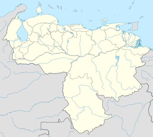
Venezuela is divided into 23 states (estados), a capital district (distrito capital) corresponding to the city of Caracas, and the Federal Dependencies (Dependencias Federales, a special territory). Venezuela is further subdivided into 335 municipalities (municipios); these are subdivided into over one thousand parishes (parroquias). The states are grouped into nine administrative regions (regiones administrativas), which were established in 1969 by presidential decree.[citation needed]
The country can be further divided into ten geographical areas, some corresponding to climatic and biogeographical regions. In the north are the Venezuelan Andes and the Coro region, a mountainous tract in the northwest, holds several sierras and valleys. East of it are lowlands abutting Lake Maracaibo and the Gulf of Venezuela.[citation needed]
The country maintains a claim on the territory it calls "Guayana Esequiba", the territory administered by Guyana west of the Esequibo River. In 1966 the British and Venezuelan governments signed the Geneva Agreement to resolve the conflict peacefully. The Port of Spain Protocol of 1970 set a deadline to try to resolve the issue, without success to date.[citation needed]
Zdroj:https://en.wikipedia.org?pojem=Etymology_of_Venezuela Text je dostupný za podmienok Creative Commons Attribution/Share-Alike License 3.0 Unported; prípadne za ďalších podmienok. Podrobnejšie informácie nájdete na stránke Podmienky použitia.


.svg)


.jpg)


_(12111191594).jpg)


_23.jpg)