
A | B | C | D | E | F | G | H | CH | I | J | K | L | M | N | O | P | Q | R | S | T | U | V | W | X | Y | Z | 0 | 1 | 2 | 3 | 4 | 5 | 6 | 7 | 8 | 9
 |
| The 64 counties of the U.S. State of Colorado. |
The U.S. State of Colorado is divided into 64 counties. Two of these counties, the City and County of Broomfield and the City and County of Denver, have consolidated city and county governments. Denver serves as the state capital. Counties are important units of government in Colorado since there are no civil townships or other minor civil divisions.
El Paso County, with a population of 730,395 in 2020, is the most populous county in Colorado, while San Juan County is the least populous, with a population of 705. Las Animas County, 4,776 square miles (12,369 km2) in area, is the most extensive county, while the City and County of Broomfield, 34 square miles (87 km2) in area, is the least extensive. The City and County of Denver is the most densely populated Colorado county, with a population density of 4,674 residents per square mile (1,805/km2) as of 2020, while Hinsdale County is the least densely populated county with a population density of 0.71 resident per square mile (0.27/km2).
Mount Elbert, the highest summit of Colorado and the entire Rocky Mountains at an elevation of 14,440 feet (4,401.2 m), is located in Lake County. The lowest point in Colorado is where the Arikaree River flows out of Yuma County and into Kansas, at 3,317 feet (1,011 m) elevation.[a] This point, which is the highest low point of any state, is higher than the highest points of 18 states and the District of Columbia.[1]
History
On November 1, 1861, the new Territory of Colorado created 17 original counties: Arapahoe, Boulder, Clear Creek, Costilla, Douglas, El Paso, Fremont, Gilpin, Guadalupe, Huerfano, Jefferson, Lake, Larimer, Park, Pueblo, Summit, and Weld; plus the Cheyenne Reserve.[2][3] Six days later, the name of Guadelupe County was changed to Conejos County.
On February 9, 1866, the first new county, Las Animas, was created, followed by Saguache in December of that year. Bent County was created in February 1870, followed by Greenwood the following month. On February 2, 1874, Grand County and Elbert County were formed, and on February 10, La Plata, Hinsdale, and Rio Grande counties were created. Greenwood was absorbed into Bent on February 5. The last county to be created under the Colorado Territory name was San Juan County, created three months before statehood.
By the time Colorado became a state on August 1, 1876, it had only 26 counties. In January 1877, Routt and Ouray were formed, followed by Gunnison and Custer counties in March. In February 1879, Chaffee County was created. From February 8–10, 1879, Lake county was renamed Carbonate County. In 1881, Dolores County and Pitkin County were created. In 1883, Montrose, Mesa, Garfield, Eagle, Delta, and San Miguel counties were formed, leaving the total number of counties at 39. The number rose to 40 in 1885 with the creation of Archuleta County on April 14. Washington County and Logan County were both created in 1887. Between February 19 and April 16 in 1889, Morgan, Yuma, Cheyenne, Otero, Rio Blanco, Phillips, Sedgwick, Kiowa, Kit Carson, Lincoln, Prowers, Baca, and Montezuma counties were formed, bringing the total to 55. By 1900, Mineral County and Teller County had been added. On November 15, 1902, Arapahoe County was split into Adams and South Arapahoe Counties, and Denver was consolidated as a city and county from portions of both newly formed counties on December 1, 1902.[4] By 1912, Jackson County, Moffat County, and Crowley County had been created. Alamosa was created in 1913, and in 2001, Broomfield was consolidated as a city and county, bringing the total to 64 counties.
List
Select the OpenStreetMap link at the right to view the location of these 64 coounties.
| County |
FIPS code[5][b] | County seat[6][7] | Est.[8] | Formed from[8] | Etymology[8] | Population[9] | Area[6] | Map |
|---|---|---|---|---|---|---|---|---|
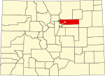
| Adams County | 001 | Brighton | 1902-11-15 | Split from Arapahoe County. | Named in honor of Alva Adams, the 5th, 10th, and 14th Governor of the State of Colorado. | 533,365 | 1,182.29 sq mi (3,062 km2) |
|
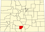
| Alamosa County | 003 | Alamosa | 1913-03-08 | Split from Costilla County and Conejos County. | Named for the cottonwood trees which grow along the Rio Grande and its tributaries. Alamosa is a Spanish word for a cottonwood grove. | 16,655 | 723.21 sq mi (1,873 km2) |
|
| Arapahoe County | 005 | Littleton | 1861-11-01 | Created as one of the 17 original counties of the Territory of Colorado. Renamed South Arapahoe County for the five months from November 15, 1902 to April 11, 1903. | Named for predecessor Arapahoe County, Kansas Territory, which in turn was named for the Arapaho Nation of Native Americans. | 656,061 | 804.41 sq mi (2,083 km2) |

|
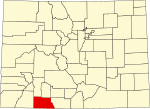
| Archuleta County | 007 | Pagosa Springs | 1885-04-14 | Split from Conejos County. | Named in honor of Colorado State Senator Antonio D. Archuleta and his father, José Manuel Archuleta. | 14,189 | 1,354.53 sq mi (3,508 km2) |
|
| Baca County | 009 | Springfield | 1889-04-16 | Split from Las Animas County. | Named in honor of pioneer and Colorado territorial legislator Felipe Baca. | 3,344 | 2,558.48 sq mi (6,626 km2) |

|
| Bent County | 011 | Las Animas | 1870-02-11 | Split from Huerfano County and former Cheyenne and Arapaho tribal land. | Named in honor of frontier trader William Bent. | 5,681 | 1,541.07 sq mi (3,991 km2) |

|
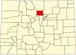
| Boulder County | 013 | Boulder | 1861-11-01 | Created as one of the 17 original counties of the Territory of Colorado. | Named for the abundance of granite boulders along Boulder Creek. | 326,831 | 740.48 sq mi (1,918 km2) |
|
| City and County of Broomfield | 014 | Broomfield | 2001-11-15 | Split from Boulder, Adams, Jefferson, and Weld counties and reorganized as a consolidated city and county. | Named for the broom corn that was formerly grown in the area. | 76,860 | 33.57 sq mi (87 km2) |

|
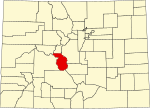
| Chaffee County | 015 | Salida | 1879-02-10 | Split from Carbonate County. | Named in honor of Jerome Bunty Chaffee, one of Colorado's first two U.S. Senators from 1876 to 1879. | 20,617 | 1,014.12 sq mi (2,627 km2) |
|
| Cheyenne County | 017 | Cheyenne Wells | 1889-03-25 | Split from Elbert and Bent counties. | Named for the Cheyenne Nation of Native Americans. | 1,727 | 1,781.90 sq mi (4,615 km2) |

|
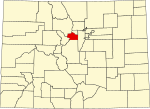
| Clear Creek County | 019 | Georgetown | 1861-11-01 | Created as one of the 17 original counties of the Territory of Colorado. | Named for Clear Creek which originates in the county. | 9,147 | 396.53 sq mi (1,027 km2) |
|
| Conejos County | 021 | Conejos | 1861-11-01 | Guadalupe County, one of the 17 original counties of the Territory of Colorado, was renamed Conejos County after six days on November 7, 1861. | Named for the cottontail rabbits in the area. Conejos is a Spanish word for rabbits. | 7,521 | 1,290.22 sq mi (3,342 km2) |

|
| Costilla County | 023 | San Luis | 1861-11-01 | Created as one of the 17 original counties of the Territory of Colorado. | Named for the Costilla River. Costilla is a Spanish word meaning either little rib or furring timber. | 3,628 | 1,229.38 sq mi (3,184 km2) |

|
| Crowley County | 025 | Ordway | 1911-05-29 | Split from Otero County. | Named in honor of Colorado State Senator John H. Crowley. | 5,636 | 800.27 sq mi (2,073 km2) |

|
| Custer County | 027 | Westcliffe | 1877-03-09 | Split from Fremont County. | Named in memory of George Armstrong Custer, (1839–1876), the U.S. Army colonel defeated and killed at the Battle of the Little Bighorn. | 5,534 | 739.24 sq mi (1,915 km2) |

|
| Delta County | 029 | Delta | 1883-02-11 | Split from Gunnison County. | Named for the town of Delta located at the delta of the Uncompahgre River. | 31,746 | 1,149.44 sq mi (2,977 km2) |

|
| City and County of Denver | 031 | Denver | 1902-12-01 | The original Arapahoe County Seat was split from Arapahoe and the newly-created Adams Counties, and reorganized as a consolidated city and county. | Named to curry favor with James W. Denver, Governor of the Territory of Kansas from 1857 to 1859. | 716,577 | 155.66 sq mi (403 km2) |

|
| Dolores County | 033 | Dove Creek | 1881-03-04 | Split from Ouray County. | Named for the Dolores River, which was originally named el Rio de Nuestra Senora de los Dolores, which is Spanish for the River of our Lady of Sorrows. | 2,513 | 1,076.93 sq mi (2,789 km2) |

|
| Douglas County | 035 | Castle Rock | 1861-11-01 | Created as one of the 17 original counties of the Territory of Colorado. | Named in honor of Stephen Arnold Douglas, (1813–1861), U.S. Senator from Illinois from 1847 to 1861. | 383,906 | 842.30 sq mi (2,182 km2) |

|
| Eagle County | 037 | Eagle | 1883-02-11 | Split from Summit County. | Named for the Eagle River which originates in the county. | 54,381 | 1,700.76 sq mi (4,405 km2) |

|
| El Paso County | 041 | Colorado Springs | 1861-11-01 | Created as one of the 17 original counties of the Territory of Colorado. | Named for Ute Pass, which connects the Great Plains to South Park and was formerly located within the county. El Paso means the pass in Spanish. | 744,215 | 2,128.60 sq mi (5,513 km2) |

|
| Elbert County | 039 | Kiowa | 1874-02-02 | Split from Douglas County. | Named in honor of Samuel Hitt Elbert, the sixth Governor of the Territory of Colorado. | 28,806 | 1,849.08 sq mi (4,789 km2) |

|
| Fremont County | 043 | Cañon City | 1861-11-01 | Created as one of the 17 original counties of the Territory of Colorado. | Named in honor of John Charles Frémont (1813–1890), the explorer, U.S. Army general, and U.S. Senator from California. | 50,318 | 1,533.09 sq mi (3,971 km2) |

|
| Garfield County | 045 | Glenwood Springs | 1883-02-10 | Split from Summit County. | Named in honor of James Abram Garfield (1831–1881), the twentieth President of the United States. | 62,707 | 2,958.23 sq mi (7,662 km2) |

|
| Gilpin County | 047 | Central City | 1861-11-01 | Created as one of the 17 original counties of the Territory of Colorado. | Named in honor of William Gilpin, the first Governor of the Territory of Colorado. | 5,926 | 150.15 sq mi (389 km2) |

|
| Grand County | 049 | Hot Sulphur Springs | 1874-02-02 | Split from Summit County. | Named for the Grand River which originates in the county. The Grand River was renamed the Colorado River in 1921, but the county retains the original name. | 15,935 | 1,868.53 sq mi (4,839 km2) |

|
| Gunnison County | 051 | Gunnison | 1877-03-09 | Split from Lake County. | Named in honor of John Williams Gunnison, the U.S. Army captain who explored the region. | 17,321 | 3,259.22 sq mi (8,441 km2) |

|
| Hinsdale County | 053 | Lake City | 1874-02-10 | Split from Lake, Conejos, and Costilla counties. | Named in honor of George Aaron Hinsdale, a Lieutenant Governor of the Territory of Colorado. | 765 | 1,123.35 sq mi (2,909 km2) |

|
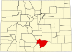
| Huerfano County | 055 | Walsenburg | 1861-11-01 | Created as one of the 17 original counties of the Territory of Colorado. | Named for Huerfano Butte, a solitary volcanic plug. Huérfano is a Spanish word meaning orphan. | 7,055 | 1,592.37 sq mi (4,124 km2) |
|
| Jackson County | 057 | Walden | 1909-05-05 | Split from Larimer County. | Named in honor of Andrew Jackson (1767–1845), the seventh President of the United States. | 1,309 | 1,619.75 sq mi (4,195 km2) |

|
| Jefferson County | 059 | Golden | 1861-11-01 | Created as one of the 17 original counties of the Territory of Colorado. | Named for its extralegal predecessor county, Jefferson County, Jefferson Territory, which in turn was named in honor of Thomas Jefferson (1743–1826), the author of the Declaration of Independence and the third President of the United States. | 576,366 | 772.85 sq mi (2,002 km2) |

|
| Kiowa County | 061 | Eads | 1889-04-11 | Split from Bent County. | Named for the Kiowa Nation of Native Americans. | 1,384 | 1,785.90 sq mi (4,625 km2) |

|
| Kit Carson County | 063 | Burlington | 1889-04-11 | Split from Elbert County. | Named in honor of Christopher Houston "Kit" Carson, the famous frontier scout and soldier. | 6,994 | 2,162.43 sq mi (5,601 km2) |

|
| La Plata County | 067
Zdroj:https://en.wikipedia.org?pojem=Colorado_counties Text je dostupný za podmienok Creative Commons Attribution/Share-Alike License 3.0 Unported; prípadne za ďalších podmienok. Podrobnejšie informácie nájdete na stránke Podmienky použitia.
Analytika
Antropológia Aplikované vedy Bibliometria Dejiny vedy Encyklopédie Filozofia vedy Forenzné vedy Humanitné vedy Knižničná veda Kryogenika Kryptológia Kulturológia Literárna veda Medzidisciplinárne oblasti Metódy kvantitatívnej analýzy Metavedy Metodika Text je dostupný za podmienok Creative
Commons Attribution/Share-Alike License 3.0 Unported; prípadne za ďalších
podmienok. www.astronomia.sk | www.biologia.sk | www.botanika.sk | www.dejiny.sk | www.economy.sk | www.elektrotechnika.sk | www.estetika.sk | www.farmakologia.sk | www.filozofia.sk | Fyzika | www.futurologia.sk | www.genetika.sk | www.chemia.sk | www.lingvistika.sk | www.politologia.sk | www.psychologia.sk | www.sexuologia.sk | www.sociologia.sk | www.veda.sk I www.zoologia.sk |

