
A | B | C | D | E | F | G | H | CH | I | J | K | L | M | N | O | P | Q | R | S | T | U | V | W | X | Y | Z | 0 | 1 | 2 | 3 | 4 | 5 | 6 | 7 | 8 | 9
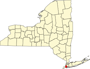
The following properties are listed on the National Register of Historic Places in Brooklyn.
This is intended to be a complete list of properties and districts listed on the National Register of Historic Places in the New York City borough of Brooklyn, which coincides with Kings County, New York. The locations of National Register properties and districts (at least for all showing latitude and longitude coordinates below) may be seen in a map by clicking on "Map of all coordinates".[1]
This National Park Service list is complete through NPS recent listings posted May 3, 2024.[2]
| Albany (Albany) – Allegany – Bronx – Broome – Cattaraugus – Cayuga – Chautauqua – Chemung – Chenango – Clinton – Columbia – Cortland – Delaware – Dutchess (Poughkeepsie, Rhinebeck) – Erie (Buffalo) – Essex – Franklin – Fulton – Genesee – Greene – Hamilton – Herkimer – Jefferson – Kings – Lewis – Livingston – Madison – Monroe (Rochester) – Montgomery – Nassau – New York (Below 14th Street, 14th to 59th Streets, 59th to 110th Streets, Above 110th Street, Islands) – Niagara (Niagara Falls) – Oneida – Onondaga (Syracuse) – Ontario – Orange – Orleans – Oswego – Otsego – Putnam – Queens – Rensselaer – Richmond – Rockland – St. Lawrence – Saratoga – Schenectady – Schoharie – Schuyler – Seneca – Steuben – Suffolk – Sullivan – Tioga – Tompkins – Ulster – Warren – Washington – Wayne – Westchester (Northern, Southern, New Rochelle, Peekskill, Yonkers) – Wyoming – Yates |
Current listings
| [3] | Name on the Register | Image | Date listed[4] | Location | Neighborhood | Description |
|---|---|---|---|---|---|---|
| 1 | 4th Avenue Station (IND) |  |
July 6, 2005 (#05000673) |
4th Ave. between 9th and 10th Sts. 40°40′13″N 73°59′24″W / 40.6703°N 73.99°W | Park Slope and Gowanus | Subway station (F and G trains); part of the New York City Subway System MPS |
| 2 | 9th Avenue Station (Dual System BRT) |  |
July 6, 2005 (#05000676) |
38th St. and 9th Ave. near the junction of New Utrecht Ave. 40°38′47″N 73°59′41″W / 40.6464°N 73.9947°W | Sunset Park | Subway station (D train); part of the New York City Subway System MPS |
| 3 | 15th Street – Prospect Park Subway Station (IND) |  |
July 27, 2005 (#05000748) |
15th St./Prospect Park W and SW 40°39′37″N 73°58′49″W / 40.6603°N 73.9803°W | Windsor Terrace and Park Slope | Subway station (F and G trains); part of the New York City Subway System MPS |
| 4 | 68th Police Precinct Station House and Stable |  |
June 3, 1982 (#82003359) |
4302 4th Ave. 40°39′01″N 74°00′34″W / 40.6503°N 74.0094°W | Sunset Park | |
| 5 | 75th Police Precinct Station House |  |
September 10, 2007 (#07000952) |
484 Liberty Ave. 40°40′29″N 73°53′33″W / 40.6747°N 73.8925°W | East New York | |
| 6 | 83rd Precinct Police Station and Stable |  |
April 14, 1982 (#82003360) |
179 Wilson Ave. 40°42′06″N 73°55′25″W / 40.7017°N 73.9236°W | Bushwick | |
| 7 | Albemarle-Kenmore Terraces Historic District |  |
June 30, 1983 (#83001685) |
Albemarle Terrace, Kenmore Terrace, and E. 21st St. 40°39′03″N 73°57′33″W / 40.6508°N 73.9592°W | Flatbush | |
| 8 | Alku and Alku Toinen |  |
May 20, 2019 (#100003932) |
816 and 826 43rd St. 40°38′40″N 73°59′56″W / 40.6445°N 73.999°W | Sunset Park | 1916 apartment buildings built for Finnish immigrant community are first purpose-built housing cooperatives in New York state. Photo shows Alku Toinen ("Beginning Two") |
| 9 | Andrews United Methodist Church |  |
January 22, 1992 (#91001977) |
95 Richmond St. 40°41′07″N 73°52′38″W / 40.6853°N 73.8772°W | East New York | |
| 10 | Astral Apartments |  |
October 29, 1982 (#82001178) |
184 Franklin St. 40°43′54″N 73°57′28″W / 40.7317°N 73.9578°W | Greenpoint | |
| 11 | Atlantic Avenue Control House |  |
May 6, 1980 (#80002643) |
Flatbush and Atlantic Aves. 40°41′04″N 73°58′42″W / 40.6844°N 73.9783°W | Downtown Brooklyn | part of the Interborough Rapid Transit Subway Control Houses TR |
| 12 | Atlantic Avenue Subway Station (IRT and BMT) |  |
September 17, 2004 (#04001023) |
Junction of Flatbush Ave. at Atlantic and 4th Aves. 40°41′05″N 73°58′42″W / 40.6847°N 73.9783°W | Downtown Brooklyn | Subway station (2, 3, 4, 5, B, D, N, Q, R and W trains); part of the New York City Subway System MPS |
| 13 | Atlantic Avenue Tunnel | 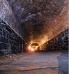 |
September 7, 1989 (#89001388) |
Below Atlantic Ave. between Boerum Pl. and Columbia St. 40°41′30″N 74°00′00″W / 40.6917°N 74.0°W | Cobble Hill | |
| 14 | Austin, Nichols and Company Warehouse |  |
June 28, 2007 (#07000629) |
184 Kent Ave. 40°43′07″N 73°57′54″W / 40.7186°N 73.965°W | Williamsburg | |
| 15 | Avenue U Station (Dual System BRT) |  |
July 6, 2005 (#05000675) |
Bet. Ave. U and Ave. T and 7th and 8th Sts. 40°35′50″N 73°58′46″W / 40.5972°N 73.9794°W | Gravesend | Subway station (N and W train); part of the New York City Subway System MPS |
| 16 | B&B Carousell |  |
February 23, 2016 (#16000035) |
1615 Boardwalk 40°34′23″N 73°59′00″W / 40.5731°N 73.9832°W | Coney Island | Coney Island's only remaining original carousel dates to 1906 |
| 17 | Baptist Temple (Brooklyn, New York) | 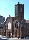 |
November 20, 1995 (#95001334) |
360 Schermerhorn St. 40°41′11″N 73°58′50″W / 40.6864°N 73.9806°W | Downtown Brooklyn | |
| 18 | Bay Parkway Station (Dual System BRT) |  |
July 6, 2005 (#05000670) |
Above Bay Parkway at 86th St. 40°36′06″N 73°59′40″W / 40.6017°N 73.9944°W | Bensonhurst and Bath Beach | Subway station (D train); part of the New York City Subway System MPS |
| 19 | Bay Ridge United Methodist Church | September 9, 1999 (#99001132) |
7002 Fourth St. 40°38′01″N 74°01′29″W / 40.6336°N 74.0247°W | Bay Ridge | Razed 21 October 2008[5] | |
| 20 | Bay Ridge Reformed Church |  |
August 17, 2020 (#100005438) |
7915 Ridge Blvd. 40°37′43″N 74°01′54″W / 40.6286°N 74.0318°W | Bay Ridge | |
| 21 | Beth El Jewish Center of Flatbush |  |
May 29, 2009 (#09000377) |
1981 Homecrest Ave. 40°36′04″N 73°57′35″W / 40.601008°N 73.959628°W | Flatbush | |
| 22 | Beth Olam Cemetery |  |
May 16, 2016 (#16000254) |
2 Cypress Hills St. 40°41′26″N 73°52′48″W / 40.69069°N 73.87990°W | Cypress Hills | Rural cemetery started in 1851 by three Jewish congregations in the city; contains many examples of architecture and funerary art. Shared with Queens. |
| 23 | Beverley Road Subway Station (BRT pre-Dual System) |  |
September 17, 2004 (#04001024) |
Beverley Rd. at Marlborough Rd. 40°38′39″N 73°57′53″W / 40.644167°N 73.964722°W | Flatbush | Subway station (Q train); part of the New York City Subway System MPS |
| 24 | Boathouse on the Lullwater of the Lake in Prospect Park |  |
January 7, 1972 (#72000850) |
Prospect Park 40°39′39″N 73°57′55″W / 40.660833°N 73.965278°W | Prospect Park (Brooklyn) | |
| 25 | Boerum Hill Historic District |  |
September 26, 1983 (#83001686) |
Roughly bounded by Pacific, Wyckoff, Bergen, Nevins, Bond and Hoyt Sts. 40°41′07″N 73°59′13″W / 40.685278°N 73.986944°W | Boerum Hill | |
| 26 | Borough Hall Subway Station (IRT) |  |
September 17, 2004 (#04001022) |
Junction of Joralemon, Court and Adams Sts. 40°41′32″N 73°59′27″W / 40.692222°N 73.990833°W | Downtown Brooklyn | Subway station (4 and 5 trains); part of the New York City Subway System MPS |
| 27 | Boy's High School |  |
February 25, 1982 (#82003361) |
832 Marcy Ave. 40°41′04″N 73°56′54″W / 40.684444°N 73.948333°W | Bedford-Stuyvesant | |
| 28 | Brooklyn Academy of Music |  |
May 2, 2006 (#06000251) |
30 Lafayette Ave. 40°41′11″N 73°58′41″W / 40.686389°N 73.978056°W | Fort Greene | |
| 29 | Brooklyn Borough Hall |  |
January 10, 1980 (#80002630) |
209 Joralemon St. 40°41′34″N 73°59′27″W / 40.692778°N 73.990833°W | Downtown Brooklyn | |
| 30 | Brooklyn Bridge |  |
October 15, 1966 (#66000523) |
Across the East River from Brooklyn to Manhattan 40°42′23″N 73°59′51″W / 40.706389°N 73.9975°W | DUMBO and Brooklyn Heights | |
| 31 | Brooklyn Heights Historic District |  |
October 15, 1966 (#66000524) |
Borough of Brooklyn, bounded by Atlantic Ave., Court and Fulton Sts. and the East River 40°41′48″N 73°59′48″W / 40.6967°N 73.9967°W | Brooklyn Heights | |
| 32 | Brooklyn Historical Society |  |
July 17, 1991 (#91002054) |
128 Pierrepont St. 40°41′41″N 73°59′34″W / 40.6947°N 73.9928°W | Brooklyn Heights | |
| 33 | Brooklyn Museum |  |
August 22, 1977 (#77000944) |
Eastern Parkway and Washington Ave. 40°40′14″N 73°57′51″W / 40.6706°N 73.9642°W | Prospect Heights | |
| 34 | Brooklyn Navy Yard Historic District |  |
May 22, 2014 (#14000261) |
Little, Evans, Navy & Williamsburg Sts., Hudson & Flushing Aves., Wallabout Bay 40°42′00″N 73°58′12″W / 40.7000°N 73.9700°W | Wallabout Basin | Shipyard where naval vessels were built and maintained from Revolution to World War II. |
| 35 | Brooklyn Public Library-Central Building |  |
January 11, 2002 (#01001446) |
Grand Army Plaza 40°40′20″N 73°58′07″W / 40.6722°N 73.9686°W | Grand Army Plaza | |
| 36 | Brooklyn Trust Company Building |  |
August 20, 2009 (#09000632) |
177 Montague St. 40°41′39″N 73°59′33″W / 40.6943°N 73.9924°W | Brooklyn Heights | |
| 37 | Brooklyn VA Hospital Historic District | May 23, 2022 (#100007725) |
800 Poly Pl. 40°36′32″N 74°01′25″W / 40.6090°N 74.0235°W | |||
| 38 | Boulevard Houses | May 26, 2022 (#100007744) |
804-920 Ashford St., 357-363 Wortman, 785-893 Schenck, and 738-765 Stanley Aves., 2156-2202 Linden Blvd. 40°39′38″N 73°52′53″W / 40.6606°N 73.8813°W | |||
| 39 | Building at 240 Broadway |  |
April 22, 2021 (#100006482) |
240 Broadway 40°42′32″N 73°57′36″W / 40.7090°N 73.9599°W | Williamsburg | |
| 40 | Buildings at 375–379 Flatbush Avenue and 185–187 Sterling Place |  |
September 7, 1984 (#84002440) |
375–379 Flatbush Ave. and 185–187 Sterling Pl. 40°40′36″N 73°58′19″W / 40.6767°N 73.9719°W | Prospect Heights | |
| 41 | Bushwick Avenue Central Methodist Episcopal Church |  |
March 27, 2017 (#100000812) |
1123 Bushwick Avenue 40°41′23″N 73°55′03″W / 40.6898°N 73.9176°W | Bushwick | Italian Renaissance Revival church built in first decade of 20th century, when Bushwick was growing rapidly. |
| 42 | Carroll Gardens Historic District |  |
September 26, 1983 (#83001687) |
Carroll and President Sts. between Smith and Hoyt Sts. 40°40′47″N 73°59′25″W / 40.6797°N 73.9903°W | Carroll Gardens | |
| 43 | Casemate Fort, Whiting Quadrangle |  |
August 7, 1974 (#74001249) |
Fort Hamilton, off NY 27 40°36′31″N 74°01′58″W / 40.6086°N 74.0328°W | Fort Hamilton | |
| 44 | Christ Evangelical English Lutheran Church | 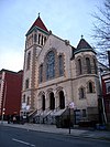 |
August 30, 2007 (#07000870) |
1084 Lafayette Ave. 40°41′32″N 73°55′45″W / 40.6922°N 73.9292°W | Bedford–Stuyvesant | |
| 45 | Church of the Holy Innocents |  |
June 16, 2005 (#05000617) |
279 E. 17th St. 40°38′39″N 73°57′46″W / 40.644167°N 73.962778°W | Flatbush | |
| 46 | Clinton Hill Historic District |  |
June 19, 1985 (#85001335) |
Roughly bounded by Willoughby and Grand Aves., Fulton St. and Vanderbilt Ave. 40°41′14″N 73°57′55″W / 40.687222°N 73.965278°W | Clinton Hill | |
| 47 | Clinton Hill South Historic District |  |
July 17, 1986 (#86001675) |
Roughly Lefferts and Brevoort Pl. between Washington Ave. and Bedford Pl. 40°40′50″N 73°57′32″W / 40.680556°N 73.958889°W | Clinton Hill | |
| 48 | Cobble Hill Historic District |  |
June 11, 1976 (#76001225) |
Roughly bounded by Atlantic Ave., Court, Degraw and Hicks Sts. 40°41′21″N 73°59′47″W / 40.689167°N 73.996389°W | Cobble Hill | |
| 49 | Coney Island Fire Station Pumping Station |  |
December 8, 1981 (#81000405) |
2301 Neptune Ave. 40°34′43″N 73°59′31″W / 40.578611°N 73.991944°W | Coney Island | |
| 50 | Coney Island Yard Electric Motor Repair Shop |  |
February 9, 2006 (#06000016) |
SW corner of Avenue X and Shell Rd. 40°35′23″N 73°58′31″W / 40.589722°N 73.975278°W | Coney Island | part of the New York City Subway System MPS |
| 51 | Coney Island Yard Gatehouse |  |
February 9, 2006 (#06000017) |
SW corner of Shell Rd. and Avenue X 40°35′22″N 73°58′30″W / 40.589444°N 73.975°W | Coney Island | part of the New York City Subway System MPS |
| 52 | Congregation Beth Israel | 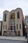 |
April 30, 2009 (#09000256) |
203 E. 37th St. 40°39′08″N 73°56′35″W / 40.652242°N 73.942922°W | East Flatbush | |
| 53 | Congregation Chevra Linath Hazedeck |  |
February 16, 2016 (#16000016) |
109 Clara St. 40°38′34″N 73°59′02″W / 40.6428°N 73.9839°W | Kensington | Synagogue completed in 1932 reflects era when Brooklyn was becoming one of the world's major Jewish population centers |
| 54 | Congregational Church of the Evangel |  |
December 11, 2009 (#09001081) |
1950 Bedford Ave. 40°39′27″N 73°57′24″W / 40.657428°N 73.956575°W | Flatbush | |
| 55 | Congregation Tifereth Israel |  |
January 11, 2002 (#01001442) |
1320 Eight Ave. 40°39′47″N 73°58′56″W / 40.663056°N 73.982222°W | South Slope | |
| 56 | William B. Cronyn House |  |
June 3, 1982 (#82005030) |
271 9th St. 40°40′11″N 73°59′16″W / 40.669722°N 73.987778°W | Park Slope | |
| 57 | Crown Heights North Historic District | 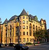 |
March 31, 2014Boundary increase: 2016-03-11 (#14000092) |
Albany, Brooklyn & St. Mark's Aves., Dean & Pacific Sts., Hampton, Lincoln, Park, Prospect, Revere & St. John's Pls. 40°40′36″N 73°56′43″W / 40.676742°N 73.9451687°W | Crown Heights | Neighborhood first developed in 1870 contains over 1,500 well-preserved buildings in distinct period styles up to 1930s. 2016 boundary increase added properties related to Shirley Chisholm, first African-American woman in Congress. |
| 58 | Cuyler Presbyterian Church |  |
March 23, 2001 (#01000253) |
358-360 Pacific St. 40°41′12″N 73°59′13″W / 40.686667°N 73.986944°W | Boerum Hill | |
| 59 | Cyclone Roller Coaster |  |
June 25, 1991 (#91000907) |
834 Surf Ave. at W. 10th St. 40°34′30″N 73°58′44″W / 40.575°N 73.978889°W | Coney Island | |
| 60 | Cypress Avenue West Historic District |  |
September 30, 1983 (#83001768) |
Roughly bounded by St. Nicholas and Seneca Aves., Linden and Stockholm Sts. 40°42′15″N 73°54′46″W / 40.704097°N 73.912906°W | Bushwick | part of the Ridgewood MRA |
| 61 | Cypress Hills National Cemetery |  |
November 13, 1997 (#97001439) |
625 Jamaica Ave. 40°41′14″N 73°52′55″W / 40.687197°N 73.882081°W | Cypress Hills | part of the Civil War Era National Cemeteries MPS |
| 62 | Ditmas Park Historic District |  |
September 30, 1983 (#83001688) |
Bounded by Marlborough Rd., Dorchester, Ocean, and Newkirk Aves. 40°38′19″N 73°57′40″W / 40.638611°N 73.961111°W | Ditmas Park | |
| 63 | DUMBO Industrial District |  |
September 22, 2000 (#00001151) |
Roughly bounded by Main and Washington Sts, East River, John St., Bridge and Jay Sts., and Front and York Sts. 40°42′11″N 73°59′17″W / 40.703056°N 73.988056°W | DUMBO | |
| 64
Zdroj:https://en.wikipedia.org?pojem=National_Register_of_Historic_Places_listings_in_Brooklyn Text je dostupný za podmienok Creative Commons Attribution/Share-Alike License 3.0 Unported; prípadne za ďalších podmienok. Podrobnejšie informácie nájdete na stránke Podmienky použitia.
Analytika
Antropológia Aplikované vedy Bibliometria Dejiny vedy Encyklopédie Filozofia vedy Forenzné vedy Humanitné vedy Knižničná veda Kryogenika Kryptológia Kulturológia Literárna veda Medzidisciplinárne oblasti Metódy kvantitatívnej analýzy Metavedy Metodika Text je dostupný za podmienok Creative
Commons Attribution/Share-Alike License 3.0 Unported; prípadne za ďalších
podmienok. www.astronomia.sk | www.biologia.sk | www.botanika.sk | www.dejiny.sk | www.economy.sk | www.elektrotechnika.sk | www.estetika.sk | www.farmakologia.sk | www.filozofia.sk | Fyzika | www.futurologia.sk | www.genetika.sk | www.chemia.sk | www.lingvistika.sk | www.politologia.sk | www.psychologia.sk | www.sexuologia.sk | www.sociologia.sk | www.veda.sk I www.zoologia.sk |
