

A | B | C | D | E | F | G | H | CH | I | J | K | L | M | N | O | P | Q | R | S | T | U | V | W | X | Y | Z | 0 | 1 | 2 | 3 | 4 | 5 | 6 | 7 | 8 | 9
This article includes a list of general references, but it lacks sufficient corresponding inline citations. (November 2009) |
| Example Symbols | ||
|---|---|---|
 |
||
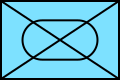
| An unidentified hostile motorized anti-tank division | ||
| 1 DPLeg |  |
Wyszków |
-_Infantry_(NATO_APP-6).svg)
| ||
| Polish 1st Legions Infantry Division of Operational Group Wyszków | ||
| 3 PPCLI |  |
1 CMBG |
-_Infantry_-_Light_Infantry_(NATO_APP-6A).svg)
| ||
| 3rd Battalion, Princess Patricia's Canadian Light Infantry of 1 Canadian Mechanized Brigade Group | ||
| 4 Pz |  |
XXIV |
-_Armour_(NATO_APP-6).svg)
| ||
| 4th Panzer Division of XXIV Army Corps | ||
 |
82 Abn | |
-_Artillery_-_Airborne_(NATO_APP-6).svg)
| ||
| 82nd Airborne Division Artillery Brigade | ||
NATO Joint Military Symbology is the NATO standard for military map symbols. Originally published in 1986 as Allied Procedural Publication 6 (APP-6), NATO Military Symbols for Land Based Systems, the standard has evolved over the years and is currently in its fifth version (APP-6D). The symbols are designed to enhance NATO's joint interoperability by providing a standard set of common symbols. APP-6 constituted a single system of joint military symbology for land, air, space and sea-based formations and units, which can be displayed for either automated map display systems or for manual map marking. It covers all of the joint services and can be used by them.
History
The first basic military map symbols began to be used by western armies in the decades following the end of the Napoleonic Wars. During World War I, there was a degree of harmonisation between the British and French systems, including the adoption of the colour red for enemy forces and blue for allies; the British had previously used red for friendly troops because of the traditional red coats of British soldiers. However, the system now in use is broadly based on that devised by the US Army Corps of Engineers in 1917. The infantry symbol of a saltire in a rectangle was said to symbolise the crossed belts of an infantryman, while the single diagonal line for cavalry was said to represent the sabre belt. With the formation of NATO in 1949, the US Army system was standardized and adapted, with different shapes for friendly (blue rectangle), hostile (red diamond) and unknown (yellow quatrefoil) forces.[1]
APP-6A was promulgated in December 1999. The NATO standardization agreement that covers APP-6A is STANAG 2019 (edition 4), promulgated in December 2000. APP-6A replaced APP-6 (last version, July 1986), which had been promulgated in November 1984 (edition 3 of STANAG 2019 covered APP-6), and was replaced in turn by Joint Symbology APP-6(B) (APP-6B) in 2008 (STANAG 2019 edition 5, June 2008) and NATO Joint Military Symbology APP-6(C) (APP-6C) in 2011 (STANAG 2019 edition 6, May 2011).
The U.S. is the current custodian of APP-6A, which is equivalent to MIL-STD-2525A.
Symbol sets
The APP-6A standard provides common operational symbology along with details on their display and plotting to ensure the compatibility, and to the greatest extent possible, the interoperability of NATO land component command, control, communications, computer, and intelligence (C4I) systems, development, operations, and training. APP-6A addresses the efficient transmission of symbology information through the use of a standard methodology for symbol hierarchy, information taxonomy, and symbol identifiers.
APP-6A recognises five broad sets of symbols, each set using its own SIDC (Symbol identification coding) scheme:
- Units, equipment, and installations
- Military operations (tactical graphics)
- METOC (meteorological and oceanographic)
- Signals intelligence
- MOOTW (military operations other than war)
Units, equipment, and installations consist of icons, generally framed, associated with a single point on the map. All sorts of graphical and textual modifiers may surround them, specifying categories, quantities, dates, direction of movement, etc.
Tactical graphics represent operational information that cannot be presented via icon-based symbols alone: unit boundaries, special area designations, and other unique markings related to battlespace geometry and necessary for battlefield planning and management. There are point, line and area symbols in this category.
Meteorological and oceanographic symbology is the only set not under the standard's control: rather, they are imported from the symbology established by the World Meteorological Organization.
The signals intelligence and military operations other than war symbology sets stand apart from Units, Equipment, and Installations although they obey the same conventions (i.e., they consist of framed symbols associated to points on the map). They do not appear in APP-6A proper, having been introduced by MIL-STD-2525B.
Symbol composition
Most of the symbols designate specific points, and consist of a frame (a geometric border), a fill, a constituent icon, and optional symbol modifiers. The latter are optional text fields or graphic indicators that provide additional information.
The frame provides a visual indication of the affiliation, battle dimension, and status of an operational object. The use of shape and colour is redundant, allowing the symbology to be used under less-than-ideal conditions such as a monochrome red display to preserve the operator's night vision. Nearly all symbols are highly stylised and can be drawn by persons almost entirely lacking in artistic skill; this allows one to draw a symbolic representation (a GRAPHREP, Graphical report) using tools as rudimentary as plain paper and pencil.
The frame serves as the base to which other symbol components and modifiers are added. In most cases a frame surrounds an icon. One major exception is equipment, which may be represented by icons alone (in which case the icons are coloured as the frame would be).
The fill is the area within a symbol. If the fill is assigned a colour, it provides an enhanced (redundant) presentation of information about the affiliation of the object. If colour is not used, the fill is transparent. A very few icons have fills of their own, which are not affected by affiliation.
The icons themselves, finally, can be understood as combinations of elementary glyphs that use simple composition rules, in a manner reminiscent of some ideographic writing systems such as Chinese. The standard, however, still attempts to provide an "exhaustive" listing of possible icons instead of laying out a dictionary of component glyphs. This causes operational problems when the need for an unforeseen symbol arises (particularly in MOOTW), a problem exacerbated by the administratively centralised maintenance of the symbology sets.
When rendering symbols with the fill on, APP-6A calls for the frame and icon to be black or white (as appropriate for the display). When rendering symbols with the fill off, APP-6A calls for a monochrome frame and icon (usually black or in accordance with the affiliation colour). NATO symbols can also be rendered with fill off using a frame coloured according to affiliation and a black icon,[2] though this is not defined in any APP-6 standard.
-
 Friendly mechanized infantry with fill on
 -
 Friendly mechanized infantry with fill off and monochrome colour frame and icon
 -
 Friendly mechanized infantry with fill off and monochrome frame and icon
 -
 Friendly mechanized infantry with fill off and bichrome frame and icon
-_Infantry_-_Mechanized_(NATO_APP-6).svg)
-_Infantry_-_Mechanized_(NATO_APP-6).svg)
-_Infantry_-_Mechanized_(NATO_APP-6).svg)
-_Infantry_-_Mechanized_(NATO_APP-6).svg)
Allegiance and affiliation
APP-6 colour representation
The concept of affiliation does not appear in the original APP-6 as these were not introduced until APP-6A. Instead, the original APP-6 described a series of "colour representations" with the purpose of distinguishing friendly and enemy elements.
- Multi-colour representation:
- Blue or black for friendly icons
- Red for enemy icons
- Green for man-made obstacles (friendly or enemy)
- Yellow for chemical, biological, radiological or nuclear events
- Other colours to be established in a map legend
- Tri-colour representation:
- Blue or black for friendly icons
- Red for enemy icons
- Green or yellow for man-made obstacles (friendly or enemy) and for chemical, biological, radiological or nuclear events
- Two colour representation:
- Blue, green, or black for friendly icons
- Red for enemy icons
- One colour representation:
- Single line border for friendly icons
- Double line border for enemy icons, and unbordered icons were labeled with "EN" to the lower right corner
-
 APP-6 friendly unit (colour)
 -
 APP-6 enemy unit (colour)
 -
 APP-6 friendly unit (B&W)
 -
 APP-6 enemy unit (B&W)
-_Unspecified_or_Composite_All-Arms_(NATO_APP-6).svg)
-_Unspecified_or_Composite_All-Arms_(NATO_APP-6).svg)
-_Unspecified_or_Composite_All-Arms_(NATO_APP-6).svg)
-_Unspecified_or_Composite_All-Arms_(NATO_APP-6).svg)
APP-6A affiliation
Affiliation refers to the relationship of the tracker to the operational object being represented. The basic affiliation categories are unknown, friend, neutral, and hostile. In the ground unit domain, a yellow quatrefoil frame is used to denote unknown affiliation, a blue rectangle frame to denote friendly affiliation, a green square frame to denote neutral affiliation, and a red diamond frame to denote hostile affiliation.[3]: 11 In the other domains (air and space, sea surface and subsurface, etc.), the same color scheme is used.
| Style | Friendly | Hostile | Neutral | Unknown |
|---|---|---|---|---|
| Fill on | -_Unspecified_or_Composite_All-Arms_(NATO_APP-6).svg)
|
-_Unspecified_or_Composite_All-Arms_(NATO_APP-6A).svg)
|
-_Unspecified_or_Composite_All-Arms_(NATO_APP-6A).svg)
|
-_Unspecified_or_Composite_All-Arms_(NATO_APP-6A).svg)
|
| Monochrome (for digital media) | -_Unspecified_or_Composite_All-Arms_(NATO_APP-6).svg)
|
-_Unspecified_or_Composite_All-Arms_(NATO_APP-6A).svg)
|
-_Unspecified_or_Composite_All-Arms_(NATO_APP-6A).svg)
|
-_Unspecified_or_Composite_All-Arms_(NATO_APP-6A).svg)
|
| Monochrome (for print media) | -_Unspecified_or_Composite_All-Arms_(NATO_APP-6).svg)
|
-_Unspecified_or_Composite_All-Arms_(NATO_APP-6A).svg)
|
-_Unspecified_or_Composite_All-Arms_(NATO_APP-6A).svg)
|
-_Unspecified_or_Composite_All-Arms_(NATO_APP-6A).svg)
|
The full set of affiliations is:
- Pending (P)
- Unknown (U)
- Assumed friend (A)
- Friend (F)
- Neutral (N)
- Suspect (S) (assumed hostile)
- Hostile (H)
- Exercise pending (G)
- Exercise unknown (W)
- Exercise assumed friend (M)
- Exercise friend (D)
- Exercise neutral (L)
- Exercise suspect (J)
- Exercise hostile (K) There are no "assumed neutral" and "exercise assumed neutral" affiliations.
These colors are used in phrases such as "blue on blue" for friendly fire, blue force tracking, red teaming, and Red Cells.
Battle dimension
Battle dimension defines the primary mission area for the operational object within the battlespace. An object can have a mission area above the Earth's surface (i.e., in the air or outer space), on it, or below it. If the mission area of an object is on the surface, it can be either on land or sea. The subsurface dimension concerns those objects whose mission area is below the sea surface (e.g., submarines and sea mines). Some cases require adjudication; for example, an Army or Marine helicopter unit is a maneuvering unit (i.e., a unit whose ground support assets are included) and is thus represented in the land dimension. Likewise, a landing craft whose primary mission is ferrying personnel or equipment to and from shore is a maritime unit and is represented in the sea surface dimension. A landing craft whose primary mission is to fight on land, on the other hand, is a ground asset and is represented in the land dimension.
Closed frames are used to denote the land and sea surface dimensions, frames open at the bottom denote the air/space dimension, and frames open at the top denote the subsurface dimension.
| Dimension | Friendly | Hostile | Neutral | Unknown |
|---|---|---|---|---|
| Air and space | 
|

|

|

|
| Ground | 
|

|

| |
| Sea surface | 
|
|
|
|
| Subsurface | 
|

|

|

|
An unknown battle dimension is possible; for example, some electronic warfare signatures (e.g., radar systems) are common to several battle dimensions and would therefore be assigned an "Unknown" battle dimension until further discrimination becomes possible. Special forces may operate in any dimension.
The full set of battle dimensions is, in ascending order of distance from Earth center:
- SOF (F)
- Sea subsurface (U)
- Sea surface (S)
- Ground (G)
- Air (A)
- Space (P)
- Other (X)
- Unknown (Z)
The mnemonic for this ordering is "Fuss-Gap".
The letter in parentheses is used by the symbol identification coding (SIDC) scheme – strings of 15 characters used to transmit symbols.
The space and air battle dimensions share a single frame shape. In the ground battle dimension, two different frames are used for the friendly (and assumed friendly) affiliations in order to distinguish between units and equipment. The SOF (special operations forces) are assigned their own battle dimension because they typically can operate across several domains (air, ground, sea surface and subsurface) in the course of a single mission; the frames are the same as for the ground (unit) battle dimension.[4]: 47–48 The other battle dimension, finally, seems to be reserved for future use (there are no instances of its use as of 2525B Change 1).
Status
The status of a symbol refers to whether a warfighting object exists at the location identified (i.e., status is "present") or will in the future reside at that location (i.e., status is "planned, anticipated, suspected," or "on order"). Regardless of affiliation, present status is indicated by a solid line and planned status by a dashed line. The frame is solid or dashed, unless the symbol icon is unframed, in which case the icon itself is drawn dashed. Planned status cannot be shown if the symbol is an unframed filled icon.
Icon placement
The icon is the innermost part of a symbol which, when displayed, provides an abstract pictorial or alphanumeric representation of an operational object. The icon portrays the role or mission performed by the object. APP-6A distinguishes between icons that must be framed or unframed and icons where framing is optional.[3]: 39–43 APP-6A defined a standard octagon boundary within each map symbol frame. This octagon is not actually shown when symbols are drawn or rendered but, with a few defined exceptions, all icons inside the frame would also fit inside these octagons. APP-6C modified some symbol frames from previous editions of the standard. From top to bottom, here is the symbol boundary shown inside the APP-6C frames of space elements, air elements, land units, land equipment and surface sea elements, and sub-surface sea elements.
.svg)
Unit symbols
Unit icon modifiers
Unit symbols can be used independently as well as in combinations. There are also some symbols that cannot appear by themselves, but can only be used to modify other unit symbols:
| Modifier meaning | Friendly | Hostile | Neutral | Unknown | Notes |
|---|---|---|---|---|---|
| Airborne | -_Modifier_-_Airborne_(NATO_APP-6).svg)
|
-_Modifier_-_Airborne_(NATO_APP-6).svg)
|
-_Modifier_-_Airborne_(NATO_APP-6).svg)
|
-_Modifier_-_Airborne_(NATO_APP-6).svg)
|
In APP-6 was including air assault and paratrooper forces; since APP-6A is specifically parachute forces |
| Parachute | -_Parachute_(NATO_APP-6).svg)
|
-_Parachute_(NATO_APP-6).svg)
|
-_Parachute_(NATO_APP-6).svg)
|
-_Parachute_(NATO_APP-6).svg)
|
Symbol used in APP-6, not used in APP-6A and later editions |
| Airmobile | -_Modifier_-_Airmobile_(NATO_APP-6A).svg)
|
-_Modifier_-_Airmobile_(NATO_APP-6A).svg)
|
-_Modifier_-_Airmobile_(NATO_APP-6A).svg)
|
-_Modifier_-_Airmobile_(NATO_APP-6A).svg)
|
|
| Airmobile with organic lift | -_Modifier_-_Air_Assault_(NATO_APP-6A).svg)
|
-_Modifier_-_Air_Assault_(NATO_APP-6A).svg)
|
-_Modifier_-_Air_Assault_(NATO_APP-6A).svg)
|
-_Modifier_-_Air_Assault_(NATO_APP-6A).svg)
|
|
| Amphibious | -_Modifier_-_Amphibious_(NATO_APP-6A).svg)
|
-_Modifier_-_Amphibious_(NATO_APP-6A).svg)
|
-_Modifier_-_Amphibious_(NATO_APP-6A).svg)
|
-_Modifier_-_Amphibious_(NATO_APP-6A).svg)
|
|
| Motorized | -_Modifier_-_Motorized_(NATO_APP-6A).svg)
|
-_Modifier_-_Motorized_(NATO_APP-6A).svg)
|
-_Modifier_-_Motorized_(NATO_APP-6A).svg)
|
-_Modifier_-_Motorized_(NATO_APP-6A).svg)
|
|
| Mountain | -_Modifier_-_Mountain_(APP-6).svg)
|
-_Modifier_-_Mountain_(APP-6).svg)
|
-_Modifier_-_Mountain_(APP-6).svg)
|
-_Modifier_-_Mountain_(APP-6).svg)
|
|
| Cannon or gun system equipped | -_Modifier_-_Gun_System_Equiped_(NATO_APP-6A).svg)
|
-_Modifier_-_Gun_System_Equiped_(NATO_APP-6A).svg)
|
-_Modifier_-_Gun_System_Equiped_(NATO_APP-6A).svg)
|
-_Modifier_-_Gun_System_Equiped_(NATO_APP-6A).svg)
|
|
| Wheeled and cross-country capable | -_Modifier_-_Wheeled_CrossCountry_(NATO_APP-6).svg)
|
-_Modifier_-_Wheeled_CrossCountry_(NATO_APP-6).svg)
|
-_Modifier_-_Wheeled_CrossCountry_(NATO_APP-6).svg)
|
-_Modifier_-_Wheeled_CrossCountry_(NATO_APP-6).svg)
|
Unit basic icons
Land unit icons require a frame.
| Unit type[5] | Friendly | Hostile | Neutral | Unknown | Notes |
|---|---|---|---|---|---|
| Air defence | -_Air_Defence_(NATO_APP-6A).svg)
|
-_Air_Defence_(NATO_APP-6C).svg)
|
-_Air_Defence_(NATO_APP-6A).svg)
|
-_Air_Defence_(NATO_APP-6B).svg)
|
Evocative of a protective dome |
| Ammunition | -_CSS_-_Ammunition_(NATO_APP-6).svg)
|
-_CSS_-_Ammunition_(NATO_APP-6).svg)
|
-_CSS_-_Ammunition_(NATO_APP-6).svg)
|
-_CSS_-_Ammunition_(NATO_APP-6).svg)
|
Stylised breech-loaded, rimmed cartridge or shell |
| Anti-tank | -_Anti-Tank_(NATO_APP-6).svg)
|
-_Anti-Tank_(NATO_APP-6).svg)
|
-_Anti-Tank_(NATO_APP-6).svg)
|
-_Anti-Tank_(NATO_APP-6).svg)
|
Representing a concentrated, piercing action |
| Armour | -_Armour_(NATO_APP-6).svg)
|
-_Armour_(NATO_APP-6).svg)
|
-_Armour_(NATO_APP-6).svg)
|
-_Armour_(NATO_APP-6).svg)
|
Stylized tank treads |
| Artillery | -_Artillery_(NATO_APP-6).svg)
|
-_Artillery_(NATO_APP-6).svg)
|
-_Artillery_(NATO_APP-6).svg)
|
-_Artillery_(NATO_APP-6).svg)
|
A cannonball |
| Rotary-wing aviation | -_Aviation_(NATO_APP-6).svg)
|
-_Aviation_(NATO_APP-6).svg)
|
-_Aviation_(NATO_APP-6).svg)
|
-_Aviation_(NATO_APP-6).svg)
|
Blurred, spinning helicopter blades |
| Fixed wing aviation | -_Aviation_-_Fixed_Wing_(NATO_APP-6A).svg)
|
-_Aviation_-_Fixed_Wing_(NATO_APP-6A).svg)
|
-_Aviation_-_Fixed_Wing_(NATO_APP-6A).svg)
|
-_Aviation_-_Fixed_Wing_(NATO_APP-6A).svg)
|
Air screw |
| Bridging | -_Military_Engineers_-_Bridging_(NATP_APP-6).svg)
|
-_Military_Engineers_-_Bridging_(NATP_APP-6).svg)
|
-_Military_Engineers_-_Bridging_(NATP_APP-6).svg)
|
-_Military_Engineers_-_Bridging_(NATP_APP-6).svg)
|
Topographical map symbol for a bridge |
| Combat service support | -_CSS_-_Combat_Service_Support_(NATO_APP-6A).svg)
|
-_CSS_-_Combat_Service_Support_(NATO_APP-6A).svg)
|
-_CSS_-_Combat_Service_Support_(NATO_APP-6A).svg)
|
-_CSS_-_Combat_Service_Support_(NATO_APP-6A).svg)
|
|
| Combined manoeuvre arms | -_Combined_Manoeuvre_Arms_(NATO_APP-6C).svg)
|
-_Combined_Manoeuvre_Arms_(NATO_APP-6C).svg)
|
-_Combined_Manoeuvre_Arms_(NATO_APP-6C).svg)
|
-_Combined_Manoeuvre_Arms_(NATO_APP-6C).svg)
|
Introduced in APP-6C for an organization of infantry and armour; it is a hybrid of the two symbols |
| Engineer | -_Military_Engineers_(NATO_APP-6).svg)
|
-_Military_Engineers_(NATO_APP-6).svg)
|
-_Military_Engineers_(NATO_APP-6).svg)
|
-_Military_Engineers_(NATO_APP-6).svg)
|
Letter E on its side. Possibly: Stylised bridge |
| Electronic ranging | -_Signals_-_Electronic_Ranging_(NATO_APP-6).svg)
|
-_Signals_-_Electronic_Ranging_(NATO_APP-6B).svg)
|
-_Signals_-_Electronic_Ranging_(NATO_APP-6B).svg)
|
-_Signals_-_Electronic_Ranging_(NATO_APP-6B).svg)
|
Simplified parabolic antenna |
| Electronic warfare | -_Electronic_Warfare_(NATO_APP-6).svg)
|
-_Electronic_Warfare_(NATO_APP-6).svg)
|
-_Electronic_Warfare_(NATO_APP-6).svg)
|
-_Electronic_Warfare_(NATO_APP-6).svg)
|