

A | B | C | D | E | F | G | H | CH | I | J | K | L | M | N | O | P | Q | R | S | T | U | V | W | X | Y | Z | 0 | 1 | 2 | 3 | 4 | 5 | 6 | 7 | 8 | 9
There are at least 26 named mountains in McCone County, Montana.
- Andrews Hill, 47°48′06″N 106°11′12″W / 47.80167°N 106.18667°W, el. 2,598 feet (792 m)[1]
- Bald Butte, 47°51′45″N 106°06′05″W / 47.86250°N 106.10139°W, el. 2,628 feet (801 m)[2]
- Big Butte, 47°51′16″N 106°03′30″W / 47.85444°N 106.05833°W, el. 2,556 feet (779 m)[3]
- Big Heaven, 47°33′12″N 105°58′05″W / 47.55333°N 105.96806°W, el. 2,582 feet (787 m)[4]
- Bonhoff Butte, 47°39′35″N 106°03′37″W / 47.65972°N 106.06028°W, el. 2,812 feet (857 m)[5]
- Caprock Butte, 47°57′18″N 106°13′02″W / 47.95500°N 106.21722°W, el. 2,628 feet (801 m)[6]
- Chalk Butte, 47°06′02″N 105°57′22″W / 47.10056°N 105.95611°W, el. 2,982 feet (909 m)[7]
- Coal Hill, 47°56′52″N 106°14′49″W / 47.94778°N 106.24694°W, el. 2,769 feet (844 m)[8]
- Cobb Hill, 47°27′14″N 106°07′39″W / 47.45389°N 106.12750°W, el. 2,749 feet (838 m)[9]
- Corner Butte, 47°49′04″N 106°04′08″W / 47.81778°N 106.06889°W, el. 2,464 feet (751 m)[10]
- Deadman Butte, 48°01′42″N 106°18′07″W / 48.02833°N 106.30194°W, el. 2,628 feet (801 m)[11]
- Devils Table Rock, 47°32′36″N 106°03′23″W / 47.54333°N 106.05639°W, el. 2,749 feet (838 m)[12]
- Goat Mountain, 47°50′39″N 106°11′41″W / 47.84417°N 106.19472°W, el. 2,657 feet (810 m)[13]
- Indian Hill, 47°59′11″N 106°18′12″W / 47.98639°N 106.30333°W, el. 2,726 feet (831 m)[14]
- Little Heaven, 47°32′39″N 105°54′47″W / 47.54417°N 105.91306°W, el. 2,779 feet (847 m)[15]
- Lower Summit, 47°13′30″N 105°31′23″W / 47.22500°N 105.52306°W, el. 2,920 feet (890 m)[16]
- Lucky Hill, 47°53′47″N 106°16′17″W / 47.89639°N 106.27139°W, el. 2,648 feet (807 m)[17]
- Lytle Hill, 47°51′26″N 106°02′59″W / 47.85722°N 106.04972°W, el. 2,520 feet (770 m)[18]
- Maxwell Hill, 47°57′06″N 106°04′10″W / 47.95167°N 106.06944°W, el. 2,431 feet (741 m)[19]
- McDonald Butte, 47°30′01″N 106°03′02″W / 47.50028°N 106.05056°W, el. 2,779 feet (847 m)[20]
- Rocky Butte, 47°49′04″N 106°04′23″W / 47.81778°N 106.07306°W, el. 2,510 feet (770 m)[21]
- Stony Butte Hill, 47°19′46″N 105°45′44″W / 47.32944°N 105.76222°W, el. 2,743 feet (836 m)[22]
- Teton Butte, 47°51′05″N 106°05′17″W / 47.85139°N 106.08806°W, el. 2,490 feet (760 m)[23]
- Vanderhoof Hill, 47°48′33″N 106°02′58″W / 47.80917°N 106.04944°W, el. 2,480 feet (760 m)[24]
- Westland Hill, 47°51′32″N 106°10′56″W / 47.85889°N 106.18222°W, el. 2,651 feet (808 m)[25]
- Willis Buttes, 47°50′12″N 106°05′08″W / 47.83667°N 106.08556°W, el. 2,589 feet (789 m)[26]
See also
Notes
- ^ "Andrews Hill". Geographic Names Information System. United States Geological Survey, United States Department of the Interior.
- ^ "Bald Butte". Geographic Names Information System. United States Geological Survey, United States Department of the Interior.
- ^ "Big Butte". Geographic Names Information System. United States Geological Survey, United States Department of the Interior.
- ^ "Big Heaven". Geographic Names Information System. United States Geological Survey, United States Department of the Interior.
- ^ "Bonhoff Butte". Geographic Names Information System. United States Geological Survey, United States Department of the Interior.
- ^ "Caprock Butte". Geographic Names Information System. United States Geological Survey, United States Department of the Interior.
- ^ "Chalk Butte". Geographic Names Information System. United States Geological Survey, United States Department of the Interior.
- ^ "Coal Hill". Geographic Names Information System. United States Geological Survey, United States Department of the Interior.
- ^ "Cobb Hill". Geographic Names Information System. United States Geological Survey, United States Department of the Interior.
- ^ "Corner Butte". Geographic Names Information System. United States Geological Survey, United States Department of the Interior.
- ^ "Deadman Butte". Geographic Names Information System. United States Geological Survey, United States Department of the Interior.
- ^ "Devils Table Rock". Geographic Names Information System. United States Geological Survey, United States Department of the Interior.
- ^ "Goat Mountain". Geographic Names Information System. United States Geological Survey, United States Department of the Interior.
- ^ "Indian Hill". Geographic Names Information System. United States Geological Survey, United States Department of the Interior.
- ^ "Little Heaven". Geographic Names Information System. United States Geological Survey, United States Department of the Interior.
- ^ "Lower Summit". Geographic Names Information System. United States Geological Survey, United States Department of the Interior.
- ^ "Lucky Hill". Geographic Names Information System. United States Geological Survey, United States Department of the Interior.
- ^ "Lytle Hill". Geographic Names Information System. United States Geological Survey, United States Department of the Interior.
- ^ "Maxwell Hill". Geographic Names Information System. United States Geological Survey, United States Department of the Interior.
- ^ "McDonald Butte". Geographic Names Information System. United States Geological Survey, United States Department of the Interior.
- ^ "Rocky Butte". Geographic Names Information System. United States Geological Survey, United States Department of the Interior.
- ^ "Stony Butte Hill". Geographic Names Information System. United States Geological Survey, United States Department of the Interior.
- ^ "Teton Butte". Geographic Names Information System. United States Geological Survey, United States Department of the Interior.
- ^ "Vanderhoof Hill". Geographic Names Information System. United States Geological Survey, United States Department of the Interior.
- ^ "Westland Hill". Geographic Names Information System. United States Geological Survey, United States Department of the Interior.
- ^ "Willis Buttes". Geographic Names Information System. United States Geological Survey, United States Department of the Interior.
Municipalities and communities of McCone County, Montana, United States | ||
|---|---|---|
| Town | 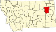 | |
| CDPs | ||
| Indian reservation | ||
| Footnotes | ‡This populated place also has portions in an adjacent county or counties | |
Text je dostupný za podmienok Creative Commons Attribution/Share-Alike License 3.0 Unported; prípadne za ďalších podmienok. Podrobnejšie informácie nájdete na stránke Podmienky použitia.
Antropológia
Aplikované vedy
Bibliometria
Dejiny vedy
Encyklopédie
Filozofia vedy
Forenzné vedy
Humanitné vedy
Knižničná veda
Kryogenika
Kryptológia
Kulturológia
Literárna veda
Medzidisciplinárne oblasti
Metódy kvantitatívnej analýzy
Metavedy
Metodika
Text je dostupný za podmienok Creative
Commons Attribution/Share-Alike License 3.0 Unported; prípadne za ďalších
podmienok.
Podrobnejšie informácie nájdete na stránke Podmienky
použitia.
www.astronomia.sk | www.biologia.sk | www.botanika.sk | www.dejiny.sk | www.economy.sk | www.elektrotechnika.sk | www.estetika.sk | www.farmakologia.sk | www.filozofia.sk | Fyzika | www.futurologia.sk | www.genetika.sk | www.chemia.sk | www.lingvistika.sk | www.politologia.sk | www.psychologia.sk | www.sexuologia.sk | www.sociologia.sk | www.veda.sk I www.zoologia.sk