A | B | C | D | E | F | G | H | CH | I | J | K | L | M | N | O | P | Q | R | S | T | U | V | W | X | Y | Z | 0 | 1 | 2 | 3 | 4 | 5 | 6 | 7 | 8 | 9
Hoke County | |
|---|---|
 Hoke County Courthouse in Raeford | |
| Motto: "Where Quality Living Meets Quality of Life" | |
 Location within the U.S. state of North Carolina | |
 North Carolina's location within the U.S. | |
| Coordinates: 35°01′01″N 79°14′24″W / 35.017°N 79.24°W | |
| Country | |
| State | |
| Founded | April 1, 1911 |
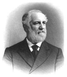
| Named for | Robert F. Hoke |
| Seat | Raeford |
| Largest community | Raeford |
| Area | |
| • Total | 391.68 sq mi (1,014.4 km2) |
| • Land | 390.15 sq mi (1,010.5 km2) |
| • Water | 1.53 sq mi (4.0 km2) 0.39% |
| Population (2020) | |
| • Total | 52,082 |
| • Estimate (2023) | 54,446 |
| • Density | 133.49/sq mi (51.54/km2) |
| Time zone | UTC−5 (Eastern) |
| • Summer (DST) | UTC−4 (EDT) |
| Congressional district | 9th |
| Website | www |
Hoke County is a county in the U.S. state of North Carolina. As of the 2020 census, its population was 52,082.[1] Its county seat is Raeford.[2]
The county is home to part of the Fort Liberty military reservation.
History
Early history
The original inhabitants of the region eventually constituting Hoke County were Tuscarora Native Americans.[3] Ancestors of the Lumbee Native Americans lived in the area in the early 1700s.[4] European settlers began establishing church congregations in the area in the mid-to-late 1700s.[3] The area was later placed under the jurisdiction of Cumberland and Robeson counties in the U.S. state of North Carolina.[5] The community of Raeford was formed in the 1890s and incorporated in 1901. In 1899, the Aberdeen and Rockfish Railroad became the first rail line laid through the area.[3]
Creation

In the early 1900s, some residents in the far reaches of Cumberland and Robeson began lobbying for the creation of a new county, complaining of long and dangerous travel to their county courthouses.[6] In 1907 and 1909 there were unsuccessful efforts to lobby the state government led by State Senator J. W. McLauchlin to create a new "Glenn County" out of portions of Cumberland and Robeson.[6][7] In 1911 a third attempt was made and conjoined with an effort to name a county in honor of Robert F. Hoke, a Confederate general in the American Civil War and railroad executive.[5]
On February 14, 1911, the North Carolina General Assembly voted to create the new Hoke County[8] effective April 1 of that year, with its first government to be appointed by the governor of North Carolina pending the holding of an election.[9] Raeford was designated the county seat,[5] and local officials served out of rented office space until a county courthouse was erected the following year.[10] At the time of its creation, Hoke County comprised about 268,000 acres of land. It had no paved roads and its economy was rooted in agriculture. Its approximately 10,000 residents were mostly white descendants of Scottish Highlanders and African Americans.[7]
Development
About 400 Hoke County residents served in the U.S. Army during World War I.[11] Between 1918 and 1923, the American federal government acquired 92,000 acres of land in the county as part of its efforts to expand Camp Bragg into Fort Bragg (now Fort Liberty).[12] leaving about 150,000 acres leftover.[7] Over 160 Hoke residents served in the armed forces during World War II.[13] After the war, the county's Lumbee population increased.[7] An effort by the U.S. Army to acquire a further 49,000 acres in the county in 1952 for Fort Bragg was abandoned after intense lobbying by local residents. In 1958, Little River Township, a section of north Hoke which was cut off from the rest of the county due to the presence of the Fort Bragg Military Reservation, was moved into the jurisdiction of Moore County.[7] Public schools, which had been originally racially segregated for whites, blacks, and Native Americans, were integrated in the 1960s.[13]
Geography
According to the U.S. Census Bureau, the county has a total area of 391.68 square miles (1,014.4 km2), of which 390.15 square miles (1,010.5 km2) is land and 1.53 square miles (4.0 km2) (0.39%) is water.[14] It is bordered by Moore, Cumberland, Robeson, Scotland, and Richmond counties.[15] Hoke lies within North Carolina's Sandhills region and Costal Plain region. It contains several Carolina bays.[3] It drains into the Lumber River basin and Cape Fear River basin.[16] Longleaf pine is native to the region.[17]
State and local protected areas
- Calloway Forest Preserve[18]
- Hoke Community Forest[19]
- Lumber River State Park (part)
- Nicholson Creek Game Land[20]
- Rockfish Creek Game Land[21]
- Sandhills Game Land (part)[22][23]
Major water bodies
- Big Marsh Swamp[24]
- Buffalo Creek[25]
- Drowning Creek
- Gum Swamp[24]
- Little Raft Swamp[24]
- Little River
- Little Rockfish Creek[24]
- Little Rockfish Lake[26]
- Lumber River
- MacArthur Lake[27]
- Mountain Creek[24]
- Quewhiffle Creek[24]
- Raft Swamp[24]
- Rockfish Creek
Demographics
2020 census
As of the 2020 census, there were 52,082 people residing in Hoke County, with Raeford recorded as the largest community.[28] It is a majority-minority county;[29] in the 2020 census, 40.4 percent of the community racially identified as white, 32.2 percent as black, 14.8 percent as Hispanic or Latino, 7 percent as Native American, 1.4 percent as Asian, and 0.4 percent as Native Hawaiian or Pacific Islander.[28] Hoke County is part of the Fayetteville, NC Metropolitan Statistical Area.[28][30]
Demographic change
| Historical population | ||||||||||||||||||||||||||||||||||||||||||||||||||||||||
| ||||||||||||||||||||||||||||||||||||||||||||||||||||||||
Hoke County's population has risen in recent decades, largely driven by expansions of Fort Liberty.[36][37] Between 1990 and 2000, the county's population expanded by 47 percent.[38] From 2000 to 2010, the population grew from about 34,000 to over 45,000 residents.[13] Between the 2010 and 2020 censuses, the county grew by 17.8 percent, adding 5,130 residents. Proportionately, the white population shrank by 4.9 percent, while the Hispanic/Latino population expanded by 2.4 percent.[28] From 2020 to 2021, the population rose faster than the average state rate of demographic growth.[39]
Law and government
Government
Hoke County's government is seated in Raeford[5] and led by a five-person county commission.[40]
Hoke County is a member of the Lumber River Council of Governments, a regional planning board representing five counties.[41] The county also has its own Soil and Water Conservation District led by two elected supervisors.[42] The northern third of the county is a part of the Fort Liberty Military Reservation.[5] It is located in the North Carolina Senate's 24th district, and the North Carolina House of Representatives' 48th district.[42] Hoke is one of the four counties within the jurisdiction of the Lumbee Tribe of North Carolina, and tribal members within the county elect some members of the tribal council.[43]
Judicial system
Hoke County lies within the bounds of North Carolina's 29th Prosecutorial District, the 19D Superior Court District, and the 19D District Court District.[44] County voters elect a county sheriff and a clerk of Superior Court.[42]
Politics
| Historical presidential election returns | ||||||||||||||||||||||||||||||||||||||||||||||||||||||||||||||||||||||||||||||||||||||||||||||||||||||||||||||||||||||||||||||||||||||||||||||||||||||||||||||||||||||||||||||||||||||||||||||||||||||||||||||
| ||||||||||||||||||||||||||||||||||||||||||||||||||||||||||||||||||||||||||||||||||||||||||||||||||||||||||||||||||||||||||||||||||||||||||||||||||||||||||||||||||||||||||||||||||||||||||||||||||||||||||||||


