A | B | C | D | E | F | G | H | CH | I | J | K | L | M | N | O | P | Q | R | S | T | U | V | W | X | Y | Z | 0 | 1 | 2 | 3 | 4 | 5 | 6 | 7 | 8 | 9
Yolo County, California | |
|---|---|
| County of Yolo | |
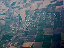
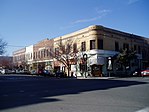
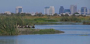
Images, from top down, left to right: The former Yolo County Courthouse in Woodland, The Ziggurat in West Sacramento, Mondavi Center on the UC Davis campus, Downtown Winters, Canada Geese at the Yolo Bypass Wildlife Area | |
 Interactive map of Yolo County | |
 Location in the state of California | |
| Coordinates: 38°33′14″N 121°44′17″W / 38.55389°N 121.73806°W | |
| Country | United States |
| State | California |
| Region | Sacramento Valley |
| CSA | Greater Sacramento |
| Incorporated | February 18, 1850[1] |
| County seat | Woodland |
| Largest city | Davis (population) West Sacramento (area) |
| Government | |
| • Type | Council–CAO |
| • Body | Board of Supervisors |
| • Chair | Oscar Villegas |
| • Vice Chair | Lucas Frerichs |
| • Board of Supervisors[2] | Supervisors
|
| • Chief Administrative Officer | Gerardo Pinedo |
| Area | |
| • Total | 1,024 sq mi (2,650 km2) |
| • Land | 1,015 sq mi (2,630 km2) |
| • Water | 8.9 sq mi (23 km2) |
| Highest elevation | 3,123 ft (952 m) |
| Population | |
| • Total | 216,403 |
| • Density | 210/sq mi (82/km2) |
| Time zone | UTC-8 (Pacific Time Zone) |
| • Summer (DST) | UTC-7 (Pacific Daylight Time) |
| Area codes | 530, 916, 279 |
| FIPS code | 06-113 |
| GNIS feature ID | 277321 |
| Congressional districts | 4th, 7th |
| Website | www |
Yolo County (/ˈjoʊloʊ/ ⓘ; Wintun: Yo-loy), officially the County of Yolo, is a county located in the northern portion of the U.S. state of California. Yolo County was one of the original counties of California, created in 1850 at the time of statehood. As of the 2020 census, the population was 216,403.[4][5] Its county seat is Woodland.[6]
Yolo County is included in the Greater Sacramento metropolitan area and is located in the Sacramento Valley.
Etymology
In the original act of 1850 the name was spelled "Yola." Yolo is a Patwin Native American name variously believed to be a corruption of a tribal name Yo-loy meaning "a place abounding in rushes", the village of Yodoi, believed to be in the vicinity of Knights Landing, California, or the name of the chief of said village, Yodo.[7][8]
History
Yolo County was one of the original counties of California, created in 1850 at the time of statehood.
Government
The county is governed by a board of five district supervisors as well as the governments of its four incorporated cities: Davis, West Sacramento, Winters, and Woodland.
Geography

According to the U.S. Census Bureau, the county has a total area of 1,024 square miles (2,650 km2), of which 1,015 square miles (2,630 km2) is land and 8.9 square miles (23 km2) (0.9%) is water.[9][10]
Adjacent counties
- Colusa County - north
- Sutter County - northeast
- Sacramento County - east
- Solano County - south
- Napa County - west
- Lake County - northwest
Transportation
Major highways
County roads
Addressing in Yolo County is based on a system of numbered county roads. The numbering system works in the following way:
- North–South roads have numbers from 41 to 117 and increase from west to east.
- East–West roads have numbers from 1 to 38A, and then from 151 to 161, and increase from north to south.
Each integer road number is generally one mile (1.6 km) apart, with letters occasionally designating roads less than one mile (1.6 km) apart. County roads entering urban areas generally become named roads once they cross a city boundary. Some examples include County Road 101 in Woodland being renamed Pioneer Ave. and County Road 102 (also known as County Route E8) in Davis being named Pole Line Road.
Public transportation
- Yolobus (Yolo County Transportation District) runs buses throughout Yolo County and into Sacramento, and Sacramento International Airport.[11]
- The University of California, Davis and the city of Davis jointly run Unitrans, a combination local city bus and campus shuttle.[12]
- Fairfield-Suisun Transit Line 30 also stops in Davis on its runs between Fairfield (Solano County) and Sacramento.
- Amtrak has a station in Davis.
Airports
- Yolo County Airport
- University Airport
- Borges–Clarksburg Airport
- Watts–Woodland Airport
Port
The Port of Sacramento, now known as the Port of West Sacramento, is an inland port in West Sacramento, California, in the Sacramento metropolitan area. It is 79 nautical miles (146 km) northeast of San Francisco, and is centered in the California Central Valley, one of the richest agricultural regions in the world.
Crime
The following table includes the number of incidents reported and the rate per 1,000 persons for each type of offense.
| Population and crime rates | ||
|---|---|---|
| Population[13] | 198,889 | |
| Violent crime[14] | 556 | 2.80 |
| Homicide[14] | 7 | 0.04 |
| Forcible rape[14] | 68 | 0.34 |
| Robbery[14] | 171 | 0.86 |
| Aggravated assault[14] | 310 | 1.56 |
| Property crime[14] | 2,979 | 14.98 |
| Burglary[14] | 1,357 | 6.82 |
| Larceny-theft[14][note 1] | 3,844 | 19.33 |
| Motor vehicle theft[14] | 559 | 2.81 |
| Arson[14] | 75 | 0.38 |
Cities by population and crime rates
| Cities by population and crime rates | ||||||||
|---|---|---|---|---|---|---|---|---|
| City | Population[15] | Violent crimes[15] | Violent crime rate per 1,000 persons |
Property crimes[15] | Property crime rate per 1,000 persons | |||
| Davis | 69,289 | 107 | 1.53 | 2,190 | 31.39 | |||
| West Sacramento | 53,727 | 212 | 3.90 | 1,603 | 29.48 | |||
| Winters | 7,286 | 9 | 1.22 | 84 | 12.49 | |||
| Woodland | 60,531 | 224 | 3.66 | 1,488 | 24.32 | |||
Politics
Yolo is a strongly Democratic county in presidential and congressional elections. The last Republican presidential candidate to win a majority in the county was Dwight Eisenhower in 1952, which is the longest Republican drought for any California county.[16] In fact, since 1928, Eisenhower's win in 1952 was the only time the county was carried by the Republican presidential nominee.
| Year | Republican | Democratic | Third party | |||
|---|---|---|---|---|---|---|
| No. | % | No. | % | No. | % | |
| 2020 | 27,292 | 28.05% | 67,598 | 69.48% | 2,404 | 2.47% |
| 2016 | 20,739 | 25.26% | 54,752 | 66.70% | 6,599 | 8.04% |
| 2012 | 23,368 | 31.29% | 48,715 | 65.24% | 2,588 | 3.47% |
| 2008 | 24,592 | 30.84% | 53,488 | 67.07% | 1,669 | 2.09% |
| 2004 | 28,005 | 38.75% | 42,885 | 59.34% | 1,379 | 1.91% |
| 2000 | 23,057 | 37.53% | 33,747 | 54.93% | 4,632 | 7.54% |
| 1996 | 18,807 | 32.38% | 33,033 | 56.88% | 6,239 | 10.74% |
| 1992 | 17,574 | 28.15% | 33,297 | 53.33% | 11,565 | 18.52% |
| 1988 | 22,358 | 41.89% | 30,429 | 57.01% | 585 | 1.10% |
| 1984 | 24,329 | 47.84% | 25,879 | 50.89% | 645 | 1.27% |
| 1980 | 19,603 | 39.45% | 21,527 | 43.32% | 8,560 | 17.23% |
| 1976 | 18,376 | 42.42% | 23,533 | 54.33% | 1,408 | 3.25% |
| 1972 | 17,969 | 42.04% | 23,694 | 55.44% | 1,075 | 2.52% |
| 1968 | 11,123 | 38.41% | 15,833 | 54.67% | 2,004 | 6.92% |
| 1964 | 7,976 | 30.36% | 18,266 | 69.52% | 32 | 0.12% |
| 1960 | 10,104 | 44.73% | 12,395 | 54.87% | 90 | 0.40% |
| 1956 | 9,347 | 47.99% | 10,075 | 51.72% | 57 | 0.29% |
| 1952 | 9,375 | 53.17% | 8,119 | 46.04% | 139 | Zdroj:https://en.wikipedia.org?pojem=Yolo_County,_California|


