A | B | C | D | E | F | G | H | CH | I | J | K | L | M | N | O | P | Q | R | S | T | U | V | W | X | Y | Z | 0 | 1 | 2 | 3 | 4 | 5 | 6 | 7 | 8 | 9
San Mateo County | |
|---|---|
| County of San Mateo | |
|
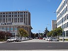
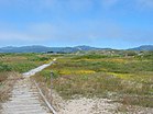
Images, from top down, left to right: View of San Francisco Bay from the San Francisco Bay Discovery Site, San Mateo County Government Center, Año Nuevo State Park | |
| Motto: All of California in One County | |
 Interactive map of San Mateo County | |
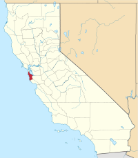
 Location in California | |
| Coordinates: 37°26′N 122°22′W / 37.44°N 122.36°W | |
| Country | United States |
| State | California |
| Incorporated | April 19, 1856[1] |
| Named for | Saint Matthew (English translation) |
| County seat and largest city by area | Redwood City |
| Largest city by population | San Mateo |
| Government | |
| • Type | Council–CEO |
| • Body | Board of Supervisors |
| • President[2] | Dave Pine |
| • Vice President[3] | Warren Slocum |
| • Board of Supervisors[4] | Supervisors
|
| • Chief executive officer | Mike Callagy |
| Area | |
| • Total | 744 sq mi (1,930 km2) |
| • Land | 448 sq mi (1,160 km2) |
| • Water | 293 sq mi (760 km2) |
| Highest elevation | 2,603 ft (793 m) |
| Population | |
| • Total | 764,442 |
| • Density | 1,704/sq mi (658/km2) |
| Gross Domestic Product | |
| • Total | US$165.414 billion (2022) |
| Time zone | UTC-8 (Pacific Time Zone) |
| • Summer (DST) | UTC-7 (Pacific Daylight Time) |
| Area codes | 415/628, 650 |
| FIPS code | 06-081 |
| GNIS feature ID | 277305 |
| Congressional districts | 15th, 16th |
| Website | www |
San Mateo County (/ˌsæn məˈteɪ.oʊ/ ⓘ SAN mə-TAY-oh), officially the County of San Mateo, is a county located in the U.S. state of California. As of the 2020 census, the population was 764,442.[8] Redwood City is the county seat,[9] and the third most populated city following Daly City and San Mateo. San Mateo County is included in the San Francisco–Oakland–Berkeley, CA MSA (metropolitan statistical area), Silicon Valley, and is part of the San Francisco Bay Area, the nine counties bordering San Francisco Bay. It covers most of the San Francisco Peninsula. San Francisco International Airport is located in the northeastern area of the county and is approximately 7 miles (11 km) south of the city and county limits of San Francisco, even though the airport itself is assigned a San Francisco postal address. The county's built-up areas are mostly suburban, and are home to many corporate campuses.
History
San Mateo County was formed in 1856 upon the division of San Francisco County, one of the state's 18 original counties established at California statehood in 1850. Until 1856, San Francisco's city limits extended west to Divisadero Street and Castro Street, and south to 20th Street. In 1856, the California state government divided the county. A straight line was then drawn across the tip of the San Francisco Peninsula just north of San Bruno Mountain. Everything south of the line became the new San Mateo County while everything north of the line became the new consolidated City and County of San Francisco.[10] San Mateo County was officially organized on April 18, 1857, under a bill introduced by Senator T.G. Phelps. The 1857 bill defined the southern boundary of San Mateo County as following the south branch of San Francisquito Creek to its source in the Santa Cruz Mountains and thence due west to the Pacific Ocean, and named Redwood City as the county seat.[11] San Mateo County then annexed part of northern Santa Cruz County in March 1868, including Pescadero and Pigeon Point.[12][11]
Although the formation bill named Redwood City the county seat, a May 1856 election marked by "unblushing frauds perpetuated on an unorganized and wholly unprotected community by thugs and ballot stuffers from San Francisco" named Belmont the county seat.[13] The election results were declared illegal and the county government was moved to Redwood City, with land being donated from the original Pulgas Grant for the county government on February 27, 1858.[13] Redwood City's status as county seat was upheld in two successive elections in May 1861 and December 9, 1873, defeating San Mateo and Belmont.[13] Another election in May 1874 named San Mateo the county seat, but the state supreme court overturned that election on February 24, 1875, and the county seat has remained at Redwood City ever since.[13]
San Mateo County bears the Spanish name for Saint Matthew. As a place name, San Mateo appears as early as 1776 in the diaries of Anza and Font.[14] Several local geographic features were also designated San Mateo on early maps including variously: a settlement, an arroyo, a headland jutting into the Pacific (Point Montara), and a large land holding (Rancho San Mateo). Until about 1850, the name appeared as San Matheo.
Japanese Americans in San Mateo
The Japanese first arrived in San Mateo County and were part of a group guided by Ambassador Tomomi Iwakura in 1872.[15] A number of male Japanese students came to San Mateo to learn English and many other helpful skills to bring back to Japan.[16] These students were also some of the first Japanese to join American students in the Belmont School for Boys. These students had to work for their housing and food before classes and in the evenings.[16] Many of the first Japanese immigrants were able to find jobs as gardeners and landscapers in San Mateo. Most of them had a good educational background from their homelands, but their lack of knowledge of the English language made it difficult for them to find other jobs in the beginning.[17]
Geography
According to the U.S. Census Bureau, the county has a total area of 741 square miles (1,920 km2), of which 448 square miles (1,160 km2) is land and 293 square miles (760 km2) (40%) is water.[18] It is the third-smallest county in California by land area. A number of bayside watercourses drain the eastern part of the county including San Bruno Creek and Colma Creek. Streams draining the western county include Frenchmans Creek, Pilarcitos Creek, Naples Creek, Arroyo de en Medio, and Denniston Creek. These streams originate along the northern spur of the Santa Cruz Mountains that run through the county. The northern and eastern parts of the county are very heavy densely populated with largely urban and suburban areas, with many of its cities as edge-cities for the Bay Area, while the deep south and the west-central parts of the county are less densely populated with more rural environment and coastal beaches areas.

Features
San Mateo County straddles the San Francisco Peninsula, with the Santa Cruz Mountains running its entire length. The county encompasses a variety of habitats, including estuarine, marine, oak woodland, redwood forest, coastal scrub and oak savannah. There are numerous species of wildlife present, especially along the San Francisco Bay estuarine shoreline, San Bruno Mountain, Fitzgerald Marine Reserve and the forests on the Montara Mountain block. Several creeks discharge to the San Francisco Bay, including San Mateo Creek and Laurel Creek, and several coastal streams discharge to the Pacific Ocean, such as Frenchmans Creek and San Vicente Creek.
Año Nuevo State Marine Conservation Area and Greyhound Rock State Marine Conservation Area are two adjoining marine protected areas off the coast of San Mateo County. Like underwater parks, these marine protected areas help conserve ocean wildlife and marine ecosystems.
Flora and fauna
The county is home to several endangered species including the San Francisco garter snake and the San Bruno elfin butterfly, both of which are endemic to San Mateo County. The endangered Ridgway's Rail is also found on the shores of San Francisco Bay, in the cities of Belmont and San Mateo. The endangered wildflower Hickman's potentilla is found near the Pacific Ocean on the lower slopes of Montara Mountain. The endangered wildflowers White-rayed pentachaeta, Pentachaeta bellidiflora, San Mateo Woolly Sunflower, Eriophyllum latilobum, Marin Dwarf Flax, Hesperolinon congestum and the San Mateo Thornmint, Acanthomintha duttonii, are found in the vicinity of the Crystal Springs Reservoir.
In May 2014, a California condor was spotted near Pescadero, a coastal community south of San Francisco[19]—it was the first California condor spotted in San Mateo County since 1904.[19] The condor, tagged with the number "597", and also known as "Lupine", is one of 439 condors living in the wild or captivity in California, Baja California and Arizona.[19][20] The three-year-old female flew more than 100 miles (160 km) north from Pinnacles National Park, in San Benito County, on May 30, and landed on a private, forested property near Pescadero, on the San Mateo County Coast, where it was photographed by a motion-activated wildlife camera.[19] Harold Heath, Professor Emeritus, of Stanford University was responsible for the 1904 sighting, 1 mile (1.6 km) west of the university campus.[19][21]
Pumas (Puma concolor), also known as cougars or mountain lions, roam the county.[22]
Tule elk (Cervus canadensis nannodes) were native to San Mateo County and among the "favored foods" of the Ohlone people based on ethnohistoric and archeological evidence there.[23] The discovery of two elk specimens made news in 1962, one a royal elk (royal elk bulls have six tines per antler) from a peat bog excavated in Pacifica's historic Laguna Alta, and now in the Museum of Vertebrate Zoology collection.[24][25] These may date from the time of Spanish settlement.[26] Laguna Alta lay just south of the Interstate 280 and Skyline Boulevard intersection, east of Mussel Rock.[27] The California Academy of Sciences also has an elk skull fragment collected one mile inland from the mouth of Purisima Creek in 1951.[28] Additional coastal elk remains dating from the Middle and Late Periods in Northern California were found in at least five more late Holocene archeological sites in San Mateo County: SMA-115 (Montara State Beach site), SMA-118 (Bean Hollow State Beach site), SMA-244 (Butano Ridge site), SMA-97 (Año Nuevo Creek site) and SMA-218 (Año Nuevo State Reserve site).[29] On the eastern side of the San Francisco Peninsula, elk remains were also unearthed at multiple archaeological sites along San Francisquito Creek.[30][31]
National protected areas
- Don Edwards San Francisco Bay National Wildlife Refuge (part)
- Golden Gate National Recreation Area (part)
Marine protected area
County parks
The County of San Mateo Parks Department operates 22 parks, trails, and historic sites spread throughout the county; the first, Memorial Park, was dedicated on July 4, 1924.[32]: 12 The County Superintendent of Schools, Roy Cloud, had visited a one-room schoolhouse in Harrison Canyon as part of his duties; at the time, it was thickly forested with old-growth redwoods and he was alarmed when he learned they were scheduled to be logged. He petitioned the County Board of Supervisors to purchase the land instead.[32]: 9–11 The Recreation Commission was not created until 1932, and the park was improved as part of the Works Progress Administration efforts starting in 1935.[32]: 15
| No. | Name | Image | Est. | Size | City | Ref. |
|---|---|---|---|---|---|---|
| 1 | Coyote Point
|

|
1963 | 149 + 538 acres 60 + 218 ha[a] |
San Mateo/Burlingame | [34][35] |
| 2 | Crystal Springs | 
|
17.5 mi 28.2 km |
Burlingame | [36] | |
| 3 | Devil's Slide | 
|
1.3 mi 2.1 km |
Pacifica/Montara | [37] | |
| 4 | Edgewood | 
|
1980 | 467 acres 189 ha |
Redwood City | [38] |
| 5 | Fitzgerald[b] | 
|
1969 | Moss Beach | [39][35] | |
| 6 | Flood | 21 acres 8.5 ha |
Menlo Park | [40] | ||
| 7 | Friendship | <1 acre 0.40 ha |
Redwood City | [41] | ||
| 8 | Huddart | 
|
1948 | 974 acres 394 ha |
Woodside | [42] |
| 9 | Junipero Serra | 
|
1960 | 103 acres 42 ha |
San Bruno | [43] |
| 10 | Memorial | 1924 | 673 acres 272 ha |
Loma Mar | [44] | |
| 11 | Mirada Surf | 15 + 34 acres 6.1 + 13.8 ha[c] |
El Granada | [34][35] | ||
| 12 | Moss Beach | 2014 | 467 acres 189 ha |
Moss Beach | [34][35] | |
| 13 | Pescadero Creek | 
|
1968 | 8,020 acres 3,250 ha |
Loma Mar | [45] |
| 14 | Pillar Point | 
|
2011 | 220 acres 89 ha |
Moss Beach | [46] |
| 15 | Quarry | 517 acres 209 ha |
El Granada | [47] | ||
| 16 | Sam McDonald | 
|
1970 | 850 acres 340 ha |
Loma Mar | [48] |
| 17 | San Bruno Mountain | 
|
1978 | 2,416 acres 978 ha |
Brisbane | [49] |
| 18 | San Pedro Valley | 
|
1970s | 1,052 acres 426 ha |
Pacifica | [50] |
| 19 | Sanchez Adobe | 
|
1953 | 5 acres 2.0 ha |
Pacifica | [51] |
| 20 | Tunitas Creek Beach | 
|
Half Moon Bay | [52] | ||
| 21 | Woodside Store | 
|
1940 | — | Woodside | [53] |
| 22 | Wunderlich | 
|
1974 | 942 acres 381 ha |
Woodside | [54] |
- Notes
- ^ 149 acres of land, 538 acres underwater
- ^ Wholly contained within the Montara State Marine Reserve
- ^ Divided by State Route 1 into the 15-acre Mirada Surf West and 34-acre East. Zdroj:https://en.wikipedia.org?pojem=San_Mateo_County,_California
Text je dostupný za podmienok Creative Commons Attribution/Share-Alike License 3.0 Unported; prípadne za ďalších podmienok. Podrobnejšie informácie nájdete na stránke Podmienky použitia.
Antropológia
Aplikované vedy
Bibliometria
Dejiny vedy
Encyklopédie
Filozofia vedy
Forenzné vedy
Humanitné vedy
Knižničná veda
Kryogenika
Kryptológia
Kulturológia
Literárna veda
Medzidisciplinárne oblasti
Metódy kvantitatívnej analýzy
Metavedy
Metodika
Text je dostupný za podmienok Creative
Commons Attribution/Share-Alike License 3.0 Unported; prípadne za ďalších
podmienok.
Podrobnejšie informácie nájdete na stránke Podmienky
použitia.
www.astronomia.sk | www.biologia.sk | www.botanika.sk | www.dejiny.sk | www.economy.sk | www.elektrotechnika.sk | www.estetika.sk | www.farmakologia.sk | www.filozofia.sk | Fyzika | www.futurologia.sk | www.genetika.sk | www.chemia.sk | www.lingvistika.sk | www.politologia.sk | www.psychologia.sk | www.sexuologia.sk | www.sociologia.sk | www.veda.sk I www.zoologia.sk


