

A | B | C | D | E | F | G | H | CH | I | J | K | L | M | N | O | P | Q | R | S | T | U | V | W | X | Y | Z | 0 | 1 | 2 | 3 | 4 | 5 | 6 | 7 | 8 | 9
Pune
Puṇē Poona | |
|---|---|
|
| |
| Nickname(s): | |
 Interactive Map Outlining Pune | |
 Pune Location of Pune in Maharashtra  Pune Location of Pune in India  Pune Location of Pune in Asia | |
| Coordinates: 18°31′13″N 73°51′24″E / 18.52028°N 73.85667°E | |
| Country | |
| State | Maharashtra |
| District | Pune district |
| Division | Pune division |
| Established | AD 758[3] |
| Government | |
| • Type | Municipal Corporation |
| • Municipal Commissioner | Vikram Kumar, IAS[4][5] |
| • Mayor | Vacant |
| Area | |
| • Pune MC[6] | 484.61 km2 (187.11 sq mi) |
| • Pune MR[7] | 7,256.46 km2 (2,801.73 sq mi) |
| Elevation | 570.62 m (1,872.11 ft) |
| Population | |
| • Pune MC[6] | 6,200,000 |
| • Pune MC[6] density | 13,000/km2 (33,000/sq mi) |
| • Pune MR[7] | 7,276,000 |
| • Pune MR[7] density | 1,000/km2 (2,600/sq mi) |
| Demonym(s) | Punekar,[8] Poonaite[9] |
| Time zone | UTC+5:30 (IST) |
| PIN Code(s) | 411001 – 411090[10] |
| Area code | 020 |
| Vehicle registration |
|
| Member of Parliament | Murlidhar Mohol |
| GDP | $69 billion[11][12][13] |
| International airports | Pune International Airport (PNQ) |
| Transit | Rapid Transit: Pune Metro Commuter rail: Pune Suburban Railway BRTS: PMPML |
| Urban Planning Authority | Pune Metropolitan Region Development Authority |
| Website | pmc.gov.in |


.JPG)

Pune (/ˈpuːnə/ POO-nə, Marathi: [ˈpuɳe] ), previously spelled in English as Poona (the official name until 1978),[15][16] is a city in Maharashtra state in the Deccan plateau in Western India. It is the administrative headquarters of the Pune district, and of Pune division. According to the 2011 Census of India, Pune has 7.2 million residents in the metropolitan region, making it the eighth-most populous metropolitan area in India.[17] The city of Pune is part of Pune Metropolitan Region.[18] Pune is one of the largest IT hubs in India.[19][20] It is also one of the most important automobile and manufacturing hubs of India. Pune is often referred to as the "Oxford of the East" because of its highly regarded educational institutions.[21][22][23] It has been ranked "the most liveable city in India" several times.[24][25]
Pune at different points in time has been ruled by the Rashtrakuta dynasty, Ahmadnagar Sultanate, the Mughals, and the Adil Shahi dynasty. In the 18th century, the city was part of the Maratha Empire, and the seat of the Peshwas, the prime ministers of the Maratha Empire.[26] Many historical landmarks like Pataleshwar caves, Shaniwarwada, Shinde Chhatri, and Vishrambaug Wada date to this era. Historical sites from different eras dot the city.
Pune has historically been a major cultural centre, with important figures like Dnyaneshwar, Shivaji, Tukaram, Baji Rao I, Balaji Baji Rao, Madhavrao I, Nana Fadnavis, Mahadev Govind Ranade, Gopal Krishna Gokhale, Mahatma Jyotirao Phule, Savitribai Phule, Gopal Ganesh Agarkar, Tarabai Shinde, Dhondo Keshav Karve, and Pandita Ramabai doing their life's work in Pune City or in an area that falls in Pune Metropolitan Region. Pune was a major centre of resistance to British Raj, with people like Gopal Krishna Gokhale, Bal Gangadhar Tilak and Vinayak Damodar Savarkar playing leading roles in struggle for Indian independence in their times.
Etymology
The earliest reference to Pune is an inscription on a Rashtrakuta Dynasty copper plate dated 937 CE, which refers to the town as Punya-Vishaya, meaning 'sacred news'.[27] By the 13th century, it had come to be known as Punawadi.[28]
During the Rashtrakuta dynasty, the city was referred to as Punnaka and Punyapur. The copper plates of 758 and 768 CE show that the Yadava dynasty had renamed the city Punakavishaya and Punya Vishaya. 'Vishaya' means land, and 'Punaka' and 'Punya' mean holy. The city was known as Kasbe Pune when under the command of Maratha king Shivaji's father, Shahaji. Mughal emperor Aurangzeb renamed a small neighbourhood in central part of the old city as Muhiyabad (the only divergent naming) some time between 1703 and 1705 in memory of his great-grandson Muhi-ul-Milan, who died there. The name Muhiyabad was reverted soon after Aurangzeb's death.[15] Anglicized to Poona in 1857 by the English during British rule, the city's name was changed to Pune in 1978.
History
Maratha Empire 1674–1818
Bombay Presidency 1843–1947
Bombay State 1947–1960
Maharashtra 1960–Present
Early and Medieval Period

Copper plates dated 858 and 868 CE show that by the 9th century an agricultural settlement known as Punnaka existed at the location of the modern Pune. The plates indicate that this region was ruled by the Rashtrakuta dynasty. The Pataleshwar rock-cut temple complex was built during this era.[29] Pune was part of the territory ruled by the Seuna Yadavas of Devagiri from the 9th century to 1327. Pune was under control of various Muslim sultanates until the late 1600s.[30][31]
The Maratha Empire
Pune was part of the Jagir (fiefdom) granted by the Nizamshahi (Ahmadnagar Sultanate) to Maloji Bhosale in 1599.[32] Maloji Bhosale passed on Jagir of Pune to his son Shahaji Bhosale. The town was destroyed by Murar Jagdeo, a general from the rival Adil Shahi dynasty in 1636.Soon Shahaji himself joined Adilshahi and got his Pune jagir back.At that time he selected the town for the residence of his wife Jijabai, and young son Shivaji, the future founder of the Maratha empire. Shahaji appointed Dadoji Konddeo to help Jijabai in the administration of Jagir and in the reconstruction of the town.The Lal Mahal residence of Jiajabai and Shivaji was completed in 1640 AD.[27] Shivaji spent his young years at the Lal Mahal. Jijabai is said to have commissioned the building of the Kasba Ganapati temple. The Ganesha idol consecrated at this temple has been regarded as the presiding deity (Gramadevata) of the city.[33] Pune changed hands between the Mughals and the Marathas many times during the rest of the 1600s.Recognizing the military potential of Pune, the Mughal general Shaista Khan and later, the emperor Aurangzeb further developed the areas around the town.[34] From 1703 to 1705, towards the end of the 27-year-long Mughal–Maratha Wars, the town was occupied by Mughal emperor Aurangzeb and its name was changed temporarily to Muhiyabad.[15][35] This name was abandoned and reverted to its original name soon after Aurangzib's death.
Peshwa Rule
In 1720, Baji Rao I was appointed Peshwa (prime minister) of the Maratha Empire by Shahu I, the fifth Chhatrapati of the Maratha Empire.[36] As the Peshwa, Bajirao moved his base from Saswad to Pune in 1728, marking the beginning of the transformation of what was a kasbah into a city.[37][38] He also commissioned the construction of the Shaniwar Wada on the high grounds of right bank of the Mutha River. The construction was completed in 1730, ushering in the era of Peshwa control of the city. Bajirao's son and successor, Nanasaheb constructed a lake at Katraj on the outskirts of the city and an underground aqueduct to bring water from the lake to Shaniwar Wada and the city.[39][40] The aqueduct was still in working order in 2004.[41][42]
.jpg)

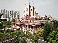
The patronage of the Maratha Peshwas resulted in a great expansion of Pune, with the construction of around 250 temples and bridges in the city, including the Lakdi Pul[43] and the temples on Parvati Hill[44] and many Maruti, Vithoba, Vishnu, Mahadeo, Rama, Krishna, and Ganesh temples. The building of temples led to religion being responsible for about 15% of the city's economy during this period.[38][45] Pune prospered as a city during the reign of Nanasaheb Peshwa. He developed Saras Baug, Heera Baug, Parvati Hill and new commercial, trading, and residential localities. Sadashiv Peth, Narayan Peth, Rasta Peth and Nana Peth were developed. The Peshwa's influence in India declined after the defeat of Maratha forces at the Battle of Panipat but Pune remained the seat of power. In 1802 Pune was captured by Yashwantrao Holkar in the Battle of Poona, directly precipitating the Second Anglo-Maratha War of 1803–1805. The Peshwa rule ended with the defeat of Peshwa Bajirao II by the British East India Company in 1818.[46]
Historian Govind Sakharam Sardesai lists 163 prominent families that held high ranks and played significant roles in politics, military, and finance in 18th century Pune. Of these 163 families, a majority(80) were Deshastha Brahmins, 46 were Chitpawan, 15 were Chandraseniya Kayastha Prabhu(CKP) whereas Karhade Brahmin and Saraswat accounted for 11 families each.[47]
British Rule (1818 – 1947)

The Third Anglo-Maratha War broke out between the Marathas and the British East India Company in 1817. The Peshwas were defeated at the Battle of Khadki (then spelled Kirkee) on 5 November near Pune and the city was seized by the British. It was placed under the administration of the Bombay Presidency and the British built a large military cantonment to the east of the city (now used by the Indian Army).[citation needed] The Southern Command of the Indian Army, established in 1895, is headquartered in Pune cantonment.[48][49]

The city of Pune was known as Poona during British rule. Poona Municipality was established in 1858. A railway line from Bombay to the city opened in 1858, run by the Great Indian Peninsula Railway (GIPR).[50][51] Navi Peth, Ganj Peth (now renamed Mahatma Phule Peth) were developed during the British Raj.[citation needed]
Centre of Social Reform and Nationalism
Pune was prominently associated with the struggle for Indian independence. In the period between 1875 and 1910, the city was a centre of agitation led by Gopal Krishna Gokhale and Bal Gangadhar Tilak. The city was also a centre for social reform led by Gopal Ganesh Agarkar, Mahatma Jyotirao Phule, feminist Tarabai Shinde, Dhondo Keshav Karve and Pandita Ramabai. They demanded the abolition of caste prejudice, equal rights for women, harmony between the Hindu and Muslim communities, and better schools for the poor.[52] Mahatma Gandhi was imprisoned at the Yerwada Central Jail several times and placed under house arrest at the Aga Khan Palace between 1942 and 1944, where both his wife Kasturba Gandhi and aide Mahadev Desai died.[53] Savarkar used to study in Fergusson College and performed the "Holi" of foreign items near Mutha river bank [citation needed].
Pune since Indian Independence


After Indian independence from the British in 1947, Pune saw enormous growth, transforming it into a modern metropolis. The Poona Municipal Council was reorganised to form the Pune Municipal Corporation (PMC) in 1950.[54] The education sector in the city continued its growth in the post-independence era with the establishment of the University of Pune (now, Savitribai Phule Pune University) in 1949, the National Chemical Laboratory in 1950 and the National Defence Academy in 1955.[55][56][57]
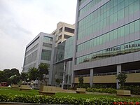
The establishment of Hindustan Antibiotics in 1954 marked the beginning of industrial development in the Hadapsar, Bhosari, and Pimpri areas.[58][59] MIDC provided the necessary infrastructure for new businesses to set up operations.[60] In the 1970s, several engineering companies were set up in the city, allowing it to vie with Chennai.[61][62] In the 1990s, Pune began to attract foreign capital, particularly in the information technology and engineering industries. IT parks were established in Aundh, Viman Nagar, Hinjawadi, Wagholi, Kharadi and Balewadi-Baner region. As a result, the city saw a huge influx of people due to opportunities offered by the manufacturing, and lately, the software industries.
The breach in the Panshet dam and the resulting flood of 1961 led to severe damage and the destruction of housing close to the river banks.[63] The mishap spurred the development of new suburbs and housing complexes.[64] To integrate urban planning, the Pune Metropolitan Region was defined in 1967 covering the area under PMC, the Pimpri-Chinchwad Municipal Corporation, the three cantonments, and the surrounding villages.[65]
In 1998 work on the six-lane Mumbai-Pune expressway began; it was completed in 2001.[66] In 2008, the Commonwealth Youth Games took place in Pune, which encouraged development in the northwest region of the city.[67] On 13 February 2010, a bomb exploded at the German Bakery in the upmarket Koregaon Park neighbourhood in eastern Pune, killing 17 and injuring 60.[68][69][70] Evidence suggested that the Indian Mujahideen terrorist group carried out the attack.[71]
21st-century
Pune has evolved greatly since Indian Independence, from notable universities, colleges and management schools, earning it the nickname of the 'Oxford Of The East', to being one of the most important automobile manufacturing hub.[72][73] Pune is also home to the world's largest vaccine manufacturer, Serum Institute of India.[74][75]
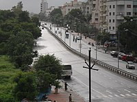
Geography

Pune is situated at approximately 18° 32" north latitude and 73° 51" east longitude. The city's total area is 15.642 km2,[76] and the municipal corporation area covers 518 km2.[77] By road Pune is 1,173 km (729 mi) south of Delhi, 734 km (456 mi) north of Bangalore, 562 km (349 mi) north-west of Hyderabad and 149 km (93 mi) south-east of Mumbai.
Pune lies on the western margin of the Deccan plateau, at an altitude of 560 m (1,840 ft) above sea level. It is on the leeward side of the Sahyadri mountain range, which forms a barrier from the Arabian Sea. It is a hilly city, with Vetal Hill rising to 800 m (2,600 ft) above sea level. The Sinhagad fort is at an altitude of 1,300 metres (4,300 feet).
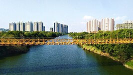
The old city of Pune is at the confluence of the Mula and Mutha rivers. The Pavana, a tributary of Mula river and Indrayani river, a tributary of the Bhima river, traverse the northwest Neighbourhoods of Pune.
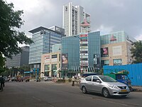
Cityscape

The modern city of Pune has many distinct neighbourhoods. These include the numerous peths of the old city on the eastern bank of the Mutha river, the cantonment areas of Khadki and Camp established by the British, and numerous suburbs.[59] There are several Peths in usual localities of the Pune city.[78] The industrial growth in the Pimpri, Chinchwad, Akurdi, Nigdi and nearby areas allowed these areas to incorporate a new governing municipal corporation.[60][79][80][81][82][83][84]
The Pune Metropolitan Region (PMR), initially defined in 1967, has grown to 7,256 km2 made up of the ten talukas of the Pune district.[85] The areas of PMC and PCMC along with the three cantonment areas of Camp, Khadki, and Dehu Road form the urban core of the PMR, which also includes seven municipal councils and 842 villages.[85][86][87]
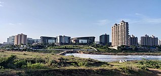
Rapid industrialisation since the 1960s has led to large influx of people into the city. Housing supply has not kept pace with demand, causing the number of slum dwellings to increase.[88] Approximately 36% of the population lives in 486 slum areas. Of these, 45% slum households do not have in-house toilet facilities and 10% do not have electricity. One third of the slums are on mixed ownership land. The living conditions in slums varies considerably, depending on their status (formal/informal) and in how far non-governmental organisations (NGOs), community organisations (CBOs) and government agencies are involved and committed to improving local living conditions.[89] Since the 1990s a number of landmark integrated townships and gated communities have been developed in Pune such as Magarpatta, Nanded city, Amanora, Blue Ridge, Life Republic and Lavasa.[90] They also offer business opportunities and access to infrastructure. According to the PMC, six townships with up to 15,000 housing units existed in Pune in 2012 and 25 more were in the planning process.[89]
The Mercer 2017 Quality of Living Rankings evaluated living conditions in more than 440 cities around the world and ranked Pune at 145, second highest in India after Hyderabad at 144.[91] The same source highlights Pune as being among evolving business centres and as one of nine emerging cities around the world with the citation "Hosts IT and automotive companies".[92] The 2017 Annual Survey of India's City-Systems (ASICS) report, released by the Janaagraha Centre for Citizenship and Democracy, adjudged Pune as the best governed of 23 major cities.[93]
- Selection of neighborhoods in Pune
-

-

-
-

-
-
-
-
-

-
-

-
-

-


.jpg)


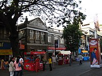
Peths in Pune
Peth is a general term in the Marathi language for a locality in Pune. Seventeen peths are located in Pune, which today constitute the old city of Pune. Most were established during the Maratha empire era under the Maratha and Peshwa rule of the city in the 18th century, before the arrival of the British.[94] Pune is home to many distinctive peths, or place names, for various neighbourhoods. The majority of them bore the names of their founders and days of the week.[95]
Climate
Pune has a tropical wet and dry (Köppen Aw) climate, closely bordering upon a hot semi-arid climate (Köppen BSh) with average temperatures ranging between 20 and 28 °C (68 and 82 °F).[96] Pune experiences three seasons: summer, monsoon, and winter. Typical summer months are from mid-March to mid-June, with maximum temperatures sometimes reaching 42 °C (108 °F). The warmest month in Pune is May. The city often has heavy dusty winds in May, with humidity remaining high. Even during the hottest months, the nights are usually cool due to Pune's high altitude. The highest temperature recorded was 43.3 °C (109.9 °F) on 30 April 1897.[97]
The monsoon lasts from June to October, with moderate rainfall and temperatures ranging from 22 to 28 °C (72 to 82 °F). Most of the 722 mm (28.43 in) of annual rainfall in the city falls between June and September, and July is the wettest month of the year. Hailstorms are not unheard of. For most of December and January the daytime temperature hovers around 29 °C (84.2 °F) while overnight temperatures are below 12 °C (53.6 °F). On 11 May 2023, Koregaon Park recorded a temperature of 44.4 °C (112 °F) [98]