[3] Name on the Register[4]
Image
Date listed[5]
Location
City or town
Description
1
Allen-Madison House Allen-Madison House March 28, 1980 (#80000015 ) Post Rd. 41°37′06″N 71°25′16″W / 41.618333°N 71.421111°W / 41.618333; -71.421111 (Allen-Madison House ) North Kingstown
2
Anthony-Kinney Farm Anthony-Kinney Farm April 17, 2013 (#13000178 ) 505 Point Judith Road 41°24′26″N 71°28′44″W / 41.407219°N 71.478977°W / 41.407219; -71.478977 (Anthony-Kinney Farm ) Narragansett
3
Austin Farm Road Agricultural Area Austin Farm Road Agricultural Area August 16, 1977 (#77000009 ) 6 mi (9.7 km) west of Exeter off Interstate 95 41°35′44″N 71°39′52″W / 41.595556°N 71.664444°W / 41.595556; -71.664444 (Austin Farm Road Agricultural Area ) Exeter
4
Babcock House Babcock House January 1, 1976 (#76000008 ) Main St. 41°20′14″N 71°42′43″W / 41.337222°N 71.711944°W / 41.337222; -71.711944 (Babcock House ) Charlestown
5
Babcock-Smith House Babcock-Smith House July 24, 1972 (#72000008 ) 124 Granite St. 41°22′16″N 71°49′13″W / 41.371111°N 71.820278°W / 41.371111; -71.820278 (Babcock-Smith House ) Westerly
6
David S. Baker Estate David S. Baker Estate August 4, 2011 (#11000512 ) 51 & 67 Prospect Ave. 41°33′54″N 71°27′11″W / 41.565°N 71.453056°W / 41.565; -71.453056 (David S. Baker Estate ) North Kingstown
7
Baptist Church in Exeter Baptist Church in Exeter November 21, 1978 (#78000014 ) North of Arcadia on RI 165 41°34′36″N 71°42′36″W / 41.576667°N 71.71°W / 41.576667; -71.71 (Baptist Church in Exeter ) Exeter
8
Beaver River Road Historic District Upload image October 25, 2021 (#100006693 ) Beaver River Rd., Beaver River Schoolhouse Rd. 41°28′45″N 71°37′35″W / 41.4792°N 71.6264°W / 41.4792; -71.6264 (Beaver River Road Historic District ) Richmond
9
Black Farm Upload image November 7, 1995 (#95001268 ) Bounded by the Rockville-Alton Rd. (RI 112 ) and the Wood River 41°28′06″N 71°43′23″W / 41.468333°N 71.723056°W / 41.468333; -71.723056 (Black Farm ) Hopkinton
10
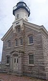
Block Island North Light Block Island North Light May 23, 1974 (#74000008 ) Sandy Point, off the northern end of Corn Neck Rd. 41°13′39″N 71°34′34″W / 41.2275°N 71.576111°W / 41.2275; -71.576111 (Block Island North Light ) New Shoreham Built in 1867; still in use with its original lens.
11
Block Island Southeast Light Block Island Southeast Light September 25, 1997 (#97001264 ) South East Light Rd. 41°09′11″N 71°32′53″W / 41.153056°N 71.548056°W / 41.153056; -71.548056 (Block Island Southeast Light ) New Shoreham Built in 1874; best surviving example of late 19th-century U.S. lighthouse construction. Still in use.
12
Bouchard Archeological Site, RI-1025 Upload image November 1, 1984 (#84000370 ) Address Restricted South Kingstown Listed in Usquepaug .
13
Bradford Village Historic District Bradford Village Historic District May 30, 1996 (#96000573 ) Roughly Bowling Ln. from the Pawcatuck River to Vars Ln. and Main St. from the Bradford Bridge to Church Ave. 41°24′08″N 71°45′06″W / 41.402222°N 71.751667°W / 41.402222; -71.751667 (Bradford Village Historic District ) Hopkinton and Westerly
14
Browning's Beach Historic District Browning's Beach Historic District September 5, 1997 (#97000952 ) Browning's Beach, 0.5 mi (0.80 km) west of the junction of Card Pond and Matunuck Beach Rds. 41°22′26″N 71°33′52″W / 41.373889°N 71.564444°W / 41.373889; -71.564444 (Browning's Beach Historic District ) South Kingstown
15
Jireh Bull Blockhouse Jireh Bull Blockhouse November 3, 1983 (#83003869 ) Address Restricted South Kingstown
16
Camp Endicott Camp Endicott October 19, 1978 (#78000015 ) Between 7th and 10th Sts. 41°36′10″N 71°25′59″W / 41.602778°N 71.433056°W / 41.602778; -71.433056 (Camp Endicott ) North Kingstown Mostly demolished; some Quonset huts survive at the Seabee Museum and Memorial Park
17
Carolina Village Historic District Carolina Village Historic District May 2, 1974 (#74000009 ) Charlestown 41°27′31″N 71°39′51″W / 41.458611°N 71.664167°W / 41.458611; -71.664167 (Carolina Village Historic District ) Charlestown and Richmond
18
Silas Casey Farm Silas Casey Farm August 14, 1973 (#73000006 ) Boston Neck Rd. 41°30′40″N 71°26′01″W / 41.511111°N 71.433611°W / 41.511111; -71.433611 (Silas Casey Farm ) North Kingstown
19
Cedar Point Historic District Upload image July 21, 2022 (#100007946 ) 13, 21, 26, 31, and 49 Loop Dr. 41°33′56″N 71°27′24″W / 41.5656°N 71.4566°W / 41.5656; -71.4566 (Cedar Point Historic District ) North Kingstown
20
Central Street Historic District Central Street Historic District August 18, 1982 (#82000015 ) Both sides of Central Street from 5th Ave. to Boon St. 41°25′46″N 71°27′44″W / 41.429444°N 71.462222°W / 41.429444; -71.462222 (Central Street Historic District ) Narragansett
21
Peleg Champlin House Upload image June 1, 1982 (#82000016 ) Rodman Pond Lane 41°11′24″N 71°35′38″W / 41.19°N 71.593889°W / 41.19; -71.593889 (Peleg Champlin House ) New Shoreham
22
Samuel Clarke Farm Samuel Clarke Farm February 4, 2019 (#100003413 ) 106 Lewiston Ave. 41°27′39″N 71°37′26″W / 41.4608°N 71.6238°W / 41.4608; -71.6238 (Samuel Clarke Farm ) Richmond
23
Cocumscossoc Archeological Site Cocumscossoc Archeological Site April 12, 1993 (#93000605 ) 55 Richard Smith Drive 41°35′00″N 71°27′16″W / 41.5833°N 71.4544°W / 41.5833; -71.4544 (Cocumscossoc Archeological Site ) North Kingstown Area around one of the state's oldest houses has yielded considerable information from digs
24
Cottrell House Cottrell House November 21, 1996 (#96001319 ) 500 Waites Corner Rd. 41°29′22″N 71°33′55″W / 41.489444°N 71.565278°W / 41.489444; -71.565278 (Cottrell House ) South Kingstown
25
Crowfield Historic District Crowfield Historic District July 19, 1985 (#85001646 ) Boston Neck Rd. 41°32′00″N 71°25′27″W / 41.533333°N 71.424167°W / 41.533333; -71.424167 (Crowfield Historic District ) North Kingstown
26
Davisville Historic District Davisville Historic District July 19, 1985 (#85001645 ) Davisville Rd. 41°37′17″N 71°28′52″W / 41.621389°N 71.481111°W / 41.621389; -71.481111 (Davisville Historic District ) North Kingstown
27
Devil's Foot Cemetery Archeological Site, RI-694 Devil's Foot Cemetery Archeological Site, RI-694 November 15, 1984 (#84000562 ) Address Restricted North Kingstown
28
Dewey Cottage Dewey Cottage May 7, 1992 (#92000467 ) 668 Matunuck Beach Rd. 41°22′42″N 71°32′56″W / 41.378333°N 71.548889°W / 41.378333; -71.548889 (Dewey Cottage ) South Kingstown
29
District Schoolhouse No. 2 District Schoolhouse No. 2 January 4, 1980 (#80000016 ) Old Post Rd. 41°23′07″N 71°39′04″W / 41.385278°N 71.651111°W / 41.385278; -71.651111 (District Schoolhouse No. 2 ) Charlestown
30
George Douglas House George Douglas House October 10, 1975 (#75000006 ) South of Allenton at Tower Hill and Gilbert Stuart Rds. 41°31′18″N 71°27′46″W / 41.521667°N 71.462778°W / 41.521667; -71.462778 (George Douglas House ) North Kingstown
31
Druidsdream Druidsdream July 20, 1989 (#89000940 ) 144 Gibson Ave. 41°25′02″N 71°27′46″W / 41.417222°N 71.462778°W / 41.417222; -71.462778 (Druidsdream ) Narragansett
32
The Dunes Club The Dunes Club May 18, 2015 (#15000243 ) 137 Boston Neck Rd. 41°26′23″N 71°26′56″W / 41.4398°N 71.4488°W / 41.4398; -71.4488 (The Dunes Club ) Narragansett
33
Dunmere Dunmere September 23, 2005 (#05001061 ) 560 Ocean Rd. 41°24′16″N 71°27′44″W / 41.404444°N 71.462222°W / 41.404444; -71.462222 (Dunmere ) Narragansett
34
Earlscourt Historic District Earlscourt Historic District August 18, 1982 (#82000017 ) Roughly bounded by Westmoreland, Noble, Woodward Sts., and Gibson Ave.(both sides) 41°25′15″N 71°27′42″W / 41.420833°N 71.461667°W / 41.420833; -71.461667 (Earlscourt Historic District ) Narragansett
35
Henry Eldred Farm Henry Eldred Farm November 18, 1991 (#91001646 ) 368 Old North Rd. 41°29′55″N 71°31′14″W / 41.498611°N 71.520556°W / 41.498611; -71.520556 (Henry Eldred Farm ) South Kingstown
36
George Fayerweather Blacksmith Shop George Fayerweather Blacksmith Shop November 29, 1984 (#84000470 ) Intersection RI 108 and 138 41°28′49″N 71°31′13″W / 41.48038°N 71.52018°W / 41.48038; -71.52018 (George Fayerweather Blacksmith Shop ) South Kingstown
37
Fernwood Archeological Site, RI-702 Upload image September 12, 1985 (#85002364 ) Address Restricted South Kingstown
38
Fisherville Historic and Archeological District Fisherville Historic and Archeological District December 5, 1980 (#80000017 ) Address Restricted Exeter
39
Flying Horse Carousel Flying Horse Carousel January 11, 1980 (#80000019 ) Bay St. 41°18′32″N 71°51′31″W / 41.308889°N 71.858611°W / 41.308889; -71.858611 (Flying Horse Carousel ) Westerly One of the earliest carousels still in use, dating to 1876. Horses are suspended from chains rather than on poles, hence the name.
40
Former Immaculate Conception Church Former Immaculate Conception Church April 24, 1973 (#73000007 ) 119 High St. 41°22′55″N 71°49′32″W / 41.381944°N 71.825556°W / 41.381944; -71.825556 (Former Immaculate Conception Church ) Westerly
41
Fort Ninigret Fort Ninigret April 28, 1970 (#70000004 ) Fort Neck Rd. 41°22′52″N 71°38′54″W / 41.381111°N 71.648333°W / 41.381111; -71.648333 (Fort Ninigret ) Charlestown
42
Foster Cove Archeological Site Foster Cove Archeological Site May 6, 1980 (#80000018 ) Address Restricted Charlestown
43
Gardencourt Gardencourt August 18, 1982 (#82000018 ) 10 Gibson Ave. 41°25′21″N 71°27′39″W / 41.4225°N 71.460833°W / 41.4225; -71.460833 (Gardencourt ) Narragansett
44
Ezekial Gardner House Ezekial Gardner House July 19, 1985 (#85001654 ) 297 Pendar Rd. 41°31′47″N 71°28′35″W / 41.529722°N 71.476389°W / 41.529722; -71.476389 (Ezekial Gardner House ) North Kingstown
45
R. R. Gardner House R. R. Gardner House November 21, 1996 (#96001320 ) 700 Curtis Corner Rd. 41°27′10″N 71°31′54″W / 41.452778°N 71.531667°W / 41.452778; -71.531667 (R. R. Gardner House ) South Kingstown
46
Gladstone Springhouse and Bottling Plant Gladstone Springhouse and Bottling Plant May 10, 1984 (#84002051 ) 145A Boon St. 41°25′35″N 71°27′25″W / 41.426389°N 71.456944°W / 41.426389; -71.456944 (Gladstone Springhouse and Bottling Plant ) Narragansett
47
Great Salt Pond Archeological District Upload image February 15, 1990 (#90000107 ) Address Restricted New Shoreham
48
Greene Inn Greene Inn June 24, 1976 (#76000009 ) 175 Ocean Rd. 41°25′23″N 71°27′23″W / 41.423056°N 71.456389°W / 41.423056; -71.456389 (Greene Inn ) Narragansett Burned down in 1980.
49
Hale House Hale House June 5, 2007 (#07000527 ) 2625A Commodore Oliver Hazard Perry Highway 41°23′52″N 71°33′03″W / 41.397778°N 71.550833°W / 41.397778; -71.550833 (Hale House ) South Kingstown
50
Hallville Historic and Archeological District Hallville Historic and Archeological District December 5, 1980 (#80000020 ) Address Restricted Exeter
51
Hamilton Mill Village Historic District Hamilton Mill Village Historic District November 3, 1983 (#83003874 ) Boston Neck and Martha Rds., Salisbury and Web Aves. 41°32′56″N 71°26′19″W / 41.548889°N 71.438611°W / 41.548889; -71.438611 (Hamilton Mill Village Historic District ) North Kingstown
52
Hillsdale Historic and Archeological District Hillsdale Historic and Archeological District November 24, 1980 (#80000021 ) Address Restricted Richmond
53
Historic Village of the Narragansetts in Charlestown Historic Village of the Narragansetts in Charlestown May 7, 1973 (#73000008 ) Bounded by Route 112 , U.S. Route 1 , King's Factory Road (Bureau of Indian Affairs Route 411), and Route 91 41°24′37″N 71°40′03″W / 41.4104°N 71.6674°W / 41.4104; -71.6674 (Historic Village of the Narragansetts in Charlestown ) Charlestown
54
Hope Valley Historic District Hope Valley Historic District July 3, 2004 (#04000654 ) Main Street 41°30′28″N 71°43′00″W / 41.507694°N 71.716586°W / 41.507694; -71.716586 (Hope Valley Historic District ) Hopkinton
55
Hopkinton City Historic District Hopkinton City Historic District May 1, 1974 (#74000010 ) Hopkinton 41°27′40″N 71°46′39″W / 41.461111°N 71.7775°W / 41.461111; -71.7775 (Hopkinton City Historic District ) Hopkinton
56
John Hoxsie House John Hoxsie House May 5, 1978 (#78000016 ) East of RI 112 41°28′35″N 71°38′37″W / 41.476389°N 71.643611°W / 41.476389; -71.643611 (John Hoxsie House ) Richmond
57
Hygeia House Hygeia House October 22, 2001 (#01001156 ) Beach Ave. 41°10′40″N 71°34′18″W / 41.177778°N 71.571667°W / 41.177778; -71.571667 (Hygeia House ) New Shoreham
58
Indian Burial Ground Indian Burial Ground April 28, 1970 (#70000005 ) Narrow Lane 41°23′48″N 71°38′00″W / 41.396667°N 71.633333°W / 41.396667; -71.633333 (Indian Burial Ground ) Charlestown
59
Joseph Jeffrey House Joseph Jeffrey House March 8, 1978 (#78000017 ) Old Mill Road 41°25′47″N 71°39′54″W / 41.429722°N 71.665°W / 41.429722; -71.665 (Joseph Jeffrey House ) Charlestown
60
Kenyon's Department Store Kenyon's Department Store November 5, 1992 (#92001540 ) 344 Main St. 41°26′17″N 71°29′59″W / 41.438056°N 71.499722°W / 41.438056; -71.499722 (Kenyon's Department Store ) South Kingstown
61
Kingston Hill Farm Kingston Hill Farm May 7, 1993 (#93000343 ) Zdroj: https://en.wikipedia.org?pojem=National_Register_of_Historic_Places_listings_in_Washington_County,_Rhode_Island
Your browser doesn’t support the object tag.
www.astronomia.sk |
www.biologia.sk | www.botanika.sk
| www.dejiny.sk | www.economy.sk
| www.elektrotechnika.sk |
www.estetika.sk | www.farmakologia.sk
| www.filozofia.sk | Fyzika
| www.futurologia.sk | www.genetika.sk
| www.chemia.sk
| www.lingvistika.sk | www.politologia.sk
| www.psychologia.sk
| www.sexuologia.sk | www.sociologia.sk
| www.veda.sk I www.zoologia.sk


