

A | B | C | D | E | F | G | H | CH | I | J | K | L | M | N | O | P | Q | R | S | T | U | V | W | X | Y | Z | 0 | 1 | 2 | 3 | 4 | 5 | 6 | 7 | 8 | 9
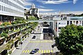
 From top to bottom; left to right: the Olympic Museum, the Cathedral of Lausanne, the Federal courts of Switzerland, aerial view of the city, and the park of Milan. | |
 Flag  Coat of arms | |
 | |
| Coordinates: 46°31.19′N 6°38.01′E / 46.51983°N 6.63350°E | |
| Country | Switzerland |
| Canton | Vaud |
| District | Lausanne |
| Government | |
| • Executive | Municipalité with 7 members |
| • Mayor | Syndic (list) Grégoire Junod SPS/PSS (as of 2016) |
| • Parliament | Conseil communal with 100 members |
| Area | |
| • Total | 41.37 km2 (15.97 sq mi) |
| Elevation (Cité) | 526 m (1,726 ft) |
| Highest elevation | 935 m (3,068 ft) |
| Lowest elevation | 372 m (1,220 ft) |
| Population (31 December 2018)[2] | |
| • Total | 139,111 |
| • Density | 3,400/km2 (8,700/sq mi) |
| Demonym | French: Lausannois(e) |
| Time zone | UTC+01:00 (Central European Time) |
| • Summer (DST) | UTC+02:00 (Central European Summer Time) |
| Postal code(s) | 1000 (in general), 1003–1007, 1010–1012, 1000 Lausanne 25–27, 1052 Le Mont-sur-Lausanne (partly), 1053 Cugy VD (partly), 1032 Crissier (partly), 1032 Romanel-sur-Lausanne (partly), 1033 Cheseaux-sur-Lausanne (partly) |
| SFOS number | 5586 |
| ISO 3166 code | CH-VD |
| Localities | Le Chalet-à-Gobet, Montblesson, Montheron, Ouchy, Vernand-Dessous, Vernand-Dessus, Vers-chez-les-Blanc |
| Surrounded by | Bottens, Bretigny-sur-Morrens, Chavannes-près-Renens, Cheseaux-sur-Lausanne, Crissier, Cugy, Écublens, Épalinges, Évian-les-Bains (FR-74), Froideville, Jouxtens-Mézery, Le Mont-sur-Lausanne, Lugrin (FR-74), Maxilly-sur-Léman (FR-74), Montpreveyres, Morrens, Neuvecelle (FR-74), Prilly, Pully, Renens, Romanel-sur-Lausanne, Saint-Sulpice, Savigny |
| Website | https://www.lausanne.ch Profile (in French), SFSO statistics |


Lausanne (/loʊˈzæn/ loh-ZAN, US also /loʊˈzɑːn/ loh-ZAHN,[3][4][5][6] French: [lɔzan] ; Arpitan: Losena [lɔˈzəna] )[a] is the capital and largest city of the Swiss French-speaking canton of Vaud. It is a hilly city situated on the shores of Lake Geneva, about halfway between the Jura Mountains and the Alps, and facing the French town of Évian-les-Bains across the lake. Lausanne is located 62 kilometres (38.5 miles) northeast of Geneva, the nearest major city.[9]
The municipality of Lausanne has a population of about 140,000, making it the fourth largest city in Switzerland after Basel, Geneva, and Zürich, with the entire agglomeration area having about 420,000 inhabitants (as of January 2019).[10] The metropolitan area of Lausanne-Geneva (including Vevey-Montreux, Yverdon-les-Bains, Valais and foreign parts), commonly designated as Arc lémanique was over 1.3 million inhabitants in 2017 and is the fastest growing in Switzerland.[11]
Initially a Celtic and Roman settlement on the shores of the lake, Lausanne became a town at the foot of Notre Dame, a cathedral built in the 12th century. In the 20th century, Lausanne became a focus of international sport, hosting the International Olympic Committee (which has recognized the city as the "Olympic Capital" since 1994),[12] the Court of Arbitration for Sport and some 55 international sport associations.[13] It lies in a noted wine-growing region. The city has a 28-station metro system, making it the smallest city in the world to have a rapid transit system.[14] Lausanne hosted the 2020 Winter Youth Olympics.[15]
History
The Romans built a military camp, which they called Lousanna, at the site of a Celtic settlement, near the lake where Vidy and Ouchy are situated; on the hill above was a fort called Lausodunon or Lousodunon (The "-y" suffix is common to many place names of Roman origin in the region (e.g.) Prilly, Pully, Lutry, etc.).[8] By the 2nd century AD, it was known as vikanor Lousonnensium and in 280 as lacu Lausonio. By 400, it was civitas Lausanna, and in 990 it was mentioned as Losanna.[8]

After the fall of the Western Roman Empire, insecurity forced the residents of Lausanne to move to its current centre, a hilly site that was easier to defend. The city which emerged from the camp was ruled by the Counts of Savoy and the Bishop of Lausanne.
From 888 to 1032, the initially relatively small town belonged to the kingdom of Upper Burgundy. During the 11th century, Lausanne developed into a political, economic and religious center. The city became the center of the secular rule of the bishops. In the period that followed, especially in the 12th and 13th centuries, Lausanne flourished. Finally, in 1275, the Lausanne Cathedral was consecrated in the presence of Pope Gregory X and King Rudolf I of Germany.
It was invaded by forces from the canton of Bern and remained under their domination from 1536 to 1798. The iconoclastic Bernese stripped the Lausanne cathedral of its Roman Catholic trappings, and a number of its cultural treasures, including the hanging tapestries in the cathedral, were permanently removed.[16] Lausanne has made repeated requests to recover them, but they never were returned.
After the revocation of the Edict of Nantes in 1685, Lausanne became (along with Geneva) a place of refuge for French Huguenots. In 1729, a seminary was opened by Antoine Court and Benjamin Duplan. By 1750, 90 pastors had been sent back to France to work clandestinely; this number would rise to 400. Official persecution ended in 1787; a faculty of Protestant theology was established at Montauban in 1808, and the Lausanne seminary was finally closed on 18 April 1812.[17] During the Napoleonic Wars, the city's status changed. In 1803, it became the capital of a newly formed Swiss canton of Vaud under which it joined the Swiss Federation.[8]
Modern history and heritage
In 1923, the city was the venue for the signing of the Treaty of Lausanne, which established the modern Turkish Republic.[18] In 1964, the city played host to the Swiss National Exhibition,[19] displaying its newly found confidence to play host to major international events.
From the 1950s to 1970s, a large number of Italians, Spaniards and Portuguese immigrated to Lausanne, settling mostly in the industrial suburb of Renens.
The city has served as a refuge for European artists. While under the care of a psychiatrist at Lausanne, T. S. Eliot composed most of his 1922 poem The Waste Land ("by the waters of Leman I sat down and wept").[20] Ernest Hemingway also visited from Paris with his wife during the 1920s, to holiday. In fact, many creative people – such as historian Edward Gibbon and Romantic era poets Shelley and Byron — have sojourned, lived, and worked in Lausanne or nearby.[21]
The city has been traditionally quiet, but in the late 1960s and early 1970s, a series of demonstrations took place that exposed tensions between young people and the police. In the early 1980s, the Lôzane Bouge protests demanded the city "open an autonomous centre, lower cinema ticket prices, liberalise cannabis and end the process of keeping records on homosexuals, all accompanied by leaflets, chants, and songs in the street".[22] Protests occurred in 2003, against the G8 meetings.[23]
In June 2022, Lausanne launched Plateforme 10, an art district comprising three museums. The trio of museums included Cantonal Museum of Fine Arts (MCBA), Photo Elysée, and the Museum of Contemporary Design and Applied Arts (MUDAC).[24][25]
Geography
Topography

The most important geographical feature of the area surrounding Lausanne is Lake Geneva (Le Léman in French). Lausanne is built on the southern slope of the Swiss plateau, with a difference in elevation of about 500 metres (1,640 ft) between the lakeshore at Ouchy and its northern edge bordering Le Mont-sur-Lausanne and Épalinges. Lausanne boasts a dramatic panorama over the lake and the Swiss and Savoyan Alps.
In addition to its generally southward-sloping layout, the centre of the city is the site of an ancient river, the Flon, which has been covered since the 19th century. The former river forms a gorge running through the middle of the city south of the old city centre, generally following the course of the present Rue Centrale, with several bridges crossing the depression to connect the adjacent neighbourhoods. Due to the considerable differences in elevation, tourists should make a note as to which plane of elevation they are on and where they want to go, otherwise they will find themselves tens of metres below or above the street in which they are trying to go. The name Flon is also used for the metro station located in the gorge.
The municipality includes the villages of Vidy, Cour, Ouchy, Mornex, Chailly, La Sallaz, Vennes, Montblesson, Vers-chez-les-Blanc, Montheron and Chalet-à-Gobet (871 m (2,858 ft)) as well as the exclave of Vernand.
Lausanne is located at the limit between the extensive wine-growing regions of Lavaux (to the east) and la Côte (to the west).
Lausanne has an area, as of 2012-2014[update], of 41.38–41.37 square kilometers (15.98–15.97 sq mi) (depending on calculation method). Of this area, 6.22 km2 (2.40 sq mi) or 15.0% is used for agricultural purposes, while 16.06 km2 (6.20 sq mi) or 38.8% is forested. Of the rest of the land, 19.00 km2 (7.34 sq mi) or 45.9% is settled (buildings or roads), 0.08 km2 (20 acres) or 0.2% is either rivers or lakes and 0.01 km2 (2.5 acres) or 0.0% is unproductive land.[26]
Of the built-up area, industrial buildings made up 1.6% of the total area while housing and buildings made up 22.8% and transportation infrastructure made up 12.4%. Power and water infrastructure as well as other special developed areas made up 1.6% of the area while parks, green belts and sports fields made up 7.4%. Out of the forested land, all of the forested land area is covered with heavy forests. Of the agricultural land, 9.4% is used for growing crops and 4.9% is pastures. All the water in the municipality is in lakes and streams.[26]
The municipality was part of the old Lausanne District until it was dissolved on 31 August 2006, and it became the capital of the new district of Lausanne.[27]
Climate
Lausanne has an average of 119.7 days of rain or snow per year and on average receives 1,153 mm (45.4 in) of precipitation. The wettest month is May during which time Lausanne receives an average of 117 mm (4.6 in) of rain. During this month there is precipitation for an average of 12.1 days. The driest month of the year is February with an average of 67 mm (2.6 in) of precipitation over 8.8 days.[28] The USDA Hardiness Zone for Lausanne-Pully is 8b with an average minimum temperature of −7.0 C over the past 20 years (1997–2016).[29]
-
 Spring
 -
 Summer
 -
 Autumn
 -
 Winter


| Climate data for Pully (Lausanne) (1991–2020), Extremes (1981–2010) | |||||||||||||
|---|---|---|---|---|---|---|---|---|---|---|---|---|---|
| Month | Jan | Feb | Mar | Apr | May | Jun | Jul | Aug | Sep | Oct | Nov | Dec | Year |
| Record high °C (°F) | 14.9 (58.8) |
15.8 (60.4) |
22.6 (72.7) |
25.5 (77.9) |
31.3 (88.3) |
33.6 (92.5) |
35.2 (95.4) |
37.1 (98.8) |
28.6 (83.5) |
25.4 (77.7) |
19.8 (67.6) |
17.7 (63.9) |
37.1 (98.8) |
| Mean daily maximum °C (°F) | 4.7 (40.5) |
5.9 (42.6) |
10.5 (50.9) |
14.6 (58.3) |
18.9 (66.0) |
22.8 (73.0) |
25.0 (77.0) |
24.5 (76.1) |
19.8 (67.6) |
14.6 (58.3) |
8.9 (48.0) |
5.4 (41.7) |
14.6 (58.3) |
| Daily mean °C (°F) | 2.7 (36.9) |
3.3 (37.9) |
7.0 (44.6) |
10.6 (51.1) |
14.6 (58.3) |
18.4 (65.1) |
20.5 (68.9) |
20.1 (68.2) |
16.0 (60.8) |
11.7 (53.1) |
6.7 (44.1) |
3.5 (38.3) |
11.3 (52.3) |
| Mean daily minimum °C (°F) | 0.7 (33.3) |
0.8 (33.4) |
3.7 (38.7) |
6.8 (44.2) |
10.7 (51.3) |
14.3 (57.7) |
16.2 (61.2) |
16.2 (61.2) |
12.7 (54.9) |
9.1 (48.4) |
4.5 (40.1) |
1.5 (34.7) |
8.1 (46.6) |
| Record low °C (°F) | −16.7 (1.9) |
−12.7 (9.1) |
−9.1 (15.6) |
−2.9 (26.8) |
2.1 (35.8) |
5.2 (41.4) |
9.0 (48.2) |
8.2 (46.8) |
4.4 (39.9) |
−1.2 (29.8) |
−6.2 (20.8) |
−10.1 (13.8) |
−16.7 (1.9) |
| Average precipitation mm (inches) | 75 (3.0) |
64 (2.5) |
72 (2.8) |
84 (3.3) |
113 (4.4) |
107 (4.2) |
103 (4.1) |
110 (4.3) |
98 (3.9) |
111 (4.4) |
99 (3.9) |
98 (3.9) |
1,132 (44.6) |
| Average snowfall cm (inches) | 10.9 (4.3) |
14.3 (5.6) |
1.6 (0.6) |
0.2 (0.1) |
0.0 (0.0) |
0.0 (0.0) |
0.0 (0.0) |
0.0 (0.0) |
0.0 (0.0) |
0.0 (0.0) |
1.1 (0.4) |
7.0 (2.8) |
35.1 (13.8) |
| Average precipitation days (≥ 1.0 mm) | 9.8 | 8.5 | 9.0 | 9.2 | 11.7 | 9.9 | 9.6 | 9.5 | 8.9 | 10.3 | 10.4 | 10.9 | 117.7 |
| Average snowy days (≥ 1.0 cm) | Zdroj:https://en.wikipedia.org?pojem=Lausanne,_Switzerland|||||||||||||