

A | B | C | D | E | F | G | H | CH | I | J | K | L | M | N | O | P | Q | R | S | T | U | V | W | X | Y | Z | 0 | 1 | 2 | 3 | 4 | 5 | 6 | 7 | 8 | 9
East Harlem | |
|---|---|
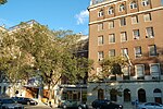
.jpg) Second Avenue and 97th Street as seen from the south in 2019 | |
 Location of East Harlem in New York City | |
| Coordinates: 40°47′55″N 73°56′30″W / 40.79861°N 73.94167°W | |
| Country | |
| State | |
| City | New York City |
| Borough | Manhattan |
| Community District | Manhattan 11[1] |
| Population | |
| • Total | 115,921 |
| Ethnicity | |
| • Hispanic | 52.1% |
| • Black | 35.7% |
| • White (non-Hispanic) | 7.3% |
| • Asian | 2.7% |
| • Other | 0.2% |
| Economics | |
| • Median income | $21,480 |
| Time zone | UTC−5 (Eastern) |
| • Summer (DST) | UTC−4 (EDT) |
| ZIP Codes | 10029, 10035 |
| Area code | 212, 332, 646, and 917 |
East Harlem, also known as Spanish Harlem or El Barrio, is a neighborhood of Upper Manhattan in New York City, north of the Upper East Side and bounded by 96th Street to the south, Fifth Avenue to the west, and the East and Harlem Rivers to the east and north.[3][4][5] Despite its name, it is generally not considered to be a part of Harlem proper, but it is one of the neighborhoods included in Greater Harlem.[6]
The neighborhood has one of the largest Hispanic communities in New York City, mostly Puerto Ricans, as well as Dominicans, Cubans, and Mexicans. The community is notable for its contributions to Latin freestyle and salsa music. East Harlem also includes the remnants of a once predominant Italian community, or Italian Harlem. The Chinese population has increased dramatically in East Harlem since 2000.[7][8][9]
East Harlem has historically suffered from many social issues, such as a high crime rate, the highest jobless rate in New York City, teenage pregnancy, AIDS, drug abuse, homelessness, and an asthma rate five times the national average.[10] It has the second-highest concentration of public housing in the United States, behind Brownsville, Brooklyn.[11] East Harlem is undergoing some gentrification, and in 2016 the city considered rezoning the area.
East Harlem is part of Manhattan Community District 11, and its primary ZIP Codes are 10029 and 10035.[1] It is patrolled by the 23rd and 25th Precincts of the New York City Police Department.[12][13]
History
.jpg)
Early history
The area which became East Harlem was rural for most of the 19th century, but residential settlements northeast of Third Avenue and East 110th Street had developed by the 1860s.[3] The construction of the elevated transit line to Harlem in 1879 and 1880, and the building of the Lexington Avenue subway in 1919,[3] urbanized the area, precipitating the construction of apartment buildings and brownstones. The extension of cable cars up Lexington Avenue into East Harlem was stymied by the incline created by Duffy's Hill at 103rd Street, one of the steepest grades in Manhattan. East Harlem was first populated by poor German, Irish, Scandinavian,[14] and Eastern European Jewish immigrants, with the Jewish population standing at 90,000 around 1917.[3] In the 1870s, Italian immigrants joined the mix after a contractor building trolley tracks on First Avenue imported Italian laborers as strikebreakers. The workers' shantytown along the East River at 106th Street was the beginning of an Italian neighborhood, with 4,000 having arrived by the mid-1880s. As more immigrants arrived, it expanded north to East 115th Street and west to Third Avenue.[15]
East Harlem consisted of pockets of ethnically sorted settlements – Italian, German, Irish, and Jewish – which were beginning to press up against each other, with the spaces still between them occupied by "gasworks, stockyards and tar and garbage dumps".[15] In 1895, the Union Settlement Association, one of the oldest settlement houses in New York City, began providing services in the area, offering the immigrant and low-income residents a range of community-based programs, including boys and girls clubs, a sewing school and adult education classes.


Italian Harlem
Southern Italians and Sicilians, with a moderate number of Northern Italians, soon predominated, especially in the area east of Lexington Avenue between 96th and 116th Streets and east of Madison Avenue between 116th and 125th Streets, with each street featuring people from different regions of Italy. The neighborhood became known as "Italian Harlem", the Italian American hub of Manhattan; it was the first part of Manhattan to be referred to as "Little Italy".[16] The first Italians arrived in East Harlem in 1878, from Polla in the province of Salerno, and settled in the vicinity of 115th Street.[17]
There were many crime syndicates in Italian Harlem from the early Black Hand to the bigger and more organized Italian gangs that formed the Italian-American Mafia. It was the founding location of the Genovese crime family, one of the Five Families that dominated organized crime in New York City.[18] This includes the current 116th Street Crew of the Genovese family. During the 1970s, Italian East Harlem was also home to the Italian-American drug gang and murder-for-hire crew known as the East Harlem Purple Gang.
In the 1920s and early 1930s, Italian Harlem was represented in Congress by future Mayor Fiorello H. La Guardia.[3] After becoming mayor, La Guardia helped plan a large expansion of Thomas Jefferson Park at First Avenue, between 111th and 114th Streets, in the mid-1930s.[19] The neighborhood was represented, in the 1940s, by Italian-American civil rights lawyer, activist, and socialist Vito Marcantonio. The Italian neighborhood approached its peak in the 1930s, with over 110,000 Italian-Americans living in its crowded, run-down apartment buildings.[3] The 1930 census showed that 81 percent of the population of Italian Harlem consisted of first- or second-generation Italian Americans, somewhat less than the concentration of Italian Americans in the Lower East Side's Little Italy with 88 percent; Italian Harlem's total population, however, was three times that of Little Italy.[17]
The fabric of the Italian-American community was torn when, after the Second World War, the unhealthy tenements started to be demolished and replaced with better housing, forcing families to relocate. Despite this, Italian Harlem endured as a large and conspicuous community through the 1980s and 1990s; and even later, the Italian-American community in East Harlem remained strong in certain areas, particularly around Pleasant Avenue.
Today, the few remaining Italian-American residents in Harlem are predominantly older, clustered around Pleasant Avenue and the Our Lady of Mount Carmel Church, mainly from 114th to 118th Streets and the surrounding area. According to the 2000 Census, there were only 1,130 Italian-Americans still living in this area.[20]
However, vestiges of the old Italian neighborhood remain. The annual Feast of Our Lady of Mount Carmel and the "Dancing of the Giglio", the first Italian feast in New York City, is still celebrated there every year on the second weekend of August by the Giglio Society of East Harlem and is centered around Church of Our Lady of Mount Carmel. Italian retail establishments still exist in Italian Harlem, such as Rao's restaurant, started in 1896, and the original Patsy's Pizzeria which opened in 1933. Another major Italian retail businesses in the neighborhood, a barbershop opened by Claudio Caponigro on 116th Street in the mid-1950s, [21] was threatened with closure by a rent increase in May 2011 [22] but ultimately closed only in 2019 when Mr. Caponigro retired.[23]
Spanish Harlem
Puerto Rican and Latin American migration after the First World War[24] established an enclave at the western portion of East Harlem – around 110th Street and Lexington Avenue – which became known as "Spanish Harlem". The area slowly grew to encompass all of East Harlem, including Italian Harlem, as Italians moved out – to the Bronx, Brooklyn, Long Island, upstate New York and New Jersey – and Latinos moved in during another wave of immigration in the 1940s and 1950s.[3]
The newly dominant Puerto Rican population, which reached 63,000 in 1950, continued to define the neighborhood according to its needs, establishing bodegas and botánicas as it expanded; by the 1930s[24] there was already an enclosed street market underneath the Park Avenue railroad viaduct between 111th and 116th Streets, called "La Marqueta" ("The Market").[3] Catholic and evangelistic Protestant churches appeared in storefronts.[3] Although "Spanish Harlem" had been in use since at least the 1930s to describe the Latino enclave – along with "Italian Harlem" and "Negro Harlem"[25] – the name began to be used to describe the entire East Harlem neighborhood by the 1950s. Later, the name "El Barrio" ("The Neighborhood") began to be used, especially by residents of the area.
Decline
In the 1950s and 1960s, large sections of East Harlem were leveled for urban renewal projects, and the neighborhood was one of the hardest hit areas in the 1960s and 1970s as New York City struggled with deficits, race riots, urban flight, gang warfare, drug abuse, crime and poverty. Tenements were crowded, poorly maintained, and frequent targets for arson. In 1969 and 1970, a regional chapter of the Young Lords which were reorganized from a neighborhood street gang in Chicago by Jose (Cha-Cha) Jimenez, ran several programs including a Free Breakfast for Children and a Free Health Clinic to help Latino and poor families. The Young Lords came together with the Black Panthers and called for Puerto Rican independence and neighborhood empowerment.
Recent history
By the beginning of the 21st century, East Harlem was a racially diverse neighborhood, with about a third of the population being Puerto Rican.[3] As it has been throughout its history, it is predominantly a working-class neighborhood.[14]
Until 2006, property values in East Harlem climbed along with those in the rest of New York City, leading to gentrification and changes to area demographics.[26]
On March 12, 2014, at 9:00 EDT, a large explosion and fire at 1644–1646 Park Avenue killed eight people and injured more than 70.[27][28][29]
The New York Post listed one part of the neighborhood – the block of Lexington Avenue between East 123rd and 124th Streets – as one of "the most dangerous blocks in the city" because police crime statistics for 2015 showed that 19 assaults had taken place there, more than for any other city block. The Post also reported that there were, according to the Harlem Neighborhood Block Association, "22 drug-treatment programs, four homeless-services providers and four transitional-living facilities" in East Harlem.[30]
East Harlem has begun to feel the effects of gentrification.[31] In February 2016, an article in The New York Times about "New York's Next Hot Neighborhoods" featured East Harlem as one of four such areas. A real-estate broker described it as "one of the few remaining areas in New York City where you can secure a good deal". The article mentioned new luxury developments, access to transportation, the opening of new retail stores, bars and restaurants, and national-brand stores beginning to appear on the outskirts of the neighborhood. Primarily, though, it was the cost of housing in comparison to the rest of Manhattan, which the article noted as the major factor.[4] Beginning in 2016, the New York City government was seeking to rezone East Harlem "to facilitate new residential, commercial, community facility, and manufacturing development".[32][33] The residents of the neighborhood generated a suggested zoning plan, the "East Harlem Neighborhood Plan", which was offered to the city in February 2017,[34] but in August 2017 residents and the Manhattan Borough President, Gale Brewer, complained that the city had ignored their plan almost entirely.[35]
In 2019, the oldest portion of the neighborhood, the blocks of East 111th through 120th Streets between Park and Pleasant Avenues, was listed on the National Register of Historic Places as the East Harlem Historic District.[36]
Demographics

The New York City Department of City Planning classifies East Harlem into two neighborhood tabulation areas: East Harlem North and East Harlem South, divided along 115th Street.[37] The two areas had a combined population of 115,921, an increase of 1,874 (1.4%) from the combined 114,047 in the 2000 Census.[2]
Based on data from the 2010 United States Census, the population of East Harlem North was 58,019, an increase of 871 (1.5%) from the 57,148 counted in 2000. Covering an area of 573.94 acres (232.27 ha), the neighborhood had a population density of 101.1/acre (64,700/sq mi; 25,000/km2).[2] The racial makeup of the neighborhood was 6.8% (3,936) White, 35.5% (20,625) African American, 0.2% (128) Native American, 3.0% (1,766) Asian, 0.0% (9) Pacific Islander, 0.3% (185) from other races, and 1.3% (769) from two or more races. Hispanic or Latino of any race were 52.7% (30,601) of the population.[38]
Based on data from the 2010 Census, the population of East Harlem South was 57,902, an increase of 1,003 (1.8%) from the 56,899 counted in 2000. Covering an area of 389.41 acres (157.59 ha), the neighborhood had a population density of 148.7/acre (95,200/sq mi; 36,700/km2).[2] The racial makeup of the neighborhood was 17.4% (10,072) White, 24.6% (14,227) African American, 0.2% (96) Native American, 8.3% (4,802) Asian, 0.1% (55) Pacific Islander, 0.4% (218) from other races, and 1.6% (933) from two or more races. Hispanic or Latino of any race were 47.5% (27,499) of the population.[38]
The most significant changes in the racial composition of East Harlem between 2000 and 2010 were the Asian population's increase by 109% (3,427), the White population's increase by 68% (5,689), and the Black population's decrease by 12% (4,625). Although more of the influx of Asian and White residents was in East Harlem South, the greatest percentage growth was in East Harlem North, while the Black population's decrease was evenly split. The Hispanic/Latino population also decreased by 4% (2,485), a decrease almost entirely concentrated in East Harlem South, where it fell from being the majority group to the plurality group. The small population of other races experienced a slight increase of 5% (132).[39]
The entirety of Manhattan Community District 11, which consists of East Harlem, Randall's Island, and Ward's Island, had 124,323 inhabitants as of NYC Health's 2018 Community Health Profile, with an average life expectancy of 77.3 years.[40]: 2, 20 This is 3.9 years lower than the median life expectancy of 81.2 for all New York City neighborhoods.[41]: 53 (PDF p. 84) Most residents are children and middle-aged adults: 21% are between the ages of 0–17, while 33% are between 25 and 44, and 23% are between 45 and 64. The ratio of college-aged and elderly residents was lower, at 10% and 13% respectively.[40]: 2
As of 2017, the median household income in Community District 11 was $36,770.[42] In 2018, an estimated 23% of Community District 11 residents lived in poverty, compared to 14% in all of Manhattan and 20% in all of New York City. One in nine residents (11%) were unemployed, compared to 7% in Manhattan and 9% in New York City. Rent burden, or the percentage of residents who have difficulty paying their rent, is 48% in Community District 11, compared to the boroughwide and citywide rates of 45% and 51% respectively. Based on this calculation, as of 2018[update], Community District 11 is considered to be gentrifying: according to the Community Health Profile, the district was low-income in 1990 and has seen above-median rent growth up to 2010.[40]: 7
In the 2020 census report, East Harlem's demographics were separated into north and south parts. North East Harlem had between 30,000 and 39,999 Hispanic residents, 20,000 to 29,999 Black residents, 5,000 to 9,999 White residents, and less than 5000 Asian residents. Meanwhile, South East Harlem was more racially diverse with 20,000 to 29,999 Hispanic residents, 10,000 to 19,999 Black residents, 10,000 to 19,999 white residents, and 5,000 to 9,999 Asian residents.[43][44]
Ethnic groups
Community District 11 is a mostly low to middle income area. It is made up of first and second generation Puerto Ricans, Dominican Americans, Cuban Americans, African-Americans, Italian-Americans, Asian-Americans, Caribbean Americans and a growing population of Mexican Americans and Salvadoran Americans and other Central American immigrants. It has one of the highest concentrations of Puerto Ricans in all of New York City.[1] As of 2010, the Puerto Rican population was 27.7% in zip code 10029,[45] and 23.4% in 10035. 10035 also has a large Mexican population, at 10.7%.[46]
As noted before, the number of Asians in East Harlem more than doubled between 2000 and 2010, largely due to Chinese people moving to East Harlem. Increasing rents in Lower Manhattan's Chinatown have driven many into public and subsidized housing developments in the neighborhood. Advocates have been calling for Chinese language services to be available in the community centers to accommodate the growing number of Chinese residents in the area. In 2000, the Chinese population in the northern portion was less than one percent, but by 2010, it has gone up to being three percent in the area. In the southern part, it rose from 4.6% to 8.4%.[7][8][9]
Social issues
Social problems, including concentrated poverty, homelessness, overcrowding, substandard housing, language barriers, food insecurity, teen pregnancy, obesity, crime, drug addiction, dropping out of school, and low rates of advanced educational attainment, have long plagued the area. Although crime rates have dropped from the historically high numbers of the crack epidemic, East Harlem suffers from a high violent crime rate, especially in the 25th Precinct above 115th Street. In 2021, the 25th Precinct had the second-highest rates of felony assault and robbery, the sixteenth-highest rate of rape, and the highest rate of murder out of the New York Police Department's 77 precincts.[47]
East Harlem has the highest concentration of shelters and facilities in Manhattan, with eight homeless shelters, 36 drug and alcohol treatment facilities and 37 mental health treatment facilities. It also has the highest jobless rate in the entire city, as well as the city's second highest cumulative AIDS rate. The asthma rate is also five times higher than national levels.[10] The neighborhood also suffers from a high poverty rate.[48] Union Settlement Association is one of the neighborhood's largest social service agencies, reaching more than 13,000 people annually at 17 locations throughout East Harlem, through a range of programs, including early childhood education, youth development, senior services, job training, the arts, adult education, nutrition, counseling, a farmers' market, community development, and neighborhood cultural events.
Housing


East Harlem is dominated by public housing complexes of various types, with a high concentration of older tenement buildings between these developments. The neighborhood contains the second-highest concentration of public housing in the United States, behind Brownsville, Brooklyn.[11] The total land area is 1.54 sq mi (4.0 km2).[49][50]
After a wave of arson ravaged the low income communities of New York City throughout the 1970s, many of the residential structures in East Harlem were left seriously damaged or destroyed. By the late 1970s, the city began to rehabilitate many abandoned tenement style buildings and designate them as low income housing. Despite recent gentrification of the neighborhood, large numbers of apartment buildings have been deliberately kept vacant by their owners. Although the businesses on the ground floor are retained, landlords do not want to have the trouble involved in residential tenants. In some cases, landlords are waiting for a revived economy, warehousing the apartments so that they can rent them later at a higher rent.[51]
In 2007, a survey of Manhattan's buildings found that 1,723 were significantly vacant, three-quarters of them north of 96th Street. A 1998 survey found that one-quarter of low-rise residential buildings on avenues or major cross streets in East Harlem had sealed-up residential floors, despite having commercial businesses on the ground floor.[51]
Public housing projects
There are 24 New York City Housing Authority developments located in East Harlem.[52] As of 2013, 93.6% of all housing units were renter-occupied, and over 25% of the population resided in public housing units managed by the NYCHA.[10]
- 335 East 111th Street; one 6-story building
- East 120th Street Rehab; one, 6-story rehabilitated tenement building
- East River Houses; 10 buildings, 6, 10 and 11 stories tall
- Edward Corsi Houses; one 16-story building
- Gaylord White Houses; one 20-story building
- George Washington Carver Houses; 13 buildings, 6 and 15 stories tall
- Governor Dewitt Clinton Houses; six buildings, 9 and 18 stories tall
- Jackie Robinson Houses; one 8-story building
- James Weldon Johnson Houses; 10 14-story buildings
- Lehman Village; four 20-story buildings
- Lexington Houses; four 14-story buildings
- Metro North Plaza; three buildings, 7, 8, and 11 stories tall
- Metro North Rehab; 17 6-story rehabilitated tenement buildings
- Milbank-Frawley; two rehabilitated tenement buildings 5 and 6 stories tall
- Morris Park Senior Citizens Home; one 9-story rehabilitated building
- Park Avenue-East 122nd Street, 123rd Streets; two 6-story buildings
- President Abraham Lincoln; 14 buildings, 6 and 14 stories tall
- President George Washington Houses; 14 buildings, 12 and 14 stories tall
- President Thomas Jefferson Houses; 18 buildings, 7, 13 and 14 stories tall
- President Woodrow Wilson Houses; three 20-story buildings
- Senator Robert A. Taft; nine 19-story buildings
- Robert F. Wagner Houses; 22 buildings, 7 and 16 stories tall
- U.P.A.C.A. (Upper Park Avenue Community Association) Site 6; one 12-story building
- U.P.A.C.A. (Upper Park Avenue Community Association) U.R.A. Site 5; one 11-story building
Other residential developments
Other subsidized housing includes:
- Taino Towers – East 122nd Street and Third Avenue. Four 35-story towers, 656 apartments. Opened 1979.[53]
- A new 68-story rental tower at 321 East 96th Street was approved in August 2017.[54] The 1,300,000 sq ft (120,000 m2) building, which is currently the site of the School of Cooperative Technical Education, would house three schools and retail space along with a mix of 1,100 affordable and market-rate apartments.[55]
Economy
The neighborhood is home to one of the few major television studios north of midtown,[56] Metropolis at 106th Street and Park Avenue,[57] where shows such as BET's 106 & Park[58] and Chappelle's Show[59] have been produced. PRdream.com, a web site on the history and culture of Puerto Ricans, founded a media gallery and digital film studio called MediaNoche in 2003. It presents technology-based art on Park Avenue and 102nd Street, providing exhibition space and residencies for artists and filmmakers, and webcasting events.
Police and crime

East Harlem is served by two precincts of the NYPD.[60][61] The area north of 116th Street is served by the 25th Precinct, located at 120 East 119th Street,[12] while the area south of 116th Street is served by the 23rd Precinct, located at 164 East 102nd Street.[13]
The 25th Precinct has a lower crime rate than in the 1990s, with crimes across all categories having decreased by 62.1% between 1990 and 2021. The precinct reported 16 murders, 12 rapes, 242 robberies, 382 felony assaults, 108 burglaries, 401 grand larcenies, and 66 grand larcenies auto in 2012.[62] Of the five major violent felonies (murder, rape, felony assault, robbery, and burglary), the 25th Precinct had a rate of 1,340 crimes per 100,000 residents in 2019, compared to the boroughwide average of 632 crimes per 100,000 and the citywide average of 572 crimes per 100,000.[63][64][65]
The 23rd Precinct also has a lower crime rate than in the 1990s, with crimes across all categories having decreased by 69.7% between 1990 and 2021. The precinct reported 8 murders, 16 rapes, 189 robberies, 366 felony assaults, 109 burglaries, 383 grand larcenies, and 60 grand larcenies auto in 2021.[66] Of the five major violent felonies (murder, rape, felony assault, robbery, and burglary), the 23rd Precinct had a rate of 819 crimes per 100,000 residents in 2019, compared to the boroughwide average of 632 crimes per 100,000 and the citywide average of 572 crimes per 100,000.[63][64][65]
As of 2018[update], Community District 11 has a non-fatal assault hospitalization rate of 130 per 100,000 people, compared to the boroughwide rate of 49 per 100,000 and the citywide rate of 59 per 100,000. Its incarceration rate is 1,291 per 100,000 people, compared to the boroughwide rate of 407 per 100,000 and the citywide rate of 425 per 100,000.[40]: 8
In 2019, the highest concentration of felony assaults in East Harlem was around the intersection of 125th Street and Lexington Avenue, where there were 39 felony assaults. This location is well known as an open-air drug market and hotspot of other crimes.[67] The highest concentration of robberies, on the other hand, was around the intersection of 116th Street and Third Avenue, where there were 21 robberies.[63] The Willis Avenue Bridge which connects East Harlem to the Mott Haven section of the Bronx has long been a hotspot for robbery.[68][69]
Fire safety
East Harlem is served by four New York City Fire Department (FDNY) fire stations:[70]
- Engine Company 35/Ladder Company 14/Battalion 12 – 2282 Third Avenue[71]
- Engine Company 53/Ladder Company 43 – 1836 Third Avenue[72]
- Engine Company 58/Ladder Company 26 – 1367 Fifth Avenue[73]
- Engine Company 91 – 242 East 111th Street[74]
Health

As of 2018[update], preterm births and births to teenage mothers in East Harlem are higher than the city average. In East Harlem, there were 108 preterm births per 1,000 live births (compared to 87 per 1,000 citywide), and 10.8 teenage births per 1,000 live births (compared to 19.3 per 1,000 citywide), though the teenage birth rate was based on a small sample size.[40]: 11 East Harlem has a low population of residents who are uninsured. In 2018, this population of uninsured residents was estimated to be 3%, slightly less than the citywide rate of 12%, though this was based on a small sample size.[40]: 14
The concentration of fine particulate matter, the deadliest type of air pollutant, in East Harlem is 0.0082 mg/m3 (8.2×10⁻⁹ oz/cu ft), more than the city average.[40]: 9 Eighteen percent of East Harlem residents are smokers, which is more than the city average of 14% of residents being smokers.[40]: 13 In East Harlem, 28% of residents are obese, 17% are diabetic, and 34% have high blood pressure—compared to the citywide averages of 24%, 11%, and 28% respectively.[40]: 16 In addition, 23% of children are obese, compared to the citywide average of 20%.[40]: 12
Eighty-four percent of residents eat some fruits and vegetables every day, which is lower than the city's average of 87%. In 2018, 76% of residents described their health as "good", "very good", or "excellent", less than the city's average of 78%.[40]: 13 For every supermarket in East Harlem, there are 17 bodegas.[40]: 10
Metropolitan Hospital Center and Mount Sinai Hospital are both located in southern East Harlem. North General Hospital, which formerly served the area as well, is now closed.[75][76] In addition, FDNY EMS Station 10 is located close to Metropolitan Hospital Center.
Fresh food

A lack of access to healthy food causes serious hardships to citizens of East Harlem, a neighborhood which is considered to be a food desert. According to an April 2008 report prepared by the New York City Department of City Planning, East Harlem is an area of the city with the highest levels of diet-related diseases due to limited opportunities for citizens to purchase fresh foods.[77]
With a high population density and a lack of nearby supermarkets, the neighborhood has little access to fresh fruit and vegetables and a low consumption of fresh foods. Citizens of East Harlem are likely to buy food from grocery stores that have a limited supply of fruits and vegetables, which are often of poor quality and generally more expensive than the same products sold at supermarkets. Compared to the Upper East Side, supermarkets in Harlem are 30% less common.[78] Without access to affordable produce and meats, East Harlem residents have difficulty eating a healthy diet, which contributes to high rates of obesity and diabetes.[79]
In 2011, Manhattan Borough President Scott Stringer announced a program which would send Veggie Vans to East Harlem senior centers and housing projects.[80] In 2012, Whole Foods announced two uptown locations, one being on 125th Street and Lenox Avenue, the other in the Upper East Side.[81] In 2010, Aldi's Grocery opened at the East River Plaza[82] located at E. 117th St. and the FDR Drive, providing access to affordable food for East Harlem's residents. In 2013, a new Super FI Emperior Grocery store opened up in East Harlem on 103rd Street and Lexington Avenue.[83]
Post offices and ZIP Codes
East Harlem is located in two primary ZIP Codes. The area south of 116th Street is part of 10029 and the area north of 116th Street is part of 10035. The extreme northwestern portion of East Harlem is also located in 10037.[84] The United States Postal Service operates two post offices near East Harlem:
- Hellgate Station – 153 East 110th Street[85]
- Triborough Finance New Station – 118 East 124th Street[86]
Education

East Harlem generally has a lower rate of college-educated residents than the rest of the city as of 2018[update]. While 38% have a college education or higher, 25% have less than a high school education and 37% are high school graduates or have some college education. By contrast, 64% of Manhattan residents and 43% of city residents have a college education or higher.[40]: 6 The percentage of East Harlem students excelling in math rose from 25% in 2000 to 51% in 2011, and reading achievement increased from 33% to 39% during the same time period.[87]
East Harlem's rate of elementary school student absenteeism is higher than the rest of New York City. In East Harlem, 30% of elementary school students missed twenty or more days per school year, more than the citywide average of 20%.[41]: 24 (PDF p. 55) [40]: 6 Additionally, 67% of high school students in East Harlem graduate on time, less than the citywide average of 75%.[40]: 6
As in other parts of the city, some schools require students pass through metal detectors and swipe ID cards to enter school buildings.[88]
Schools
The New York City Department of Education operates public schools in East Harlem as part of Community School District 2. The following public elementary schools are located in East Harlem:
|
|
The following public middle schools are located in East Harlem:
- Esperanza Preparatory Academy (grades 6–12)[110]
- Isaac Newton MS For Math And Science (grades 6–8)[111]
- MS 224 Manhattan East School For Arts And Academy (grades 6–8)[112]
- Renaissance School of the Arts (grades 6–8)[113]
- Young Women's Leadership School, East Harlem (grades 6–12)[114]
The following public high schools are located in East Harlem:
- Harlem Renaissance High School (grades 9–12)[115]
- Manhattan Center for Science and Mathematics (grades 9–12)[116] – replaced Benjamin Franklin High School, a school which had the smallest graduating class in the city at the time of its closing.[117]
- PS 79 Horan School (grades 6–12)[118]
- The Heritage School (grades 9–12)[119]
The public charter schools in East Harlem include:
- Success Academy Harlem 2 of Success Academy Charter Schools (grades K–8)[120]
- Harlem Village Academy (grades K–9)[121]
- East Harlem Scholars Academies (grades PK–8)[122]
- Dream Charter School (grades PK–8)[123]
St. Cecilia's School in East Harlem was closed by the Roman Catholic Archdiocese of New York – which operates Catholic schools in Manhattan and the Bronx – in 1991.[124]
Libraries

The New York Public Library (NYPL) operates two branches in East Harlem:
- The Aguilar branch is located at 174 East 110th Street. The three-story Carnegie library opened in 1903 and was renovated in 1996. It is named for the author Grace Aguilar.[125]
- The 125th Street branch is located at 224 East 125th Street. The two-story Carnegie library opened in 1901 and was renovated in 2001.[126]
Two additional NYPL branches are located nearby. The 96th Street branch is located at 112 East 96th Street, at the border with the Upper East Side,[127] while the Harlem branch is located at 9 West 124th Street, near the border with Harlem.[128]
Transportation


The Harlem River separates the Bronx and Manhattan, necessitating several spans between the two New York City boroughs. Three free bridges connect East Harlem and the Bronx: the Willis Avenue Bridge (for northbound traffic only), Third Avenue Bridge (for southbound traffic only), and Madison Avenue Bridge. In East Harlem, the Wards Island Bridge, also known as the 103rd Street Footbridge, connects Manhattan with Wards Island. The Triborough Bridge (officially the Robert F. Kennedy Bridge) is a complex of three separate bridges that offers connections between Queens, East Harlem, and the Bronx.[129]
Public transportation service is provided by the Metropolitan Transportation Authority. The New York City Subway's IRT Lexington Avenue Line runs through East Harlem, with an express station at 125th Street (served by the 4, 5, 6, and <6> routes) as well as local stations at the 116th Street, 110th Street, 103rd Street, and 96th Street (served by the 6 and <6> routes). There is also a Second Avenue Subway station at 96th Street on the Q route.[130] MTA Regional Bus Operations' M15, M15 SBS, M35, M60 SBS, M96, M98, M101, M102, M103, M106, M116 and M125 bus routes serve East Harlem as well.[131] Metro-North Railroad has a commuter rail station at Harlem–125th Street, serving trains to the Lower Hudson Valley and Connecticut.[132]
Notable people


.jpg)


- Jack Agüeros (1934–2014), community activist, poet, writer, translator, and the former director of El Museo del Barrio.[133]
- Petra Allende (1920–2002), community activist[134]
- Marc Anthony (born 1968), singer[135][136]
- Frankie Cutlass (born 1971), DJ and record producer.[137]
- Arcángel (born 1985), reggaeton singer[138]
- ASAP Rocky (born 1988), rapper[139]
- Ray Barretto (1929–2006), musician[140]
- Joe Bataan (born 1942), singer[141]
- Walter Berry (born 1964), former professional NBA basketball player.[142]
- Mario Biaggi (1917-2015), decorated policeman and US Congressman[143]
- Frank Bonilla (1925–2010), academic of Puerto Rican descent; leading figure in Puerto Rican studies.[144]
- Joe Budden (born 1980), rapper and member of hip hop group Slaughterhouse.[145]
- Cam'ron (born 1976), rapper[146]
- Duke Carmel (1937–2021), former professional baseball player who played all or part of four seasons in Major League Baseball.[147]
- Daniel Celentano (1902–1980), artist[148]
- Frank Costello (1891–1973), mobster[149]
- Leonard Covello (1887–1982), educator, founder and first principal of Benjamin Franklin High School[3][150]
- Bobby Darin (1936–1973), singer[151]
- Julia de Burgos (1914–1953), poet[152]
- James De La Vega (c. 1974), visual artist best known for his street aphorisms and muralist art.[153]
- Angelo Del Toro (1947–1994), politician[154]
- Nelson Antonio Denis, New York State Assemblyman[155]
- Dave East (born 1988), rapper[156]
- Erik Estrada (born 1949), actor.[157]
- Destiny Frasqueri (born 1992), rapper who performs under the stage name "Princess Nokia"[158]
- Giosue Gallucci (1865–1915), gangster[159]
- Joan Hackett (1934–1983), actress who appeared on television, film and stage.[160]
- Langston Hughes (1901–1967), writer and social activist[161]
- Jose Cha Cha Jimenez (born 1948), founder of the Young Lords[162]
- Jim Jones (born 1976), rapper[163]
- Roger Katan, architect, planner, sculptor, and activist.[164]
- DJ Kay Slay (born 1966), hip hop disc jockey[165]
- Fiorello H. La Guardia (1882–1947), Congressman and mayor of New York City[3]
- Burt Lancaster (1913–1994), actor and film producer[166]
- Lillian López (1925–2005), activist and librarian[167]
- Tommy Lucchese (1899–1967), mobster[168]
- Lumidee (born 1984), rapper[169]
- Machito (1908–1984), musician[170]
- Vito Marcantonio (1902–1954), lawyer and politician[3]
- Alpo Martinez (born 1966), former drug dealer who rose to prominence alongside Azie Faison and Rich Porter in the mid-1980s in Harlem during the War on Drugs.[171]
- Soraida Martinez (born 1956), artist and designer[172]
- Thomas Minter (1924–2009), education official who served in the United States government and the government of New York City.[173]
- Monifah (born 1972), R&B singer-songwriter[174]
- Edward Mosberg (1926-2022), Polish-American Holocaust survivor, educator, and philanthropist[175]
- Alice Neel (1900–1984), painter[176][177]
- Dael Orlandersmith, actress, poet and playwright known for her Obie Award-winning Beauty's Daughter and the 2002 Pulitzer Prize Finalist in Drama, Yellowman.[178]
- Al Pacino (born 1940), actor[179]
- Tito Puente (1923–2000), musician[180]
- Ernesto Quiñonez (born 1969), writer[181]
- Anthony Salerno (1911–1992), mobster[182]
- Jonas Salk (1914-1995), virologist who developed polio vaccine[183]
- Ray Santos (1928–2019), Grammy Award-winning Latin musician.[184]
- Tupac Shakur (1971–1996), rapper and actor[185]
- Gregory Sierra (1937–2021), actor known for his roles as Detective Sergeant Chano Amengual on Barney Miller and as Julio Fuentes, the Puerto Rican neighbor of Fred G. Sanford on Sanford and Son.[186]
- Ronnie Spector (1943–2021) and the Ronettes, singers[187]
- Piri Thomas (1928–2011), writer[188]
- Joseph Valachi (1904–1971), gangster, notable as the first member of the Italian-American Mafia to publicly acknowledge its existence, and credited with popularization of the term Cosa Nostra.[189]
- Marilyn Zayas (born 1965), judge who became the first Latina on the Ohio District Courts of Appeals when she was elected in 2016.[190]
In popular cultureedit
Music
- Ben E. King's song, "Spanish Harlem" (1961) and the 1966 cover of it by The Mamas & the Papas[191]
- Bob Dylan's song "Spanish Harlem Incident" from his album Another Side of Bob Dylan (1964)[192]
- Phil Ochs' song "Lou Marsh" from his album All the News That's Fit to Sing (1964)
- Louie Ramirez's song "Lucy's Spanish Harlem" from his album In the Heart of Spanish Harlem (1967)
- The Velvet Underground's song I'm Waiting for the Man (1967)[193]
- Elton John's "Mona Lisas and Mad Hatters" from Honky Château (1972)
- Paul Simon's song "Adios Hermanos" from his album Songs from The Capeman (1997)
- Cocoa Brovaz, Tony Touch & Hurricane G's song, "Spanish Harlem" (1997)
- Van Morrison's song "Contemplation Rose" from his anthology album "Philosopher's Stone" (1998)[194]
- Carlos Santana's songs "Maria Maria" and "Smooth" from his album Supernatural (1999)
- Beirut's song, "East Harlem" (2011)
- Edward W. Hardy's composition Flying (Dancing in Spanish Harlem) for Latin ensemble, alternative version for string quartet (2019)[195][196]
Literature
- Piri Thomas's memoir Down These Mean Streets (1967)[197]
- Ernesto Quiñonez's Spanish Harlem Trilogy, Bodega Dreams (2000), Chango's Fire (2005), Taina (2019)
- Salvatore Mondello's novel A Sicilian in East Harlem (2005)
- Nora Roberts's novel Salvation in Death (2008)
Film
- The film Popi (1969), written by Tina Pine and Lester Pine and directed by Arthur Hiller
- Nelson Denis's film Vote For Me! (2003)
Music videos
- Frankie Cutlass's "Puerto Rico" music video was shot in Spanish Harlem (1994)
- Jay-Z's "Death of Autotune" music video was shot inside Rao's Italian restaurant (2009)
- ASAP Rocky's "Peso" music video features footage of East Harlem (2011)
Galleryedit
-

-
 Julia de Burgos Latino Cultural Center, formerly P.S. 72
(1680 Lexington Ave.) -
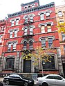
-
 El Museo del Barrio
(1230 Fifth Ave.) -

-
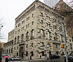
 Hope Community Hall, formerly the 28th Precinct Station house
(177 East 104th St.) -
-

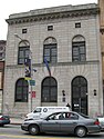
-
 All Saints Roman Catholic Church
(47 East 129th St.) -
 Church of the Living Hope
(161 East 104th St.) -
 Greater Emmanuel Baptist Church
(325 East 118th St.) -
 Hellenic Orthodox Church of Sts. George and Demetrios
(140 East 103rd St.)


Referencesedit
Notesedit
- ^ a b c "NYC Planning | Community Profiles". communityprofiles.planning.nyc.gov. New York City Department of City Planning. Retrieved March 18, 2019.
- ^ a b c d Table PL-P5 NTA: Total Population and Persons Per Acre – New York City Neighborhood Tabulation Areas*, 2010 Archived June 10, 2016, at the Wayback Machine, Population Division – New York City Department of City Planning, February 2012. Accessed June 16, 2016.
- ^ a b c d e f g h i j k l m Lapp, Michael "East Harlem" in Jackson, Kenneth T., ed. (2010). The Encyclopedia of New York City (2nd ed.). New Haven: Yale University Press. p. 391. ISBN 978-0-300-11465-2. Quote: "During the 1930s as many as 110,000 Italians lived east of Lexington Avenue between 96th and 116th streets and east of Madison Avenue between 116th and 125th streets."
- ^ a b Higgins, Michelle (February 26, 2016) "New York's Next Hot Neighborhoods" Archived September 29, 2017, at the Wayback Machine. The New York Times.
- ^ "El Barrio (Spanish Harlem) New York City.com : Visitor Guide : Editorial Review". Nyc.com. Retrieved September 19, 2012.
- ^ Gurock, Jeffrey S., et al. "Harlem" in Jackson, Kenneth T., ed. (2010). The Encyclopedia of New York City (2nd ed.). New Haven: Yale University Press. ISBN 978-0-300-11465-2., p. 573.
- ^ a b Mays, Jeff (August 3, 2011). "East Harlem Tries to Serve Huge Influx of Chinese Residents". DNAinfo. Archived from the original on February 24, 2013. Retrieved September 19, 2012.
- ^ a b Barron, Laignee (August 8, 2011). "Chinese population climbs 200% in Harlem and East Harlem over 10 yrs". New York Daily News. Retrieved September 19, 2012.
- ^ a b "Chinese American Population in Harlem NYC Surges". apaforprogress.org. Archived from the original on November 9, 2013. Retrieved September 19, 2012.
- ^ a b c "Community District Needs" (PDF). Archived from the original (PDF) on March 17, 2013. Retrieved September 19, 2012.
- ^ a b Mays, Jeff (April 14, 2011). "Low-Income Parents Worry Cuts to Childcare Will Force Them Out of Work – DNAinfo.com New York". Dnainfo.com. Archived from the original on October 8, 2012. Retrieved September 19, 2012.
- ^ a b "NYPD – 25th Precinct". www.nyc.gov. New York City Police Department. Retrieved October 3, 2016.
- ^ a b "NYPD – 23rd Precinct". www.nyc.gov. New York City Police Department. Retrieved October 3, 2016.
- ^ a b White, Norval; Willensky, Elliot; Leadon, Fran (2010). AIA Guide to New York City (5th ed.). New York: Oxford University Press. p. 548. ISBN 978-0-19538-386-7.
- ^ a b Burrows, Edwin G. and Wallace, Mike (1999). Gotham: A History of New York City to 1898. New York: Oxford University Press. ISBN 0-195-11634-8., p.1123-24
- ^ Nevius, Michelle & Nevius, James (2009), Inside the Apple: A Streetwise History of New York City, New York: Free Press, ISBN 141658997X p.154
- ^ a b Meyer, Gerald. "Italian Harlem: America's Largest and Most Italian Little Italy" Archived August 12, 2014, at the Wayback Machine
- ^ "Genovese Crime Family-One of the "Five Families"". American Mafia History. May 6, 2012. Retrieved September 19, 2012.
- ^ "Thomas Jefferson Park Highlights". New York City Department of Parks and Recreation. Retrieved January 11, 2021.
- ^ Garland, Sarah. "A Reunion of Little Italy in East Harlem" Archived July 30, 2017, at the Wayback Machine, The New York Times, September 5, 2006. Accessed January 2, 2008. "Now, there are only 1,130 Italian-Americans left in East Harlem, according to the 2000 census."
- ^ Berger, Joseph (November 11, 2002). "Sit in This Chair, Go Back in Time; Barber Is Unchanged as Old Neighborhood Vanishes". The New York Times. p. 1. Retrieved May 28, 2011.
- ^ Berger, Joseph (May 13, 2011). "East Harlem Rent Tripling, Barber May Have to Close Shop After 60 Years". The New York Times. Retrieved May 13, 2011.
- ^ "New York Secretary of State Robert J. Rodriguez Issues Proclamation to Legendary Barber and Promotes Career Opportunities".
- ^ a b Federal Writers' Project (1939). New York City Guide. New York: Random House. ISBN 978-1-60354-055-1. (Reprinted by Scholarly Press, 1976; often referred to as WPA Guide to New York City.). p. 265-268
- ^ Federal Writers' Project (1939). New York City Guide. New York: Random House. ISBN 978-1-60354-055-1. (Reprinted by Scholarly Press, 1976; often referred to as WPA Guide to New York City.), p.253
- ^ "Yuppies Are Moving into Notorious East Harlem". Business Insider. November 20, 2013. Retrieved November 20, 2013.
- ^ "New York Gas Explosion Kills Six People" Sky News (March 13, 2014)
- ^ Alcindor, Yamiche and Stanglin, Doug. "8th body found in ruins of East Harlem buildings" Archived September 29, 2017, at the Wayback Machine USA Today (March 13, 2014)
- ^ Santora, Marc (March 12, 2014). "At Least 3 Killed in Gas Blast on East Harlem Block; 2 Buildings Leveled". The New York Times. Retrieved March 12, 2014.
- ^ Balsamini, Dean (March 6, 2016) "Do you live on one of New York's most dangerous blocks?" Archived September 14, 2020, at the Wayback Machine New York Post
- ^ Daniel Goodman (September 9, 2013). "New York's East Harlem: Neighborhood Fighting To Keep Its Culture In The Face Of Gentrification". Business Insider. Retrieved April 12, 2016.
- ^ Staff (November 10, 2016) "East Harlem Scoping Notification" Archived March 1, 2017, at the Wayback Machine New York City Department of City Planning
- ^ "Scoping Documents Environmental Review – DCP". www1.nyc.gov.
- ^ "East Harlem Neighborhood Plan". www.eastharlemplan.nyc.
- ^ Solis, Gustavo (August 24, 2017) "Mayor Ignoring Residents in East Harlem Rezoning Plan, Boro Prez Says" Archived September 7, 2017, at the Wayback Machine DNAinfo
- ^ "Weekly List 20190712". U.S. National Park Service. July 12, 2019. Retrieved July 15, 2019.
- ^ New York City Neighborhood Tabulation Areas*, 2010 Archived November 29, 2018, at the Wayback Machine, Population Division - New York City Department of City Planning, February 2012. Accessed June 16, 2016.
- ^ a b Table PL-P3A NTA: Total Population by Mutually Exclusive Race and Hispanic Origin – New York City Neighborhood Tabulation Areas*, 2010 Archived June 10, 2016, at the Wayback Machine, Population Division – New York City Department of City Planning, March 29, 2011. Accessed June 14, 2016.
- ^ "Race / Ethnic Change by Neighborhood" (Excel file). Center for Urban Research, The Graduate Center, CUNY. May 23, 2011. Retrieved March 19, 2020.
- ^ a b c d e f g h i j k l m n o "East Harlem (Including East Harlem, Randalls Island and Wards Island)" (PDF). nyc.gov. NYC Health. 2018. Retrieved March 2, 2019.
East Harlem's average life expectancy is 3.9 years shorter than NYC overall. - 77.3 Life Expectancy
- ^ a b "2016-2018 Community Health Assessment and Community Health Improvement Plan: Take Care New York 2020" (PDF). nyc.gov. New York City Department of Health and Mental Hygiene. 2016. Retrieved September 8, 2017.
- ^ "NYC-Manhattan Community District 11--East Harlem PUMA, NY". Archived from the original on March 25, 2019. Retrieved July 17, 2018.
- ^ Staff (August 2021) "2020 Census Results for New York City: Key Population & Housing Characteristics" Archived September 25, 2021, at the Wayback Machine City of New York Department of City Planning
- ^ Keefe, John; Wolfe, Daniel; and Hernandez, Sergio (August 21, 2021) "Race and ethnicity across the nation" Archived October 4, 2021, at the Wayback Machine CNN
- ^ "2010 Census, /zip-code/10029/10029". Retrieved April 3, 2016.
- ^ "2010 Census, /zip-code/10035/10035". Retrieved April 3, 2016.
- ^ "NYC Crime Map". www.nyc.gov. New York Police Department. Retrieved March 21, 2020.
- ^ "Archived copy". Archived from the original on June 27, 2008. Retrieved March 6, 2008.
{{cite web}}: CS1 maint: archived copy as title (link) - ^ "Manhattan Community Board 11" (PDF). nyc.gov. New York City Department of Planning. December 2007. Archived from the original (PDF) on September 28, 2013. Retrieved January 3, 2009.
- ^ "Census Tract 240". United States Census Bureau. US Census Bureau. Retrieved January 3, 2009.
- ^ a b "East Harlem Landlords Keep Apartments Sealed Up". The New York Times. October 31, 2011. Retrieved October 31, 2011.
- ^ "NYCHA". Nyc.gov. Archived from the original on May 25, 2015. Retrieved September 19, 2012.
- ^ Baldwin, Susan, "Taino: 'Dream' Housing For Poor Set To Open: From 30 years ago: Long in the making, a unique subsidized housing project finally opened its doors" Archived December 13, 2010, at the Wayback Machine, City Limits, January 5, 2009. This includes the original article: Baldwin, Susan, "Taino: 'Dream' Housing For Poor Set To Open", City Limits, February 1979, Vol. 4, No. 2
- ^ "City Council committee OKs AvalonBay's 673-foot East Harlem tower". The Real Deal New York. August 10, 2017. Retrieved March 25, 2019.
- ^ Walker, Ameena (March 23, 2017). "68-story rental tower approved by East Harlem's community board". Curbed NY. Retrieved March 24, 2017.
- ^ "NYC Studios and Stages". NYC.gov. City of New York. Retrieved June 14, 2017.
- ^ "NEP Metropolis Studio". NEP, Inc. NEP Group, Inc. Archived from the original on June 11, 2017. Retrieved June 14, 2017.
- ^ Furman, Phyllis (July 5, 2000). "BET Taking its Show to 106th & Park". NYDailyNews.com. Retrieved June 14, 2017.
- ^ "Dave Chapelle Free TV Show Tickets in New York City". New York Show Tickets. New York Show Tickets Inc. Archived from the original on September 29, 2017. Retrieved June 14, 2017.
- ^ "Find Your Precinct and Sector - NYPD". www.nyc.gov. Retrieved March 3, 2019.
- ^ Feeney, Michael J. (May 11, 2012). "Plea for peace in East Harlem". New York Daily News. Retrieved September 19, 2012.
- ^ "25th Precinct CompStat Report" (PDF). www.nyc.gov. New York City Police Department. Retrieved March 20, 2020.
- ^ a b c "NYC Crime Map". www.nyc.gov. New York City Police Department. Retrieved March 23, 2020.
- ^ a b "Citywide Seven Major Felony Offenses 2000-2019" (PDF). www.nyc.gov. New York Police Department. Retrieved March 23, 2020.
- ^ a b "Citywide Seven Major Felony Offenses by Precinct 2000-2019" (PDF). www.nyc.gov. New York Police Department. Retrieved March 23, 2020.
- ^ "23rd Precinct CompStat Report" (PDF). www.nyc.gov. New York City Police Department. Retrieved March 20, 2020.
- ^ Vergara, Camilo José (July 3, 2018). "Photographing the Push and Pull of a Harlem Intersection". Bloomberg.com. Retrieved March 27, 2020.
- ^ "Revolt of the delivery workers". September 13, 2021.
- ^ Marcos, Coral Murphy (October 12, 2021). "As Bike Thefts Jump, Delivery Workers Band Together for Safety". The New York Times.
- ^ "FDNY Firehouse Listing – Location of Firehouses and companies". NYC Open Data; Socrata. New York City Fire Department. September 10, 2018. Retrieved March 14, 2019.
- ^ "Engine Company 35/Ladder Company 14/Battalion 12". FDNYtrucks.com. Retrieved March 14, 2019.
- ^ "Engine Company 53/Ladder Company 43". FDNYtrucks.com. Retrieved March 14, 2019.
- ^ "Engine Company 58/Ladder Company 26". FDNYtrucks.com. Retrieved March 14, 2019.
- ^ "Engine Company 91". FDNYtrucks.com. Retrieved March 14, 2019.
- ^ "Manhattan Hospital Listings". New York Hospitals. Retrieved March 20, 2019.
- ^ "Best Hospitals in New York, N.Y." U.S. News & World Report. July 26, 2011. Retrieved March 20, 2019.
- ^ "Socioeconomic & Housing – Going to Market: New York City's Neighborhood Grocery Store and Supermarket Shortage". Nyc.gov. Archived from the original on October 16, 2012. Retrieved September 19, 2012.
- ^ "NYC.gov". NYC.gov. December 18, 2007. Retrieved September 19, 2012.
- ^ Morland, K; Diez Roux, AV; Wing, S (March 10, 2006). "American Journal of Preventive Medicine – Supermarkets, Other Food Stores, and Obesity: The Atherosclerosis Risk in Communities Study" (PDF). American Journal of Preventive Medicine. 30 (4): 333–339. doi:10.1016/j.amepre.2005.11.003. hdl:2027.42/57754. PMID 16530621.
- ^ "Veggie Vans Slated to Sell Fresh Produce in East Harlem – DNAinfo.com New York". Dnainfo.com. Archived from the original on July 24, 2012. Retrieved September 19, 2012.
- ^ Kusisto, Laura (October 16, 2012). "Whole Foods Plans New Stores for Harlem, Upper East Side". Wall Street Journal. Retrieved October 16, 2012.
- ^ "East River Plaza". East River Plaza. Archived from the original on May 3, 2015. Retrieved April 9, 2015.
- ^ "Super FI Opens in Harlem". The Source. July 26, 2013. Retrieved July 26, 2013.
- ^ "East Harlem, New York City-Manhattan, New York Zip Code Boundary Map (NY)". United States Zip Code Boundary Map (USA). Retrieved March 23, 2019.
- ^ "Location Details: Hellgate". USPS.com. Retrieved March 7, 2019.
- ^ "Location Details: Triborough Finance New". USPS.com. Retrieved March 7, 2019.
- ^ "East Harlem – MN 11" (PDF). Furman Center for Real Estate and Urban Policy. 2011. Retrieved October 5, 2016.
- ^ "East Harlem, Harlem, NY |". Harlemworldmag.com. October 10, 2010. Archived from the original on May 19, 2012. Retrieved September 19, 2012.
- ^ "Central Park East I". New York City Department of Education. 2018. Retrieved March 26, 2019.
- ^ "Central Park East II". New York City Department of Education. 2018. Retrieved March 26, 2019.
- ^ "James Weldon Johnson". New York City Department of Education. 2018. Retrieved March 26, 2019.
- ^ "Mosaic Preparatory Academy". New York City Department of Education. 2018. Retrieved March 26, 2019.
- ^ "P.S. 007 Samuel Stern". New York City Department of Education. 2018. Retrieved March 26, 2019.
- ^ "P.S. 030 Hernandez/Hughes". New York City Department of Education. 2018. Retrieved March 26, 2019.
- ^ "P.S. 38 Roberto Clemente". New York City Department of Education. 2018. Retrieved March 26, 2019.
- ^ "P.S. 083 Luis Munoz Rivera". New York City Department of Education. 2018. Retrieved March 26, 2019.
- ^ "P.S. 096 Joseph Lanzetta". New York City Department of Education. 2018. Retrieved March 26, 2019.
- ^ "P.S. 102 Jacques Cartier". New York City Department of Education. 2018. Retrieved March 26, 2019.
- ^ "P.S. 108 Assemblyman Angelo Del Toro Educational Complex". New York City Department of Education. 2018. Retrieved March 26, 2019.
- ^ "P.S. 112 Jose Celso Barbosa". New York City Department of Education. 2018. Retrieved March 26, 2019.
Zdroj:https://en.wikipedia.org?pojem=Italian_Harlem
Text je dostupný za podmienok Creative Commons Attribution/Share-Alike License 3.0 Unported; prípadne za ďalších podmienok. Podrobnejšie informácie nájdete na stránke Podmienky použitia.
Antropológia
Aplikované vedy
Bibliometria
Dejiny vedy
Encyklopédie
Filozofia vedy
Forenzné vedy
Humanitné vedy
Knižničná veda
Kryogenika
Kryptológia
Kulturológia
Literárna veda
Medzidisciplinárne oblasti
Metódy kvantitatívnej analýzy
Metavedy
Metodika
Text je dostupný za podmienok Creative
Commons Attribution/Share-Alike License 3.0 Unported; prípadne za ďalších
podmienok.
Podrobnejšie informácie nájdete na stránke Podmienky
použitia.
www.astronomia.sk | www.biologia.sk | www.botanika.sk | www.dejiny.sk | www.economy.sk | www.elektrotechnika.sk | www.estetika.sk | www.farmakologia.sk | www.filozofia.sk | Fyzika | www.futurologia.sk | www.genetika.sk | www.chemia.sk | www.lingvistika.sk | www.politologia.sk | www.psychologia.sk | www.sexuologia.sk | www.sociologia.sk | www.veda.sk I www.zoologia.sk