

A | B | C | D | E | F | G | H | CH | I | J | K | L | M | N | O | P | Q | R | S | T | U | V | W | X | Y | Z | 0 | 1 | 2 | 3 | 4 | 5 | 6 | 7 | 8 | 9
Hayward | |
|---|---|
.jpg)     Top: Holy Sepulcher Church; Portuguese Memorial Park; Hayward Water Tower. Bottom: City Hall; All Saints Church. | |
 Flag  Seal | |
| Nickname: Haystack | |
| Motto: Heart of the Bay[1] | |
 Location of Hayward in Alameda County, California | |
 Hayward Location in California  Hayward Location in the United States of America | |
| Coordinates: 37°40′08″N 122°04′51″W / 37.668820°N 122.080796°W[2] | |
| Country | United States |
| State | California |
| County | Alameda |
| Incorporated | March 11, 1876[3] |
| Government | |
| • Type | Council-Manager |
| • Mayor | Mark Salinas[4] |
| • State Senate | Aisha Wahab (D)[5] |
| • Assemblymember | Liz Ortega (D)[6] |
| • U. S. rep. | Eric Swalwell (D)[7] |
| Area | |
| • City | 64.06 sq mi (165.92 km2) |
| • Land | 45.77 sq mi (118.56 km2) |
| • Water | 18.29 sq mi (47.36 km2) 28.9% |
| Elevation | 105 ft (32 m) |
| Population | |
| • City | 162,954 |
| • Rank | 3rd in Alameda County 34th in California 164th in the United States |
| • Density | 2,500/sq mi (980/km2) |
| Time zone | UTC−8 (Pacific) |
| • Summer (DST) | UTC−7 (PDT) |
| ZIP codes[11] | 94540–94546, 94552, 94557 |
| Area code | 510, 341 |
| FIPS code | 06-33000 |
| GNIS feature IDs | 277607, 2410724 |
| Flower | Carnation[1] |
| Website | www |
Hayward is a city located in Alameda County, California, United States, in the East Bay subregion of the San Francisco Bay Area. With a population of 162,954 as of 2020,[10] Hayward is the sixth largest city in the Bay Area, and the third largest in Alameda County.[12] Hayward was ranked as the 34th most populous municipality in California. It is included in the San Francisco–Oakland–San Jose Metropolitan Statistical Area by the US Census.[13] It is located primarily between Castro Valley, San Leandro and Union City, and lies at the eastern terminus of the San Mateo–Hayward Bridge. The city was devastated early in its history by the 1868 Hayward earthquake. From the early 20th century until the beginning of the 1980s, Hayward's economy was dominated by its now defunct food canning and salt production industries.
History
Early history
Human habitation of the greater East Bay, including Hayward, dates from at least 4000 BC. The most recent pre-European inhabitants of the Hayward area were the Native American Ohlone people.[14]
19th century
.jpg)
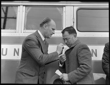
In the 19th century, the land that is now Hayward became part of Rancho San Lorenzo, a Spanish land grant to Guillermo Castro, in 1841. The site of his home was on the former El Camino Viejo, or Castro Street (now Mission Boulevard) between C and D Streets, but the structure was severely damaged in the 1868 Hayward earthquake, with the Hayward Fault running directly under its location. Most of the city's structures were destroyed in the earthquake, the last major earthquake on the fault. In 1930, that site was chosen for the construction of the City Hall, which served the city until 1969.[15]
Hayward was originally known as "Hayward's", then as "Haywood", later as "Haywards", and eventually as "Hayward". There is some disagreement as to how it was named. Most historians believe it was named for William Dutton Hayward, who opened a hotel there in 1852.[16] The U.S. Geological Survey Geographic Names Information System states the city was named after Alvinza Hayward, a millionaire from the California Gold Rush.[17][18] Regardless of which Hayward the area was named for, the name was changed to "Haywood" when the post office was first established in 1860.[19]
William Hayward eventually became the road commissioner for Alameda County. He used his authority to influence the construction of roads in his own favor. He was also an Alameda County supervisor. In 1876, a town was chartered by the State of California under the name of "Haywards". The name of the post office was then able to change because of the loss of the apostrophe before the "s". This change occurred in 1880.[19] It remained "Haywards" until 1910 when the "s" was officially dropped. William Hayward died in 1891.

Hayward grew steadily throughout the late 19th century, with an economy based on agriculture and tourism. Important crops were tomatoes, potatoes, peaches, cherries, and apricots. Hunt Brothers Cannery opened in 1895. Chicken and pigeon raising also played important roles in the economy. A rail line between Oakland and San Jose, the South Pacific Coast Railroad, was established but later destroyed in the 1868 earthquake.[21] The Hayward shore of the Bay was developed into extensive salt evaporation ponds, and was one of the most productive areas in the world, with Leslie Salt being one of the largest companies.[22]
20th century
The San Mateo–Hayward Bridge opened in 1929, connecting the city to the San Francisco Peninsula.[23]
During the 1930s, the Harry Rowell Rodeo Ranch, now within the bounds of Castro Valley, drew rodeo cowboys from across the continent, and Western movie actors such as Slim Pickens and others from Hollywood.[24][25]
Prior to World War II, Hayward had a high concentration of Japanese Americans, who were subject to the Japanese-American internment during the war. The war brought an economic and population boom to the area, as factories opened to manufacture war material. Many of the workers stayed after the end of the war. Two suburban tract housing pioneers, Oliver Rousseau and David D. Bohannon, were prominent builders of postwar housing in the area.[27]
The Hayward Area Recreation and Park District was formed in 1944.
California State University, Hayward opened in the Hayward Hills in 1957. Southland Mall was dedicated in 1964.
The second San Mateo–Hayward Bridge opened in 1967. The City Center Building opened in 1969 and acted as the new city hall until 1989 when the 1989 Loma Prieta earthquake damaged the building and forced the city government to move out. The building was closed to the public in 1998, with the new Hayward City Hall opening the same year. The "Bay Area Rapid Transit" system began operating in the Bay Area in 1972, with stations in downtown Hayward and south Hayward.
The Hunt Brothers Cannery closed in 1981.
21st century

The city's downtown area was slated for redevelopment in 2012 and 2013, with landscaping, new businesses opening up, and older ones getting façade upgrades.[28]
Warren Hall on the California State University, East Bay campus was demolished in 2013.
The Russell City Energy Center began operating in 2013 at the Hayward shoreline.
In May 2015, the city's former shoreline landfill was declared a site for conversion to a solar farm, set to generate enough electricity to power 1,200 homes. It will be one of 186 sites in the Regional Renewable Energy Procurement Project.[29]
In October 2015, construction began for the Hayward 21st Century Library and Heritage Plaza. The library opened in September 2019, and the plaza was originally expected to open sometime in 2019.[30][31]
Former communities
Mount Eden was a former city that was incorporated into Hayward in the 1950s, at the same time as Schafer Park.[19][32]
Russell City was a former unincorporated community. It existed from 1853 until 1964. It is now the location of an industrial park. The Russell City Energy Center, a 429-megawatt natural gas-fired power plant built by Calpine, is located there.[33][34]
Stokes Landing, Hayward Heath, and Eden Landing were communities now within Hayward city limits.[19]
Geography
According to the United States Census Bureau, the city has a total area of 63.7 square miles (165 km2). 45.3 square miles (117 km2) of it is land and 18.4 square miles (48 km2) of it (comprising 28.9%) is water.
The Hayward Fault Zone runs through much of Hayward, including the downtown area. The United States Geological Survey has stated that there is an "increasing likelihood" of a major earthquake on this fault zone, with potentially serious resulting damage.[35]
The San Lorenzo Creek runs through the city.
Hayward borders on many municipalities and communities. The cities bordering on Hayward are San Leandro, Union City, Fremont, and Pleasanton. The census-designated places bordering on Hayward are Castro Valley, San Lorenzo, Cherryland, Sunol, and Fairview.
-
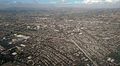
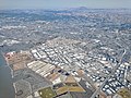 Industrial areas on west side of city
 -
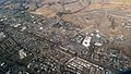
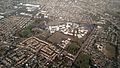
 South Hayward Hills
 -
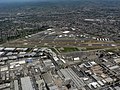
 Hayward, California - South Hayward BART station and surrounding area
 -
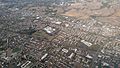 South Hayward
 -
 Interchange of Interstate 880 and California State Route 92
 -
-


Climate
This section needs additional citations for verification. (November 2015) |
Hayward has a Mediterranean climate, and contains microclimates, both of which are features of the greater Bay Area. In 2012, the USDA rated Hayward as a zone 10A climate.
| Climate data for Hayward, California | |||||||||||||
|---|---|---|---|---|---|---|---|---|---|---|---|---|---|
| Month | Jan | Feb | Mar | Apr | May | Jun | Jul | Aug | Sep | Oct | Nov | Dec | Year |
| Record high °F (°C) | 73.4 (23.0) |
80.6 (27.0) |
82.4 (28.0) |
96.8 (36.0) |
98.6 (37.0) |
104.0 (40.0) |
102.2 (39.0) |
107.6 (42.0) |
104.0 (40.0) |
102.2 (39.0) |
89.6 (32.0) |
75.2 (24.0) |
107.6 (42.0) |
| Mean daily maximum °F (°C) | 57.2 (14.0) |
60.2 (15.7) |
63.7 (17.6) |
66.1 (18.9) |
68.5 (20.3) |
71.9 (22.2) |
73.0 (22.8) |
75.3 (24.1) |
75.6 (24.2) |
71.5 (21.9) |
63.6 (17.6) |
57.5 (14.2) |
67.0 (19.5) |
| Daily mean °F (°C) | 49.9 (9.9) |
52.7 (11.5) |
55.5 (13.1) |
57.7 (14.3) |
60.5 (15.8) |
63.6 (17.6) |
65.2 (18.4) |
66.5 (19.2) |
66.4 (19.1) |
62.6 (17.0) |
55.5 (13.1) |
50.0 (10.0) |
58.8 (14.9) |
| Mean daily minimum °F (°C) | 42.5 (5.8) |
45.3 (7.4) |
47.4 (8.6) |
49.3 (9.6) |
52.6 (11.4) |
55.2 (12.9) |
57.4 (14.1) |
57.7 (14.3) |
57.1 (13.9) |
53.6 (12.0) |
47.4 (8.6) |
42.6 (5.9) |
50.7 (10.4) |
| Record low °F (°C) | 26.6 (−3.0) |
26.6 (−3.0) |
28.4 (−2.0) |
30.2 (−1.0) |
35.6 (2.0) |
41.0 (5.0) |
44.6 (7.0) |
42.8 (6.0) |
41.0 (5.0) |
30.2 (−1.0) |
30.2 (−1.0) |
17.6 (−8.0) |
17.6 (−8.0) |
| Average precipitation inches (mm) | 3.30 (84) |
3.47 (88) |
2.63 (67) |
1.24 (31) |
0.55 (14) |
0.20 (5.1) |
0.01 (0.25) |
0.04 (1.0) |
0.32 (8.1) |
1.00 (25) |
2.17 (55) |
3.12 (79) |
18.05 (457.45) |
| Mean monthly sunshine hours | 165.0 | 182.0 | 251.0 | 281.0 | 314.0 | 330.0 | 300.0 | 272.0 | 267.0 | 243.0 | 189.0 | 156.0 | 2,950 |
| Source 1: NOAA[36] | |||||||||||||
| Source 2: The Weather Channel,[37] usclimatedata.com[38] for Sunshine hours data | |||||||||||||
Demographics
| Census | Pop. | Note | %± |
|---|---|---|---|
| 1870 | 504 | — | |
| 1880 | 1,231 | 144.2% | |
| 1890 | 1,419 | 15.3% | |
| 1900 | 1,965 | 38.5% | |
| 1910 | 2,746 | 39.7% | |
| 1920 | 3,487 | 27.0% | |
| 1930 | 5,530 | 58.6% | |
| 1940 | 6,736 | 21.8% | |
| 1950 | 14,272 | 111.9% | |
| 1960 | 72,700 | 409.4% | |
| 1970 | 93,058 | 28.0% | |
| 1980 | 93,585 | 0.6% | |
| 1990 | 111,498 | 19.1% | |
| 2000 | 140,030 | 25.6% | |
| 2010 | 144,186 | 3.0% | |
| 2020 | 162,954 | 13.0% | |
| U.S. Decennial Census[39] | |||
2020
| Race / Ethnicity (NH = Non-Hispanic) | Pop 2000[40] | Pop 2010[41] | Pop 2020[42] | % 2000 | % 2010 | % 2020 |
|---|---|---|---|---|---|---|
| White alone (NH) | 40,896 | 27,178 | 21,436 | 29.21% | 18.85% | 13.15% |
| Black or African American alone (NH) | 14,846 | 16,297 | 14,003 | 10.60% | 11.30% | 8.59% |
| Native American or Alaska Native alone (NH) | Zdroj:https://en.wikipedia.org?pojem=History_of_Hayward,_California