Building name
Area
Image
Notes
Refs
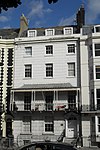
7–19 Palmeira Mansions (More images ) Hove 50°49′37″N 0°09′46″W / 50.8269°N 0.1627°W / 50.8269; -0.1627 (7–19 Palmeira Mansions, Hove ) .
[8]
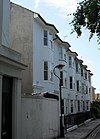
21–31 Palmeira Mansions (More images ) Hove 50°49′38″N 0°09′49″W / 50.8271°N 0.1637°W / 50.8271; -0.1637 (21–31 Palmeira Mansions, Hove ) .
[9]
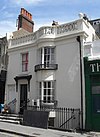
1–17 Palmeira Square (More images ) Hove 50°49′35″N 0°09′46″W / 50.8263°N 0.1629°W / 50.8263; -0.1629 (1–17 Palmeira Square, Hove ) .
[10]
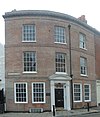
18–30 Palmeira Square (More images ) Hove 50°49′35″N 0°09′50″W / 50.8265°N 0.1640°W / 50.8265; -0.1640 (18–30 Palmeira Square, Hove ) .
[11]
Parochial Offices (former) (More images ) Kemptown 50°49′20″N 0°08′09″W / 50.8222°N 0.1358°W / 50.8222; -0.1358 (Parochial Offices (former), Kemptown ) .
[12]
Park Street Gate (More images ) Queen's Park 50°49′24″N 0°07′36″W / 50.8232°N 0.1268°W / 50.8232; -0.1268 (Park Street Gate, Queen's Park ) Queen's Park opened as Brighton Park in 1823 and was given two triumphal arch entrances in the late 19th century. In 1890 Francis May designed both Egremont Gate and the less ornate Park Gate, which is built of artificial stone with a tall central arch to the road and flat-arched side entrances for pedestrians. The main arch has an architrave with a prominent keystone , a dentil cornice and an inscribed panel naming the trustees who were responsible for giving the park to the residents of Brighton.[13] [14]
Patcham Court Farmhouse Patcham 50°52′02″N 0°09′04″W / 50.8673°N 0.1512°W / 50.8673; -0.1512 (Patcham Court Farmhouse, Patcham ) .
[15]
4–7 Pavilion Buildings Brighton 50°49′20″N 0°08′18″W / 50.8221°N 0.1382°W / 50.8221; -0.1382 (4–7 Pavilion Buildings, Brighton ) .
[16]
12–14 Pavilion Buildings (More images ) Brighton 50°49′18″N 0°08′18″W / 50.8216°N 0.1382°W / 50.8216; -0.1382 (12–14 Pavilion Buildings, Brighton ) .
[17]
3 and 4 Pavilion Parade Brighton 50°49′22″N 0°08′10″W / 50.8227°N 0.1360°W / 50.8227; -0.1360 (3 and 4 Pavilion Parade, Brighton ) .
[18]
5 Pavilion Parade Brighton 50°49′22″N 0°08′10″W / 50.8227°N 0.1361°W / 50.8227; -0.1361 (5 Pavilion Parade, Brighton ) .
[19]
6–11 Pavilion Parade Brighton 50°49′21″N 0°08′10″W / 50.8224°N 0.1362°W / 50.8224; -0.1362 (6–11 Pavilion Parade, Brighton ) .
[20]
Pavilion Theatre (More images ) North Laine 50°49′25″N 0°08′21″W / 50.8236°N 0.1391°W / 50.8236; -0.1391 (Pavilion Theatre, North Laine ) .
[21]
Pearson House Kemptown 50°49′07″N 0°07′14″W / 50.8185°N 0.1205°W / 50.8185; -0.1205 (Pearson House, Kemptown ) .
[22]
Pelham Institute (former)(More images ) Kemptown 50°49′12″N 0°07′34″W / 50.8200°N 0.1262°W / 50.8200; -0.1262 (Pelham Institute (former), Kemptown ) .
[23]
1–7 Pelham Square North Laine 50°49′40″N 0°08′11″W / 50.8277°N 0.1364°W / 50.8277; -0.1364 (1–7 Pelham Square, North Laine ) .
[24]
8–12 Pelham Square North Laine 50°49′39″N 0°08′13″W / 50.8275°N 0.1369°W / 50.8275; -0.1369 (8–12 Pelham Square, North Laine ) .
[25]
15–24 Pelham Square North Laine 50°49′40″N 0°08′14″W / 50.8277°N 0.1371°W / 50.8277; -0.1371 (15–24 Pelham Square, North Laine ) .
[26]
25 Pelham Square North Laine 50°49′41″N 0°08′13″W / 50.8280°N 0.1370°W / 50.8280; -0.1370 (25 Pelham Square, North Laine ) .
[27]
Pennant Lodge Queen's Park 50°49′36″N 0°07′31″W / 50.8266°N 0.1253°W / 50.8266; -0.1253 (Pennant Lodge, Queen's Park ) .
[28]
Pepper Pot (More images ) Queen's Park 50°49′38″N 0°07′29″W / 50.8273°N 0.1248°W / 50.8273; -0.1248 (Pepper Pot, Queen's Park ) .
[29]
1–8 Percival Terrace (More images ) Kemp Town 50°49′00″N 0°06′59″W / 50.8166°N 0.1164°W / 50.8166; -0.1164 (1–8 Percival Terrace, Kemp Town ) .
[30]
Percy and Wagner Almshouses (More images ) Brighton 50°49′54″N 0°07′47″W / 50.8317°N 0.1297°W / 50.8317; -0.1297 (Percy and Wagner Almshouses, Brighton ) .
[31]
Phoenix Brewery office (former) (More images ) Brighton 50°49′44″N 0°08′00″W / 50.8289°N 0.1333°W / 50.8289; -0.1333 (Phoenix Brewery office (former), Brighton ) .
[32]
Pillar Box at Montpelier Road (More images ) Brighton 50°49′29″N 0°09′11″W / 50.8248°N 0.1530°W / 50.8248; -0.1530 (Pillar Box at Montpelier Road, Brighton ) This pillar box is a First National Standard type dating from 1859 and cast by the Cochrane Grove & Co. foundry in Dudley . Such boxes are very rare, but this example is believed to be the only "anonymous" one in the United Kingdom, lacking any Royal cypher or any emblem indicating that it belongs to the General Post Office . It is a cylindrical cast iron box on a moulded plinth, topped with a shallow dome immediately above the narrow slot.
[33]
Port Hall Prestonville 50°50′09″N 0°09′06″W / 50.8359°N 0.1517°W / 50.8359; -0.1517 (Port Hall, Prestonville ) .
[34]
1–11 Portland Place Kemptown 50°49′05″N 0°07′15″W / 50.8180°N 0.1209°W / 50.8180; -0.1209 (1–11 Portland Place, Kemptown ) .
[35]
15–25 Portland Place Kemptown 50°49′04″N 0°07′13″W / 50.8179°N 0.1204°W / 50.8179; -0.1204 (15–25 Portland Place, Kemptown ) .
[36]
Portslade railway station (More images ) Portslade 50°50′09″N 0°12′19″W / 50.8357°N 0.2052°W / 50.8357; -0.2052 (Portslade railway station, Portslade ) .
[37]
Post Office (former), College Road Kemptown 50°49′10″N 0°07′23″W / 50.8194°N 0.1231°W / 50.8194; -0.1231 (Post Office (former), College Road, Kemptown ) .
[38]
Post Office (former), Ship Street (More images ) The Lanes 50°49′22″N 0°08′30″W / 50.8227°N 0.1416°W / 50.8227; -0.1416 (Post Office (former), Ship Street, The Lanes ) .
[39]
Post on pavement outside 77 and 78 West Street Brighton 50°49′17″N 0°08′40″W / 50.8213°N 0.1444°W / 50.8213; -0.1444 (Post on pavement outside 77 and 78 West Street, Brighton ) .
[40]
1–11 Powis Square Montpelier 50°49′40″N 0°08′55″W / 50.8278°N 0.1487°W / 50.8278; -0.1487 (1–11 Powis Square, Montpelier ) .
[41]
12 Powis Square Montpelier 50°49′39″N 0°08′54″W / 50.8275°N 0.1483°W / 50.8275; -0.1483 (12 Powis Square, Montpelier ) .
[42]
13 Powis Square Montpelier 50°49′39″N 0°08′54″W / 50.8274°N 0.1483°W / 50.8274; -0.1483 (13 Powis Square, Montpelier ) .
[43]
14–24 Powis Square Montpelier 50°49′39″N 0°08′56″W / 50.8274°N 0.1490°W / 50.8274; -0.1490 (14–24 Powis Square, Montpelier ) .
[44]
2 Powis Villas Montpelier 50°49′38″N 0°08′54″W / 50.8273°N 0.1482°W / 50.8273; -0.1482 (2 Powis Villas, Montpelier ) .
[45]
3 Powis Villas C Montpelier 50°49′39″N 0°08′53″W / 50.8275°N 0.1480°W / 50.8275; -0.1480 (3 Powis Villas, Montpelier ) .
[46]
4 Powis Villas Montpelier 50°49′40″N 0°08′52″W / 50.8277°N 0.1479°W / 50.8277; -0.1479 (4 Powis Villas, Montpelier ) .
[47]
5 Powis Villas C Montpelier 50°49′39″N 0°08′51″W / 50.8276°N 0.1475°W / 50.8276; -0.1475 (5 Powis Villas, Montpelier ) .
[48]
6 and 7 Powis Villas C Montpelier 50°49′39″N 0°08′52″W / 50.8274°N 0.1477°W / 50.8274; -0.1477 (6 and 7 Powis Villas, Montpelier ) .
[49]
8 and 9 Powis Villas C Montpelier 50°49′38″N 0°08′52″W / 50.8272°N 0.1478°W / 50.8272; -0.1478 (8 and 9 Powis Villas, Montpelier ) .
[50]
10–13 Powis Villas C Montpelier 50°49′37″N 0°08′53″W / 50.8270°N 0.1480°W / 50.8270; -0.1480 (10–13 Powis Villas, Montpelier ) .
[51]
Pressley's Brighton 50°49′18″N 0°08′17″W / 50.8217°N 0.1380°W / 50.8217; -0.1380 (Pressley's, Brighton ) .
[52]
199 Preston Road Preston Village 50°50′33″N 0°09′06″W / 50.8426°N 0.1516°W / 50.8426; -0.1516 (199 Preston Road, Preston Village ) .
[53]
5 Preston Street Brighton 50°49′21″N 0°09′06″W / 50.8224°N 0.1518°W / 50.8224; -0.1518 (5 Preston Street, Brighton ) .
[54]
58 Preston Street Brighton 50°49′27″N 0°09′02″W / 50.8241°N 0.1506°W / 50.8241; -0.1506 (58 Preston Street, Brighton ) .
[55]
60 Preston Street Brighton 50°49′26″N 0°09′02″W / 50.8240°N 0.1506°W / 50.8240; -0.1506 (60 Preston Street, Brighton ) .
[56]
79 Preston Street A Brighton 50°49′22″N 0°09′05″W / 50.8227°N 0.1513°W / 50.8227; -0.1513 (79 Preston Street, Brighton ) .
[57]
Prince Albert pub (More images ) North Laine 50°49′42″N 0°08′27″W / 50.8284°N 0.1407°W / 50.8284; -0.1407 (Prince Albert pub, North Laine ) .
[58]
1 Prince Albert Street The Lanes 50°49′16″N 0°08′26″W / 50.8210°N 0.1405°W / 50.8210; -0.1405 (1 Prince Albert Street, The Lanes ) .
[59]
2–8 Prince Albert Street The Lanes 50°49′16″N 0°08′27″W / 50.8210°N 0.1409°W / 50.8210; -0.1409 (2–8 Prince Albert Street, The Lanes ) .
[60]
10 Prince Albert Street The Lanes 50°49′17″N 0°08′28″W / 50.8214°N 0.1412°W / 50.8214; -0.1412 (10 Prince Albert Street, The Lanes ) .
[61]
11–13 Prince Albert Street The Lanes 50°49′17″N 0°08′29″W / 50.8215°N 0.1413°W / 50.8215; -0.1413 (11–13 Prince Albert Street, The Lanes ) .
[62]
15 Prince Albert Street A The Lanes 50°49′18″N 0°08′28″W / 50.8217°N 0.1411°W / 50.8217; -0.1411 (15 Prince Albert Street, The Lanes ) .
[63]
15b Prince Albert Street The Lanes 50°49′18″N 0°08′28″W / 50.8217°N 0.1412°W / 50.8217; -0.1412 (15b Prince Albert Street, The Lanes ) .
[64]
16 Prince Albert Street The Lanes 50°49′17″N 0°08′28″W / 50.8214°N 0.1410°W / 50.8214; -0.1410 (16 Prince Albert Street, The Lanes ) .
[65]
17 and 17a Prince Albert Street The Lanes 50°49′17″N 0°08′27″W / 50.8213°N 0.1409°W / 50.8213; -0.1409 (17 and 17a Prince Albert Street, The Lanes ) .
[66]
18 and 19 Prince Albert Street The Lanes 50°49′17″N 0°08′27″W / 50.8213°N 0.1408°W / 50.8213; -0.1408 (18 and 19 Prince Albert Street, The Lanes ) .
[67]
20, 21, 21a and 21b Prince Albert Street The Lanes 50°49′16″N 0°08′27″W / 50.8212°N 0.1407°W / 50.8212; -0.1407 (20, 21, 21a and 21b Prince Albert Street, The Lanes ) .
[68]
24 Prince Albert Street The Lanes 50°49′16″N 0°08′25″W / 50.8212°N 0.1404°W / 50.8212; -0.1404 (24 Prince Albert Street, The Lanes ) .
[69]
Princes House (More images ) Brighton 50°49′21″N 0°08′21″W / 50.8224°N 0.1391°W / 50.8224; -0.1391 (Princes House, Brighton ) .
[70]
18–20 Princes Street A Kemptown 50°49′19″N 0°08′10″W / 50.8219°N 0.1360°W / 50.8219; -0.1360 (18–20 Princes Street, Kemptown ) .
[71]
Prospect Cottage (More images ) Rottingdean 50°48′23″N 0°03′33″W / 50.8064°N 0.0592°W / 50.8064; -0.0592 (Prospect Cottage, Rottingdean ) .
[72]
Puget's Cottage Brighton 50°49′20″N 0°08′23″W / 50.8222°N 0.1398°W / 50.8222; -0.1398 (Puget's Cottage, Brighton ) .
[73]
Pump House Tavern (More images ) The Lanes 50°49′17″N 0°08′25″W / 50.8215°N 0.1402°W / 50.8215; -0.1402 (Pump House Tavern, The Lanes ) .
[74]
Pylon on east side of London Road Patcham 50°52′50″N 0°09′54″W / 50.8806°N 0.1651°W / 50.8806; -0.1651 (Pylon on east side of London Road, Patcham ) .
[75]
Pylon on west side of London Road Patcham 50°52′50″N 0°09′55″W / 50.8806°N 0.1654°W / 50.8806; -0.1654 (Pylon on west side of London Road, Patcham ) .
[76]
The Quadrant pub Brighton 50°49′27″N 0°08′37″W / 50.8241°N 0.1435°W / 50.8241; -0.1435 (The Quadrant pub, Brighton ) .
[77]
Queens Hotel (eastern wing) Brighton 50°49′11″N 0°08′21″W / 50.8198°N 0.1392°W / 50.8198; -0.1392 (Queens Hotel (eastern wing), Brighton ) .
[78]
4–9 Queens Place (More images ) Brighton 50°49′47″N 0°08′06″W / 50.8298°N 0.1351°W / 50.8298; -0.1351 (4–9 Queens Place, Brighton ) .
[79]
27 Queens Road A (More images ) Brighton 50°49′33″N 0°08′34″W / 50.8258°N 0.1427°W / 50.8258; -0.1427 (27 Queens Road, Brighton ) .
[80]
Railings at Marine Parade East Cliff50°49′00″N 0°07′08″W / 50.8167°N 0.1189°W / 50.8167; -0.1189 (Railings at Marine Parade, East Cliff )
.
[81]
Railings at Queens Road Rest Garden (east side) Brighton 50°49′31″N 0°08′33″W / 50.8254°N 0.1426°W / 50.8254; -0.1426 (Railings at Queens Road Rest Garden (east side), Brighton ) .
[82]
Railings at Queens Road Rest Garden (south side) Brighton 50°49′31″N 0°08′34″W / 50.8252°N 0.1427°W / 50.8252; -0.1427 (Railings at Queens Road Rest Garden (south side), Brighton ) .
[83]
Railings at The Esplanade Brighton 50°49′20″N 0°09′21″W / 50.8223°N 0.1558°W / 50.8223; -0.1558 (Railings at The Esplanade, Brighton ) .
[84]
Railings on west side of Queen's Road Brighton 50°49′33″N 0°08′33″W / 50.8258°N 0.1426°W / 50.8258; -0.1426 (Railings on west side of Queen's Road, Brighton ) .
[85]
Ralli Hall (More images ) Hove 50°50′05″N 0°10′12″W / 50.8346°N 0.1699°W / 50.8346; -0.1699 (Ralli Hall, Hove ) .
[86]
Ray Mausoleum at Brighton Extramural Cemetery Brighton 50°50′13″N 0°07′13″W / 50.8369°N 0.1202°W / 50.8369; -0.1202 (Ray Mausoleum at Brighton Extramural Cemetery, Brighton ) .
[87]
Rectory Cottage (More images ) Ovingdean 50°48′57″N 0°04′38″W / 50.8159°N 0.0771°W / 50.8159; -0.0771 (Rectory Cottage, Ovingdean ) .
[88]
Rectory Lodge Ovingdean 50°48′58″N 0°04′37″W / 50.8160°N 0.0770°W / 50.8160; -0.0770 (Rectory Lodge, Ovingdean ) .
[89]
10 and 11 Regency Mews Brighton 50°49′25″N 0°09′03″W / 50.8235°N 0.1508°W / 50.8235; -0.1508 (10 and 11 Regency Mews, Brighton ) .
[90]
22–25 Regency Square and 67 Preston Street A Brighton 50°49′24″N 0°09′03″W / 50.8234°N 0.1509°W / 50.8234; -0.1509 (22–25 Regency Square and 67 Preston Street, Brighton ) .
[91]
38–46 Regency Square B Brighton 50°49′23″N 0°08′57″W / 50.8231°N 0.1493°W / 50.8231; -0.1493 (38–46 Regency Square, Brighton ) .
[92]
46a Regency Square Brighton 50°49′23″N 0°08′56″W / 50.8230°N 0.1489°W / 50.8230; -0.1489 (46a Regency Square, Brighton ) .
[93]
46b Regency Square Brighton 50°49′22″N 0°08′56″W / 50.8229°N 0.1489°W / 50.8229; -0.1489 (46b Regency Square, Brighton ) .
[94]
47–49 Regency Square A Brighton 50°49′22″N 0°08′57″W / 50.8229°N 0.1491°W / 50.8229; -0.1491 (47–49 Regency Square, Brighton ) .
[95]
Regency Tavern (More images ) Brighton 50°49′22″N 0°08′56″W / 50.8229°N 0.1488°W / 50.8229; -0.1488 (Regency Tavern, Brighton ) .
[96]
18–20 Regent Hill Brighton 50°49′29″N 0°08′48″W / 50.8247°N 0.1466°W / 50.8247; -0.1466 (18–20 Regent Hill, Brighton ) .
[97]
1–3 Richmond Terrace F Brighton 50°49′45″N 0°08′00″W / 50.8292°N 0.1334°W / 50.8292; -0.1334 (1–3 Richmond Terrace, Brighton ) .
[98]
4–6 Richmond Terrace A Brighton 50°49′46″N 0°07′59″W / 50.8294°N 0.1331°W / 50.8294; -0.1331 (4–6 Richmond Terrace, Brighton ) .
[99]
7 Richmond Terrace D Brighton 50°49′46″N 0°07′59″W / 50.8295°N 0.1330°W / 50.8295; -0.1330 (7 Richmond Terrace, Brighton ) .
[100]
11–14 Richmond Terrace D Brighton 50°49′48″N 0°07′56″W / 50.8300°N 0.1323°W / 50.8300; -0.1323 (11–14 Richmond Terrace, Brighton ) .
[101]
15 Richmond Terrace A Brighton 50°49′49″N 0°07′56″W / 50.8302°N 0.1321°W / 50.8302; -0.1321 (15 Richmond Terrace, Brighton ) .
[102]
16 Richmond Terrace Brighton 50°49′49″N 0°07′55″W / 50.8303°N 0.1320°W / 50.8303; -0.1320 (16 Richmond Terrace, Brighton ) .
[103]
17 and 18 Richmond Terrace C Brighton 50°49′49″N 0°07′54″W / 50.8304°N 0.1318°W / 50.8304; -0.1318 (17 and 18 Richmond Terrace, Brighton ) .
[104]
Robin's Row Portslade 50°50′32″N 0°13′12″W / 50.8422°N 0.2201°W / 50.8422; -0.2201 (Robin's Row, Portslade ) .
[105]
Roedean School (More images ) Roedean 50°48′43″N 0°05′03″W / 50.8120°N 0.0841°W / 50.8120; -0.0841 (Roedean School, Roedean ) .
[106]
Rokesley House and Grosvenor House A East Cliff50°49′05″N 0°07′21″W / 50.8180°N 0.1225°W / 50.8180; -0.1225 (Rokesley House and Grosvenor House, East Cliff )
.
[107]
Rookery Cottage Hangleton 50°49′54″N 0°10′04″W / 50.8316°N 0.1679°W / 50.8316; -0.1679 (Rookery Cottage, Hangleton ) .
[108]
Rottingdean Club Rottingdean 50°48′20″N 0°03′31″W / 50.8056°N 0.0587°W / 50.8056; -0.0587 (Rottingdean Club, Rottingdean ) .
[109]
1–13 Roundhill Crescent A Round Hill 50°50′06″N 0°07′47″W / 50.8350°N 0.1297°W / 50.8350; -0.1297 (1–13 Roundhill Crescent, Round Hill ) .
[110]
19 and 21 Roundhill Crescent A Round Hill 50°50′07″N 0°07′47″W / 50.8354°N 0.1296°W / 50.8354; -0.1296 (19 and 21 Roundhill Crescent, Round Hill ) .
[111]
23–27 Roundhill Crescent A Round Hill 50°50′09″N 0°07′46″W / 50.8357°N 0.1294°W / 50.8357; -0.1294 (23–27 Roundhill Crescent, Round Hill ) .
Zdroj: https://en.wikipedia.org?pojem=Grade_II_listed_buildings_in_Brighton_and_Hove:_P–R
Your browser doesn’t support the object tag.
www.astronomia.sk |
www.biologia.sk | www.botanika.sk
| www.dejiny.sk | www.economy.sk
| www.elektrotechnika.sk |
www.estetika.sk | www.farmakologia.sk
| www.filozofia.sk | Fyzika
| www.futurologia.sk | www.genetika.sk
| www.chemia.sk
| www.lingvistika.sk | www.politologia.sk
| www.psychologia.sk
| www.sexuologia.sk | www.sociologia.sk
| www.veda.sk I www.zoologia.sk


