A | B | C | D | E | F | G | H | CH | I | J | K | L | M | N | O | P | Q | R | S | T | U | V | W | X | Y | Z | 0 | 1 | 2 | 3 | 4 | 5 | 6 | 7 | 8 | 9
El Dorado County | |
|---|---|
|
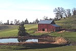
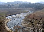
Images, from top down, left to right: A barn in El Dorado County, the shore of Lake Tahoe in Ed Z'berg Sugar Pine Point State Park, the South Fork American River running through the El Dorado hills, Marshall Gold Discovery State Historic Park | |
 Interactive map of El Dorado County | |
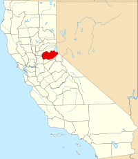
 Location in the state of California | |
| Country | United States |
| State | California |
| Regions | Northern California, Sierra Nevada, Gold Country |
| Metropolitan area | Greater Sacramento |
| Incorporated | February 18, 1850[1] |
| Named for | Spanish for "the golden" and El Dorado |
| County seat | Placerville |
| Largest community | El Dorado Hills |
| Government | |
| • Type | Council–CAO |
| • Body | Board of Supervisors[2]
|
| • Chair | Lori Parlin |
| • Vice Chair | Wendy Thomas |
| • Chief Administrative Office[3] | Don Ashton |
| Area | |
| • Total | 1,786 sq mi (4,630 km2) |
| • Land | 1,708 sq mi (4,420 km2) |
| • Water | 78 sq mi (200 km2) |
| Highest elevation | 10,886 ft (3,318 m) |
| Population (2020) | |
| • Total | 191,185 |
| • Density | 110/sq mi (41/km2) |
| Time zone | UTC−8 (Pacific Time Zone) |
| • Summer (DST) | UTC−7 (Pacific Daylight Time) |
| ZIP code | 95762 |
| Area code | 530, 916, 279 |
| FIPS code | 06-017 |
| GNIS feature ID | 277273 |
| Congressional districts | 3rd, 5th |
| Website | www.edcgov.us |
El Dorado County (/ˌɛl dəˈrɑːdoʊ/ ⓘ), officially the County of El Dorado, is a county located in the U.S. state of California. As of the 2020 census, the population was 191,185.[5] The county seat is Placerville.[6] The county is part of the Sacramento-Roseville-Arden-Arcade, CA Metropolitan Statistical Area. It is located entirely in the Sierra Nevada, from the historic Gold Country in the western foothills to the High Sierra in the east. El Dorado County's population has grown as Greater Sacramento has expanded into the region. Where the county line crosses US 50 at Clarksville, the distance to Sacramento is 15 miles. In the county's high altitude eastern end at Lake Tahoe, environmental awareness and environmental protection initiatives have grown along with the population since the 1960 Winter Olympics, hosted at the former Squaw Valley Ski Resort in neighboring Placer County.
History
What is now known as El Dorado County has been home to the Maidu, Nisenan, Washoe, and Miwok Indigenous American nations for centuries. The region became famous for being the site of the 1848 discovery that sparked the California Gold Rush. As a result, the name "El Dorado" was derived from the Spanish word for, "The Gilded One."[7] The County of El Dorado was one of California's original 27 counties created effective February 18, 1850 (the number has risen to 58 today). Its name is derived from the Spanish meaning "the gilded/golden".[8]
The final segments of the Pony Express mail route ran through El Dorado County until its replacement with the telegraph service in 1861; U.S. Highway 50 follows the Pony Express route today.
- Local landmarks:
- Marshall Gold Discovery State Historic Park
- Confidence Hall
- Fountain-Tallman Soda Works
- John Pearson Soda Works
- Combellack-Blair House
- Rubicon Point Light
The Placerville Mountain Democrat, California's oldest surviving newspaper, serves El Dorado County.
The Caldor Fire started on August 14, 2021, near Little Mountain, south of Pollock Pines in El Dorado County,[9] about two miles East of Omo Ranch and four miles south of Grizzly Flats.[10][11] It initially burned slowly, but exploded in size on August 16 due to high winds. By the night of August 16 it was 6,500 acres (2,600 ha).[12] On August 17 the fire grew to 30,000 acres (12,000 ha) as it expanded rapidly north and east, crossing the North Fork Cosumnes River and approaching Sly Park Reservoir. By August 20 the fire had burned nearly to Highway 50, forcing a closure of the highway.[13] Over the next few days, the fire crossed Highway 50 in the vicinity of Kyburz. Starting on August 27 winds drove the fire rapidly east towards the Lake Tahoe Basin. By August 30, it had reached Echo Summit, less than 5 miles (8.0 km) from South Lake Tahoe.
There are only two municipalities in El Dorado County: Placerville and South Lake Tahoe.[14]
Government and policing
Policing
The El Dorado County Sheriff provides court protection, county jail administration, and coroner service for all of the county and provides patrol and detective services for the unincorporated areas of the county. Incorporated towns Placerville, population 11,000, has a municipal police department, as does South Lake Tahoe, population 22,000.
Sheriffs
- James Hume (Feb 18, 1850- November 7, 1852)
- Steven Charles Austin (Nov 7, 1852- November 7, 1856)
- William Tanner Henson (Nov 7, 1856- September 15, 1859) - Resigned
- Walter J. Burwell (Sep 15, 1859- August 15, 1863) - Resigned
- Henry Gooding (Aug 15, 1863- November 7, 1867)
- Jacob Hart Neff (Nov 7, 1867- November 7, 1871)
- Charles Benjamin Dunnam (Nov 7, 1871- November 7, 1875)
- Jason McCormick (Nov 7, 1875- November 7, 1881)
- George Burnham (Nov 7, 1881- November 7, 1883)
- Thomas Augustus Galt (Nov 7, 1883- November 7, 1887)
- George H. Hilbert (Nov 7, 1887- November 7, 1898)
- Archie Speer Bosquit (Nov 7, 1898- November 7, 1907)
- Gilbert Cook (Nov 7, 1907- May 9, 1912) - Suicide
- Albert George Bradshaw (May 9, 1912- November 7, 1914)
- Charles E. Hand (Nov 7, 1914- November 7, 1925)
- Charles F. Woods (Nov 7, 1925- November 7, 1931)
- George Martin Smith Sr. (Nov 7, 1931- November 7, 1941)
- Lowell Fred West (Nov 7, 1941- November 7, 1949)
- Rowland Lee Morris (Nov 7, 1949- November 7, 1955)
- Ernie Carlson (Nov 7, 1955- November 7, 1965)
- Robert Mitchum (Nov 7, 1965- November 7, 1971)
- Ernie Carlson (Nov 7, 1971- November 7, 1975)
- Al Coombs (Nov 7, 1975 - November 7, 1977)
- Richard "Dick" Pacileo (Nov 7, 1975 - November 7, 1991)
- Don McDonald (1991 - 1997)
- Hal Barker (1997 - 2002)
- Jeff Neves (Nov 7, 2001- November 7, 2010)
- John D'Agostini (Nov 7, 2010 - January 3, 2023)
- Jeff Leikauf (current, from January 3, 2023)
Geography
According to the U.S. Census Bureau, the county has a total area of 1,786 square miles (4,630 km2), of which 1,708 square miles (4,420 km2) is land and 78 square miles (200 km2) (4.4%) is water.[15]
The county, owing to its location in the Sierra Nevada, consists of rolling hills and mountainous terrain. The northeast corner is in the Lake Tahoe Basin (part of the Great Basin), including a portion of the lake itself. Across the Sierra crest to the west lies the majority of the county, referred to as the "western slope." A portion of Folsom Lake is in the northwest corner of the county.
Much of the county is public land. The Eldorado National Forest comprises a significant portion (approximately 43%) of the county's land area, primarily on the western slope. The Lake Tahoe Basin Management Unit, formerly part of the Eldorado and two other National Forests, manages much of the land east of the crest. The Pacific Crest Trail runs through the eastern part of the county, along or roughly paralleling the Sierra crest. The county is home to the Desolation Wilderness, a popular destination for hiking, backpacking, and fishing.
Adjacent counties
- Placer County - north
- Douglas County, Nevada - northeast
- Alpine County - southeast
- Amador County - south
- Sacramento County - southwest
Geographic features
- American River
- Carson Range
- Crystal Range
- Echo Lake
- Fallen Leaf Lake
- Folsom Lake
- Francis Lake
- Freel Peak[16] as its highest point at 10,886 feet (3,318 m)
- Gilmore Lake
- Green Springs Ranch
- Lake Tahoe
- Loon Lake
- Lost Lake
- Mount Price
- Mount Tallac
- Pyramid Lake
- Sierra Nevada
- Silver Peak
- Talking Mountain
- Union Valley Reservoir
- Waca Lake
Recreation
Parks
Skiing
Racing
Wineries
Demographics
The vast majority of the population lives in a narrow strip along U.S. Route 50, with the majority living between El Dorado Hills and Pollock Pines. The remainder resides in the South Lake Tahoe area, and in various dispersed rural communities.
| Census | Pop. | Note | %± |
|---|---|---|---|
| 1850 | 20,057 | — | |
| 1860 | 20,562 | 2.5% | |
| 1870 | 10,309 | −49.9% | |
| 1880 | 10,683 | 3.6% | |
| 1890 | 9,232 | −13.6% | |
| 1900 | 8,986 | −2.7% | |
| 1910 | 7,492 | −16.6% | |
| 1920 | 6,426 | −14.2% | |
| 1930 | 8,325 | 29.6% | |
| 1940 | 13,229 | 58.9% | |
| 1950 | 16,207 | 22.5% | |
| 1960 | 29,390 | 81.3% | |
| 1970 | 43,833 | 49.1% | |
| 1980 | 85,812 | 95.8% | |
| 1990 | 125,955 | 46.8% | |
| 2000 | 156,299 | 24.1% | |
| 2010 | 181,058 | 15.8% | |
| 2020 | 191,185 | 5.6% | |
| 2023 (est.) | 192,215 | [17] | 0.5% |
| U.S. Decennial Census[18] 1790–1960[19] 1900–1990[20] 1990–2000[21] 2010[22] 2020[23] | |||
2020 census
| Race / Ethnicity | Pop 2010[22] | Pop 2020[23] | % 2010 | % 2020 |
|---|---|---|---|---|
| White alone (NH) | 144,689 | 140,141 | 79.91% | 73.30% |
| Black or African American alone (NH) | 1,296 | 1,436 | 0.72% | 0.75% |
| Native American or Alaska Native alone (NH) | 1,553 | 1,273 | 0.86% | 0.67% |
| Asian alone (NH) | 6,143 | 9,024 | 3.39% | 4.72% |
| Pacific Islander alone (NH) | 261 | 276 | 0.14% | 0.14% |
| Some Other Race alone (NH) | 318 | 1,215 | 0.18% | 0.64% |
| Mixed Race/Multi-Racial (NH) | 4,923 | 11,361 | 2.72% | 5.94% |
| Hispanic or Latino (any race) | 21,875 | 26,459 | 12.08% | 13.84% |
| Total | 181,058 | 191,185 | 100.00% | 100.00% |
Note: the US Census treats Hispanic/Latino as an ethnic category. This table excludes Latinos from the racial categories and assigns them to a separate category. Hispanics/Latinos can be of any race.
2011
| Population, race, and income | |||||
|---|---|---|---|---|---|
| Total population[24] | 179,878 | ||||
| White[24] | 157,853 | 87.8% | |||
| Black or African American[24] | 1,367 | 0.8% | |||
| American Indian or Alaska Native[24] | 1,802 | 1.0% | |||
| Asian[24] | 6,260 | 3.5% | |||
| Native Hawaiian or other Pacific Islander[24] | 167 | 0.1% | |||
| Some other race[24] | 6,323 | 3.5% | |||
| Two or more races[24] | 6,106 | 3.4% | |||
| Hispanic or Latino (of any race)[25] | 21,222 | 11.8% | |||
| Per capita income[26] | $34,385 | ||||
| Median household income[27] | $68,815 | ||||
| Median family income[28] | $82,930 | ||||
Places by population, race, and income
| Places by population and race | ||||||||
|---|---|---|---|---|---|---|---|---|
| Place | Type[29] | Population[24] | White[24] | Other[24] [note 1] |
Asian[24] | Black or African American[24] |
Native American[24] [note 2] |
Hispanic or Latino (of any race)[25] |
| Auburn Lake Trails | CDP | 3,741 | 97.0% | 1.5% | 0.2% | 1.0% | 0.3% | 2.3% |
| Cameron Park | CDP | 16,697 | 90.8% | 6.1% | 2.2% | 0.6% | 0.4% | 15.4% |
| Camino | CDP | 1,933 | 98.7% | 0.7% | 0.3% | 0.4% | 0.0% | 3.5% |
| Cold Springs | CDP | 569 | 90.9% | 9.1% | 0.0% | 0.0% | 0.0% | 3.3% |
| Coloma | CDP | 353 | 82.4% | 17.3% | 0.3% | 0.0% | 0.0% | 20.1% |
| Diamond Springs | CDP | 11,367 | 93.6% | 2.3% | 1.3% | 0.7% | 2.1% | 9.4% |
| El Dorado Hills | CDP | 43,563 | 84.0% | 5.4% | 8.9% | 1.7% | 0.1% | 7.3% |
| Georgetown | CDP | 2,338 | 89.9% | 8.2% | 0.0% | 0.1% | 1.8% | 10.7% |
| Grizzly Flats | CDP | 923 | 97.4% | 0.0% | 0.9% | Zdroj:https://en.wikipedia.org?pojem=El_Dorado_County,_California|||


