

A | B | C | D | E | F | G | H | CH | I | J | K | L | M | N | O | P | Q | R | S | T | U | V | W | X | Y | Z | 0 | 1 | 2 | 3 | 4 | 5 | 6 | 7 | 8 | 9
East Hampton, New York | |
|---|---|
| Town of East Hampton | |
 Hook Mill | |
,_NY_Seal.png) Seal | |
 Location in Suffolk County | |
   | |
| Coordinates: 40°57′25″N 72°11′56″W / 40.95694°N 72.19889°W | |
| Country | United States |
| State | New York |
| County | Suffolk |
| Government | |
| • Type | Town |
| • Supervisor | Peter Van Scoyoc (D)[1] |
| Area | |
| • Total | 386.57 sq mi (1,001.21 km2) |
| • Land | 74.33 sq mi (192.52 km2) |
| • Water | 312.24 sq mi (808.70 km2) |
| Elevation | 33 ft (10 m) |
| Population | |
| • Total | 28,385 |
| • Density | 381.87/sq mi (147.44/km2) |
| Time zone | UTC−05:00 (Eastern (EST)) |
| • Summer (DST) | UTC−04:00 (EDT) |
| ZIP Code | 11937 |
| Area code | 631 |
| FIPS code | 36-22194 |
| GNIS feature ID | 978919 |
| Website | ehamptonny |
The Town of East Hampton is located in southeastern Suffolk County, New York, at the eastern end of the South Shore of Long Island. It is the easternmost town in the state of New York. At the time of the 2020 United States census, it had a total population of 28,385.[3]
The town includes the village of East Hampton, as well as the hamlets of Montauk, Amagansett, Wainscott, and Springs. It also includes part of the incorporated village of Sag Harbor.
East Hampton is located on a peninsula, bordered on the south by the Atlantic Ocean, to the east by Block Island Sound and to the north by Gardiners Bay, Napeague Bay and Fort Pond Bay. To the west is western Long Island, reaching to the East River and New York City. The Town has eight state parks, most located at the water's edge.
The town consists of 70 square miles (180 km2) and stretches nearly 25 miles (40 km), from Wainscott in the west to Montauk Point in the east. It is approximately six miles (10 km) wide at its widest point and less than one mile at its narrowest. The town has jurisdiction over Gardiners Island, which is one of the largest privately owned islands in the United States. The town has 70 miles (110 km) of shoreline.[4]
History
Native-American history

This area had been inhabited for thousands of years by wandering tribes of indigenous peoples. At the time of European contact, East Hampton was home to the Pequot people, part of the culture that also occupied territory on the northern side of Long Island Sound, in what is now Connecticut of southern New England. They belong to the large Algonquian-speaking language family. Bands on Long Island were identified by their geographic locations. The historical people known to the colonists as the Montaukett, who were Pequot, controlled most of the territory at the east end of Long Island.[5]
Indians inhabiting the western part of Long Island were part of the Lenape nation, whose language is also in the Algonquian family. Their territory extended to lower New York, western Connecticut and the mid-Atlantic coastal areas into New Jersey and Pennsylvania. Their bands were also known by the names of their geographic locations but did not constitute distinct peoples.[5]
In the late-17th century Chief Wyandanch of the Montaukett negotiated with English colonists for the land in the East Hampton area. The differing concepts held by the Montaukett and English about land and its use contributed to the Montaukett losing most of their lands over the ensuing centuries. Wyandanch's elder brother, the grand sachem Poggaticut, sold an island to English colonist Lion Gardiner for "a large black dog, some powder and shot, and a few Dutch blankets."[6] The next trade involved the land extending from present-day Southampton to the foot of the bluffs, at what is now Hither Hills State Park, for 24 hatchets, 24 coats, 20 looking glasses and 100 muxes.[6]
In 1660, Chief Wyandanch's widow signed away the rest of the land from present-day Hither Hills to the tip of Montauk Point for 100 pounds, to be paid in 10 equal installments of "Indian corn or good wampum at six to a penny".[7] The sales provided that the Montaukett were permitted to stay on the land, to hunt and fish at will, and to harvest the tails and fins of whales that beached on the East Hampton shores. Town officials who bought the land filed for reimbursement from the colony for the rum with which they had plied the tribe during negotiations. Gradually, however, colonists stopped the Montaukett using the land by preventing them from hunting and fishing. They were said to interfere with the crops on their farms, in a conflict similar to the later farmer-rancher arguments of the Old West.[6]
Many of the Montaukett died during the 17th and 18th centuries from epidemics of smallpox, a Eurasian disease carried by some English and Dutch colonists and endemic in their communities, to which the Indians had no immunity. After the American Revolution, some Montaukett relocated with Shinnecock to Oneida County in western upstate New York, led by the Mohegan missionary Samson Occom, to try to escape the settlers' civilization. They formed the Brothertown Indians with other Indians from New England, and gave up some of their traditions. In 1831-1836, the Brothertown Indians migrated to Wisconsin, where they founded the settlement of Brothertown.[8]

Some Montaukett continued to live on Long Island. In the mid to late nineteenth century, their most well-known member was Stephen Talkhouse. Their area on Lake Montauk was called Indian Fields until 1879. With their population reduced, over the years the Montaukett intermarried with other peoples of the area, but brought up many of their descendants as Montaukett in their culture. When Arthur W. Benson brought a government auction of Montauk, New York, in which he bought nearly the entire east end of the town, he evicted the Montaukett. They relocated to Freetown, a community established by free people of color on the northern edge of East Hampton Village. The tribe made several attempts to get the courts to declare the evictions illegal, but the court ruled in favor of the evictions. Since the 1990s, the Montaukett have pressed for formal recognition as a tribe. The Shinnecock Indian Nation, many of whom had continued to occupy a portion of land on the South Shore and claimed it as their reservation, received federal recognition in 2010 as a tribe and also have state recognition. Historically both groups were part of the larger Pequot people.
Montaukett artifacts and sweat lodges are visible from trails at Theodore Roosevelt County Park. The park was formerly called Montauk County Park.
Anglo-European settlement

East Hampton was the first English settlement in the state of New York. In 1639 Lion Gardiner purchased land, what became known as Gardiner's Island, from the Montaukett people. In 1648 a royal British charter recognized the island as a wholly contained colony, independent of both New York and Connecticut. It kept that status until after the American Revolution, when it came under New York State and the Town of East Hampton authority.
On June 12, 1640, nine Puritan families from Lynn, Massachusetts landed at what is now known as Conscience Point, in Southampton; some later migrated to present-day East Hampton. Among the first English settlers in East Hampton were John Hand, Thomas Talmage, Daniel Howe, Thomas Thomson, John Mulford, William Hedges, Ralph Dayton, Thomas Chatfield and Thomas Osborn.[9]
The Mulford Farmhouse, on James Lane, is the best-preserved 17th-century English colonial house in East Hampton. The barn dates to 1721, and the complex is operated as a living museum. It is listed on the National Register of Historic Places.[10] The house was built in 1680 for Josiah Hobart, a prominent early settler, named in the first formal deed of conveyance of East Hampton. This was known as the East-Hampton Pattent[11] or Dongan Patent. The 1686 instrument granting the Town of East Hampton to its new proprietors was signed by Thomas Dongan, then Governor of New York.[12] The patent named Capt. Hobart one of "Trustees of the freeholders and commonalty of the town of East-Hampton". Sons of Rev. Peter Hobart, founding minister of Old Ship Church in Hingham, Massachusetts, Josiah Hobart and his brother Joshua both migrated to Long Island with their families. Josiah Hobart settled in East Hampton, where he served as High Sheriff of Suffolk County. His brother Joshua, a minister, went to Southold, where he served the town for 45 years.
Isaac Van Scoy from Amagansett wed Mercy Edwards in February 1757, and during the spring of that year, the couple relocated to the region referred to as Northwest or Alewife Brook Neck, located approximately six miles north of East Hampton Village. This Northwest "Ghost town" settlement during the mid 1800's saw developement due to Northwest Harbor, later it was deemed too shallow for deep draft ships and the harbor moved to Sag Harbor, leading to the settlements demise.

East Hampton was the third Connecticut settlement on the East end of Long Island. East Hampton formally united with Connecticut in 1657. Long Island was formally declared to be part of New York (and also subject to English law) by Charles II of England after four British frigates captured what is today New York City, releasing East Hampton from its Connecticut governance.
East Hampton was first called Maidstone, after Maidstone, Kent, England. The name was later changed to "Easthampton", reflecting the geographic names of its neighbors, Southampton and Westhampton.[13] In 1885 the name was split into two words, after the local newspaper the East Hampton Star began using the two-word name. "Maidstone" is frequently used in place names throughout the town, including the Maidstone Golf Club.
Deep Hollow Ranch, established in 1658 in Montauk, is the oldest continuously operating cattle ranch in the United States.
Geography
East Hampton is bounded by Southampton to the west, the Atlantic Ocean to the south, Block Island Sound to the east, and Napeague Bay to the north.
According to the United States Census Bureau, the town has a total area of 386.6 square miles (1,001 km2), of which 74.4 square miles (193 km2) is land and 312.2 square miles (809 km2) (80.76%) is water.[14]
Climate
East Hampton has an Oceanic climate climate (Köppen Cfb).[15] East Hampton has chilly, wet winters and very warm, dry summers due to the moderating influence of the ocean, which suppresses thunderstorm development and moderates summer temperatures. Summers have very warm, sunny, and stable weather, whereas the winters are often stormy due to coastal storms which bring rain but little snow. The region averages only about 10 inches or 0.25 metres of snow annually.
| Climate data for East Hampton | |||||||||||||
|---|---|---|---|---|---|---|---|---|---|---|---|---|---|
| Month | Jan | Feb | Mar | Apr | May | Jun | Jul | Aug | Sep | Oct | Nov | Dec | Year |
| Record high °F (°C) | 57 (14) |
59 (15) |
70 (21) |
84 (29) |
86 (30) |
97 (36) |
95 (35) |
97 (36) |
91 (33) |
81 (27) |
72 (22) |
63 (17) |
97 (36) |
| Mean daily maximum °F (°C) | 37 (3) |
41 (5) |
45 (7) |
55 (13) |
64 (18) |
73 (23) |
79 (26) |
77 (25) |
72 (22) |
63 (17) |
52 (11) |
41 (5) |
59 (15) |
| Mean daily minimum °F (°C) | 23 (−5) |
25 (−4) |
30 (−1) |
41 (5) |
48 (9) |
57 (14) |
64 (18) |
63 (17) |
57 (14) |
46 (8) |
37 (3) |
27 (−3) |
43 (6) |
| Record low °F (°C) | 0 (−18) |
−2 (−19) |
10 (−12) |
16 (−9) |
34 (1) |
36 (2) |
46 (8) |
50 (10) |
39 (4) |
19 (−7) |
18 (−8) |
1 (−17) |
−2 (−19) |
| Average rainfall inches (mm) | 2.8 (71) |
3.1 (79) |
3.5 (89) |
4.0 (102) |
3.1 (79) |
2.1 (53) |
1.3 (33) |
1.2 (30) |
2.1 (53) |
2.9 (74) |
5.4 (137) |
2.6 (66) |
34.1 (866) |
| Source: Weatherbase [dubious ] | |||||||||||||
Gallery
-
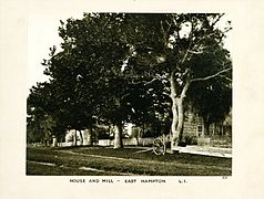 House and Mill, East Hampton, Long Island, c. 1872-1887. George Bradford Brainerd, Brooklyn Museum
 -
 Blacksmith Shop, East Hampton, Long Island, c. 1872-1887. George Bradford Brainerd, Brooklyn Museum
 -
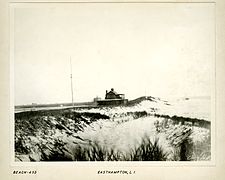 Along Beach, East Hampton, Long Island, c. 1872-1887. George Bradford Brainerd, Brooklyn Museum
 -
 Academy, East Hampton, Long Island, c. 1872-1887
 -
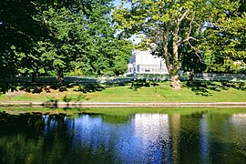 Town Pond at the white house
 -
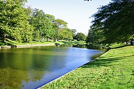 Town Pond
 -
 Gardiner Windmill
 -
 Pantigo Windmill
 -
 Hook Mill


_6913.jpg)

Whaling

While East Hampton was developed originally for agriculture, the settlers soon discovered that whales frequently beached along the South shore of the town. The whales could be carved up for food and oil. Town laws were written to regulate the proper handling of such carcasses. As the demand for whale products grew, residents became more aggressive in their harvesting techniques. No longer content to settle for harvesting beached whales, they began harvesting live whales that were coming near shore.
Northwest Harbor, located at Northwest Landing on Gardiner's Bay, was the town's first harbor. The harbor turned out to be too shallow for large ships, so a larger port was developed two miles (3 km) West, at Sag Harbor. Some accounts say that it was named because of its relation to the settlement of Sagaponack, New York in the Town of Southampton.[citation needed]
At the peak of the whaling industry, in 1847, some 60 whale ships were based in Sag Harbor, employing 800 men in related businesses. Herman Melville made numerous references to this village in his novel, Moby-Dick. The port rivaled that of New York.[citation needed] After 1847 the whaling industry dropped off dramatically because of the rise of alternative fuel products.
Among the sea captains of Sag Harbor were ancestors of politician Howard Dean, who was born in East Hampton.[17]
The most famous voyages out of Sag Harbor were those by Mercator Cooper. In 1845 he was on an American ship that picked up shipwrecked Japanese sailors in the Bonin Islands and returned them to Tokyo. In 1853 Cooper traveled with an expedition to the far South, where he broke through the ice shelf to become the first person to touch East Antarctica.[citation needed]
The Town of East Hampton is still highly influenced by maritime businesses, including tourism. It attracts large summer crowds of residents and tourists. Montauk is New York state's largest fishing port.[18] The Town is famed for its commercial sports fishing, made particularly famous by Frank Mundus. One of the largest buildings in the town is the Promised Land fish meal factory at Napeague.
Presidents and First Ladies
First Ladies Julia Gardiner Tyler and Jacqueline Bouvier Kennedy Onassis spent their childhoods there. Theodore Roosevelt was briefly quarantined in Montauk, at Camp Wyckoff, after returning from the Spanish–American War. Bill and Hillary Clinton spent week-long summer vacations in 1998 and 1999.
Julia Gardiner Tyler

Julia Gardiner was born on Gardiners Island and her father had a house in East Hampton village. On February 28, 1844, she and her father, David Gardiner, were part of the Presidential party aboard the USS Princeton when a malfunctioning cannon exploded. Her father and two Cabinet officers were killed. According to legend Julia fainted into the arms of President John Tyler (who had earlier lost his first wife). They married four months later, creating a national scandal, since there was a 30-year difference in their ages.
Although Tyler was a member of the wealthy Gardiner family and a former First Lady of the United States, she had economic problems after the American Civil War. She and her husband had supported the Confederate States of America. She is buried with the President in Hollywood Cemetery in Richmond, Virginia, the Confederate capital during the war and the capital of Virginia. Her father and one of her sons are buried in the South End Burial Ground in East Hampton.
Jacqueline Bouvier Kennedy Onassis

Jacqueline Kennedy Onassis was born at Southampton Hospital on July 28, 1929. She would have been born in New York City but she was six weeks late. Her parents, Janet Norton Lee and John Vernou Bouvier III, known as "Black Jack," were staying at Lasata, the East Hampton home of her paternal grandfather, Major John Vernou Bouvier Jr.[19]
Her parents had been married at St. Philomena's Catholic Church in East Hampton on July 7, 1928. The reception was held at the East Hampton village home of her maternal grandparents, James T. Lee and Margaret Lee, located on Lily Pond.
Her family were members of the Maidstone Club. She and her younger sister, Lee Bouvier, spent their summers at the house in East Hampton until she was 10, when her parents divorced. Her connection to East Hampton received renewed national attention in the 1970s. It was covered in news reports following the release of the 1975 documentary Grey Gardens, which explored the lives of her aunt, Edith Ewing Bouvier Beale, and cousin, Edith Bouvier Beale. They were revealed to be living in poverty in a mansion of that name. Jacqueline and her husband Aristotle Onassis donated money to improve the lives of her relatives. (The documentary was adapted as a Broadway musical of the same name. A documentary on the estate was released in 2006.)
Jacqueline's aunt and uncle, Winifred Lee and Franklin d'Olier, continued to own the Lily Pond Lane home of her maternal grandparents until 2002. The Bouvier family cemetery plot is at Most Holy Trinity Catholic Cemetery on Cedar Street. Jackie's father, maternal grandmother, paternal grandparents, and paternal great-grandparents, as well as various relatives, including Edith Ewing Bouvier Beale, are buried in the cemetery.
Bill and Hillary Clinton
In 1998 and 1999 as talk surfaced that Hillary Clinton was considering a Senate run from New York, they began summering in East Hampton, where they stayed at the Georgica Pond home of Steven Spielberg. Clinton gave a Saturday radio chat from the Amagansett fire station.
In June 2008, at the conclusion of Hillary Clinton's Presidential bid, she stayed at the Wiborg Beach home of Thomas H. Lee in East Hampton Village.[20]
African-American history
East Hampton has played an important role in African-American history. After the American Revolutionary War, New York passed a gradual abolition law, making children free who were born to slave mothers. But the last slaves were not freed until 1827. During the War of 1812, the Gardiners used slaves to transport supplies back and forth to Gardiner's Island. According to the Gardiners, slaves were easier to pass through British blockades since it was "obvious" that they were "owned."
During this period Sag Harbor rose to a port status, rivaling New York, due to its whale oil trade.[21][citation needed] Many slaves worked on the docks in connection with shipping and the whale trade. After slavery had ended, Gardiner's former slaves developed small houses in Freetown (East Hampton), just north of East Hampton village. Sag Harbor's freedmen developed the Eastville community in Sag Harbor.

In 1808 the United States and Great Britain cooperated in ending the African slave trade, but Spain continued to transport slaves to its Caribbean and Latin American colonies. On August 26, 1839, crew from La Amistad, an illegal slave ship that had been commandeered by its captives off Cuba, dropped anchor at Culloden Point and came ashore at Montauk to get supplies. The slaves, who were inexperienced navigators, thought they were on course to Africa. Members of the U.S. Navy ship USS Washington, seeing the slaves on shore, arrested them and took them to Connecticut.
This was an international case, with Spain arguing for the return of the ship and slaves (or compensation). The United States had its own laws to interpret. The Mende people who had been illegally taken argued for their freedom. Amistad case was ultimately decided by the U.S. Supreme Court in 1841. John Quincy Adams argued for the Africans. The court decided in their favor, opining that the initial capture of the Mende by the Spanish was illegal, so they were classified as free men defending their freedom and were not charged under slave law with mutiny or revolt. East Hampton film director Steven Spielberg popularized the slave revolt and Supreme Court case in the 1997 film Amistad.
One of the Amistad former slaves stayed in the United States after the trial. He worked as a valet for President John Tyler. He was killed aboard USS Princeton along with David Gardiner and two Cabinet officers, when one of the cannons exploded during a demonstration.
In 1845 African-American sailor Pyrrhus Concer of Sag Harbor was aboard the Manhattan, a ship captained by Mercator Cooper, which picked up shipwrecked Japanese sailors in the Bonin Islands. The ship was allowed to enter Tokyo Bay under escort to return the sailors. As Japan had been closed to foreign shipping, it was the first American ship to visit Tokyo. Concer was the first African American the Japanese had seen. He is depicted in their drawings of the event.[citation needed]
Playground for the rich

East Hampton from its earliest days with the settlement of Gardiners Island has had a reputation as being a home for the wealthy especially after the Gardiners married into almost all the wealthy New York City families.
More than one hundred fifty miles from Manhattan, East Hampton remained largely undeveloped until 1880 when Austin Corbin extended the Long Island Rail Road from Bridgehampton to Montauk. As part of the development, Arthur W. Benson forced an auction and paid US$151,000 for 10,000 acres (40 km2) around Montauk. He forced the eviction of the Montaukket Native Americans there.
Benson brought in architect Stanford White to design six "cottages", mansions near Ditch Plains in Montauk. They formed the Montauk Association to govern their exclusive neighborhood. With new access to the village of East Hampton from New York, wealthy families ventured east from Southampton and built mansions in East Hampton. The Maidstone Golf Club opened in 1891. Among the early "cottages" was Tick Hall, later owned in the late 20th century by TV figure Dick Cavett. It burned in 1993, but Cavett had it restored. He had the process filmed for a television documentary.
Corbin had industrial ambitions associated with extending the train to Montauk. He thought a new port city would develop around the train station on Fort Pond Bay, and that oceangoing ships from Europe would dock there. Passengers could take the train into New York City–thus saving a day in transit.
The grand plans for Montauk did not pan out. The land was sold to the United States Army. Theodore Roosevelt made a much publicized visit to Camp Wyckoff there at the end of the Spanish–American War.
In 1926, Carl G. Fisher intended to revive the dream of an urban Montauk, with plans to develop it as a destination, the Miami Beach of the north. He bought the former Benson property for $2.5 million (it was sold as surplus government property following the end of World War I). He built the six-story Montauk Improvement Building in downtown Montauk (which is still the town's tallest occupied structure—as subsequent zoning has forbidden highrise structures), the Montauk Manor (which was a luxury hotel), dredged Lake Montauk and opened it to Block Island Sound to support his Montauk Yacht Club and the associated Star Island Casino, as well as the Montauk Downs golf club.[22]
Fisher lost his fortune in the Stock Market Crash of 1929. The land was sold back to the military in World War II. During World War II, the Army developed its land for Army, Navy and Air Force bases.
Through the year,s East Hampton's wealth has evolved. The village has grown, and former farmland dominated by potato fields has been developed for residential housing. The village of East Hampton is considered to have the most dazzling row of mansions, located along Further Lane and Lily Pond Lane parallel to the ocean.
While ostentatious displays of wealth occurred near the ocean ("south of the Montauk Highway"), much simpler houses and bungalows have been built in such areas as Springs and Montauk. In the 1950s and 1960s, following the Kitchen Debate between Nikita Khrushchev and Richard Nixon, more cheap affordable prefabricated homes called Leisurama were built as second homes in Montauk at Culloden Point.
In November 2006, the median price of a house in the Town was US $895,000 [23] compared with a national median for the U.S. of $225,000.[24] Several houses in East Hampton now sell for prices in the tens of millions of dollars. Living in East Hampton is relatively expensive, in 2007 the cost of living was 168% of the national average.[25]
Service community
A portion of the community consists of working people who provide services to the wealthy community. The service community within the town of East Hampton is centered in Springs which contains the more modest housing available.[26]
Artists' colony

East Hampton's reputation as an artists' colony began with painter Jackson Pollock, who resided in Springs, New York in the 1940s and 1950s, with Lee Krasner, at what is now known as the Pollock-Krasner House and Studio. Many of his most famous paintings were painted in the barn, which he had converted into a studio. The property is now open to the public for tours, by appointment. It is now owned by Stony Brook University with scheduled appointments to view his studio, which was left unchanged after his death.
Among the other artists who popularized East Hampton as an artists' colony were Willem de Kooning, Mark Rothko, Franz Kline, Ian Hornak, Larry Rivers, Alfonso Ossorio, Robert Motherwell, Andy Warhol, John Ferren, Thomas Moran, Louis Schanker, and Charlotte Park as well as art dealers Leo Castelli and Ileana Sonnabend.
Pollock died in 1956 while driving with his mistress, Ruth Kligman, and a friend of hers, on Springs Fireplace Road, after picking them up at the Long Island Railroad station in East Hampton.[27]
Pollock and Krasner are buried in Green River Cemetery, in Springs, along with many of the artists of their generation. Pollock's influence continues to be felt in the community.
Marcia Gay Harden won a 2000 Academy Award for Best Supporting Actress for portraying Krasner in Pollock, which was shot in East Hampton as the dream project of Ed Harris, who was also nominated for Best Actor.
An ongoing debate rages over whether 24 paintings and drawings found in a Wainscott locker in 2003 are Pollock originals. Physicists have argued over whether fractals can be used to authenticate the paintings. The debate is still inconclusive.[28]
Andy Warhol and his longtime collaborator, Paul Morrissey, had a large, waterfront estate in Montauk called Eothen. Among their guests were Jacqueline Onassis, Lee Radziwill, the Rolling Stones, Bianca Jagger, Jerry Hall, Liza Minnelli, Elizabeth Taylor, John Lennon, John Phillips, and Halston.[29]
In 1993, the Andy Warhol Foundation donated 15.6 acres (63,000 m2) of the estate to the Nature Conservancy for the Andy Warhol Visual Arts Preserve, which is run in conjunction with Art Barge in nearby Napeague.[30]
Natural disasters

Two major natural disasters that affected East Hampton include the Hurricane of 1938 and Hurricane Carol, in 1954, both of which found the Atlantic Ocean splitting the town in two at Napeague. The 1938 storm also washed up so much sand that the Cedar Point Lighthouse, which had been on an island, became connected to the mainland. The 1954 storm also toppled the MacKay Radio towers at Napeague.
East Hampton does not have the barrier beaches that run almost the entire length of the south shore of Long Island from Coney Island to Southampton. East Hampton's ocean beaches are connected to the mainland, which prevents them from being washed over in storms.
Due to storms on Fort Pond Bay, the hamlet of Montauk was actually moved by the Navy at the end of World War II. The hamlet was originally located at the train station, but was constantly being flooded.
East Hampton is regularly hit by hurricanes and Nor'easters. Given the town's generally flat topography, water often accumulates on town roads stranding motorists in heavy rains.
The town's most serious environmental problem is beach erosion. The town has severely restricted development on ocean front property, thus limiting impact. The Montauk Lighthouse, which used to be almost 300 feet (91 m) from the cliffs is now 56 feet (17 m) from the cliffs. The most threatened areas now are in the hamlet of Montauk, which is the only community in the town with its business district next to the ocean, as are the oceanfront estates of East Hampton. At Georgica Pond the United States Corps of Engineers built Groynes to protect the mansions. The construction is a source of friction with Southampton, which says the jetties interrupt the longshore drift, greatly increasing beach erosion there.
The lack of beach front development, including the fact there are no boardwalk promenades, which are features of many developed beach communities, has contributed to East Hampton beaches being listed among the best beaches in the country.[31]
Military history
While East Hampton is considered almost exclusively a residential community, it has been the home of United States Navy, United States Army, and United States Air Force bases, the last of which closed in the 1980s. It currently has a United States Coast Guard headquarters.
Skirmishes and military incidents took place in the town from the 17th century through World War II.
Massacre Valley

The biggest recorded loss of life in the various skirmishes and conflicts in East Hampton was "Massacre Valley" in 1653 in Montauk when 30 members of the Montaukett tribe were killed by members of the Narragansett tribe at the foot of what is now Montauk Manor.[32]
The Montauketts had a thriving wampum (made from whelk shells on the East Hampton beaches) trade Connecticut tribes. The arrangements were disrupted in 1637 by the Pequot War which was to solidify English domination of New England and change the balance of power among Native American tribes.
The Pequot War was to contribute to the Montauketts selling Gardiners Island, East Hampton and Southampton to the English with the understanding the English would protect the Montauketts from attacks from Connecticut. However a war broke out between the Montauketts and the Narragansett, the nominal Native American victors in Pequot War.
In 1653 the Narragansetts under Ninigret attacked and burned the Montaukett village, killed 30 and captured one of Wyandanch's daughters. The daughter was ransomed with the aid of Lion Gardiner (who in turn was to get large portion of Smithtown, New York in appreciation). The Montauketts temporarily moved closer to East Hampton village and the English ordered ships in Long Island Sound to sink Narragansett canoes.[33] The skirmishes were to end in 1657.
Captain Kidd
East Hampton had pirates on its waterways in the 17th century and early 18th century, the most notable of which was Captain Kidd who was hanged after his booty on Gardiners Island was introduced at his trial.
Kidd is said to have buried treasure all over Long Island. He parted ways after his east indian adventures with his quartermaster, Hendrick van der Heul, at Little Northwest Creek, near Sag Harbor in 1699 after dividing up the booty from the voyage. Money Ponds at the Montauk Lighthouse are named because of treasure reported to have been left there.
In June 1699 Kidd was stopped on the island while sailing to Boston to try to clear his name. With the permission of the proprietor, Mrs. Gardiner, he buried $30,000 in treasure in a ravine between Bostwick's Point and the Manor House. For her troubles he gave her a piece of gold cloth (a piece of which is now at the East Hampton library) that was captured from a Moorish ship off Madagascar, as well as a bag of sugar. Kidd warned that if it was not there when he returned he would kill Gardiner. Kidd was tried in Boston and Gardiner was ordered to deliver the treasure as evidence. The booty included gold dust, bars of silver, Spanish dollars, rubies, diamonds, candlesticks and porringers. Gardiner kept one of the diamonds, which he gave his daughter. A plaque on the island marks the spot, but it's on private property.[34]
American Revolution


In 1775 the British first ventured toward Long Island at Fort Pond Bay at Montauk during the Siege of Boston. John Dayton, who had limited troops at his disposal, feigned that he had more by walking them back and forth across a hill turning their coats inside out to make it look like there more of them (a tactic referred to as Dayton's Ruse).[35] The British would not formally attack Long Island until 1776.
After the fall of Long Island during the Battle of Long Island, the East Hampton ports of Northwest and Sag Harbor were blockaded by the British and the British used Gardiner's Island for a hunting preserve.
The first American victory in New York after the Battle of Long Island was Meigs Raid on Sag Harbor (sometimes called the Battle of Sag Harbor) when continentals from Connecticut raided the British earth works in the village and burned the ships and wharfs on the East Hampton side of the village. The Americans killed six and transported 90 British prisoners back to Connecticut without losing a single soldier.
A story often circulated is the story of Isaac Van Scoy who had a farm in Northwest. According to the tales the British raided his farmhouse and he killed one soldier with a pitchfork. Van Scoy was reported to have eventually been captured and taken to a prison ship in Sag Harbor where he escaped.[36] The earthen remains of Van Scoy's house are still visible in the Northwest Preserve where he is buried (American flags mark his grave on holidays). His name is applied to various placenames in the area including Van Scoy Pond.
The manor house on Gardiners Island had just been built in 1774 and members of the British forces were to use it throughout the war – with or without permission. Among the British guests were Henry Clinton and John André. At one point Major Andre and Gardiner son Nathaniel Gardiner, who was a surgeon for the New Hampshire Continental Infantry, exchanged toasts on the island. Gardiner would later be the American surgeon who attended to Andre when he was executed after being caught spying with Benedict Arnold.[37]
The British fleet used East Hampton waters for blockading Connecticut and planning for a new offense to retake New England (that never took place). One of the ships, HMS Culloden, ran aground at what is now called Culloden Point in Montauk during a winter storm on January 24, 1781. The ship was scuttled and burned. In the 1970s remains of the ship were discovered and is now Long Island's only underwater park. Remains of the ship can be seen at the East Hampton Marine Museum in Amagansett.
After the war, Gardiners Island which had been considered an independent colony was officially added to New York and East Hampton.
George Washington was to authorize construction of the Montauk Point Lighthouse.
War of 1812


During the War of 1812 British frigates once again controlled the northern bays of East Hampton with frigates headquartered in Gardiners Bay particularly harassing ships going into Sag Harbor.[38]
Sag Harbor had a fort manned by 3,000 troops on Turkey Hill. July 11, 1813 One hundred British Marines raided the wharf but were driven back after setting fire to one sloop by Americans led by Capt. David Hand.[39]
During the War of 1812 a British fleet of seven ships of the line and several smaller frigates anchored in Cherry Harbor and conducted raids on American shipping Long Island Sound. Crews would come ashore for provisions which were purchased at market prices. During one of the British excursions, Americans captured some of the crew. The British came to arrest then Lord of the Manor John Lyon Gardiner. Gardiner, who was a delicate man, adopted the "green room defense" where he stayed in a bed with green curtains surrounded by medicine to make him look feeble. The British, not wanting a sick man on board, let him be.[37]
The British were to bury several personnel on the island. Some of the British fleet that burned Washington assembled in the harbor in 1814.[40]
Gardiner's supply boats were manned by slaves during the war and this made it easier for them to pass through British lines. Many of the Gardiner slaves were to live in the Freetown (East Hampton), just north of East Hampton (village), New York.[37]
American Civil Waredit
Zdroj:https://en.wikipedia.org?pojem=East_Hampton_(town),_New_YorkText je dostupný za podmienok Creative Commons Attribution/Share-Alike License 3.0 Unported; prípadne za ďalších podmienok. Podrobnejšie informácie nájdete na stránke Podmienky použitia.
Antropológia
Aplikované vedy
Bibliometria
Dejiny vedy
Encyklopédie
Filozofia vedy
Forenzné vedy
Humanitné vedy
Knižničná veda
Kryogenika
Kryptológia
Kulturológia
Literárna veda
Medzidisciplinárne oblasti
Metódy kvantitatívnej analýzy
Metavedy
Metodika
Text je dostupný za podmienok Creative
Commons Attribution/Share-Alike License 3.0 Unported; prípadne za ďalších
podmienok.
Podrobnejšie informácie nájdete na stránke Podmienky
použitia.
www.astronomia.sk | www.biologia.sk | www.botanika.sk | www.dejiny.sk | www.economy.sk | www.elektrotechnika.sk | www.estetika.sk | www.farmakologia.sk | www.filozofia.sk | Fyzika | www.futurologia.sk | www.genetika.sk | www.chemia.sk | www.lingvistika.sk | www.politologia.sk | www.psychologia.sk | www.sexuologia.sk | www.sociologia.sk | www.veda.sk I www.zoologia.sk