A | B | C | D | E | F | G | H | CH | I | J | K | L | M | N | O | P | Q | R | S | T | U | V | W | X | Y | Z | 0 | 1 | 2 | 3 | 4 | 5 | 6 | 7 | 8 | 9
Dawson City | |
|---|---|
City | |
| City of Dawson[1] | |
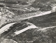
 Aerial view of Dawson City and the Yukon River | |
| Nicknames: | |
| Coordinates: 64°03′36″N 139°25′55″W / 64.06000°N 139.43194°W[3] | |
| Country | Canada |
| Territory | Yukon |
| Settled | 1896 |
| City | 1902 |
| Town | 1980 |
| Named for | George Mercer Dawson |
| Government | |
| • Mayor | Bill Kendrick |
| Area | |
| • Total | 32.45 km2 (12.53 sq mi) |
| Elevation | 370 m (1,214 ft) |
| Population (2016)[4] | |
| • Total | 1,577 |
| • Density | 42.4/km2 (110/sq mi) |
| Time zone | UTC−07:00 (MST) |
| Canadian Postal code | Y0B 1G0 |
| Area code | 867 |
| NTS Map | 116B3 Dawson |
| GNBC Code | KAHFT |
| Climate | Dfc |
| Website | Official website |
| Type | Cultural |
| Criteria | iii, iv |
| Designated | 2023 (45th session) |
| Part of | Tr’ondëk-Klondike |
| Reference no. | 1564-006 |
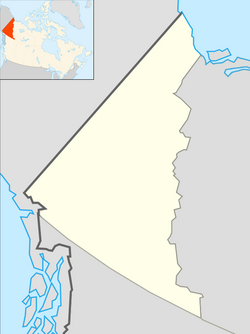
Dawson City, officially the City of Dawson, is a city in the Canadian territory of Yukon. It is inseparably linked to the Klondike Gold Rush (1896–1899). Its population was 1,577 as of the 2021 census,[6] making it the second-largest city in Yukon.
History

Prior to the late modern period the area was used for hunting and gathering by the Hän-speaking people of the Tr’ondëk Hwëch’in and their forebears. The heart of their homeland was Tr'ochëk, a fishing camp at the confluence of the Klondike River and Yukon River, now a National Historic Site of Canada, just across the Klondike River from modern Dawson City. This site was also an important summer gathering spot and a base for moose-hunting on the Klondike Valley.
The current settlement was founded by Joseph Ladue and named in January 1897 after noted Canadian geologist George M. Dawson, who had explored and mapped the region in 1887. It served as Yukon's capital from the territory's founding in 1898 until 1952, when the seat was moved to Whitehorse.


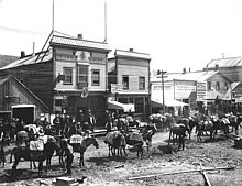
Dawson City was the centre of the Klondike Gold Rush.[7] It began in 1896 and changed the First Nations camp into a thriving city of 16,000–17,000[8] by 1898. By 1899, the gold rush had ended and the town's population plummeted as all but 8,000 people left. When Dawson was incorporated as a city in 1902, the population was under 5,000. St. Paul's Anglican Church, also built that same year, is a National Historic Site. The downtown was devastated by fire in November 1897 (started when dance hall girl Dolly Mitchell threw a lamp at another girl in an argument), 1899 (started in the Bodega Saloon), 1900 (started at the Monte Carlo Theatre) and flooding in 1925, 1944, 1966, 1969 and 1979.[9]
The population dropped after World War II when the Alaska Highway bypassed it 518 kilometres (322 mi)[10] to the south. The economic damage to Dawson City was such that Whitehorse, the highway's hub, replaced it as territorial capital in 1953.[7] Dawson City's population languished around the 600–900 mark through the 1960s and 1970s, but has risen and held stable since then. The high price of gold has made modern placer mining operations profitable, and the growth of the tourism industry has encouraged development of facilities. In the early 1950s, Dawson was linked by road to Alaska, and in fall 1955, with Whitehorse along a road that now forms part of the Klondike Highway.
In 1978, another kind of buried treasure was discovered with the Dawson Film Find when a construction excavation inadvertently uncovered a forgotten collection of more than 500 discarded films on highly flammable nitrate film stock from the early 20th century that were buried in (and preserved by) the permafrost. These silent-era film reels, dating from "between 1903 and 1929, were uncovered in the rubble beneath old hockey rink".[11] (See Dawson Film Find.) Owing to its dangerous chemical volatility,[12] the historical find was moved by military transport to Library and Archives Canada and the U.S. Library of Congress for both transfer to safety film and storage. A documentary about the find, Dawson City: Frozen Time, was released in 2016.[13]
The City of Dawson and the nearby ghost town of Forty Mile are featured prominently in the novels and short stories of American author Jack London, including The Call of the Wild. London lived in the Dawson area from October 1897 to June 1898. Other writers who lived in and wrote of Dawson City include Pierre Berton and the poet Robert Service. The childhood home of the former is now used as a residency and retreat for professional writers administered by the Writers' Trust of Canada.[14][15]
In 2023, the Dawson City townsite became part of the Tr’ondëk-Klondike UNESCO World Heritage Site, because of its archaeological record highlighting the transformation of the site from predominanty Indigenous to predominantly European use, and the adaptations that the Indigenous people made in response to EUropean colonialism. [16]
Geography

Dawson City lies on the Tintina Fault. This fault has created the Tintina Trench and continues eastward for several hundred kilometres. Erosional remnants of lava flows form outcrops immediately north and west of Dawson City.
Climate
Dawson City has a subarctic climate (Köppen climate classification: Dsc), with significantly higher continentality than the territory capital of Whitehorse. Despite this classification, most precipitation actually occurs during summer and July is the wettest month. However, April, one of the six warmer months is sufficiently drier than October and November. Hence the letter 's' is used instead of 'f' (as in Dfc).
The average temperature in July is 15.7 °C (60.3 °F) and in January is −26.0 °C (−14.8 °F).[17] The highest temperature ever recorded is 35.0 °C (95 °F) on 9 July 1899[18] and 18 June 1950.[19] The lowest temperature ever recorded is −58.3 °C (−73 °F) on 3 February 1947.[20] It experiences a wide range of temperatures surpassing 30 °C (86 °F) in most summers and dropping below −40 °C (−40 °F) in winter.[17] In the very cold month of December 1917, the temperature did not rise above −37.2 °C (−35 °F) and it averaged −46.3 °C (−51 °F).[21]
The community is at an elevation of 320 m (1,050 ft)[5] and the average rainfall in July is 49.0 mm (1.93 in) and the average snowfall in January is 27.6 cm (10.87 in). Dawson has an average total annual snowfall of 166.5 cm (65.55 in) and averages 70 frost free days per year.[17] The town is built on a layer of frozen earth, which may pose a threat to the town's infrastructure in the future if the permafrost melts.[22][23]
| Climate data for Dawson City (Dawson City Airport) Climate ID: 2100402; coordinates 64°02′35″N 139°07′40″W / 64.04306°N 139.12778°W; elevation: 370.3 m (1,215 ft); 1991–2020 normals, extremes 1897–present | |||||||||||||
|---|---|---|---|---|---|---|---|---|---|---|---|---|---|
| Month | Jan | Feb | Mar | Apr | May | Jun | Jul | Aug | Sep | Oct | Nov | Dec | Year |
| Record high humidex | 9.7 | 8.8 | 10.7 | 22.4 | 34.9 | 35.0 | 39.4 | 37.9 | 24.9 | 19.5 | 10.0 | 5.0 | 39.4 |
| Record high °C (°F) | 9.7 (49.5) |
9.5 (49.1) |
14.8 (58.6) |
23.0 (73.4) |
34.7 (94.5) |
35.0 (95.0) |
35.0 (95.0) |
33.5 (92.3) |
26.1 (79.0) |
20.1 (68.2) |
12.8 (55.0) |
12.8 (55.0) |
35.0 (95.0) |
| Mean maximum °C (°F) | −4.9 (23.2) |
−1.0 (30.2) |
6.5 (43.7) |
16.6 (61.9) |
24.3 (75.7) |
29.0 (84.2) |
29.4 (84.9) |
27.4 (81.3) |
19.8 (67.6) |
10.7 (51.3) |
−0.5 (31.1) |
−2.8 (27.0) |
30.9 (87.6) |
| Mean daily maximum °C (°F) | −21.6 (−6.9) |
−15.1 (4.8) |
−4.2 (24.4) |
7.9 (46.2) |
16.4 (61.5) |
22.1 (71.8) |
23.1 (73.6) |
19.5 (67.1) |
12.6 (54.7) |
0.2 (32.4) |
−14.7 (5.5) |
−18.8 (−1.8) |
2.4 (36.3) |
| Daily mean °C (°F) | −25.7 (−14.3) |
−20.9 (−5.6) |
−12.6 (9.3) |
0.4 (32.7) |
8.8 (47.8) |
14.4 (57.9) |
15.9 (60.6) |
12.7 (54.9) |
6.4 (43.5) |
−4.0 (24.8) |
−17.7 (0.1) |
−23.0 (−9.4) |
−3.8 (25.2) |
| Mean daily minimum °C (°F) | −29.8 (−21.6) |
−26.5 (−15.7) |
−20.9 (−5.6) |
−7.1 (19.2) |
1.2 (34.2) |
6.7 (44.1) |
8.7 (47.7) |
5.8 (42.4) |
0.2 (32.4) |
−8.2 (17.2) |
−21.7 (−7.1) |
−27.1 (−16.8) |
−9.9 (14.2) |
| Mean minimum °C (°F) | −45.4 (−49.7) |
−42.1 (−43.8) |
−36.4 (−33.5) |
−21.8 (−7.2) |
−5.5 (22.1) |
−0.2 (31.6) |
2.1 (35.8) |
−3.1 (26.4) |
−9.8 (14.4) |
−23.7 (−10.7) |
−36.1 (−33.0) |
−42.0 (−43.6) |
−47.9 (−54.2) |
| Record low °C (°F) | −56.1 (−69.0) |
−58.3 (−72.9) |
−47.8 (−54.0) |
−40.6 (−41.1) |
−15.6 (3.9) |
−3.3 (26.1) |
−2.4 (27.7) |
−11.0 (12.2) |
−23.2 (−9.8) |
−36.5 (−33.7) |
−47.9 (−54.2) |
−54.4 (−65.9) |
−58.3 (−72.9) |
| Record low wind chill | −59.8 | −58.6 | −47.7 | −37.9 | −18.2 | −3.5 | 0.0 | −9.2 | −25.8 | −41.0 | −50.9 | −63.8 | −63.8 |
| Average precipitation mm (inches) | 19.4 (0.76) |
12.8 (0.50) |
9.9 (0.39) |
8.2 (0.32) |
30.8 (1.21) |
38.2 (1.50) |
49.0 (1.93) |
43.4 (1.71) |
34.0 (1.34) |
31.4 (1.24) |
25.5 (1.00) |
22.0 (0.87) |
324.4 (12.77) |
| Average rainfall mm (inches) | 0.1 (0.00) |
0.0 (0.0) |
0.3 (0.01) |
2.6 (0.10) |
28.4 (1.12) |
38.2 (1.50) |
49.0 (1.93) |
43.1 (1.70) |
29.7 (1.17) |
9.4 (0.37) |
0.1 (0.00) |
0.4 (0.02) |
201.3 (7.93) |
| Average snowfall cm (inches) | 27.6 (10.9) |
18.2 (7.2) |
12.1 (4.8) |
7.2 (2.8) |
2.5 (1.0) |
0.0 (0.0) |
0.0 (0.0) |
0.4 (0.2) |
4.6 (1.8) |
26.7 (10.5) |
36.3 (14.3) |
31.0 (12.2) |
166.5 (65.6) |
| Average precipitation days (≥ 0.2 mm) | 11.7 | 8.7 | 6.3 | 4.5 | 10.9 | 12.0 | 14.4 | 13.7 | 11.0 | 12.7 | 12.7 | 11.5 | 130.2 |
| Average rainy days (≥ 0.2 mm) | 0.2 | 0.0 | 0.2 | 2.0 | 10.6 | 12.0 | 14.4 | 13.6 | 10.0 | 3.8 | 0.3 | 0.1 | 67.1 |
| Average snowy days (≥ 0.2 cm) | 12.3 | 9.8 | 6.5 | 3.2 | 1.0 | 0.0 | 0.0 | 0.1 | 1.5 | 9.9 | 13.5 | 12.2 | 69.8 |
| Source: Environment and Climate Change Canada, [17] [18][24][25] Météo Climat[26][27] | |||||||||||||
Demographics
| Year | Pop. | ±% |
|---|---|---|
| 1901 | 9,142 | — |
| 1911 | 3,013 | −67.0% |
| 1921 | 975 | −67.6% |
| 1931 | 819 | −16.0% |
| 1941 | 1,043 | +27.4% |
| 1951 | 783 | −24.9% |
| 1956 | 851 | +8.7% |
| 1961 | 881 | +3.5% |
| 1966 | 742 | −15.8% |
| 1971 | 762 | +2.7% |
| 1976 | 838 | +10.0% |
| 1981 | 697 | −16.8% |
| 1986 | 896 | +28.6% |
| 1991 | 972 | +8.5% |
| 1996 | 1,287 | +32.4% |
| 2001 | 1,251 | −2.8% |
| 2006 | 1,327 | +6.1% |
| 2011 | 1,319 | −0.6% |
| 2016 | 1,375 | +4.2% |
| 2021 | 1,577 | +14.7% |
| Source: Statistics Canada [28][29][30][31][32][33][34][35][36][37][38][6] | ||
In the 2021 Census of Population conducted by Statistics Canada, Dawson had a population of 1,577 living in 770 of its 836 total private dwellings, a change of 14.7% from its 2016 population of 1,375. With a land area of 30.91 km2 (11.93 sq mi), it had a population density of 51.0/km2 (132.1/sq mi) in 2021.[6]
Ethnicity
According to the 2021 Census, the town is predominately European Canadian with 60.8% of the population with Indigenous Canadians accounting for 31.4% of the population and East Asian Canadians accounting for 3.0% of the population.[39]

