A | B | C | D | E | F | G | H | CH | I | J | K | L | M | N | O | P | Q | R | S | T | U | V | W | X | Y | Z | 0 | 1 | 2 | 3 | 4 | 5 | 6 | 7 | 8 | 9
Cartagena | |
|---|---|
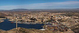
City Hall The wall of Carlos III Panorama view Pedreño Palace Gran Hotel | |
| Motto(s): Muy noble, muy leal y siempre heroica ciudad de Cartagena | |
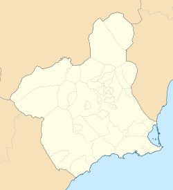
 Location of Cartagena | |
| Coordinates: 37°36′7″N 0°59′3″W / 37.60194°N 0.98417°W | |
| Country | Spain |
| Autonomous community | Region of Murcia |
| Province | Province of Murcia |
| Comarca | Campo de Cartagena |
| Judicial district | Cartagena |
| Founded | 227 BC |
| Government | |
| • Mayor | Ana Belén Castejón Hernández (Ind.) |
| Area | |
| • Total | 558.08 km2 (215.48 sq mi) |
| Elevation | 10 m (30 ft) |
| Highest elevation | 50 m (160 ft) |
| Lowest elevation | 0 m (0 ft) |
| Population (2018)[1] | |
| • Total | 213,943 |
| • Density | 380/km2 (990/sq mi) |
| Demonym | Cartageneros |
| Time zone | UTC+1 (CET) |
| • Summer (DST) | UTC+2 (CEST) |
| Postal code | 302xx and 303xx |
| Dialing code | (+34) 968 |
| Website | www |
Cartagena (Spanish pronunciation: [kaɾtaˈxena]) is a Spanish city and a major naval station on the Mediterranean coast, south-eastern Iberia. As of January 2018, it has a population of 218,943 inhabitants.[2] This makes Cartagena Murcia's second-largest municipality and Spain's sixth-largest city that is not a provincial-capital. The wider urban or metropolitan area of Cartagena, known as Campo de Cartagena, has a population of 409,586 inhabitants.
Cartagena has been inhabited for over two millennia, being founded around 227 BC[3] by the Carthaginian military leader Hasdrubal the Fair[4] as Qart Hadasht (Phoenician: 𐤒𐤓𐤕𐤟𐤇𐤃𐤔𐤕 QRT𐤟ḤDŠT; meaning "New Town"), the same name as the original city of Carthage. The city had its heyday during the Roman Empire, when it was known as Carthago Nova (the New Carthage) and Carthago Spartaria, capital of the province of Carthaginensis.
Much of the historical significance of Cartagena stemmed from its coveted defensive port, one of the most important in the western Mediterranean. Cartagena has been the capital of the Spanish Navy's Maritime Department of the Mediterranean since the arrival of the Spanish Bourbons in the 18th century.[5] As far back as the 16th century it was one of the most important naval ports in Spain, together with Ferrol in the North. It is still an important naval seaport, the main military haven of Spain, and is home to a large naval shipyard.[6]
The confluence of civilizations, its strategic harbor, and the influence of the local mining industry have led to a unique historic, architectural and artistic heritage. This heritage is reflected in a number of landmarks of Cartagena, including the Roman Theatre, an abundance of Phoenician, Roman, Byzantine and Moorish remains, and a plethora of Art Nouveau buildings from the early 20th century. Cartagena is now established as a major cruise ship destination[7] in the Mediterranean and an emerging cultural focus.
It was the first of a number of cities that have been named Cartagena, most notably Cartagena, Colombia.
Geography and climate
Geography and relief
The city of Cartagena is located in the southeastern region of Spain in the Campo de Cartagena. The Cartagena region can be viewed as a great plain inclined slightly in the direction NW-SE, bordered at the north and the northwest by pre-coastal mountain ranges (Carrascoy, El Puerto, Los Villares, Columbares and Escalona), and at the south and southwest by coastal mountain ranges (El Algarrobo, La Muela, Pelayo, Gorda, La Fausilla y Minera, with its last spurs in Cape Palos).
The dominant geology of the region is metamorphic (slate, marble) and sedimentary (limestone). The most widely present kind of soil is calcic xerosol. Other soils that occur in the municipality are the leptosol, which forms the Mediterranean coast, and the petrocalcic xerosol.[8]
The city is located just at the end of the new AP-7 motorway. The following villages are part of Cartagena municipality: La Azohía, Isla Plana, Los Urrutias and Los Nietos.
The Old Town is limited by five small hills (Molinete, Monte Sacro, Monte de San José, Despeñaperros and Monte de la Concepción) following the example of Rome.[9] In the past, there was an inner sea between the hills called the Estero that eventually dried up. On this site, the "Ensanche" (Expansion or New Town) was built at the beginning of the 20th century.[10][11]
The urban area is delimited or crossed by several watercourses, some of which go deep into the urban network during a large part of their courses.[11]
Climate
Cartagena has a hot semi-arid climate. Its location near the sea moderates the temperature, and annual precipitation typically does not surpass 300 mm (12 in). The annual average temperature goes up to around 18.8 °C (66 °F). The coldest month is January, with an average temperature of 11.9 °C (53 °F). In August, the warmest month, the average temperature is 26.5 °C (80 °F). The wind is an important climatic factor in the region.
| Climate data for Cartagena, Murcia, 1981-2010 normals | |||||||||||||
|---|---|---|---|---|---|---|---|---|---|---|---|---|---|
| Month | Jan | Feb | Mar | Apr | May | Jun | Jul | Aug | Sep | Oct | Nov | Dec | Year |
| Record high °C (°F) | 25.8 (78.4) |
28.2 (82.8) |
30.5 (86.9) |
34.8 (94.6) |
37.3 (99.1) |
39.6 (103.3) |
43.8 (110.8) |
42.1 (107.8) |
38.7 (101.7) |
34.1 (93.4) |
30.8 (87.4) |
24.6 (76.3) |
43.8 (110.8) |
| Mean daily maximum °C (°F) | 16.1 (61.0) |
16.9 (62.4) |
18.8 (65.8) |
20.7 (69.3) |
23.6 (74.5) |
27.6 (81.7) |
30.6 (87.1) |
30.8 (87.4) |
27.8 (82.0) |
24.0 (75.2) |
19.6 (67.3) |
16.9 (62.4) |
22.8 (73.0) |
| Daily mean °C (°F) | 11.9 (53.4) |
12.6 (54.7) |
14.5 (58.1) |
16.3 (61.3) |
19.4 (66.9) |
23.2 (73.8) |
26.0 (78.8) |
26.5 (79.7) |
23.9 (75.0) |
20.1 (68.2) |
15.8 (60.4) |
12.9 (55.2) |
18.6 (65.5) |
| Mean daily minimum °C (°F) | 7.6 (45.7) |
8.4 (47.1) |
10.1 (50.2) |
12.0 (53.6) |
15.1 (59.2) |
18.9 (66.0) |
21.4 (70.5) |
22.1 (71.8) |
20.0 (68.0) |
16.3 (61.3) |
11.9 (53.4) |
8.9 (48.0) |
14.4 (57.9) |
| Average precipitation mm (inches) | 45.3 (1.78) |
38.2 (1.50) |
33.4 (1.31) |
26.7 (1.05) |
26.6 (1.05) |
7.4 (0.29) |
1.6 (0.06) |
10.9 (0.43) |
44.8 (1.76) |
52.3 (2.06) |
53.6 (2.11) |
29.5 (1.16) |
370.3 (14.56) |
| Average rainy days | 3.5 | 2.8 | 3.2 | 2.5 | 1.8 | 1.0 | 0.3 | 0.7 | 2.2 | 3.1 | 4.1 | 3.2 | 28.4 |
| Mean daily sunshine hours | 5.0 | 6.0 | 6.0 | 7.0 | 9.0 | 9.0 | 10.0 | 9.0 | 7.0 | 6.0 | 6.0 | 5.0 | 7.1 |
| Percent possible sunshine | 50 | 55 | 50 | 54 | 64 | 60 | 71 | 64 | 58 | 55 | 60 | 50 | 58 |
| Source 1: World Meteorological Organization[12] | |||||||||||||
| Source 2: Various sources: AEMET "Atlas Climático de Murcia". Atlas de Murcia,[13] University of Murcia,[14] Weather Atlas (sunshine data)[15] | |||||||||||||
| Climate data for Cartagena | |||||||||||||
|---|---|---|---|---|---|---|---|---|---|---|---|---|---|
| Month | Jan | Feb | Mar | Apr | May | Jun | Jul | Aug | Sep | Oct | Nov | Dec | Year |
| Average sea temperature °C (°F) | 14.8 (58.6) |
14.4 (57.9) |
14.6 (58.3) |
16.6 (61.9) |
18.9 (66.0) |
22.0 (71.6) |
24.7 (76.5) |
25.9 (78.6) |
24.4 (75.9) |
22.0 (71.6) |
19.3 (66.7) |
16.6 (61.9) |
19.5 (67.1) |
| Mean daily daylight hours | 10.0 | 11.0 | 12.0 | 13.0 | 14.0 | 15.0 | 15.0 | 14.0 | 13.0 | 12.0 | 11.0 | 10.0 | 12.6 |
| Average Ultraviolet index | 2 | 3 | 5 | 7 | 8 | 9 | 10 | 9 | 7 | 5 | 3 | 2 | 5.8 |
| Source: Weather Atlas[15] | |||||||||||||
Human geography

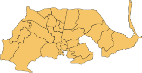
The municipality has 24 districts, known as diputaciones (councils). The origin of this administrative structure has its date in the beginning of the 18th century when the population was increasing and the municipality was becoming less tractable.[16] The districts are:[17]
- Cartagena Casco: This is the district where the main town (also named Cartagena) is located and is located in the south of the municipality. Its population consisted of 57,001 in 2019.
- San Antonio Abad: It is located in the south of the municipality and adjoins Cartagena Casco in its south and Canteras in its west. The number of inhabitants was 44,882 in 2019.
- El Plan: It adjoins La Magdalena in its west and Lentiscar in its east. There were 35,974 residents in 2019.
- Rincón de San Ginés: It is located in the southeast end of the municipality. Its population consisted of 10,214 people in 2019.
- Canteras: This coastal district is placed in the south of the territory and faces the Mediterranean Sea in its south. It is also adjoining to Perín in its west and San Antonio Abad in its east. There were 10,167 people living in 2019.
- El Algar: It is located in the east of Cartagena and adjoins Lentiscar in its north. The number of inhabitants consisted in 7,961.
- Santa Lucía: It is located in the south of the municipality and faces the Mediterranean Sea in its south.
- La Palma: It is located in the north of the municipality. It shares borders with Lentiscar in its east.
- Pozo Estrecho: It is placed in the north of Cartagena and shares borders with La Palma in its east and with El Albujón in its west. There were 5,149 people who resided in the area in 2019. Zdroj:https://en.wikipedia.org?pojem=Cartagena,_Murcia
Text je dostupný za podmienok Creative Commons Attribution/Share-Alike License 3.0 Unported; prípadne za ďalších podmienok. Podrobnejšie informácie nájdete na stránke Podmienky použitia.
Antropológia
Aplikované vedy
Bibliometria
Dejiny vedy
Encyklopédie
Filozofia vedy
Forenzné vedy
Humanitné vedy
Knižničná veda
Kryogenika
Kryptológia
Kulturológia
Literárna veda
Medzidisciplinárne oblasti
Metódy kvantitatívnej analýzy
Metavedy
Metodika
Text je dostupný za podmienok Creative
Commons Attribution/Share-Alike License 3.0 Unported; prípadne za ďalších
podmienok.
Podrobnejšie informácie nájdete na stránke Podmienky
použitia.
www.astronomia.sk | www.biologia.sk | www.botanika.sk | www.dejiny.sk | www.economy.sk | www.elektrotechnika.sk | www.estetika.sk | www.farmakologia.sk | www.filozofia.sk | Fyzika | www.futurologia.sk | www.genetika.sk | www.chemia.sk | www.lingvistika.sk | www.politologia.sk | www.psychologia.sk | www.sexuologia.sk | www.sociologia.sk | www.veda.sk I www.zoologia.sk


