131 (MBTA bus) - Biblioteka.sk

Upozornenie: Prezeranie týchto stránok je určené len pre návštevníkov nad 18 rokov!
Zásady ochrany osobných údajov.
Používaním tohto webu súhlasíte s uchovávaním cookies, ktoré slúžia na poskytovanie služieb, nastavenie reklám a analýzu návštevnosti. OK, súhlasím


Panta Rhei Doprava Zadarmo
...
...


A | B | C | D | E | F | G | H | CH | I | J | K | L | M | N | O | P | Q | R | S | T | U | V | W | X | Y | Z | 0 | 1 | 2 | 3 | 4 | 5 | 6 | 7 | 8 | 9
131 (MBTA bus)
 ...

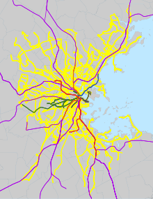
Geographic map of MBTA bus service

The Massachusetts Bay Transportation Authority bus division operates 152 bus routes in the Boston, Massachusetts metropolitan area. All routes connect to MBTA subway, MBTA Commuter Rail, and/or other MBTA bus services. Many routes are descendants of the streetcar routes of the Boston Elevated Railway, or of suburban companies including the Eastern Massachusetts Street Railway and Middlesex and Boston Street Railway. 148 routes are directly operated by the MBTA, while private companies operate four routes under contract. Four additional suburban operations are partially funded by the MBTA.

A number of routes were temporarily suspended or placed on modified routings during the COVID-19 pandemic; overall service levels were restored to pre-COVID levels in 2021, though some routes were not restored. Since 2018, the MBTA has been planning a major bus network overhaul, with implementation expected to be complete in 2028.[1]

Silver Line

SL2 bus at South Station

The Silver Line is a six-route bus rapid transit system marketed as rapid transit. It is divided into two branches: Waterfront service (SL1, SL2, SL3, and the rush-hour SLW shuttle) that runs through the South Boston Transitway tunnel, and Washington Street service (SL4 and SL5) that runs on the surface via Washington Street. The Waterfront service costs the same as a subway fare, while the Washington Street service costs a regular bus fare. All Silver Line routes use articulated 60-foot (18 m) buses; the Waterfront routes use hybrid buses with extended battery range for electric operation in the tunnel.

The SL5 route was created in 2002 as a replacement for the Washington Street Elevated. The Shuttle route began operations in 2004, followed by the SL2 and SL3 (former) in 2004 and SL1 in 2005 when dual-mode buses became available. The SL4 was introduced in 2009 as a replacement for the canceled Phase III tunnel. A new SL3 route to Chelsea opened in 2018.[2]

Route Description MBTA link
SL1 Logan Airport terminals–South Station Link
SL2 Drydock Avenue–South Station Link
SL3 ChelseaSouth Station Link
SLW Silver Line WaySouth Station Link
SL4 Nubian stationSouth Station Link
SL5 Nubian stationDowntown Crossing (Temple Place) Link

Crosstown

The two crosstown (CT) routes provide limited-stop service on two routes that connect major subway and bus transfer points. Three crosstown routes were created by the MBTA in 1994; route CT1 was merged with route 1 in 2019.[2]

Route Description MBTA link
CT2 Sullivan Square stationRuggles station Link
CT3 Beth Israel Deaconess HospitalAndrew station Link

1–121

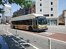
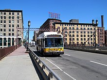
A route 1 bus in Cambridge
A route 7 bus in downtown Boston
A route 29 bus on Columbus Avenue in Roxbury, Boston
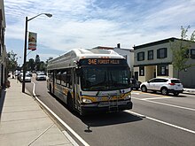
A route 34E bus in Walpole
A route 39 bus in Jamaica Plain
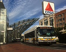
A route 60 bus at Kenmore station
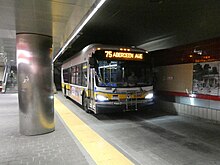
A route 75 bus in the Harvard Bus Tunnel
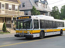
A route 96 bus in Somerville
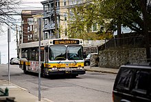
A route 101 bus on Main Street in Somerville
A route 111 bus at Bellingham Square

These routes provide almost all local service in the core of the metropolitan area; most were originally Boston Elevated Railway streetcar routes. They were originally numbered roughly clockwise from southeast to northeast, with 4 the furthest south in South Boston and 121 the furthest north (roughly) in East Boston. The BERy folded into the Metropolitan Transit Authority in 1947, and the M.T.A. in turn was reorganized as the MBTA in 1964. Despite some changes, including minor routes being merged into trunk routes, the core service network has remained roughly intact since the BERy eta. New routes have been added during the M.T.A. and MBTA eras.[2]

Seven routes – 52, 59, 61, 62, 67, 70, and 76 – serve more distant western suburbs including Bedford, Waltham, Lexington, and Needham. They are descendants of routes acquired from the Middlesex and Boston Street Railway in 1972, which were subsequently renumbered using previously discontinued designations.[2]

Fifteen routes – 1, 15, 22, 23, 28, 32, 39, 57, 66, 71, 73, 77, 111, 116, and 117 – are designated as key bus routes. The highest–ridership routes in the system, they supplement the subway system to provide frequent service to the densest areas of the city. Key bus routes typically operate at higher frequencies than other routes.[3] Routes 28 and 39 use 60-foot articulated buses.

Four early morning round trips are run between outlying stations and Haymarket, each running over portions of several local routes. Although intended primarily for station agents, they are open to all passengers. The trips are internally numbered 191–194, but are shown in timetables as variants of local routes.[2]

Zdroj:https://en.wikipedia.org?pojem=131_(MBTA_bus)
Text je dostupný za podmienok Creative Commons Attribution/Share-Alike License 3.0 Unported; prípadne za ďalších podmienok. Podrobnejšie informácie nájdete na stránke Podmienky použitia.


Text je dostupný za podmienok Creative Commons Attribution/Share-Alike License 3.0 Unported; prípadne za ďalších podmienok.
Podrobnejšie informácie nájdete na stránke Podmienky použitia.

Your browser doesn’t support the object tag.

www.astronomia.sk | www.biologia.sk | www.botanika.sk | www.dejiny.sk | www.economy.sk | www.elektrotechnika.sk | www.estetika.sk | www.farmakologia.sk | www.filozofia.sk | Fyzika | www.futurologia.sk | www.genetika.sk | www.chemia.sk | www.lingvistika.sk | www.politologia.sk | www.psychologia.sk | www.sexuologia.sk | www.sociologia.sk | www.veda.sk I www.zoologia.sk


Route Description MBTA link
1 Harvard SquareNubian station Link
4 North StationMarine Park Link
7 City PointOtis Street & Summer Street Link
8 Harbor PointKenmore station Link
9 City PointCopley Square Link
10 City PointCopley Square Link
11 City PointChauncy Street & Summer Street Link
14 Roslindale SquareHeath Street station Link
15 Fields Corner station or Kane Square–Ruggles station Link
16 Forest Hills stationAndrew station or Harbor Point Link
17 Fields Corner stationAndrew station Link
18 Ashmont stationAndrew station Link
19 Fields Corner stationKenmore station or Ruggles station Link
21 Ashmont stationForest Hills station Link
22 Ashmont stationRuggles station via Talbot Avenue Link
23 Ashmont stationRuggles station via Washington Street Link
24 Wakefield Avenue–Ashmont station Link
26 Ashmont station–Norfolk Street Loop Link
28 Mattapan stationRuggles station Link
29 Mattapan stationJackson Square station Link
30 Mattapan stationForest Hills station via Cummins Highway and Roslindale Square Link
31 Mattapan stationForest Hills station via Morton Street Link
32 Wolcott or Cleary SquareForest Hills station Link
33 River Street & Milton Street–Mattapan station Link
34 Dedham Mall–Forest Hills station Link
34E Walpole CenterForest Hills station Link
35 Dedham Mall or Stimson Street–Forest Hills station Link
36 Millennium Park or VA Hospital–Forest Hills station Link
37 Baker Street & Vermont Street–Forest Hills station Link
38 Wren Street–Forest Hills station Link
39 Forest Hills stationBack Bay station Link
40 Georgetowne–Forest Hills station Link
41 Centre Street & Eliot StreetJFK/UMass station Link
42 Forest Hills stationNubian station Link
43 Ruggles stationPark Street station Link
44 Jackson Square stationRuggles station Link
45 Franklin ParkRuggles station Link
47 Central Square, CambridgeBroadway station Link
50 Cleary SquareForest Hills station Link
51 Reservoir stationForest Hills station Link
52 Dedham Mall–Watertown Yard Link
55 FenwayCopley Square Link
57 Watertown YardKenmore station Link
59 Needham JunctionWatertown Square Link
60 Chestnut HillKenmore station Link
61 North Waltham–Waltham Center Link
62 Bedford VA Hospital–Alewife station Link
62/76 Bedford VA Hospital–Alewife station via Hanscom Airport Link
64 Oak SquareUniversity Park or Kendall/MIT station Link
65 Brighton CenterKenmore station Link
66 Harvard SquareNubian station via Allston Link
67 Turkey Hill–Alewife station Link
68 Harvard SquareKendall/MIT station Link
69 Harvard SquareLechmere station Link
70 Market Place Drive or Waltham CenterUniversity Park Link
71 Watertown SquareHarvard station Link
73 Waverley SquareHarvard station Link
74 Belmont CenterHarvard via Concord Avenue Link
75 Belmont CenterHarvard via Huron Avenue Link
76 Lincoln LabAlewife station Link
77 Arlington HeightsHarvard station Link
78 Arlmont Village–Harvard station Link
80 Arlington CenterLechmere station Link
83 Rindge Avenue–Central Square, Cambridge Link
85 Spring Hill–Kendall/MIT station Link
86 Sullivan Square stationReservoir station Link
87 Clarendon Hill or Arlington CenterLechmere station Link
88 Clarendon Hill–Lechmere station Link
89 Clarendon Hill or Davis stationSullivan Square station Link
90 Davis stationAssembly Row Link
91 Sullivan Square stationCentral Square, Cambridge Link
92 Sullivan Square stationDowntown via Main Street Link
93 Sullivan Square stationDowntown via Bunker Hill Street Link
94 Medford SquareDavis station Link
95 West Medford or Arlington CenterSullivan Square station Link
96 Medford SquareHarvard station Link
97 Malden Center stationWellington station Link
99 Woodland Road–Wellington station Link
100 Elm Street–Wellington station Link
101 Malden Center stationSullivan Square station via Winter Hill Link
104 Malden Center stationSullivan Square station via Ferry Street Link
105 Malden Center stationSullivan Square station via Newland Street Housing Link
106 Lebanon Loop–Wellington station Link
108 Linden Square–Wellington station Link
109 Linden Square–Sullivan Square station Link
110 Wonderland stationWellington station Link
111 Woodlawn–Haymarket station Link
112