

A | B | C | D | E | F | G | H | CH | I | J | K | L | M | N | O | P | Q | R | S | T | U | V | W | X | Y | Z | 0 | 1 | 2 | 3 | 4 | 5 | 6 | 7 | 8 | 9
You can help expand this article with text translated from the corresponding article in German. (February 2009) Click for important translation instructions.
|
Heroldstatt | |
|---|---|
 Coat of arms | |
Location of Heroldstatt within Alb-Donau-Kreis district 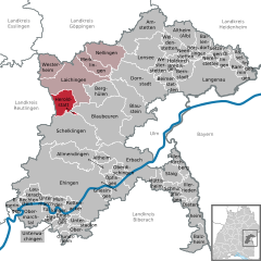 | |
 Heroldstatt  Heroldstatt | |
| Coordinates: 48°26′47″N 9°40′18″E / 48.44639°N 9.67167°E | |
| Country | Germany |
| State | Baden-Württemberg |
| Admin. region | Tübingen |
| District | Alb-Donau-Kreis |
| Subdivisions | 2 |
| Government | |
| • Mayor (2018–26) | Michael Weber[1] |
| Area | |
| • Total | 21.81 km2 (8.42 sq mi) |
| Elevation | 770 m (2,530 ft) |
| Population (2022-12-31)[2] | |
| • Total | 2,928 |
| • Density | 130/km2 (350/sq mi) |
| Time zone | UTC+01:00 (CET) |
| • Summer (DST) | UTC+02:00 (CEST) |
| Postal codes | 72535 |
| Dialling codes | 07389 |
| Vehicle registration | UL |
| Website | www.heroldstatt.de |
Heroldstatt is a village in the district of Alb-Donau in Baden-Württemberg in Germany.
Geographyedit
Heroldstatt is located on the Swabian Jura about 25 kilometers west of Ulm.
Neighboring communitiesedit
The municipality borders in the north and east to the town of Laichingen, in the southeast to the town of Blaubeuren , in the south to the town of Schelklingen (all Alb-Donau-district) and in the west to Gutsbezirk Münsingen (district Reutlingen).
Municipality arrangementedit
The municipality consists of the two districts Ennabeuren and Sontheim and the allotment Breithülen.
Historyedit
Ennabeurenedit
A documentary mention was made in 1092 to a nobleman Egilolf Oninburrin. In 1806, the village had around 300 Protestant and 200 Catholic residents. Ennabeuren lost in 1895 and 1938 a total of 940 hectares - about half of the municipal area - to the military training area Münsingen.
Sontheimedit
During the Reformation the village received in 1537 its own parish. By 1800 it had about 420 inhabitants.


Heroldstattedit
The two previously independent municipalities joined as part of the municipal reform on October 1, 1973, together. About halfway between the village centers a new community center with the mountain hall (multi-purpose hall, 1984, extended in 2000) and the town hall (1987) was erected.
Breithülenedit
The 77.5 hectare and 64 inhabitants allotment Breithülen was incorporated to Heroldstatt on January 1, 2011.
Lookoutedit
- The 30 m high Heroldstatt tower is about 2 kilometers northwest of the district Ennabeuren on the former military training area Münsingen and was built in 1981. The tower of the Schwäbischer Albverein is freely accessible (key deposit).[3]
Wind power test fieldedit
Northeast of the town there is a testing ground for Wind turbines. To this belongs a 1989 erected Enercon E-17 with 28 m hub height, 17 m rotor diameter and 80 kW power and a 25 m high Darrieus rotor with 15 m diameter which has an output of 55 kW.[4]

Natural monumentsedit
- Sontheimer Höhle, the oldest show cave in Germany
- Hintere Kohlhaldenhöhle
Literaturedit
- Der Alb-Donau-Kreis. Amtliche Kreisbeschreibung, Band 2, Landesarchivdirektion Baden-Württemberg (Hrsg.), Sigmaringen 1992, ISBN 3-7995-1351-5, S. 307–328
- Karl Schnizer: Reformationsgeschichte von Enabeuren O. A. Münsingen. In: Blätter für württembergische Kirchengeschichte. N. F., 11. Jg. 1907, S. 62–68 (Digitalisat)
Referencesedit
- ^ Aktuelle Wahlergebnisse, Staatsanzeiger, accessed 11 September 2021.
- ^ "Bevölkerung nach Nationalität und Geschlecht am 31. Dezember 2022" [Population by nationality and sex as of December 31, 2022] (CSV) (in German). Statistisches Landesamt Baden-Württemberg. June 2023.
- ^ Schwäbischer Albverein - Heroldstatt-Turm
- ^ EnBW bricht historisches Windrad bei Heroldstatt ab. In: Schwäbische Zeitung, 17 December 2012. Retrieved 17 December 2012.
| International | |
|---|---|
| National | |
This Alb-Donau-Kreis location article is a stub. You can help Wikipedia by expanding it. |
Text je dostupný za podmienok Creative Commons Attribution/Share-Alike License 3.0 Unported; prípadne za ďalších podmienok. Podrobnejšie informácie nájdete na stránke Podmienky použitia.
Antropológia
Aplikované vedy
Bibliometria
Dejiny vedy
Encyklopédie
Filozofia vedy
Forenzné vedy
Humanitné vedy
Knižničná veda
Kryogenika
Kryptológia
Kulturológia
Literárna veda
Medzidisciplinárne oblasti
Metódy kvantitatívnej analýzy
Metavedy
Metodika
Text je dostupný za podmienok Creative
Commons Attribution/Share-Alike License 3.0 Unported; prípadne za ďalších
podmienok.
Podrobnejšie informácie nájdete na stránke Podmienky
použitia.
www.astronomia.sk | www.biologia.sk | www.botanika.sk | www.dejiny.sk | www.economy.sk | www.elektrotechnika.sk | www.estetika.sk | www.farmakologia.sk | www.filozofia.sk | Fyzika | www.futurologia.sk | www.genetika.sk | www.chemia.sk | www.lingvistika.sk | www.politologia.sk | www.psychologia.sk | www.sexuologia.sk | www.sociologia.sk | www.veda.sk I www.zoologia.sk