

A | B | C | D | E | F | G | H | CH | I | J | K | L | M | N | O | P | Q | R | S | T | U | V | W | X | Y | Z | 0 | 1 | 2 | 3 | 4 | 5 | 6 | 7 | 8 | 9
Yekaterinburg
Екатеринбург | |
|---|---|
  _%D0%95%D0%BA%D0%B0%D1%82%D0%B5%D1%80%D0%B8%D0%BD%D0%B1%D1%83%D1%80%D0%B3.jpg)   Top-down, left-to-right: View of Yekaterinburg-City and the Iset River from Vysotsky; Church of All Saints; Sevastyanov's house; the main building of the Ural Federal University; Summit Business Center and Yekaterinburg Circus. | |
.svg) Flag | |
Location of Yekaterinburg  | |
 Yekaterinburg Location of Yekaterinburg  Yekaterinburg Yekaterinburg (Sverdlovsk Oblast) | |
| Coordinates: 56°50′08″N 60°36′46″E / 56.83556°N 60.61278°E | |
| Country | Russia |
| Federal subject | Sverdlovsk Oblast[1] |
| Founded | 18 November 1723[2] |
| City status since | 1781[3] |
| Government | |
| • Body | City Duma[4] |
| • Head[5] | Alexey Orlov |
| Area | |
| • Total | 1,111 km2 (429 sq mi) |
| Elevation | 237 m (778 ft) |
| Population | |
| • Total | 1,349,772 |
| • Estimate (2021)[8] | 1,495,066 |
| • Rank | 4th in 2010 |
| • Density | 1,200/km2 (3,100/sq mi) |
| • Subordinated to | City of Yekaterinburg[9] |
| • Capital of | Sverdlovsk Oblast,[1] City of Yekaterinburg |
| • Urban okrug | Yekaterinburg Urban Okrug[10] |
| • Capital of | Yekaterinburg Urban Okrug[10] |
| Time zone | UTC+5 (MSK+2 |
| Postal code(s)[12] | 620000 |
| Dialing code(s) | +7 343[12] |
| OKTMO ID | 65701000001 |
| City Day | 3rd Saturday of August |
| Website | екатеринбург |
.svg)
Yekaterinburg[a] is a city and the administrative centre of Sverdlovsk Oblast and the Ural Federal District, Russia. The city is located on the Iset River between the Volga-Ural region and Siberia, with a population of roughly 1.5 million residents,[14] up to 2.2 million residents in the urban agglomeration. Yekaterinburg is the fourth-largest city in Russia, the largest city in the Ural Federal District, and one of Russia's main cultural and industrial centres. Yekaterinburg has been dubbed the "Third capital of Russia", as it is ranked third by the size of its economy, culture, transportation and tourism.[15][16][17][18]
Yekaterinburg was founded on 18 November 1723 and named after the Orthodox name of Catherine I (born Marta Helena Skowrońska), the Polish wife of Russian Emperor Peter the Great. The city served as the mining capital of the Russian Empire as well as a strategic connection between Europe and Asia. In 1781, Catherine the Great gave Yekaterinburg the status of a district town of Perm Province, and built the historical Siberian Route through the city.[3] Yekaterinburg became a key city to Siberia, which had rich resources. In the late 19th century, Yekaterinburg became one of the centres of revolutionary movements in the Urals. In 1924, after the Russian SFSR founded the Soviet Union, the city was renamed Sverdlovsk after the Bolshevik leader Yakov Sverdlov. During the Soviet era, Sverdlovsk was turned into an industrial and administrative powerhouse. On 23 September 1991 the city returned to its historical name.
Yekaterinburg is one of Russia's most important economic centres and was one of the host cities of the 2018 FIFA World Cup. The city is currently experiencing an economic and population boom, which resulted in some of the tallest skyscrapers of Russia being located in the city. Yekaterinburg is home to the headquarters of the Central Military District of the Russian Armed Forces, as well as the presidium of the Ural Branch of the Russian Academy of Sciences.
Yekaterinburg is famous for its constructivist architecture[19][20][21] and is also considered the "Russian capital of street art".[22][23][24]
History
Prehistory

The area was settled in prehistory. The earliest settlements date to 8000–7000 BC, in the Mesolithic period. The Isetskoe Pravoberezhnoye I archaeological site contains a Neolithic settlement dated to 6000–5000 BC. It includes stone processing workshops with artefacts such as grinding plates, anvils, clumps of rock, tools, and finished products. Over 50 different types of rock and minerals were used in tool making, indicating extensive knowledge of the region's natural resources. The Gamayun peninsula (left bank of the Upper Iset pond) has archaeological findings from the Chalcolithic Period: workshops for producing stone tools (upper area) and two dwellings of the Ayat people (lower area). There are also traces of the Koptyak people from 2000 BC: dishes decorated with bird images and evidence of metallurgical production. The Tent I site contains the only Koptyak burials discovered in the Ural Mountains. In the Bronze Age, the Gamayun people lived in the area. They left fragments of ceramics, weapons, and ornaments.[25][26][27]
Archaeological artifacts in the vicinity of Yekaterinburg were first discovered during railway construction, at the end of the 19th century. Excavation and research began in the 20th century. Artifacts are held at the Sverdlovsk Regional Museum of Local Lore, at the Hermitage, at the Museum of Anthropology and Ethnography of the Academy of Sciences, and at other museums.[26]
Imperial era

The settlements within the boundaries of the future city were the villages of Uktus, and Verkhniy Uktus, Novaya Pyshma, or Novopyshminskaya. In 1702–1704, the first mining plant was built – Uktusskiy-Nizhniy, which burned down "without a trace" in the spring of 1718. In 1714–1716 on the river, the source was built and produced a small private ironworks, known as the Shuvakishsky. Since August 1718, the Nizhne-Uktussky mining plant was rebuilt, whereby the end of the year more than 500 poods of pure copper had been produced, however, the plant did not receive further development due to the lack of water in Uktus river. At this time, the manager of the burnt down Uktusskiy plant T. M. Burtsov was ordered to find out "if there is another place nearby where another mining plant could be built ... on this or another river." By 16–17 February 1723, the project of the plant and the dam on the Iset river was drawn up and approved.
Construction on the Iset river actually began in February–March 1723. Russian historian Vasily Tatishchev and Russian engineer Georg Wilhelm de Gennin founded Yekaterinburg with the construction of a massive iron-making plant under the decree of Russian emperor Peter the Great in 1723.[28] They named the city after the emperor's wife, Yekaterina, who later became empress regnant Catherine I.[2] Officially, the city's founding date is 18 November 1723, when the shops carried out a test run of the bloomery for trip hammers.[2] The plant was commissioned 6 days later, on 24 November.[29] 1723 also saw the establishment of Yekaterinburg fortress, which would encompass many of the settlement's earliest buildings. Dmitry Mamin-Sibiryak very vividly described the beginning of the construction of a mining plant and a fortress: "Imagine completely deserted banks of the Iset river, covered with forest. In the spring of 1723, soldiers from Tobolsk, peasants of the assigned settlements, hired craftsmen appeared, and everything around came to life, as if by the dictates of a fairy tale. They dropped the forest, prepared a place for the dam, laid blast furnaces, raised the rampart, set up barracks and houses for the authorities... ".[30] In 1722–1726 the Verkhne-Uktussky mining plant was built,[31] which was officially called the plant of the princess Elizabeth (the future village of Elizabeth, or Elizavetinskoe) and became a part of modern Yekaterinburg in 1934.[32]

The city was one of Russia's first industrial cities, prompted at the start of the 18th century by decrees from the Tsar[specify] requiring the development in Yekaterinburg of metalworking industries. With extensive use of iron, the city was built to a regular square plan with ironworks and residential buildings at the centre. These were surrounded by fortified walls so that Yekaterinburg was at the same time both a manufacturing centre and a fortress at the frontier between Europe and Asia. It, therefore, found itself at the heart of Russia's strategy for further development of the entire Ural region. The so-called Siberian Route became operational in 1763 and placed the city on an increasingly important transit route, which led to its development as a focus of trade and commerce between east and west, and gave rise to the description of the city as the "window to Asia". With the growth in trade and the city's administrative importance, the ironworks became less critical, and the more important buildings were increasingly built using expensive stone. Small manufacturing and trading businesses proliferated. In 1781 Russia's empress, Catherine the Great, granted Yekaterinburg town status and nominated it as the administrative centre for the wider region.[3] In 1807, the role of the capital of the mining and smelting region was confirmed by assigning it the status of the only "mountain city" in Russia. Until 1863, Yekaterinburg remained subordinate to the head of the mining plants of the Uralsky ridge, the minister of finance and personally to the emperor, and enjoyed considerable freedom from the governor's power. Since the 1830s, mountainous Yekaterinburg has become the center of mechanical engineering.[30]
In 1820–1845, 45% of the world's gold was mined in Yekaterinburg. This is the first ever "Gold Rush".[33] Until 1876, 80% of the coins in circulation in the Russian Empire were produced at the Yekaterinburg mint.[34]

Following the October Revolution, the family of deposed Tsar Nicholas II was sent to internal exile in Yekaterinburg where they were imprisoned in the Ipatiev House in the city. In July 1918, the Czechoslovak Legions were closing on Yekaterinburg. In the early hours of the morning of 17 July, the deposed Tsar, his wife Alexandra, and their children Grand Duchesses Olga, Tatiana, Maria, Anastasia, and Tsarevich Alexei were murdered by the Bolsheviks at the Ipatiev House. Other members of the Romanov family were killed at Alapayevsk later the same day. The Legions arrived less than a week later and captured the city.[35][36] The city remained under the control of the White movement in which a provisional government was established. The Red Army took back the city and restored Soviet authority on 14 July 1919.[37][38]
Soviet era

In the years following the Russian Revolution and the Russian Civil War, political authority of the Urals was transferred from Perm to Yekaterinburg. On 19 October 1920, Yekaterinburg established its first university, the Ural State University, as well as polytechnic, pedagogical, and medical institutions under the decree of Soviet leader Vladimir Lenin. Enterprises in the city ravaged by the war were nationalised, including: the Metalist (formerly Yates) Plant, the Verkh-Isetsky (formerly Yakovleva) Plant, and the Lenin flax-spinning factory (formerly Makarov). In 1924, the city of Yekaterinburg was renamed Sverdlovsk after the Bolshevik leader Yakov Sverdlov.[39][40][37]
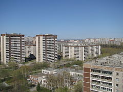
During the reign of Stalin, Sverdlovsk was one of several places developed by the Soviet government as a centre of heavy industry. Old factories were reconstructed and new large factories were built, especially those specialised in machine-building and metalworking. These plants included Uralmash, Magnitogorsk, and the Chelyabinsk Tractor Plant. During this time, the population of Sverdlovsk tripled in size, and it became one of the fastest-growing cities of the Soviet Union. At that time, very large powers were given to the regional authorities. By the end of the 1930s, there were 140 industrial enterprises, 25 research institutes, and 12 higher education institutions in Sverdlovsk.[41][42]
During World War II, the city became the headquarters of the Ural Military District on the basis of which more than 500 different military units and formations were formed, including the 22nd Army and the Ural Volunteer Tank Corps. Uralmash became the main production site for armoured vehicles. Many state technical institutions and whole factories were relocated to Sverdlovsk away from cities affected by war (mostly Moscow), with many of them staying in Sverdlovsk after the victory. The Hermitage Museum collections were also partly evacuated from Leningrad to Sverdlovsk in July 1941 and remained there until October 1945.[43] In the postwar years, new industrial and agricultural enterprises were put into operation and massive housing construction began.[44][37] The lookalike five-story apartment blocks that remain today in Kirovsky, Chkalovsky, and other residential areas of Sverdlovsk sprang up in the 1960s, under the direction of Nikita Khrushchev's government.[45] In 1977, Ipatiev House was demolished by order of Boris Yeltsin in accordance to a resolution from the Politburo in order to prevent it from being used as a rallying location for monarchists. Yeltsin later became the first President of Russia and represented the people at the funeral of the former Tsar in 1998.[46] There was an anthrax outbreak in Sverdlovsk in April and May 1979, which was attributed to a release from the Sverdlovsk-19 military facility.[47]
Contemporary era
During the 1991 coup d'état attempt, Sverdlovsk, the home city of President Boris Yeltsin, was selected by him as a temporary reserve capital for the Russian Federation, in case Moscow became too dangerous for the Russian government. A reserve cabinet headed by Oleg Lobov was sent to the city, where Yeltsin enjoyed strong popular support at that time.[48] Shortly after the failure of the coup and subsequent dissolution of the Soviet Union, the city regained its historical name of Yekaterinburg on 23 September 1991. However, Sverdlovsk Oblast, of which Yekaterinburg is the administrative centre, kept its name.[49][50]
In the 2000s, an intensive growth of trade, business, and tourism began in Yekaterinburg. In 2003, Russian President Vladimir Putin and German Chancellor Gerhard Schröder negotiated in Yekaterinburg. On 15–17 June 2009, the SCO and BRIC summits were held in Yekaterinburg, which greatly improved the economic, cultural, and tourist situation in the city. On 13–16 July 2010, a meeting between Russian President Dmitry Medvedev and German Chancellor Angela Merkel took place in the city.[51]
In 2018, Yekaterinburg hosted four matches of the 2018 FIFA World Cup and hosted the inaugural University International Sports Festival in 2023.[52]
Geography and climate
Location
_and_vicinities,_satellite_image_2017-07-12.jpg)
Geographically, Yekaterinburg is in North Asia, close to the Ural Mountains (which divide Europe from Asia), 1,667 km (1,036 mi) east of the nation's capital Moscow.
The city has a total area of 1,111 km2 (429 sq mi).
Yekaterinburg is on the eastern side of the Urals. The city is surrounded by wooded hills, partially cultivated for agricultural purposes. Yekaterinburg is located on a natural watershed, so there would be many bodies of water close and in the city. The city is bisected by the Iset River, which flows from the Urals into the Tobol River. There are two lakes in the city, Lake Shuvakish and Lake Shartash. The city borders Verkh-Isetskiy Pond, through which the Iset River flows. Lake Isetskoye and Lake Baltym are both near the city, with Lake Isetskoye located near Sredneuralsk, and Lake Baltym located near the towns of Sanatornyy and Baltym.
Time
Yekaterinburg uses the Yekaterinburg Time, which is five hours ahead of UTC (UTC+5), and two hours ahead of Moscow Time.[53]
Climate
The city possesses a humid continental climate (Dfb) under the Köppen climate classification.[54] It is characterised by sharp variability in weather conditions, with well-marked seasons. The Ural Mountains, despite their insignificant height, block air from the west, from the European part of Russia. As a result, the Central Urals are open to the invasion of cold arctic air and continental air from the West Siberian Plain. Equally, warm air masses from the Caspian Sea and the deserts of Central Asia can freely penetrate from the south. Therefore, the weather in Yekaterinburg is characterised by sharp temperature fluctuations and weather anomalies: in winter, from frost at −40 °C to thaw and rain; in summer, from frosts to temperatures above 35 °C (95 °F).[54]
-
 Spring in Yekaterinburg
 -
 Summer in Yekaterinburg
 -
 Autumn in Yekaterinburg
 -
 Winter in Yekaterinburg
.jpg)
.jpg)
.jpg)
.jpg)
The distribution of precipitation is determined by the circulation of air masses, relief, and air temperatures. The main part of the precipitation is brought by cyclones with a western air mass transfer, that is, from the European part of Russia, while their average annual amount is 601 mm. The maximum falls on a warm season, during which about 60–70% of the annual amount falls. For the winter period is characterized by snow cover with an average capacity of 40–50 cm. The coefficient of moistening(the ratio of yearly precipitation and potential evaporation) – 1.[54]
- The average temperature in January is −14.7 °C (5.5 °F). The record minimum temperature is −44.6 °C (−48.3 °F) (6 January 1915);
- The average July temperature is 18.1 °C (64.6 °F). The record maximum temperature is 40.0 °C (104.0 °F) (11 July 2023);
- The average annual temperature is 2.1 °C (35.8 °F);
- The average annual wind speed is 2.9 m/s (10 km/h; 6.5 mph);
- The average annual humidity is 75%;
- The average annual precipitation is 601 mm (23.7 in);
| Climate data for Yekaterinburg (1991–2020, extremes 1831–present) | |||||||||||||
|---|---|---|---|---|---|---|---|---|---|---|---|---|---|
| Month | Jan | Feb | Mar | Apr | May | Jun | Jul | Aug | Sep | Oct | Nov | Dec | Year |
| Record high °C (°F) | 5.6 (42.1) |
9.4 (48.9) |
18.1 (64.6) |
28.8 (83.8) |
34.7 (94.5) |
36.4 (97.5) |
40.0 (104.0) |
37.2 (99.0) |
31.9 (89.4) |
24.7 (76.5) |
13.5 (56.3) |
5.9 (42.6) |
40.0 (104.0) |
| Mean daily maximum °C (°F) | −9.3 (15.3) |
−6.6 (20.1) |
0.9 (33.6) |
10.1 (50.2) |
18.3 (64.9) |
22.6 (72.7) |
24.3 (75.7) |
21.4 (70.5) |
15.0 (59.0) |
6.9 (44.4) |
−2.6 (27.3) |
−7.8 (18.0) |
7.8 (46.0) |
| Daily mean °C (°F) | −12.6 (9.3) |
−10.8 (12.6) |
−3.6 (25.5) |
4.7 (40.5) |
12.2 (54.0) |
16.9 (62.4) |
18.9 (66.0) |
16.2 (61.2) |
10.4 (50.7) |
3.6 (38.5) |
−5.4 (22.3) |
−10.7 (12.7) |
3.3 (37.9) |
| Mean daily minimum °C (°F) | −15.5 (4.1) |
−14.1 (6.6) |
−7.3 (18.9) |
0.3 (32.5) |
6.9 (44.4) |
12.0 (53.6) |
14.4 (57.9) |
12.2 (54.0) |
6.8 (44.2) |
1.0 (33.8) |
−7.8 (18.0) |
−13.3 (8.1) |
−0.4 (31.3) |
| Record low °C (°F) | −44.6 (−48.3) |
−42.4 (−44.3) |
−39.2 (−38.6) |
−21.8 (−7.2) |
−13.5 (7.7) |
−5.3 (22.5) |
1.5 (34.7) |
−2.2 (28.0) |
−9.0 (15.8) |
−22.0 (−7.6) |
−39.2 (−38.6) |
−44.0 (−47.2) |
−44.6 (−48.3) |
| Average precipitation mm (inches) | 25 (1.0) |
19 (0.7) |
25 (1.0) |
31 (1.2) |
47 (1.9) |
73 (2.9) |
93 (3.7) |
75 (3.0) |
45 (1.8) |
41 (1.6) |
33 (1.3) |
28 (1.1) |
535 (21.1) |
| Average extreme snow depth cm (inches) | 33 (13) |
42 (17) Zdroj:https://en.wikipedia.org?pojem=Екатеринбург Text je dostupný za podmienok Creative Commons Attribution/Share-Alike License 3.0 Unported; prípadne za ďalších podmienok. Podrobnejšie informácie nájdete na stránke Podmienky použitia.
Analytika
Antropológia Aplikované vedy Bibliometria Dejiny vedy Encyklopédie Filozofia vedy Forenzné vedy Humanitné vedy Knižničná veda Kryogenika Kryptológia Kulturológia Literárna veda Medzidisciplinárne oblasti Metódy kvantitatívnej analýzy Metavedy Metodika Text je dostupný za podmienok Creative
Commons Attribution/Share-Alike License 3.0 Unported; prípadne za ďalších
podmienok. www.astronomia.sk | www.biologia.sk | www.botanika.sk | www.dejiny.sk | www.economy.sk | www.elektrotechnika.sk | www.estetika.sk | www.farmakologia.sk | www.filozofia.sk | Fyzika | www.futurologia.sk | www.genetika.sk | www.chemia.sk | www.lingvistika.sk | www.politologia.sk | www.psychologia.sk | www.sexuologia.sk | www.sociologia.sk | www.veda.sk I www.zoologia.sk | |||||||||||